UK Postcode SY14 - The 30 nearest easy-to-follow, circular walk route maps to you
The thirty nearest easy-to-follow, circular walk route maps to you in UK Postcode SY14 in Walk Grade Order
The UK cities, towns and villages in Cheshire, England that have SY14 in their UK Postcode include:
• Barton • Bickerton • Bickley Moss • Bickley Town • Bulkeley • Chorlton Lane • Croxton Green • Cuddington Heath • Duckington • Egerton Green • Gallantry Bank • Hampton Heath • Higher Wych • Horton Green • Malpas • No Man's Heath • Oldcastle Heath • Shocklach • Stretton • Tallarn Green • Threapwood • Tilston •
Not familiar with the area around SY14?
See these 30 nearest walks to UK Postcode SY14 on a google map
   |
Vital Statistics:
| Length: | 6.5 miles (10.5 km) |
| Ascent: | 6ft (421m) |
| Time: | 2.75hrs |
| Grade: |  |
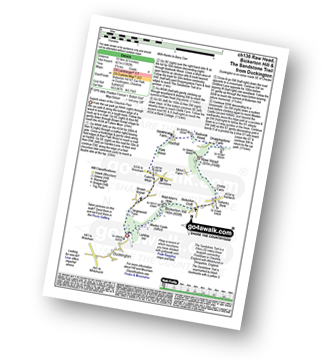
Route Summary:
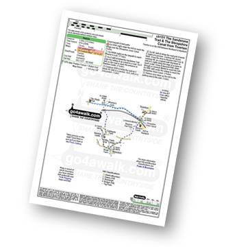
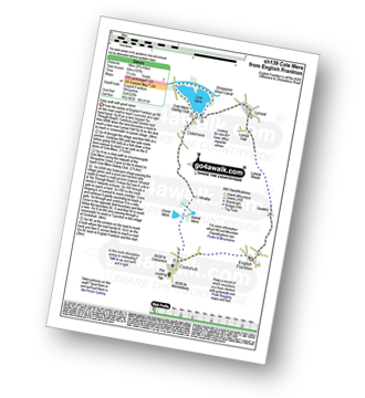
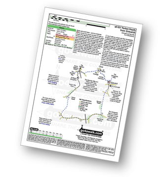
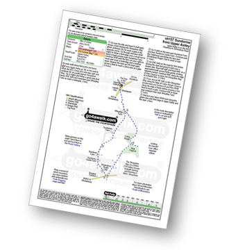
Duckington - Bickerton Hill - Brown Knowl - Fullers Moor - Harthill - Bodnook Wood - Droppingstone Farm - The Sandstone Trail - Raw Head (Rawhead) - Chiflik Farm - Gallantry Bank - Bickerton - Bickerton Hill - Maiden Castle (Bickerton Hill) - Duckington
|
Vital Statistics:
| Length: | 5.5 miles (8.5 km) |
| Ascent: | 1,050ft (320m) |
| Time: | 3 hrs |
| Grade: | |
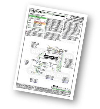
Route Summary:
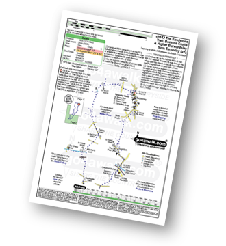
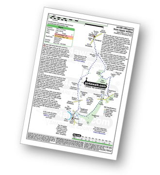
Higher Burwardsley - The Sandstone Trail - Bulkeley Hill - Raw Head (Rawhead) - Bodnook Wood - Burwardsley Hill - Burwardsley - Higher Burwardsley
|
Vital Statistics:
| Length: | 9.5 miles (15 km) |
| Ascent: | 1,831ft (558m) |
| Time: | 5.25hrs |
| Grade: |  |
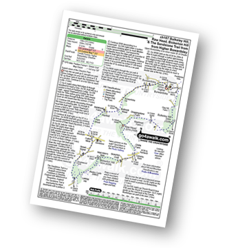
Route Summary:
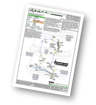
Higher Burwardsley - The Sandstone Trail - Bulkeley Hill - Raw Head (Rawhead) - Chiflik Farm - Gallantry Bank - Bickerton - Bickerton Hill - Maiden Castle (Bickerton Hill) - Brown Knowl - Fullers Moor - Harthill - Burwardsley - Higher Burwardsley
|
Vital Statistics:
| Length: | 4.75 miles (7.5 km) |
| Ascent: | 515ft (157m) |
| Time: | 2.25hrs |
| Grade: |  |
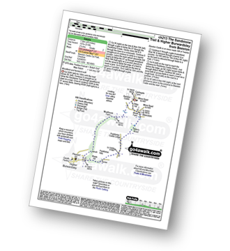
Route Summary:
Beeston - Beeston Castle - The Sandstone Trail - Peckforton Woods - Higher Burwardsley - Waste Hill - Peckforton Hills - Peckforton Castle Lodge - Willis's Wood - Beeston
|
Vital Statistics:
| Length: | 3.5 miles (5.5 km) |
| Ascent: | 286ft (87m) |
| Time: | 1.75hrs |
| Grade: | |
Route Summary:
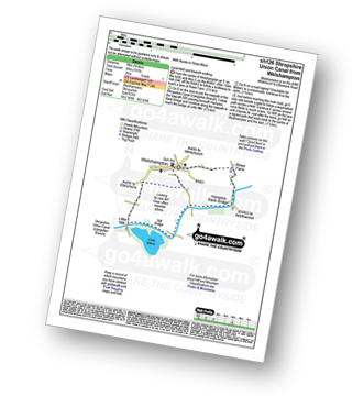
Tiverton - The Shropshire Union Canal - Wharton's Lock - The Sandstone Trail - Beeston Castle - Beeston - Beeston Hall Farm - Tiverton
|
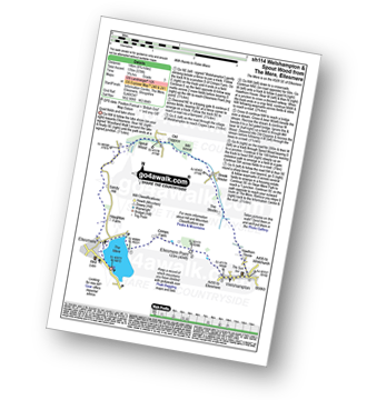
Vital Statistics:
| Length: | 5 miles (8 km) |
| Ascent: | 197ft (60m) |
| Time: | 2 hrs |
| Grade: |  |
Route Summary:
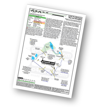
Welshampton - Rowe Farm - Shropshire Union Canal (Llangollen Branch) - Cole Mere - Welshampton
|
Vital Statistics:
| Length: | 11.25 miles (18 km) |
| Ascent: | 883ft (269m) |
| Time: | 5 hrs |
| Grade: |  |
Route Summary:
Tarpoley - The Sandstone Trail - Ferney Lees - Wharton's Bridge - The Shorpshire Union Canal - Wharton's Lock - Beeston Castle - Beeston - Peckforton Woods - Higher Burwardsley - Waste Hill - Peckforton Hills - Peckforton Castle Lodge - Willis's Wood - Beeston - A49 - Tiverton - Tarpoley
|
Vital Statistics:
| Length: | 6 miles (9.5 km) |
| Ascent: | 295ft (90m) |
| Time: | 2½ hrs |
| Grade: | |
Route Summary:
Tarpoley - The Sandstone Trail - Ferney Lees - Wharton's Bridge - The Shorpshire Union Canal - Wharton's Lock - A49 - Tiverton - Tarpoley
|
Vital Statistics:
| Length: | 6.5 miles (10.5 km) |
| Ascent: | 241ft (104m) |
| Time: | 2.75hrs |
| Grade: | |
Route Summary:
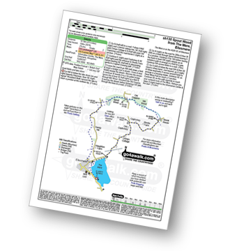
The Mere - Ellesmere - Crimps Cottage - Old Coptiviney - Coptiviney - Brook House - Mill Wood - Old Coppice - Spout Wood - Sandy Hall - Haughton Farm - The Mere - Ellesmere.
|
Vital Statistics:
| Length: | 8.75 miles (14 km) |
| Ascent: | 578ft (176m) |
| Time: | 3.75hrs |
| Grade: |  |
Route Summary:
The Mere - Ellesmere - Crimps�Farm - Ellesmere Point - Welshampton - Hawthorn House - The Stocks - Brook House - Mill Wood - Old Coppice - Spout Wood - Sandy Hall - Haughton Farm - The Mere - Ellesmere.
|
Vital Statistics:
| Length: | 7.5 miles (12 km) |
| Ascent: | 420ft (128m) |
| Time: | 3.25hrs |
| Grade: | |
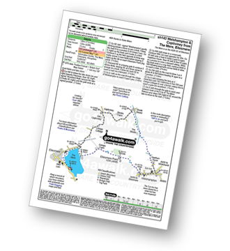
Route Summary:
The Mere - Ellesmere - Crimps Farm - Ellesmere Point - Welshampton - Hawthorn House - The Stocks - Brook House - Stocks Farm - Coptiviney - Old Coptiviney - Crimps Cottage - The Mere - Ellesmere.
|
Vital Statistics:
| Length: | 9.25 miles (14.5 km) |
| Ascent: | 321ft (98m) |
| Time: | 3.75hrs |
| Grade: | |
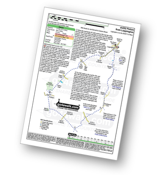
Route Summary:
Loppington - Bentley Farm - Roden Farm - Brandwood Farm - Marton Coppice - Petton - Petton Hall - Petton Park - The Wood Farm - Woodgate Farm - Loppington
|
Vital Statistics:
| Length: | 9 miles (14.5 km) |
| Ascent: | 420ft (128m) |
| Time: | 3.75hrs |
| Grade: | |
Route Summary:
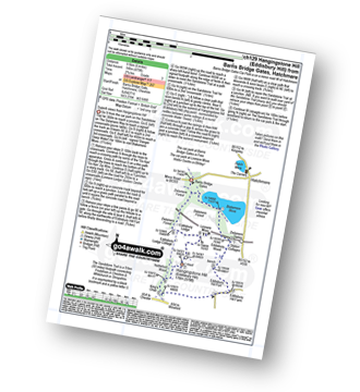
Cockshutt - English Frankton - Quaikin - Lyneal Wood - Lyneal Hall - River Roden - Lyneal - Cole Mere - Colemere - Whattal Farm - Whattal Moss - Seat Mere - Crose Mere - Lloyd's Wood - Crosemere House - Cockshutt,.
|
Vital Statistics:
| Length: | 5 miles (8 km) |
| Ascent: | 542ft (165m) |
| Time: | 2½ hrs |
| Grade: | |
Route Summary:
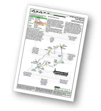
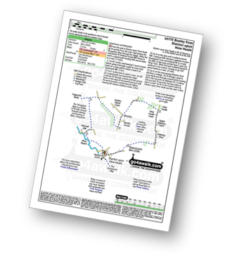
Weston - Wixhill - Lee Brockhurst - The Shropshire Way - Weston Heath Coppice - Weston Heath - Weston
|
Vital Statistics:
| Length: | 8.25 miles (13 km) |
| Ascent: | 295ft (90m) |
| Time: | 3½ hrs |
| Grade: | |
Route Summary:
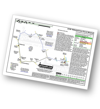
Church Minshull - Sunnyside - Eel Brook - Paradise Green - Paradise Wood - Wettenhall Green - Wettenhall - Stockerlane - Bankside Farm - Brookside Wood - Wettenhall Brook - Darnall Radio Telescope - Paradise Farm - Paradise Green - Eel Brook - Sunnyside - Church Minshull
Not familiar with the area around SY14?
See these 30 nearest walks to UK Postcode SY14 on a google map
|
Vital Statistics:
| Length: | 6 miles (9.5 km) |
| Ascent: | 479ft (146m) |
| Time: | 2.75hrs |
| Grade: | |
Route Summary:
Hatchmere - Barns Bridge Gate - Delamere Forest - The Sandstone Way - The Delamere Way - Blakemere Moss - Linmere Visitor Centre - Eddisbury Hill - Eddisbury Hill Fort - Eddisbury Hill Farm - Hangingstone Hill (Eddisbury Hill) - Nettleford Wood - The Sandstone Way - Eddisbury Lodge Cottage - Eddisbury Lodge - Delamere Forest - Barns Bridge Gate - Hatchmere
|
Vital Statistics:
| Length: | 5.5 miles (9 km) |
| Ascent: | 295ft (90m) |
| Time: | 2½ hrs |
| Grade: | |
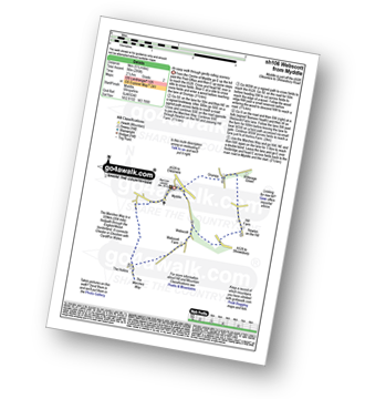
Route Summary:
Myddle - Myddle Hill - Grumpy - Hill Farm - Newton on the Hill - Webscott - The Hollins - Myddle
|
Vital Statistics:
| Length: | 5.25 miles (8.5 km) |
| Ascent: | 459ft (140m) |
| Time: | 2½ hrs |
| Grade: | |
|
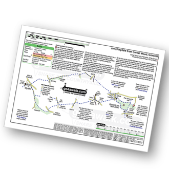
Vital Statistics:
| Length: | 6.25 miles (10 km) |
| Ascent: | 558ft (170m) |
| Time: | 2.75hrs |
| Grade: | |
Route Summary:
Corbet Wood - Clive - Witterage Green - Newton On The Hill - Yorton - Grinshill - Corbet Wood
|
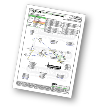
Vital Statistics:
| Length: | 9 miles (14.5 km) |
| Ascent: | 797ft (243m) |
| Time: | 4.25hrs |
| Grade: | |
Route Summary:
Corbet Wood - Grinshill - Clive - Grumpy - Myddle - The Marches Way - Webscott - Newton on the Hill - Yorton - Clive - Grinshill - The Shropshire Way - Corbet Wood - Grinshill
|
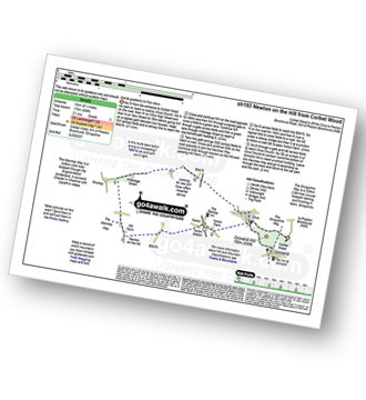
Vital Statistics:
| Length: | 6 miles (9.5 km) |
| Ascent: | 351ft (107m) |
| Time: | 2½ hrs |
| Grade: | |
Route Summary:
Grinshill - The Marches Way - Yorton Villa Farm - Yorton House Farm - Yorton Heath - Sansaw Heath - Sheepcotes - Sansaw Business Park - The Shropshire Way - Grinshill
|
Vital Statistics:
| Length: | 5.25 miles (8.5 km) |
| Ascent: | 417ft (127m) |
| Time: | 2½ hrs |
| Grade: | |
Route Summary:
Whitegate - New Pool - Petty Pool - Pettypool Wood - Newchurch Common - Whitegate Way (Dismantled Railway) - Whitegate Station - Martonsands - Foxwist Green - Whitegate
|
Vital Statistics:
| Length: | 6.25 miles (10 km) |
| Ascent: | 295ft (90m) |
| Time: | 2½ hrs |
| Grade: | |
Route Summary:
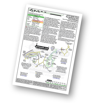
Stanton Upon Hine Heath - The Shropshire Way - River Roden - Harcourt Mill - Paperbank Mill - Hardcourt Farm - The Woodlands - Booley - Old Shop Farm - Quarry Coppice - Megan's Coppice - Hine Heath - Hine Heath Farm - Upper Blakeley Farm - Blakeley Stud - Blakeleyhill - Stanton Upon Hine Heath
|
Vital Statistics:
| Length: | 6.25 miles (10 km) |
| Ascent: | 1,254ft (382m) |
| Time: | 3½ hrs |
| Grade: | |
Route Summary:
Frodsham - Beacon Hill (Frodsham) - Frodsham Golf Course - Dunsdale Wood - Tong Dean - Helsby Hill Fort - Helsby Hill - The Longster Trail - Harmers Wood - The Sandstone Trail - Snidley Moor and Woodhouse Hill - Snidley Moor Wood - Beacon Hill (Frodsham) - Frodsham
|
Vital Statistics:
| Length: | 3.75 miles (6 km) |
| Ascent: | 197ft (60m) |
| Time: | 1.75hrs |
| Grade: | |
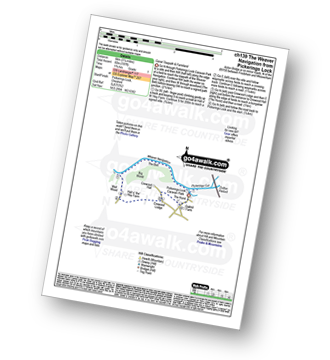
Route Summary:
Pickerings Lock - The Weaver Navigation - The Belt - Hall O' The' Hey Farm - Crewood Lodge - The Hurst - Oakwell Farm - Pickerings Lock
|
Vital Statistics:
| Length: | 4 miles (6.5 km) |
| Ascent: | 233ft (71m) |
| Time: | 1.75hrs |
| Grade: | |
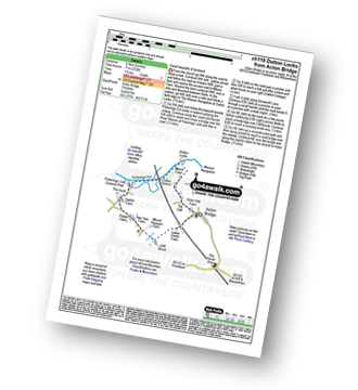
Route Summary:
Acton Bridge - Manor Farm - Dutton Locks - River Weaver - Pickerings Cut - Dutton Viaduct - Pickerings Lock - Oakhill Farm - Cliff Brook - Lower Green Farm - Acton Bridge
|
Vital Statistics:
| Length: | 7.25 miles (11.5 km) |
| Ascent: | 384ft (117m) |
| Time: | 3 hrs |
| Grade: | |
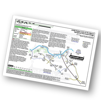
Route Summary:
Acton Bridge - Manor Farm - Dutton Locks - River Weaver - Pickerings Cut - Dutton Viaduct - Pickerings Lock - The Weaver Navigation - The Belt - Hall O' The' Hey Farm - Crewood Lodge - Oakhill Farm - Cliff Brook - Lower Green Farm - Acton Bridge
|
Vital Statistics:
| Length: | 5 miles (8 km) |
| Ascent: | 338ft (103m) |
| Time: | 2.25hrs |
| Grade: | |
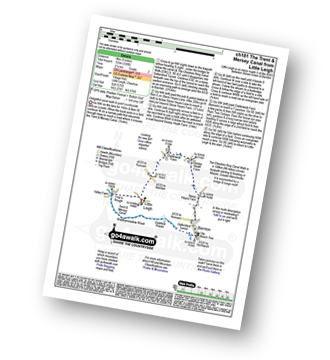
Route Summary:
Little Leigh - Friar's Rough - Trent and Mersey Canal - Bardleymeadow Wood - Daleford House - Saltersford Tunnel - Barnton - Stone Heyes Farm - Desley Heath Farm - Claterwick Farm - Little Leigh
|
Vital Statistics:
| Length: | 5 miles (8 km) |
| Ascent: | 161ft (49m) |
| Time: | 2 hrs |
| Grade: | |
Route Summary:
Upper Astley - The Shropshire Way - Wheatley Farm - Sunderton Farm - Sundorne Farm - Sundorne Castle Farm - Shrewsbury Rugby Club - New Coppice - Colin's Rough - Wheatley Farm - Upper Astley
|
Vital Statistics:
| Length: | 7.5 miles (12 km) |
| Ascent: | 361ft (110m) |
| Time: | 3 hrs |
| Grade: | |
Route Summary:
Upper Astley - The Shropshire Way - Wheatley Farm - Sunderton Farm - Sundorne Farm - Sundorne Castle Farm - The River Severn - Uffington - Haughmond Hill (Forest Commisison) - The Hollies - Haughmond Abbey - Abbey Wood - Haughmond Farm - New Coppice - Colins Rough - Wheatley Farm - Upper Astley
Not familiar with the area around SY14?
See these 30 nearest walks to UK Postcode SY14 on a google map


