UK Postcode PL30 - The 30 nearest easy-to-follow, circular walk route maps to you
The thirty nearest easy-to-follow, circular walk route maps to you in UK Postcode PL30 in Walk Grade Order
The UK cities, towns and villages in Cornwall, England that have PL30 in their UK Postcode include:
• Blisland • Cardinham • Helland • Hellandbridge • Lane-end • Lanivet • Luxulyan • Maidenwell • Michaelstow • Mount • Nanstallon • Pendoggett • Redmoor • Row • Ruthernbridge • St Breward • St Kew • St Kew Highway • St Lawrence • St Mabyn • St Teath • St Tudy • St Wenn • Sweetshouse • Temple • Trebyan • Trelill • Warleggan • Washaway • Withiel •
Not familiar with the area around PL30?
See these 30 nearest walks to UK Postcode PL30 on a google map
   |
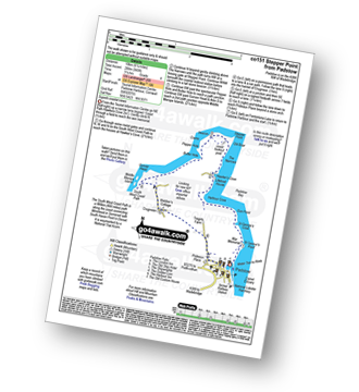
Vital Statistics:
| Length: | 11 miles (17.5 km) |
| Ascent: | 1,657ft (505m) |
| Time: | 5½ hrs |
| Grade: |  |
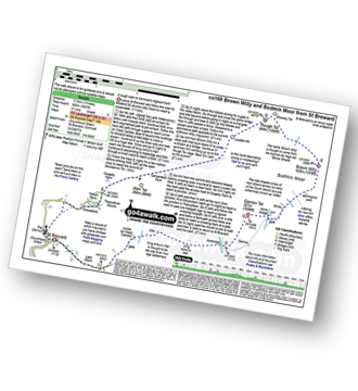
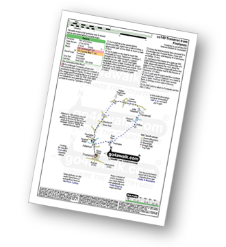
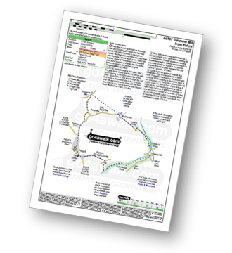
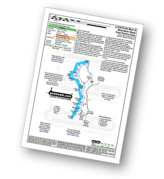
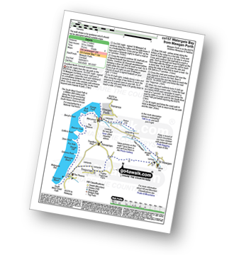
Route Summary:
St Breward - Churchtown - Lady Down - West Candra - Lower Candra - King Arthur's Hall - Bodmin Moor - Garrow Tor - Butter's Tor - Brown Willy - Little Rough Tor - Rough Tor - Louden Hill - Alex Tor - Treswallock - St Breward
|
Vital Statistics:
| Length: | 7.25 miles (11.5 km) |
| Ascent: | 1,805ft (550m) |
| Time: | 4½ hrs |
| Grade: |  |
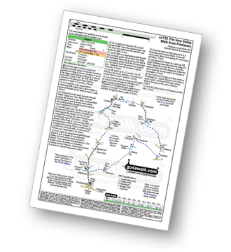
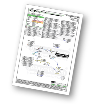
Route Summary:
Port Isaac - Port Gaverne - Trewetha - Trelights - Rosecarrock Farm - Port Quin - Kellan Head - Downgate Cove - Greengarden Cove - Varley Head - Varley Sands - Pine Haven - Lobber Point - Port Isaac
|
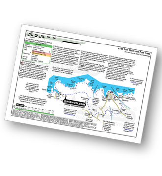
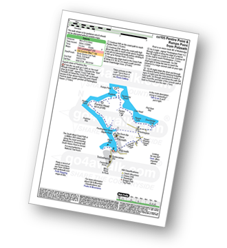
Vital Statistics:
| Length: | 11.75 miles (19 km) |
| Ascent: | 1,867ft (569m) |
| Time: | 6.25hrs |
| Grade: | |
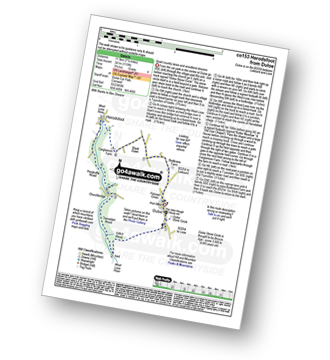
Route Summary:
Rock (Padstow Bay) - The South West Coast Path - Brea Hill - Daymer Bay (Trebetherick) - Trebetherick Point - Greenaway Beach - Broadagogue Cove - Hayle Bay - Trebetherick - Polzeath - New Polzeath - Slipper Point - Pentireglaze Haven - Pentire Point - Pentire Head - Guglane - Rumps Point - Sandinway Beach - Com Head - Pengrit Cove - Downhedge Cove - Pentireglaze - Portkillock Farm - Roserrow - Pityme - Splatt - Stoptide - Rock (Padstow Bay)
|
Vital Statistics:
| Length: | 6.5 miles (10 km) |
| Ascent: | 755ft (230m) |
| Time: | 3 hrs |
| Grade: |  |
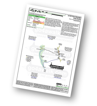
Route Summary:
Rock (Padstow Bay) - Porthilly Cove - Stoptide - Rock (Padstow Bay) - St Endoc Golf Course - St Endoc Church - Trebetherick - The South West Coast Path - Broadagogue Cove - Greenaway Beach - Padstow Bay - Daymer Bay (Trebetherick) - Brea Hill - Rock (Padstow Bay)
|
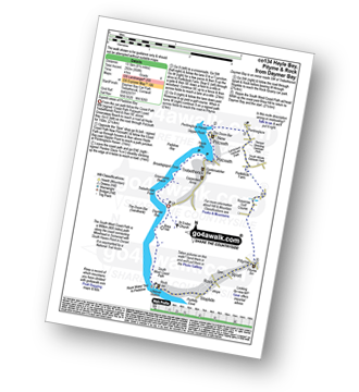
Vital Statistics:
| Length: | 6.25 miles (10 km) |
| Ascent: | 945ft (288m) |
| Time: | 3.25hrs |
| Grade: |  |
Route Summary:
Padstow - Padstow Harbour - The South West Coast Path - St Saviour's Point - St George's Cove - Gun Point - Harbour Cove - Hawker's Cove - The Narrows - Old Boad - Stepper Point - Stepper Point Beacon - Crams - Pepper Hole - Butter Hole - Ginver Head - Middle Merope Islands - Crugmeer - Tregirls Farm - Prideaux Place - Padstow - Padstow Harbour.
|
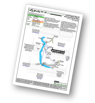
Vital Statistics:
| Length: | 5.5 miles (9 km) |
| Ascent: | 1,208ft (368m) |
| Time: | 3½ hrs |
| Grade: | |
Route Summary:
Trebetherick - The South West Coast Path - Polzeath - New Polzeath - Slipper Point - Pentireglaze Haven - Pentire Point - Pentire Head - Guglane - Rumps Point - Sandinway Beach - Com Head - Pengrit Cove - Downhedge Cove - Pentireglaze - Polzeath - Trebetherick
|
Vital Statistics:
| Length: | 8.25 miles (13.5 km) |
| Ascent: | 958ft (292m) |
| Time: | 4 hrs |
| Grade: | |
Route Summary:
Daymer Bay (Trebetherick) - The South West Coast Path - Trebetherick Point - Greenaway Beach - Broadagogue Cove - Hayle Bay - Trebetherick - Polzeath - New Polzeath - Slipper Point - Pentireglaze Haven - Pentireglaze - Portkillock Farm - Roserrow - Pityme - Splatt - Stoptide - Rock (Padstow Bay) - St Endoc Church - Daymer Bay (Trebetherick)
|
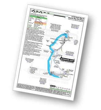
Vital Statistics:
| Length: | 4 miles (6.5 km) |
| Ascent: | 391ft (119m) |
| Time: | 2 hrs |
| Grade: |  |
Route Summary:
Daymer Bay (Trebetherick) - The South West Coast Path - Brea Hill - Rock (Padstow Bay) - St Endoc Golf Course - St Endoc Church - Daymer Bay (Trebetherick)
|
Vital Statistics:
| Length: | 5 miles (8 km) |
| Ascent: | 1,096ft (334m) |
| Time: | 3 hrs |
| Grade: | |
Route Summary:
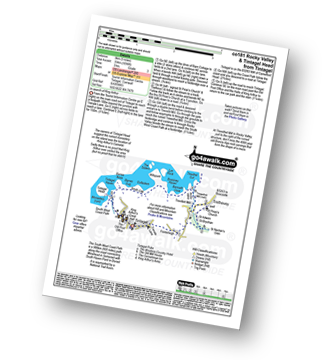
Tintagel - Fenterleigh - St Nectan's Glen - St Piran's Church - Trethevey - Trevelleit Mill - Trewethett Mill - Rocky Valley - The South West Coast Path - Benoath Cove - Bossiney Haven - Gullastern - Smith Cliff - Barras Gut - Barras Nose - Tintagel Haven - Tintagel Castle - Tintagel Head - Tintagel
|
Vital Statistics:
| Length: | 6.75 miles (11 km) |
| Ascent: | 1,234ft (376m) |
| Time: | 3.75hrs |
| Grade: | |
Route Summary:
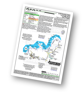
Tintagel - Fenterleigh - St Nectan's Glen - St Piran's Church - Trethevey - Trevalga - The South West Coast Path - Ladies Window - Trevalga Cliff - Trewthet Gut - Trewethett Mill - Rocky Valley - Benoath Cove - Bossiney Haven - Gullastern - Smith Cliff - Barras Gut - Barras Nose - Tintagel Haven - Tintagel Castle - Tintagel Head - Tintagel
|
Vital Statistics:
| Length: | 4.75 miles (7.5 km) |
| Ascent: | 807ft (246m) |
| Time: | 2½ hrs |
| Grade: | |
Route Summary:
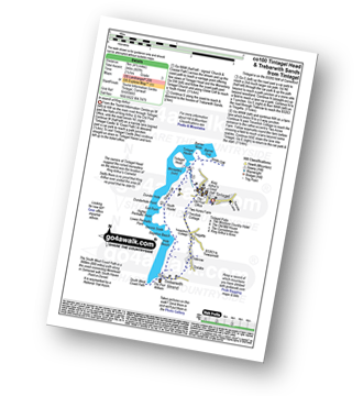
Tintagel - Tintagel Castle - Tintagel Haven - Tintagel Head - Glebe Cliff - Dunderhole Point - Penhallic Point - Hole Beach - Trebarwith Sands - Trelake - Treknow - Two Acre Farm - Tintagel
|
Vital Statistics:
| Length: | 10.75 miles (17 km) |
| Ascent: | 1,983ft (568m) |
| Time: | 5.75hrs |
| Grade: | |
Route Summary:
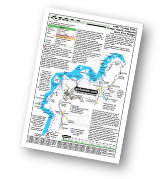
Tintagel - Fenterleigh - St Nectan's Glen - St Piran's Church - Trethevey - Trevalga - The South West Coast Path - Ladies Window - Trevalga Cliff - Trewthet Gut - Trewethett Mill - Rocky Valley - Benoath Cove - Bossiney Haven - Gullastern - Smith Cliff - Barras Gut - Barras Nose - Tintagel Haven - Tintagel Head - Glebe Cliff - Dunderhole Point - Penhallic Point - Hole Beach - Trebarwith Sands - Trelake - Treknow - Two Acre Farm - Tintagel
|
Vital Statistics:
| Length: | 4.5 miles (7 km) |
| Ascent: | 561ft (171m) |
| Time: | 2.25hrs |
| Grade: | |
Route Summary:
Fivelanes - Five Lanes - Altarnun - Penpont Water - Penhallow Manor - Higher Tregunnon Farm - Lower Tregunnon - Trenarrett - Penpont Water - Tresmaine - Altarnun - Fivelanes
|
Vital Statistics:
| Length: | 7.5 miles (12 km) |
| Ascent: | 1,109ft (338m) |
| Time: | 4 hrs |
| Grade: | |
Route Summary:
Fivelanes - Five Lanes - Altarnun - Penpont Water - Penhallow Manor - Higher Tregunnon Farm - River Inny - Laneast - Treroose - Trespearne - Gimblett's Mill - River Inny - Trethinna - Trerithick - Little Trenarrett - Penpont Water - Tresmaine - Altarnun - Fivelanes
|
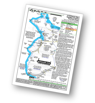
Vital Statistics:
| Length: | 7.25 miles (11.5 km) |
| Ascent: | 1,119ft (341m) |
| Time: | 3.75hrs |
| Grade: | |
Route Summary:
Duloe - Duloe Stone Circle - Gillhill Wood - West Looe River - Tremadart Wood - Churchbridge - Pendruffle Wood - Herodsfoot - Carglonnon Farm - Black Down - Bodbrane Farm - Polvean Cross - Duloe
Not familiar with the area around PL30?
See these 30 nearest walks to UK Postcode PL30 on a google map
|
Vital Statistics:
| Length: | 3.75 miles (6 km) |
| Ascent: | 630ft (192m) |
| Time: | 2 hrs |
| Grade: | |
Route Summary:
Duloe - Duloe Stone Circle - Gillhill Wood - West Looe River - Tremadart Wood - Churchbridge - Duloe
|
Vital Statistics:
| Length: | 6 miles (9.5 km) |
| Ascent: | 1,076ft (328m) |
| Time: | 3.25hrs |
| Grade: | |
Route Summary:
Pelynt - Outways Farm - Tregarrick Mill - Muchlarnick - Yearle's Wood - West Looe River - Sowden's Bridge - Trelawne Mill - Kiln Wood - Cathrinepark Wood - Pelynt
|
Vital Statistics:
| Length: | 5 miles (8 km) |
| Ascent: | 673ft (205m) |
| Time: | 2½ hrs |
| Grade: | |
Route Summary:
Laneast - Treroose - Trespearne - Gimblett's Mill - River Inny - Trethinna - Trerithick - Trenarrett - Lower Tregunnon - Higher Tregunnon Farm - River Inny - Laneast
|
Vital Statistics:
| Length: | 5 miles (8 km) |
| Ascent: | 952ft (290m) |
| Time: | 2.75hrs |
| Grade: | |
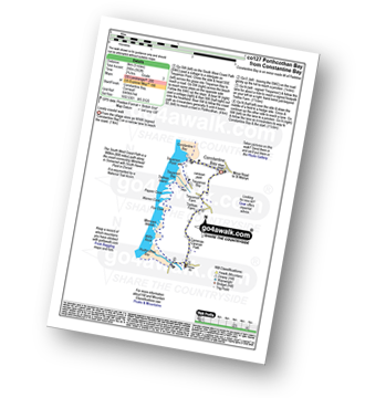
Route Summary:
Constantine Bay - The South West Coast Path - Treyarnon Point - Treyarnon Bay - Trethias Island - Pepper Cove - Warren Cove - Fox Cove - Minnows Islands - Will's Rock - Porthcothan Bay - Carnevas - Trethias Farm - Treyarnon Farm - Constantine Bay
|
Vital Statistics:
| Length: | 7 miles (11 km) |
| Ascent: | 1,789ft (545m) |
| Time: | 4½ hrs |
| Grade: | |
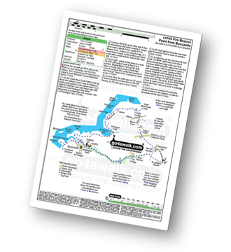
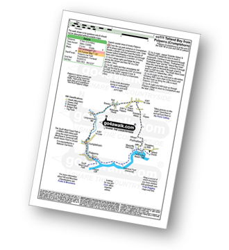
Route Summary:
Boscastle - The South West Coast Path - River Valency - Boscastle Harbour - Penally Point - Penally Hill - Pentargon Bay - Pentargon Falls - Beeny Cliff - Seals Hole - Fire Beacon Point - Beeny - Trebyla Farm - Penvention Farm - St Julietta's Church - River Valency - Boscastle
|
Vital Statistics:
| Length: | 11.25 miles (18 km) |
| Ascent: | 3,197ft (974m) |
| Time: | 7½ hrs |
| Grade: |  |
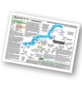
Route Summary:
Boscastle - The South West Coast Path - River Valency - Boscastle Harbour - Penally Point - Penally Hill - Pentargon Bay - Pentargon Falls - Beeny Cliff - Seals Hole - Fire Beacon Point - Beeny - Trebyla Farm - Penvention Farm - St Julietta's Church - River Valency - Minster Wood - Upper Boscastle - Trehane Farm - Trevalga - The South West Coast Path - Grower Rock - Grower Gut - Western Blackapit - Willapark - Boscastle Harbour - Boscastle
|
Vital Statistics:
| Length: | 6.25 miles (10 km) |
| Ascent: | 1,729ft (527m) |
| Time: | 4 hrs |
| Grade: | |
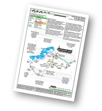
Route Summary:
Boscastle - River Valency - Minster Wood - Upper Boscastle - Trehane Farm - Trevalga - The South West Coast Path - Grower Rock - Grower Gut - Western Blackapit - Willapark - Boscastle Harbour - Boscastle
|
Vital Statistics:
| Length: | 3.25 miles (5 km) |
| Ascent: | 765ft (233m) |
| Time: | 2 hrs |
| Grade: | |
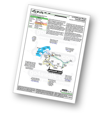
Route Summary:
Boscastle - River Valency - Minster Wood - Jordan Valley - Upper Boscastle - Boscastle Harbour - Boscastle
|
Vital Statistics:
| Length: | 4.5 miles (7 km) |
| Ascent: | 748ft (228m) |
| Time: | 2½ hrs |
| Grade: | |
Route Summary:
Pentire Farm - Porth Mear - The South West Coast Path - High Cove - Park Head - Mackerel Cove - Pentire Steps - Diggory's Island - Bedruthan Steps - Pendarve Point - Whitestone Cove - Bedruthan Steps Visitor Centre - B3276 - Pentire Farm
|
Vital Statistics:
| Length: | 7 miles (11 km) |
| Ascent: | 1,086ft (331m) |
| Time: | 3.75hrs |
| Grade: | |
Route Summary:
Mawgan Porth - Bracken Cott - Vale of Mawgan - St Mawgan - Trevarrian - Tregurrian - Watergate Bay - The South West Coast Path - Ontonna Rock - Stem Point - Griffin's Point - Beacon Cove - Berryl's Point - Butt Rock - Grange Point - Mawgan Porth
|
Vital Statistics:
| Length: | 5.5 miles (9 km) |
| Ascent: | 1,407ft (448m) |
| Time: | 3½ hrs |
| Grade: | |
Route Summary:
Crumplehorn - Polperro - Landaviddy Manor - Raphael - Little Lizzen - East Coombe - The South West Coast Path - East Coombe - Broad Cove - Shag Rock - Colours Cove - Chapel Cliff - Polperro - Crumplehorn
|
Vital Statistics:
| Length: | 8 miles (12 km) |
| Ascent: | 1,759ft (536m) |
| Time: | 4½ hrs |
| Grade: | |
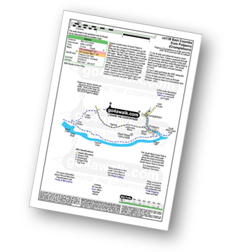
Route Summary:
Crumplehorn - Polperro - Landaviddy Manor - Raphael - Great Tregue - Lansallos - West Coombe - The South West Coast Path - East Coombe - Broad Cove - Shag Rock - Colours Cove - Chapel Cliff - Polperro - Crumplehorn
|
Vital Statistics:
| Length: | 5.25 miles (8.5 km) |
| Ascent: | 1,260ft (384m) |
| Time: | 3.25hrs |
| Grade: | |
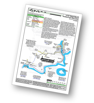
Route Summary:
Crumplehorn - Longcoombe Mill - Watergate House - Sclerder Abbey - Porthallow - Talland Bay - The South West Coast Path - Downend Point - Polperro - Crumplehorn
|
Vital Statistics:
| Length: | 7.5 miles (12 km) |
| Ascent: | 1,533ft (467m) |
| Time: | 4.25hrs |
| Grade: | |
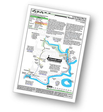
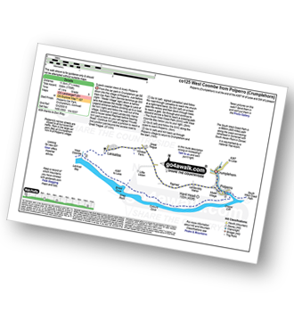
Route Summary:
Millpool Car Park - West Looe - East Looe - The South West Coast Path - Hannafore Point - Portnadler Bay - Hore Stone - Talland Bay - Talland Church - Tencreek Campsite - Parkers Cross - Kilminorth - Watergate - West Looe River - Kilminorth Wood - West Looe - East Looe.
|
Vital Statistics:
| Length: | 6.25 miles (10 km) |
| Ascent: | 1,122ft (342m) |
| Time: | 3½ hrs |
| Grade: | |
Route Summary:
Millpool Car Park - West Looe - East Looe - The South West Coast Path - Hannafore Point - Portnadler Bay - Hore Stone - Talland Bay - Talland Church - Tencreek Campsite - Portlooe - West Looe - East Looe.
Not familiar with the area around PL30?
See these 30 nearest walks to UK Postcode PL30 on a google map


