UK Postcode LE17 - The 30 nearest easy-to-follow, circular walk route maps to you
The thirty nearest easy-to-follow, circular walk route maps to you in UK Postcode LE17 in Walk Grade Order
The UK cities, towns and villages in Leicestershire, England that have LE17 in their UK Postcode include:
• Ashby Magna • Ashby Parva • Bitteswell • Bruntingthorpe • Catthorpe • Claybrooke Magna • Claybrooke Parva • Cotesbach • Dunton Bassett • Frolesworth • Gilmorton • Husbands Bosworth • Kimcote • Laughton • Leire • Lutterworth • Misterton • Mowsley • North Kilworth • Peatling Parva • Shawell • Shearsby • South Kilworth • Swinford • Theddingworth • Ullesthorpe • Walcote • Walton • Wibtoft •
Not familiar with the area around LE17?
See these 30 nearest walks to UK Postcode LE17 on a google map
   |
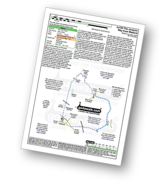
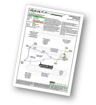
Vital Statistics:
| Length: | 6.5 miles (10.5 km) |
| Ascent: | 338ft (103m) |
| Time: | 2.75hrs |
| Grade: |  |
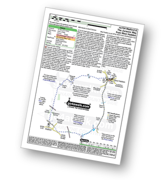
Route Summary:
West Haddon - Foxhill Farm - Watford - The Jurassic Way - Barleypiece Spinney - Long Spinney - Flavell's Lodge - Silsworth Lodge Farm - West Haddon
|
Vital Statistics:
| Length: | 5.25 miles (8.5 km) |
| Ascent: | 292ft (89m) |
| Time: | 2.25hrs |
| Grade: | |
|
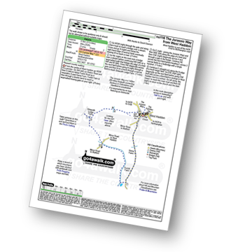
Vital Statistics:
| Length: | 5.75 miles (9 km) |
| Ascent: | 226ft (69m) |
| Time: | 2½ hrs |
| Grade: | |
Route Summary:
Watford - The Jurassic Way - Barleypiece Spinney - Long Spinney - Watford Covert - Flavell's Lodge - Silsworth Lodge Farm - Cherry Lodge - Watford
|
Vital Statistics:
| Length: | 5 miles (8 km) |
| Ascent: | 345ft (105m) |
| Time: | 2.25hrs |
| Grade: | |
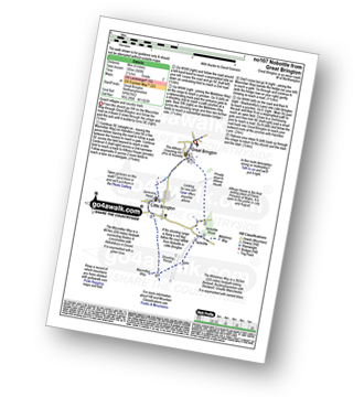
Route Summary:
Great Brington - Nobottle Wood - The Midshires Way - Nobottle - The Macmillan Way - Little Brington - Great Brington
|
Vital Statistics:
| Length: | 5.5 miles (9 km) |
| Ascent: | 499ft (152m) |
| Time: | 2½ hrs |
| Grade: |  |
|
Vital Statistics:
| Length: | 7 miles (11 km) |
| Ascent: | 771ft (235m) |
| Time: | 3.25hrs |
| Grade: |  |
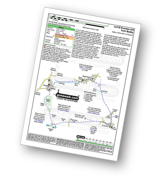
Route Summary:
Badby - Knightley Way - Badby Wood - Badby Down - Fawsley Hall - Everdon Hill - Everdon - Little Everdon - The Nene Way - River Nene - Newnham - Badby
|
Vital Statistics:
| Length: | 8.5 miles (13.5 km) |
| Ascent: | 246ft (75m) |
| Time: | 3½ hrs |
| Grade: | |
|
Vital Statistics:
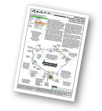
| Length: | 3.5 miles (5.5 km) |
| Ascent: | 289ft (88m) |
| Time: | 1.75hrs |
| Grade: |  |
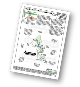
Route Summary:
Conkers Discovery Centre - Swadlincote - Conkers Waterside - Ashby Woulds Heritage Trail - Donisthorpe - Donisthorpe Woodland Park - Ashby De La Zouch Canal - Moira Lock - Moira Furnace Museum - Moira - Sarah's Wood - Conkers Waterside - Conkers Discovery Centre - Swadlincote.
|
Vital Statistics:
| Length: | 7 miles (11 km) |
| Ascent: | 151ft (46m) |
| Time: | 2.75hrs |
| Grade: | |
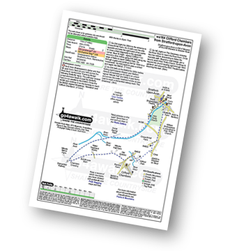
Route Summary:
Stratford-upon-Avon - Tramway - River Stour - Clifford Chambers - The Greenway - River Avon - Stratford-upon-Avon
|
Vital Statistics:
| Length: | 7.25 miles (11.5 km) |
| Ascent: | 515ft (157m) |
| Time: | 3 hrs |
| Grade: | |
|
Vital Statistics:
| Length: | 6.5 miles (10 km) |
| Ascent: | 328ft (100m) |
| Time: | 2½ hrs |
| Grade: | |
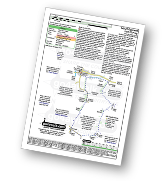
Route Summary:
Turvey - Turvey Abbey - Priory Farm - Grotto Plantation - Hill Spinney - Ramacre Wood - Gorewell - The Milton Keynes Boundary Walk - Gullet Wood - Keepers (Church's) Cottage - Woodside - Turvey
|
Vital Statistics:
| Length: | 6.75 miles (10 km) |
| Ascent: | 256ft (78m) |
| Time: | 2.75hrs |
| Grade: | |
|
Vital Statistics:
| Length: | 7.75 miles (12.5 km) |
| Ascent: | 295ft (90m) |
| Time: | 3.25hrs |
| Grade: | |

|
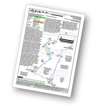
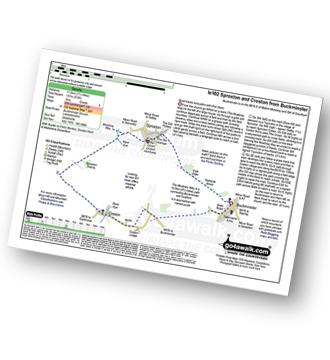
Vital Statistics:
| Length: | 5.25 miles (8.5 km) |
| Ascent: | 177ft (54m) |
| Time: | 2.25hrs |
| Grade: | |
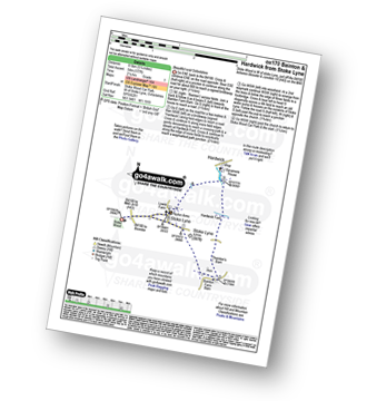
Route Summary:
Stoke Wood - Stoke Lyne - Bainton - Hardwick Ford - Hardwick - Stoke Bushes - Stoke Lyne - Stoke Wood
|
Vital Statistics:
| Length: | 9.75 miles (15 km) |
| Ascent: | 555ft (169m) |
| Time: | 4 hrs |
| Grade: | |
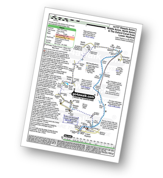
Route Summary:
Lower Heyford - Heyford Wharfe - The Oxford Canal - The Eye Catcher - Steeple Aston - Three Corner Clump - Middle Aston - Warren Lodge - Hendon Farm - North Aston - The Manor - River Cherwell - Somerton - The Oxfordshire Canal Walk - The Oxford Canal - Somerton Crossing - Heyford Common Lock - Allens Lock - Lower Heyford
Not familiar with the area around LE17?
See these 30 nearest walks to UK Postcode LE17 on a google map
|
Vital Statistics:
| Length: | 6.75 miles (11 km) |
| Ascent: | 427ft (130m) |
| Time: | 3 hrs |
| Grade: | |
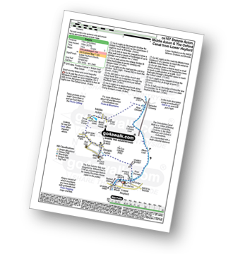
Route Summary:
Lower Heyford - Heyford Wharfe - The Oxford Canal - The Eye Catcher - Steeple Aston - Three Corner Clump - Middle Aston - River Cherwell - Somerton Crossing - The Oxfordshire Canal Walk - The Oxford Canal - Heyford Common Lock - Allens Lock - Lower Heyford
|
Vital Statistics:
| Length: | 4.75 miles (7.5 km) |
| Ascent: | 368ft (112m) |
| Time: | 2.25hrs |
| Grade: | |
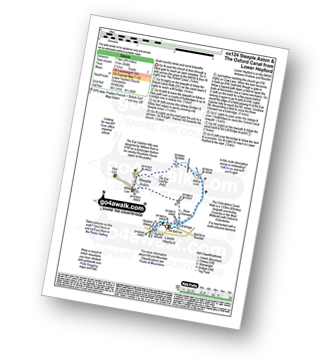
Route Summary:
Lower Heyford - Heyford Wharfe - The Oxford Canal - Steeple Aston - The Eye Catcher (Folly) - River Cherwell - The Oxfordshire Canal Walk - The Oxford Canal - Allens Lock - Lower Heyford
|
Vital Statistics:
| Length: | 10.25 miles (16.5 km) |
| Ascent: | 463ft (141m) |
| Time: | 4.25hrs |
| Grade: | |
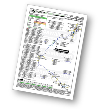
Route Summary:
Moreton-in-Marsh - The Mornarch's Way - Upper Fields Farm - Longborough - Donnington - Broadwell - Quinmoor Far - River Evenlode - Evenlode - Codicote Farm - Moreton-in-Marsh
|
Vital Statistics:
| Length: | 6.25 miles (10 km) |
| Ascent: | 670ft (204m) |
| Time: | 3 hrs |
| Grade: | |
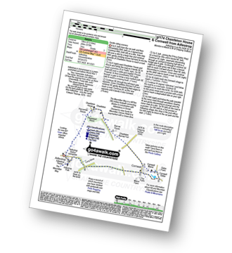
Route Summary:
Adlestrop - The Macmillan Way - Chastleton - Chastleton House - Chastleton Barrow Iron Age Fort - Cornwell - Adlestrop
|
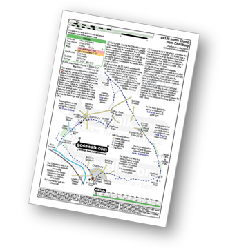
Vital Statistics:
| Length: | 3.75 miles (6 km) |
| Ascent: | 394ft (120m) |
| Time: | 1.75hrs |
| Grade: | |
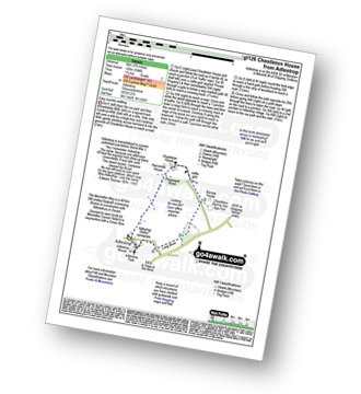
Route Summary:
Adlestrop - The Macmillan Way - Chastleton - Chastleton House - Chastleton Barrow Iron Age Fort - Long Drive - Adlestrop
|
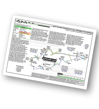
Vital Statistics:
| Length: | 9 miles (14.5 km) |
| Ascent: | 801ft (244m) |
| Time: | 4.25hrs |
| Grade: | |
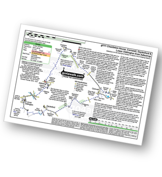
Route Summary:
Adlestrop - The Macmillan Way - Chastleton - Chastleton House - Chastleton Barrow Iron Age Fort - Cornwell - Daylesford - The Macmillan Way - Lower Oddington - Adlestrop Park - Adlestrop
|
Vital Statistics:
| Length: | 8.25 miles (13 km) |
| Ascent: | 696ft (212m) |
| Time: | 3.75hrs |
| Grade: | |
|
Vital Statistics:
| Length: | 5.5 miles (9 km) |
| Ascent: | 400ft (122m) |
| Time: | 2½ hrs |
| Grade: | |
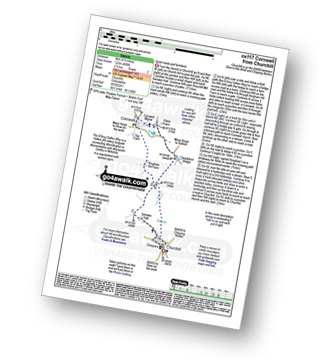
Route Summary:
Churchill - Sarsden Halt. Kingham Hill Farm - Cornwell - Swailsford Bridge - Churchill
|
Vital Statistics:
| Length: | 4.75 miles (7.5 km) |
| Ascent: | 476ft (145m) |
| Time: | 2.25hrs |
| Grade: | |
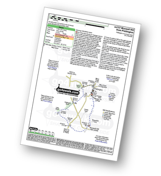
Route Summary:
Piddington - Muswell Hill - Oakcroft Farm - Little Wood - Piddington Wood - Widnell Park - Piddington
|
Vital Statistics:
| Length: | 8.75 miles (14 km) |
| Ascent: | 574ft (175m) |
| Time: | 3.75hrs |
| Grade: | |
Route Summary:
Charlbury - The Oxfordshire Way - Dean Grove - Coldron Mill - Spelsbury - Taston - Taston Village Cross - The Wychwood Way - Inotts Clump - Shilcott Wood - Ditchley Park - Charlbury
|
Vital Statistics:
| Length: | 6 miles (9.5 km) |
| Ascent: | 508ft (155m) |
| Time: | 2½ hrs |
| Grade: | |
Route Summary:
Stow-on-the-Wold - The Monarch's Way - Broadwell - Donnington - Battle of Stow Memorial - The Gloucestershire Way - Upper Swell - Stow-on-the-Wold
|
Vital Statistics:
| Length: | 6.5 miles (10.5 km) |
| Ascent: | 272ft (83m) |
| Time: | 2.75hrs |
| Grade: | |
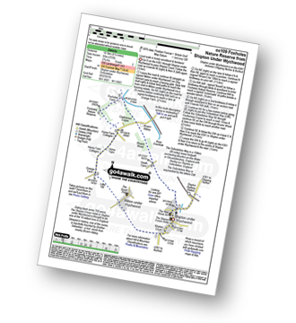
Route Summary:
Shipton Under Wychwood - Milton Under Wychwood - Grange Farm - Home Farm - Foxholes Nature Reserve - The Oxfordshire Way - Bruern Abbey - Shipton Under Wychwood
|
Vital Statistics:
| Length: | 6.75 miles (11 km) |
| Ascent: | 876ft (267m) |
| Time: | 3½ hrs |
| Grade: | |
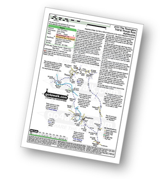
Route Summary:
Mappleton Lane (Ashbourne) - The Tissington Trail - Thorpe - The Limestone Way - Coldwall Bridge - River Dove - Big Peg's Wood - Little Peg's Wood - Littlepark Farm - Mappleton (aka Mapleton) - Callow Top - Mappleton Lane (Ashbourne)
|
Vital Statistics:
| Length: | 12.25 miles (19.5 km) |
| Ascent: | 1,930ft (588m) |
| Time: | 6½ hrs |
| Grade: |  |
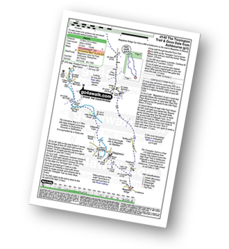
Route Summary:
Mappleton Lane (Ashbourne) - The Tissington Trail - Thorpe - Pike House - Bostern Grange Farm - Hanson Grange - The Nabs - Dove Dale - Dove Holes - Taylors Wood - Pickering Rock - Ilam Rock - Shaplow Dale - Lin Dale - Thorpe Cloud - Thorpe Mill Farm - The Limestone Way - Coldwall Bridge - River Dove - Big Peg's Wood - Little Peg's Wood - Littlepark Farm - Mappleton (aka Mapleton) - Callow Top - Mappleton Lane (Ashbourne)
|
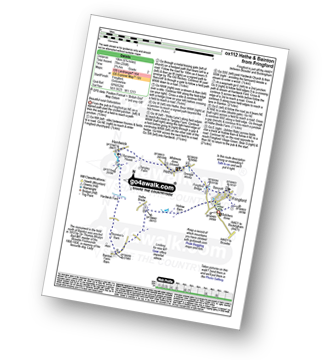
Vital Statistics:
| Length: | 8.25 miles (13 km) |
| Ascent: | 843ft (257m) |
| Time: | 3.75hrs |
| Grade: | |
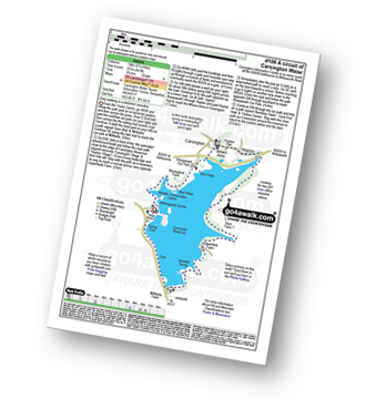
Route Summary:
Carsington Water Visitors Centre - Carsington Water Dam - Millfields - 'Wooden' House - Upperfield Farm - Hopton - Hopton Hall - Carsington - Sheepwash - Carsington Wildlife Conservation Centre - Carsington Water Visitors Centre
Not familiar with the area around LE17?
See these 30 nearest walks to UK Postcode LE17 on a google map


