UK Postcode HP12 - The 30 nearest easy-to-follow, circular walk route maps to you
The thirty nearest easy-to-follow, circular walk route maps to you in UK Postcode HP12 in Walk Grade Order
The UK cities, towns and villages in Buckinghamshire, England that have HP12 in their UK Postcode include:
• Booker •
Not familiar with the area around HP12?
See these 30 nearest walks to UK Postcode HP12 on a google map
   |
Vital Statistics:
| Length: | 5.5 miles (9 km) |
| Ascent: | 722ft (220m) |
| Time: | 2.75hrs |
| Grade: |  |
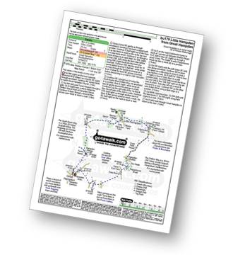
Route Summary:
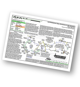
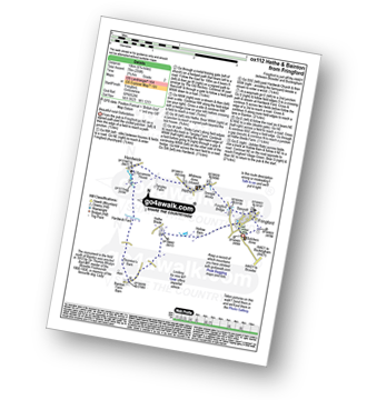
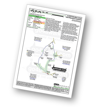
Great Hampden - The Chiltern Way - Hampden House - Little Hampden - The South Bucks Way - Cobbleshill Farm - Hampden Bottom - Pepperboxes Wood - Honor End Farm - Great Hampden
|
Vital Statistics:
| Length: | 5 miles (8 km) |
| Ascent: | 230ft (70m) |
| Time: | 2 hrs |
| Grade: |  |
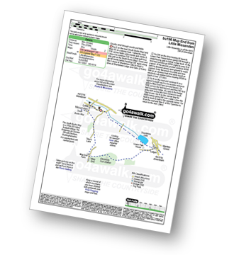
Route Summary:
Little Missenden - The South Bucks Way - Lower Park - Shardeloes Lake - Amersham Cricket Ground - Lower Park House - Wheatley Wood - Mop End - Mop End Farm - Taby's Lane - Breaches Wood - Little Missenden
|
Vital Statistics:
| Length: | 3.75 miles (6 km) |
| Ascent: | 538ft (164m) |
| Time: | 2 hrs |
| Grade: | |
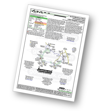
Route Summary:
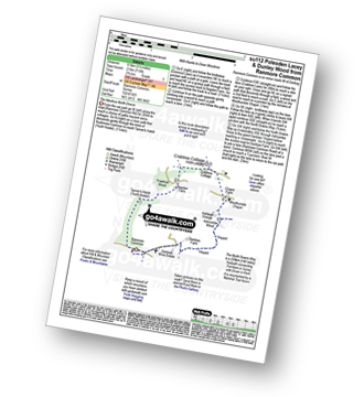
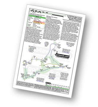
Little Hampden Common - Little Hampden - The South Bucks Way - Cobblershill Farm - The Chiltern Way - Cockshoots Wood - Mayortorne Manor - Russell Farm - Dunsmore - Scrub Wood - Hampdenleaf Wood - The Icknield Way - Little Hampden Common
|
Vital Statistics:
| Length: | 6 miles (9.5 km) |
| Ascent: | 528ft (161m) |
| Time: | 2.75hrs |
| Grade: | |
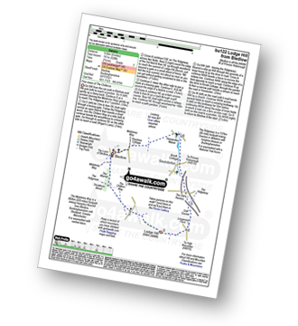
Route Summary:
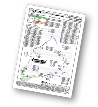
Bledlow - The Midshires Way - The Warren - The Ridgeway - Thickthorn Wood - Lodge Hill - Longwood Farm - The Old Rectory - Saunderton - Horsenden - Bledlow
|
Vital Statistics:
| Length: | 4.5 miles (7 km) |
| Ascent: | 345ft (105m) |
| Time: | 2 hrs |
| Grade: | |
Route Summary:
The Lee - Kiln Cottage - Lee Gate - The Chiltern Way - Durham Farm - Wendoverdean Farm - Wendover Dean - Mayortorne Manor - Spinney Cottage - The Lee
|
Vital Statistics:
| Length: | 8.25 miles (13 km) |
| Ascent: | 919ft (280m) |
| Time: | 4 hrs |
| Grade: |  |
Route Summary:
The Lee - Kiln Cottage - Lee Gate - The Chiltern Way - Durham Farm - Wendoverdean Farm - Wendover Dean - Mayortorne Manor - Russell Farm - Dunsmore - Scrub Wood - Hampdenleaf Wood - The Icknield Way - Little Hampden Common - Little Hampden - The South Bucks Way - Cobblershill Farm - The Chiltern Way - Cockshoots Wood - Mayortorne Manor - Spinney Cottage - The Lee
|
Vital Statistics:
| Length: | 4.5 miles (7 km) |
| Ascent: | 693ft (211m) |
| Time: | 2½ hrs |
| Grade: | |
Route Summary:
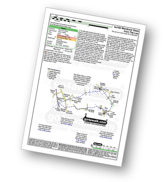
Great Kimble - The North Bucks Way - Askett - Monks Risborough - Whiteleaf - The Icknield Way - The Ridgeway - Whiteleaf Cross - Cadsden - Grangelands And Pulpit Hill Nature Reserve - Chequer's Knap - The North Bucks Way - Great Kimble
|
Vital Statistics:
| Length: | 5.5 miles (9 km) |
| Ascent: | 853ft (260m) |
| Time: | 3 hrs |
| Grade: | |
Route Summary:
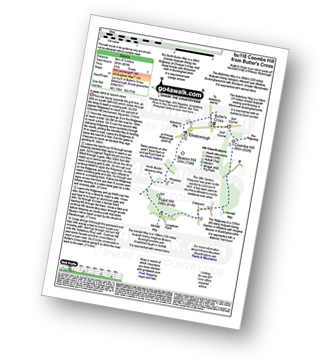
Butler's Cross - Monument Hill (Coombe Hill) - The Ridgeway - Linton's Wood - Goodmerhill Wood - Chisley Wood - The Icknield Way - Chequers - Pond Wood - Pulpit Wood - The North Bucks Way - The Midshires Way - Chequers Knap - Whorley Wood - Ellesborough Warren - Boxtree Wood - Beacon Hill (Ellesborough) - Ellesborough - The Aylesbury Ring - Springs Farm - Butler's Cross
|
Vital Statistics:
| Length: | 9 miles (14.5 km) |
| Ascent: | 328ft (100m) |
| Time: | 3½ hrs |
| Grade: | |
Route Summary:
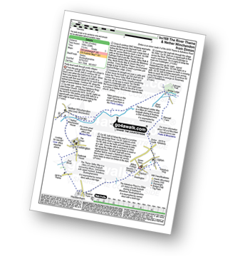
Dinton - Upton - The Aylsebury Ring - Dinton Castle - Starveall Farm - Eythrope Park - The Midshires Way - The North Bucks Way - The Swans Way - Bridge Lodge - The River Thame - The Bernwood Jubilee Way - The Thame Valley Way - Nether Winchendon - Lower Winchendon - Cuddington - Haddenham - Dad Brook - Townsend - Haddenham - Westington - Dinton
|
Vital Statistics:
| Length: | 6.5 miles (10.5 km) |
| Ascent: | 230ft (70m) |
| Time: | 2½ hrs |
| Grade: | |
Route Summary:
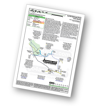
Stone - Hartwell Church - Upper Hartwell - Whaddon Hill Farm - The North Bucks Way - River Thame - Thame Valley Walk - The Midshires Way - Weir Lodge - Bridge Lodge - Eythrope Park - Beachendon Cottages - Eythrope House - Aylesbury Ring - Stone
|
Vital Statistics:
| Length: | 4.25 miles (6.5 km) |
| Ascent: | 131ft (40m) |
| Time: | 1.75hrs |
| Grade: |  |
Route Summary:
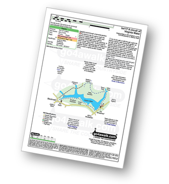
Virginia Water - Wick Pond - Totem Pole - Oxshed Clump - Valley Gardens - Heather Gardens - Johnson's Pond - Blacknest - Frostform Plantation - Leptis Magna Roman Ruins - Cascade Bridge - Virginia Water
|
Vital Statistics:
| Length: | 6.5 miles (10 km) |
| Ascent: | 722ft (220m) |
| Time: | 3 hrs |
| Grade: | |
Route Summary:
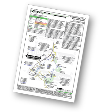
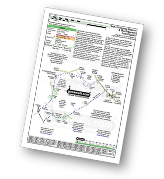
Dagnall - Chlitern Farm - Former Radio Station - Gallows Hill - Ivinghoe Beacon - The Ridgeway - Ivinghoe Hills - Steps Hill - Down Farm - Clipperdown Cottage - Clipper Down - Ward's Hurst Farm - Hog Hall - Hog Hall Lane - Dagnall
|
Vital Statistics:
| Length: | 6.5 miles (10.5 km) |
| Ascent: | 637ft (194m) |
| Time: | 3 hrs |
| Grade: | |
Route Summary:
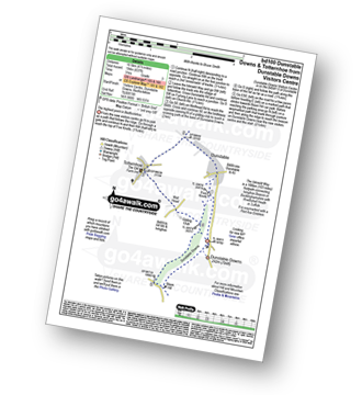
Dunstable Downs Visitors Centre - The Icknield Way - Five Knolls - Drovers Way - Totternhoe - Well Head - Bison Hill - Dunstable Downs Visitors Centre
|
Vital Statistics:
| Length: | 4.75 miles (7.5 km) |
| Ascent: | 476ft (145m) |
| Time: | 2.25hrs |
| Grade: | |
Route Summary:
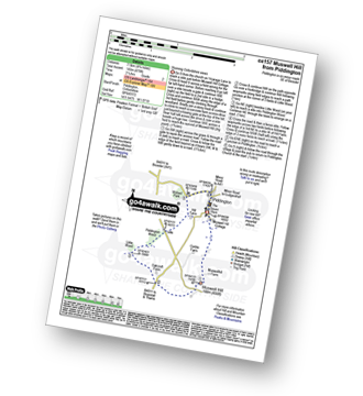
Piddington - Muswell Hill - Oakcroft Farm - Little Wood - Piddington Wood - Widnell Park - Piddington
|
Vital Statistics:
| Length: | 7.25 miles (11.5 km) |
| Ascent: | 381ft (116m) |
| Time: | 3 hrs |
| Grade: | |
Route Summary:
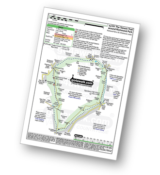
Richmond Park - Pembroke Lodge - Hamcross Plantation - Ham Bottom - Park Gate - Kingston Gate - Robin Hood Gate - Beverley Brook - Roehampton Gate - Adam's Pond - Sheen Gate - The Bog - Richmond Gate - Richmond Park (Richmond Park) - Pembroke Lodge - Richmond Park
Not familiar with the area around HP12?
See these 30 nearest walks to UK Postcode HP12 on a google map
|
Vital Statistics:
| Length: | 5 miles (8 km) |
| Ascent: | 190ft (58m) |
| Time: | 2 hrs |
| Grade: | |
Route Summary:
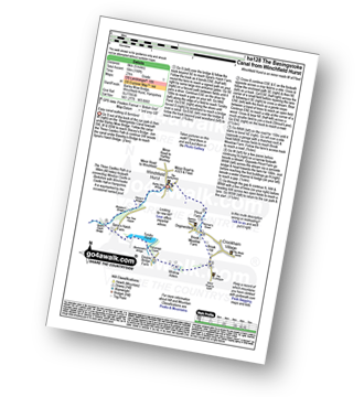
Winchfield Hurst - Barley Mow Bridge - The Basingstoke Canal - Stacey's Bridge - The Three Castles Path - Baseley's Bridge - Sprat's Hatch Bridge - Sprat's Hatch Farm - Tundry Pond - Parsonage Copse - Double Bridge Farm - Whitlow Alders - Crookham Village - Brook Hill - Brook Meadow Farm - Dogmersfield - Norman's Green - Pilcot Farm - Winchfield Hurst
|
Vital Statistics:
| Length: | 7.75 miles (12.5 km) |
| Ascent: | 295ft (90m) |
| Time: | 3.25hrs |
| Grade: | |

|
Vital Statistics:
| Length: | 6.75 miles (10 km) |
| Ascent: | 256ft (78m) |
| Time: | 2.75hrs |
| Grade: | |
|
Vital Statistics:
| Length: | 5.25 miles (8.5 km) |
| Ascent: | 177ft (54m) |
| Time: | 2.25hrs |
| Grade: | |
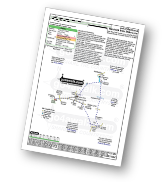
Route Summary:
Stoke Wood - Stoke Lyne - Bainton - Hardwick Ford - Hardwick - Stoke Bushes - Stoke Lyne - Stoke Wood
|
Vital Statistics:
| Length: | 7.5 miles (12 km) |
| Ascent: | 1,175ft (358m) |
| Time: | 4 hrs |
| Grade: | |
Route Summary:
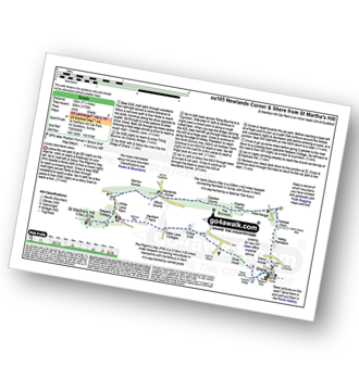
St Martha's Hill Car Park - Pilgram's Way - Newbarn Farm - Water Lane Cottages - Timber Croft - Silver Wood - Shere - Netley Plantation Hollister Farm - The North Downs Way - West Hanger - Chantry Wood - The Boxwood - Clandon Downs - Newlands Corner - Albury Downs - Merrow Downs - White Lane Farm - Keepers Cottage - St Martha's Hill - St Martha's Hill Car Park
|
Vital Statistics:
| Length: | 5.5 miles (9 km) |
| Ascent: | 945ft (288m) |
| Time: | 3 hrs |
| Grade: | |
Route Summary:
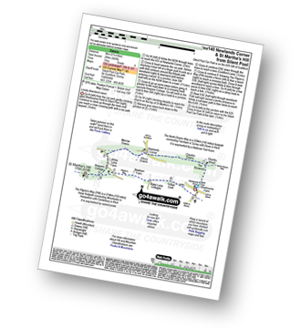
Silent Pool Car Park - Sherbourne Pond - Silent Pool - The Boxwood - Clandon Downs - Newlands Corner - Albury Downs - Merrow Downs - White Lane Farm - Keepers Cottage - St Martha's Hill - Pilgram's Way - Newbarn Farm - Water Lane Cottages - Timber Croft - Albury St - Silent Pool Car Park
|
Vital Statistics:
| Length: | 4.75 miles (7.5 km) |
| Ascent: | 368ft (112m) |
| Time: | 2.25hrs |
| Grade: | |
Route Summary:
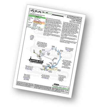
Lower Heyford - Heyford Wharfe - The Oxford Canal - Steeple Aston - The Eye Catcher (Folly) - River Cherwell - The Oxfordshire Canal Walk - The Oxford Canal - Allens Lock - Lower Heyford
|
Vital Statistics:
| Length: | 6.75 miles (11 km) |
| Ascent: | 427ft (130m) |
| Time: | 3 hrs |
| Grade: | |
Route Summary:
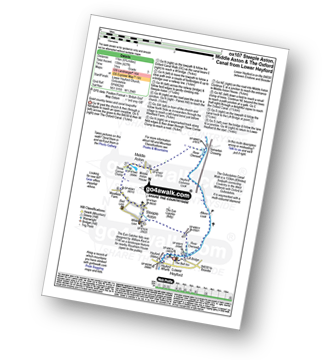
Lower Heyford - Heyford Wharfe - The Oxford Canal - The Eye Catcher - Steeple Aston - Three Corner Clump - Middle Aston - River Cherwell - Somerton Crossing - The Oxfordshire Canal Walk - The Oxford Canal - Heyford Common Lock - Allens Lock - Lower Heyford
|
Vital Statistics:
| Length: | 9.75 miles (15 km) |
| Ascent: | 555ft (169m) |
| Time: | 4 hrs |
| Grade: | |
Route Summary:
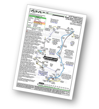
Lower Heyford - Heyford Wharfe - The Oxford Canal - The Eye Catcher - Steeple Aston - Three Corner Clump - Middle Aston - Warren Lodge - Hendon Farm - North Aston - The Manor - River Cherwell - Somerton - The Oxfordshire Canal Walk - The Oxford Canal - Somerton Crossing - Heyford Common Lock - Allens Lock - Lower Heyford
|
Vital Statistics:
| Length: | 5.5 miles (9 km) |
| Ascent: | 466ft (142m) |
| Time: | 2½ hrs |
| Grade: | |
Route Summary:
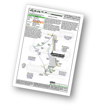
Tattenham Corner - Epsom Downs Racecourse - Langley Cale - The Warren - Nohome Farm - Downs View Wood - Walton On The Hill - The Nere - Withybed Corner - Walton Downs - Tattenham Corner - Epsom Downs Racecourse.
|
Vital Statistics:
| Length: | 4.75 miles (7.5 km) |
| Ascent: | 630ft (192m) |
| Time: | 2½ hrs |
| Grade: | |
Route Summary:
Ranmore Common - Yewtree Farm - Polesden Lacey - Connicut Wood - Freehold Wood - Tanner's Hatch (Yough Hostel) - Ranmore Common
|
Vital Statistics:
| Length: | 5.25 miles (8.5 km) |
| Ascent: | 715ft (218m) |
| Time: | 2.75hrs |
| Grade: | |
Route Summary:
Ranmore Common - Tanner's Hatch (Youth Hostel) - Bagden Farm - Crabtree Cottage - Chapel Farm - Westhumble Church - The North Downs Way - Ashcombe Wood - Denbies - St Barnabus Church - Ranmore Common
|
Vital Statistics:
| Length: | 7.25 miles (11.5 km) |
| Ascent: | 873ft (266m) |
| Time: | 3½ hrs |
| Grade: | |
Route Summary:
Ranmore Common - Yewtree Farm - Polesden Lacey - Pigden Cottage - Hogden Cottage - Friars Farm - Dunley Wood - The North Downs Way - White Downs - Burnetts Leaf - The Roadabouts - The Spains - Ranmore Common
|
Vital Statistics:
| Length: | 8.5 miles (13.5 km) |
| Ascent: | 866ft (264m) |
| Time: | 4 hrs |
| Grade: | |
Route Summary:
Ranmore Common - The North Downs Way - The Spains - The Roundabouts - Burnetts Leaf - Hogden Cottage - Pigden Cottage - Polesden Lacey - Bookham Wood - Crabtree Cottage - Chapel Farm - Westhumble Chapel - Ashcombe Wood - St Barnabus Church - Ranmore Common
|
Vital Statistics:
| Length: | 7 miles (11 km) |
| Ascent: | 1,115ft (340m) |
| Time: | 3½ hrs |
| Grade: | |
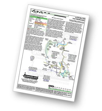
Route Summary:
Car Park S of Mickleham - River Mole - Norbury Park House - Fetcham Downs - Westhumble - The North Downs Way - Box Hill - Car Park S of Mickleham
Not familiar with the area around HP12?
See these 30 nearest walks to UK Postcode HP12 on a google map


