UK Postcode DE56 - The 30 nearest easy-to-follow, circular walk route maps to you
The thirty nearest easy-to-follow, circular walk route maps to you in UK Postcode DE56 in Walk Grade Order
The UK cities, towns and villages in Derbyshire, England that have DE56 in their UK Postcode include:
• Alderwasley • Ambergate • Belper • Belper Lane End • Cross o' the Hands • Duffield • Fritchley • Hazelwood • Heage • Holbrook • Idridgehay • Kilburn • Milford • Mount Pleasant • Shottle • Shottlegate • Turnditch • White Moor • Windley • Windley Meadows •
Not familiar with the area around DE56?
See these 30 nearest walks to UK Postcode DE56 on a google map
   |
Vital Statistics:
| Length: | 8.25 miles (13 km) |
| Ascent: | 843ft (257m) |
| Time: | 3.75hrs |
| Grade: |  |
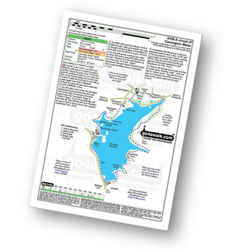
Route Summary:
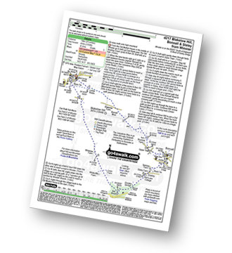
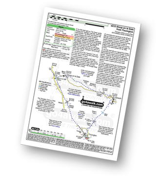
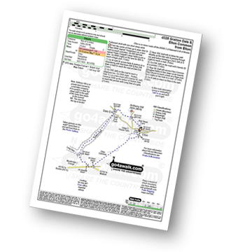
Carsington Water Visitors Centre - Carsington Water Dam - Millfields - 'Wooden' House - Upperfield Farm - Hopton - Hopton Hall - Carsington - Sheepwash - Carsington Wildlife Conservation Centre - Carsington Water Visitors Centre
|
Vital Statistics:
| Length: | 7.25 miles (11.5 km) |
| Ascent: | 1,080ft (329m) |
| Time: | 3.75hrs |
| Grade: | |
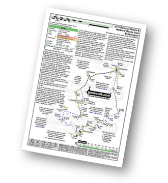
Route Summary:
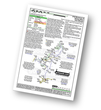
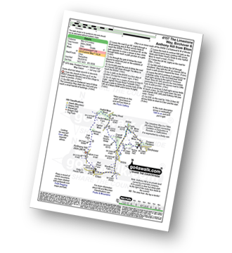
Brassington - The Limestone Way - Rainster Rocks - Longcliffe - Aldwark - Grangemill - The Limestone Way - Grange Mill Quarry - Harboro' Farm - Harboro' Rocks - Bee Nest Mine - Brassington
|
Vital Statistics:
| Length: | 8 miles (12.5 km) |
| Ascent: | 1,010ft (305m) |
| Time: | 4 hrs |
| Grade: | |
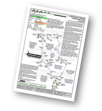
Route Summary:
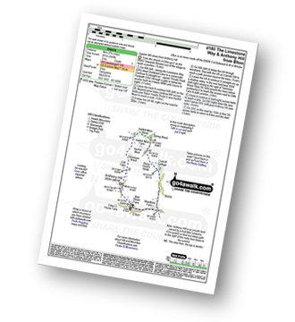
Kniveton - Whitelands - Wigber Low - Bradbourne Mill - Bletch Brook - Sitterlow Farm - Parwich - Ballidon - Bradbourne - Newhouse Farm - Kniveton
|
Vital Statistics:
| Length: | 12.75 miles (20.5 km) |
| Ascent: | 1,956ft (596m) |
| Time: | 6.75hrs |
| Grade: |  |
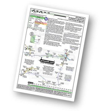
Route Summary:
Darley Bridge - Wensley Dale - Northern Dale - Ash Plantation - Brightgate Farm - Bonsall Moor - The Limestone Way - Luntor Rocks - Winster - Westhill Farm - Robin Hood's Stride - Harthill Moor - Harthill Moor Wood - Bleakley Dike - River Bradford - Bradford Dale - Youlgreave - Rhienstor Plantation - Greenfield Farm - Stoney Ley Wood - Rocking Stone Farm - Birchover - Uppertown Farm - Clough Wood - Sabine Hey Wood - Cowley Knowl - Darley Bridge
|
Vital Statistics:
| Length: | 8.75 miles (14 km) |
| Ascent: | 1,342ft (409m) |
| Time: | 4½ hrs |
| Grade: |  |
Route Summary:
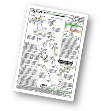
Winster - The Limestone Way - Westhill Farm - Robin Hood's Stride - Harthill Moor - Harthill Moor Wood - Bleakley Dike - River Bradford - Bradford Dale - Youlgreave - Mawstone Farm - Bleakley Plantation - Longshawe Wood - Anthony Hill - Elton - Sacheveral Farm - Winster
|
Vital Statistics:
| Length: | 8.25 miles (13 km) |
| Ascent: | 1,358ft (414m) |
| Time: | 4½ hrs |
| Grade: | |
Route Summary:
Winster - Luntor Rocks - The Limestone Way - Blakelow Hill - Bonsall Moor - Upper Town - Bonsall - Slaley - Dunsley Springs - Bonsall Wood - Ible Wood - Whitelow Farm - Bonsall Moor - Wyns Tor - Winster
|
Vital Statistics:
| Length: | 5.75 miles (9 km) |
| Ascent: | 1,046ft (319m) |
| Time: | 3.25hrs |
| Grade: | |
Route Summary:
Winster - Upper Town - Uppertown Farm - Rocking Stone Farm - Birchover - Stanton Moor - Cork Stone - Nine Ladies Stone Circle - The Reform Tower (or Earl Grey Tower) - Winster
|
Vital Statistics:
| Length: | 5.75 miles (9 km) |
| Ascent: | 1,217ft (371m) |
| Time: | 3.25hrs |
| Grade: | |
Route Summary:
Winster - Upper Town - Clough Wood - Sabine Hay Wood - Cowley Knowl - Cambridge Wood - Wensley - Big Dungeon - Wensley Dale - Northern Dale - Brightgate Farm - The Limestone Way - Luntor Rocks - Winster
|
Vital Statistics:
| Length: | 12.25 miles (19.5 km) |
| Ascent: | 1,930ft (588m) |
| Time: | 6½ hrs |
| Grade: | |
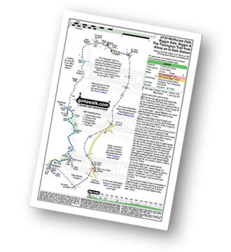
Route Summary:
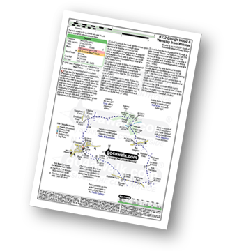
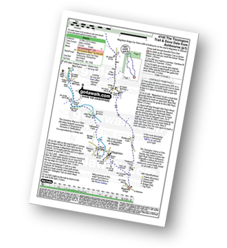
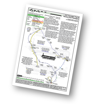
Mappleton Lane (Ashbourne) - The Tissington Trail - Thorpe - Pike House - Bostern Grange Farm - Hanson Grange - The Nabs - Dove Dale - Dove Holes - Taylors Wood - Pickering Rock - Ilam Rock - Shaplow Dale - Lin Dale - Thorpe Cloud - Thorpe Mill Farm - The Limestone Way - Coldwall Bridge - River Dove - Big Peg's Wood - Little Peg's Wood - Littlepark Farm - Mappleton (aka Mapleton) - Callow Top - Mappleton Lane (Ashbourne)
|
Vital Statistics:
| Length: | 6.75 miles (11 km) |
| Ascent: | 876ft (267m) |
| Time: | 3½ hrs |
| Grade: | |
Route Summary:
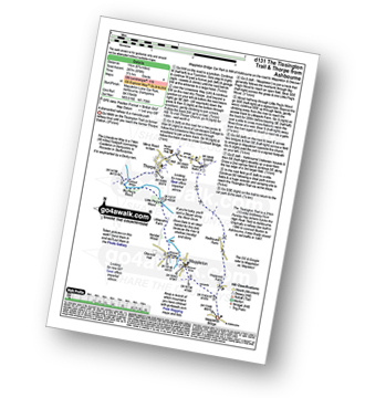
Mappleton Lane (Ashbourne) - The Tissington Trail - Thorpe - The Limestone Way - Coldwall Bridge - River Dove - Big Peg's Wood - Little Peg's Wood - Littlepark Farm - Mappleton (aka Mapleton) - Callow Top - Mappleton Lane (Ashbourne)
|
Vital Statistics:
| Length: | 4 miles (6.5 km) |
| Ascent: | 508ft (155m) |
| Time: | 2 hrs |
| Grade: |  |
Route Summary:
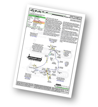
Fenny Bentley - Lees Farm - Darfield Plantation - Tissington - The Tissington Trail - Thorpe Station - Fenny Bentley
|
Vital Statistics:
| Length: | 9 miles (14.5 km) |
| Ascent: | 1,453ft (446m) |
| Time: | 4.75hrs |
| Grade: | |
Route Summary:
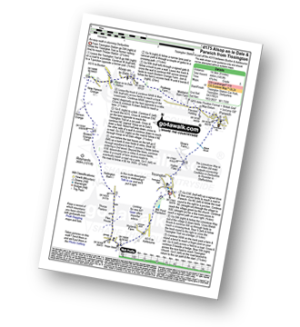
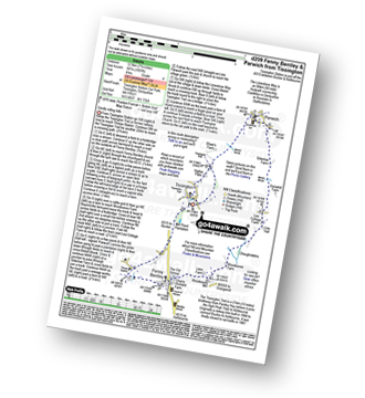
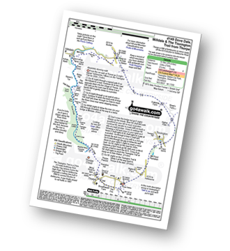
Tissington - The Tissington Trail - Thorpe Station - Thorpe - Pike House - Thorpe Pasture - Bostern Grange Farm - Alsop en le Dale Station - Parwich - The Limestone Way - Tissington
|
Vital Statistics:
| Length: | 8.5 miles (13.5 km) |
| Ascent: | 1,099ft (335m) |
| Time: | 4.25hrs |
| Grade: | |
Route Summary:
Tissington - The Tissington Trail - Alsop en le Dale Station - Oxdales Farm - Eaton Dale - Eatondale Wood - Flaxdale Holding - Parwich - Bletch Brook - Higher Flats - Tissington
|
Vital Statistics:
| Length: | 7.25 miles (12.5 km) |
| Ascent: | 1,007ft (307m) |
| Time: | 4 hrs |
| Grade: | |
Route Summary:
Tissington - The Tissington Trail - Thorpe Station - Fenny Bentley - Woodeaves Mill - Woodeaves Farm - Lea Hall - Lee Cottage Farm - Bletch Book - Sittlerlow Farm - Parwich - The Limestone Way - Bletch Brook - The Tissington Trail - Tissington
|
Vital Statistics:
| Length: | 15.5 miles (24.5 km) |
| Ascent: | 1,742ft (531m) |
| Time: | 7.25hrs |
| Grade: |  |
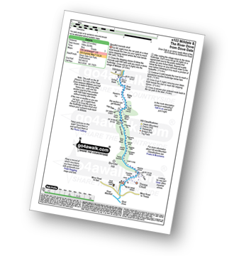
Route Summary:
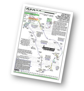
Tissington - The Tissington Trail - Thorpe Station - Thorpe - Pike House - Thorpe Pasture - Bostern Grange Farm - Milldale - River Dove - Mill Dale - Lode Mill Bridge - Coldeaton Bridge - Wolfscote Dale - Biggin Dale - Biggin - The Tissington Trail - Alsop en le Dale Station - Tissington
Not familiar with the area around DE56?
See these 30 nearest walks to UK Postcode DE56 on a google map
|
Vital Statistics:
| Length: | 7.25 miles (12.5 km) |
| Ascent: | 1,056ft (322m) |
| Time: | 3.75hrs |
| Grade: | |
Route Summary:
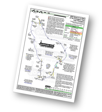
Tissington - The Tissington Trail - Thorpe Station - Thorpe - Pike House - Thorpe Pasture - Bostern Grange Farm - Alsop en le Dale Station - Tissington
|
Vital Statistics:
| Length: | 6.25 miles (10 km) |
| Ascent: | 941ft (287m) |
| Time: | 3.25hrs |
| Grade: | |
Route Summary:
Tissington - Newton Grange - The Tissington Trail - Alsop en le Dale Station - Alsop en le Dale - Flaxdale Holding - Parwich - Bletch Brook - Higher Flats - Tissington
|
Vital Statistics:
| Length: | 6.5 miles (10.5 km) |
| Ascent: | 745ft (227m) |
| Time: | 3.25hrs |
| Grade: |  |
Route Summary:
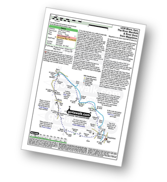
Mappleton (aka Mapleton) - Okeover Bridge - Okeover Hall - Okeover Park - Cowclose Wood - Martin Hill Farm - Woodhouses Farm - Blore - Blore Pastures - Ilam - River Manifold - The Manifold Trail - Fishpond Wood - River Dove - Coldwall Bridge - Big Peg's Wood - Little Peg's Wood - Littlepark Farm - Okeover Bridge - Mappleton (aka Mapleton)
|
Vital Statistics:
| Length: | 3.25 miles (5.5 km) |
| Ascent: | 367ft (112m) |
| Time: | 1½ hrs |
| Grade: | |
Route Summary:
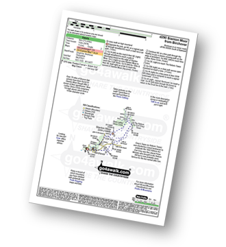
Birchover - Stanton Moor - Cork Stone - Nine Ladies Stone Circle - The Reform Tower (or Earl Grey Tower) - Birchover
|
Vital Statistics:
| Length: | 9.75 miles (15.5 km) |
| Ascent: | 735ft (224m) |
| Time: | 5.25hrs |
| Grade: | |
Route Summary:
Thorpe - The Tissington Trail - Lin Dale - Dove Dale - The River Dove - Stepping Stones - Lover's Leap - Tissington Spires - Shaplow Dale - Dove Holes - Milldale - Mill Dale - Alsop en le Dale - The Tissington Trail - Tissington - Thorpe
|
Vital Statistics:
| Length: | 4.5 miles (7 km) |
| Ascent: | 551ft (168m) |
| Time: | 2.25hrs |
| Grade: | |
|
Vital Statistics:
| Length: | 5.5 miles (9 km) |
| Ascent: | 984ft (300m) |
| Time: | 3 hrs |
| Grade: | |
Route Summary:
Elton - The Limestone Way - Dudwood Lane - Birchover - The Mires - Robin Hood's Stride - Harthill Moor Wood - Cliffe Farm - Anthony Hill - Elton
|
Vital Statistics:
| Length: | 3.75 miles (6 km) |
| Ascent: | 660ft (200m) |
| Time: | 3 hrs |
| Grade: | |
Route Summary:
Elton - The Limestone Way - Dudwood Lane - Robin Hood's Stride - Harthill Moor Wood - Cliffe Farm - Anthony Hill - Elton
|
Vital Statistics:
| Length: | 8.5 miles (13.5 km) |
| Ascent: | 978ft (298m) |
| Time: | 4 hrs |
| Grade: | |
Route Summary:
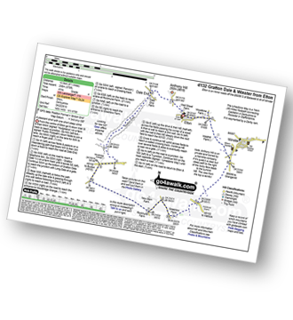
Elton - Anthony Hill - Dale End (Elton) - Gratton Dale - Mouldridge Grange - Rockhurst Farm - Greenlow Farm - Winster - The Limestone Way - Elton
|
Vital Statistics:
| Length: | 5 miles (8 km) |
| Ascent: | 433ft (132m) |
| Time: | 2 hrs |
| Grade: | |
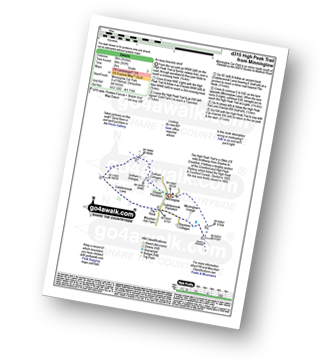
Route Summary:
Minninglow - The High Peak Trail - Green Lane - Cobblersnook Lane - Minninglow Lane - The High Peak Trail - Minninglow
|
Vital Statistics:
| Length: | 7.5 miles (12 km) |
| Ascent: | 1,335ft (407m) |
| Time: | 4.25hrs |
| Grade: | |

Route Summary:
Stanton in Peak - Nine Ladies Stone Circle - The Reform Tower (or Earl Grey Tower) - Cork Stone - Stanton Moor - Birchover - The Limestone Way - Robin Hood's Stride - Harthill Moor - Harthill Moor Farm - River Bradford - Bradford Dale - Rhienstor Plantation - Alport - Tolls Wood - Stanton in Peak
|
Vital Statistics:
| Length: | 6.5 miles (10.5 km) |
| Ascent: | 1,115ft (340m) |
| Time: | 3½ hrs |
| Grade: | |
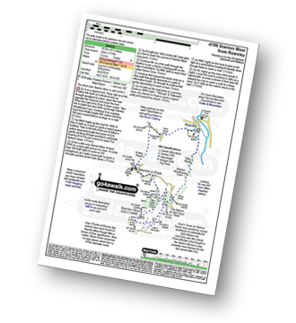
Route Summary:
Rowsley - Holly Wood - Stanton Woodhouse Farm - Stanton Moor - The Reform Tower (or Earl Grey Tower) - The Cork Stone - Nine Ladies Stone Circle - Stanton in Peak - Smithy Wood - Congreave Farm - Rowsley
|
Vital Statistics:
| Length: | 6.25 miles (10 km) |
| Ascent: | 623ft (190m) |
| Time: | 3 hrs |
| Grade: | |
Route Summary:
Dove Dale - The River Dove - Stepping Stones - Lover's Leap - Tissington Spires - Shaplow Dale,Natural Arch - Raynard's Cave - Upper Taylor's Wood - Dove Holes - Viator's Bridge - Milldale - Achas Bank - Hall Dale - Hurt's Wood - Ilam Rock - Jacob's Ladder (Dove Dale) - Dove Dale Wood - Dovedale Castle - Dove Dale
|
Vital Statistics:
| Length: | 9.5 miles (15.5 km) |
| Ascent: | 705ft (215m) |
| Time: | 1.25hrs |
| Grade: | |
Route Summary:
Alsop en le Dale Station - New Hanson Grange - Milldale - River Dove - Mill Dale - Lode Mill Bridge - Coldeaton Bridge - Iron Tors - Gipsy Bank - Drabber Tor - Peasland Rocks - Wolfscote Dale - Biggin Dale - Furny Bottom - Dale End (Heathcote) - Biggin - The Tissington Trail - Alsop en le Dale Station
|
Vital Statistics:
| Length: | 4 miles (6.5 km) |
| Ascent: | 400ft (122m) |
| Time: | 2 hrs |
| Grade: | |
Route Summary:
Hell Bank Plantation - Beeley Plantation - Rabbit Warren - Beeley Brook - Hob Hurst's House - Harland Edge - Beeley Moor - Beeley Moor (South East Top) - Beeley Lane - Harland Sick - Hell Bank Plantation
Not familiar with the area around DE56?
See these 30 nearest walks to UK Postcode DE56 on a google map


