![]()
Latrigg
367m (1204ft)
The Northern Fells, The Lake District, Cumbria, England
Tap/mouse over a coloured circle (1-3 easy walks, 4-6 moderate walks, 7-9 hard walks) and click to select.
The summit of Latrigg is marked by an Ordnance Survey Trig Point.
Not familiar with this top?
   |
|---|
Vital Statistics:
| Length: | 2ml (3km) |
|---|---|
| Ascent: | 413ft (126m) |
| Time: | 1 hrs |
| Grade: |  (Easy) (Easy) |
Route Summary:
Keswick - Gale Road (Underscar) - The Cumbria Way - Latrigg - Gale Road (Underscar) - Nr Keswick.
|
|---|
Vital Statistics:
| Length: | 6.25ml (10km) |
|---|---|
| Ascent: | 941ft (287m) |
| Time: | 3 hrs |
| Grade: |  (Moderate) (Moderate) |
|
|---|
Vital Statistics:
| Length: | 15.25ml (24.5km) |
|---|---|
| Ascent: | 5,458ft (1,663m) |
| Time: | 11 hrs |
| Grade: |  (Very Hard) (Very Hard) |
Route Summary:
Keswick - Millbeck - The Allerdale Ramble - Doups - Dodd (Skiddaw) - White Stones (Skiddaw) - Carl Side - Longside Edge - Long Side - Ullock Pike - Carlside Tarn - Skiddaw - Blake Hill - Bakestall - Little Man (Skiddaw) - Jenkin Hill - Lonscale Fell - Lonscale Crags - The Cumbria Way - Latrigg - Applethwaite - The Allerdale Ramble - Millbeck - Nr Keswick.
See Latrigg and the surrounding tops on our free-to-access 'Google Style' Peak Bagging Maps:
The Northern Fells of The Lake District National Park
Less data - quicker to download
The Whole of The Lake District National Park
More data - might take a little longer to download
See Latrigg and the surrounding tops on our downloadable Peak Bagging Maps in PDF format:

NB: Whether you print off a copy or download it to your phone, these PDF Peak Baggers' Maps might prove incredibly useful when your are up there on the tops and you cannot get a phone signal.
*This version is marked with the walk routes you need to follow to Walk all 214 Wainwrights in just 59 walks.
You can find Latrigg & all the walks that climb it on these unique free-to-access Interactive Walk Planning Maps:
1:25,000 scale OS Explorer Map (orange/yellow covers):
1:50,000 scale OS Landranger Maps (pink/magenta covers):
 Fellow go4awalkers who have already walked, climbed, summited & bagged Latrigg
Paul Roddam walked up Latrigg on April 3rd, 2023 [with] Tom, Barb, Rice [weather] Sunny
Geoff Hand climbed it on April 9th, 2025 [from/via/route] Stopped off after visiting the Honister slate mine to knock a few outstanding Wainwrights off. Straight up & down. [with] Solo [weather] Gorgeous sunny day with cold wind. - Super panoramic views of the North lake district.
Nick Tippins bagged it on March 21st, 2025 [from/via/route] c242: Latrigg from Keswick [with] Fran
James Hughes hiked Latrigg on March 10th, 2025 [from/via/route] c242 Latrigg from Keswick [weather] Overcast, very blustery on top. - Pleasant walk up through woods before approaching from behind. Route down through woodland to Greta River before returning on Keswick/Threkeld railway. Walked instead of Eagle Crag/Ullscarf route due to inclement weather.
Claire Kirk summited on January 12th, 2025 [from/via/route] Keswick [with] Self [weather] Fine, snow & ice on tops
To add (or remove) your name and experiences on this page - Log On and edit your Personal Mountain Bagging Record
. . . [see more walk reports]
More Photographs & Pictures of views from, on or of Latrigg
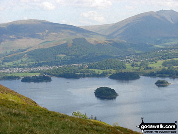
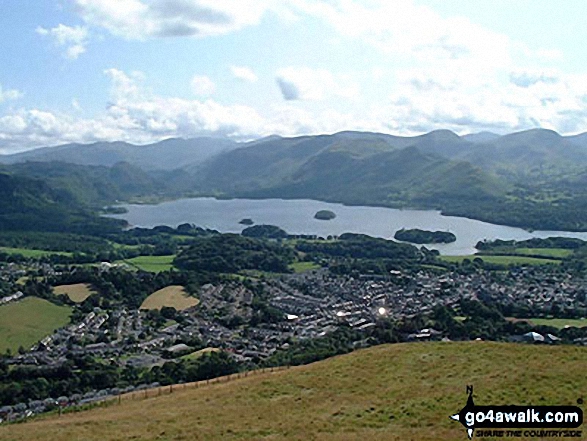
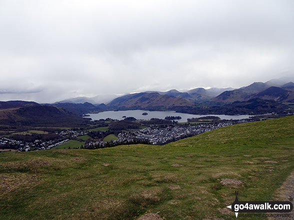
Derwent Water from Cat Bells (Catbells) with Latrigg (left) and Blencathra or Saddleback (right) beyond
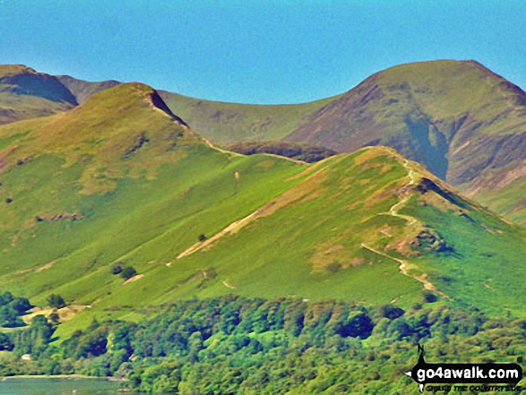
Cat Bells (Catbells) with Dale Head (Newlands) & Hindscarth beyond from Latrigg
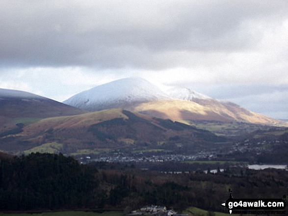
Swinside, Keswick, Latrigg and Blencathra (or Saddleback) from Rowling End
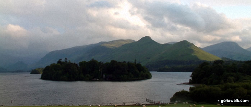
*High Spy, High Spy (North Top) and Cat Bells (Catbells) and Derwent Water from Latrigg
Send us your photographs and pictures on, of, or from Latrigg
If you would like to add your walk photographs and pictures to this page, please send them as email attachments (configured for any computer) along with your name to:
and we shall do our best to publish them.
(Guide Resolution = 300dpi. At least = 660pixels (wide) x 440 pixels (high).)

You can also submit photos via our Facebook Page.
NB. Please indicate where each photo was taken and whether you wish us to credit your photos with a Username or your First Name/Last Name.