
![]()
Bakestall
673m (2209ft)
The Northern Fells, The Lake District, Cumbria, England
Not familiar with this top?
You can walk/hike to the top of Bakestall by using any of these 3 easy‑to‑follow route maps:
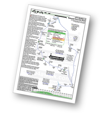
Walk c248 Skiddaw from High Side
Stunning high level route
   |
|---|
Vital Statistics:
| Length: | 8.25ml (13km) |
|---|---|
| Ascent: | 2,919ft (890m) |
| Time: | 6 hrs |
| Grade: |  (Moderate) (Moderate) |

Route Summary:
High Side - The Allerdale Ramble - Ling How - The Edge - Ullock Pike - Longside Edge - Long Side - Carl Side - Skiddaw - Bakestall - Birkett Edge - Whitewater Dash - Back O' Skiddaw - Melbecks - High Side
Walk c273 Skiddaw and Bakestall from Gale Road (Underscar) nr Keswick
Excellent high level ridge walk
|
|---|
Vital Statistics:
| Length: | 11.5ml (18.5km) |
|---|---|
| Ascent: | 3,214ft (980m) |
| Time: | 7½ hrs |
| Grade: |  (Hard) (Hard) |
Route Summary:
Keswick - Gale Road - Lonscale Fell - Jenkin Hill - Little Man (Skiddaw) - Skiddaw - Bakestall - Birkett Edge - Whitewater Dash - Back O' Skiddaw - The Cumbria Way - Skiddaw House - Gale Road (Underscar) Nr Keswick.
Walk c447 The Skiddaw Massif from Millbeck, nr Keswick
Long high level route
|
|---|
Vital Statistics:
| Length: | 15.25ml (24.5km) |
|---|---|
| Ascent: | 5,458ft (1,663m) |
| Time: | 11 hrs |
| Grade: |  (Very Hard) (Very Hard) |

Route Summary:
Keswick - Millbeck - The Allerdale Ramble - Doups - Dodd (Skiddaw) - White Stones (Skiddaw) - Carl Side - Longside Edge - Long Side - Ullock Pike - Carlside Tarn - Skiddaw - Blake Hill - Bakestall - Little Man (Skiddaw) - Jenkin Hill - Lonscale Fell - Lonscale Crags - The Cumbria Way - Latrigg - Applethwaite - The Allerdale Ramble - Millbeck - Nr Keswick.
See Bakestall and the surrounding tops on our free-to-access 'Google Style' Peak Bagging Maps:
The Northern Fells of The Lake District National Park
Less data - quicker to download
The Whole of The Lake District National Park
More data - might take a little longer to download
See Bakestall and the surrounding tops on our unique, downloadable, PDF Peak Bagging Maps:

NB: Whether you print off a copy or download it to your phone, these PDF Peak Baggers' Maps might prove incredibly useful when your are up there on the tops and you cannot get a phone signal.
*This version is marked with the walk routes you need to follow to Walk all 214 Wainwrights in just 59 walks.
You can find Bakestall & all the walks that climb it on these unique free-to-access Interactive Walk Planning Maps:
1:25,000 scale OS Explorer Map (orange/yellow covers):
1:50,000 scale OS Landranger Maps (pink/magenta covers):
 Fellow go4awalkers who have already walked, climbed, scaled, summited, hiked & bagged Bakestall
Paul Roddam walked up Bakestall on April 3rd, 2023 [with] Tom, Barb, Rice [weather] Sunny
James Hughes climbed it on May 13th, 2025 [from/via/route] c273 Skiddaw & Bakestall from Gale Road [weather] Clear, blue skies with strong breeze/wind on tops. - Awesome walk with some sharp stiff climbs (Lonscale & Skiddaw Little Man). Good way to climb Skiddaw avoiding main track all way. Easy drop down to Bakestall & very pleasant meander on Cumbria Way via Skiddaw House back to beginning. Car Park absolute nightmare when full & cars on sides as nearly impossible to turn around. Stopped off at White Horse Inn in hope to bunk for night, but not possible as needed to hire whole room. Pint of Corby Blonde & back home.
Richard Holmes bagged it on April 7th, 2025 [from/via/route] High side [with] Myself. [weather] Hot, very hot, some clouds & occasional wind. Going Skiddaw. - One of the best walks.
Caroline Winter hiked Bakestall on March 11th, 2025 [from/via/route] Peter House Farm, Dash Falls, fence line to Bakestall, Cock up [with] Solo [weather] Warm excellent views over Soloway.
David Higginbottom summited on February 1st, 2025 [from/via/route] Own loop 10k up past dash falls [with] Carolyn [weather] Clear but cold & windy at the top - Nice walk easy steady loop , a little steep in places
To add (or remove) your name and experiences on this page - Log On and edit your Personal Mountain Bagging Record
. . . [see more walk reports]
More Photographs & Pictures of views from, on, or of, Bakestall
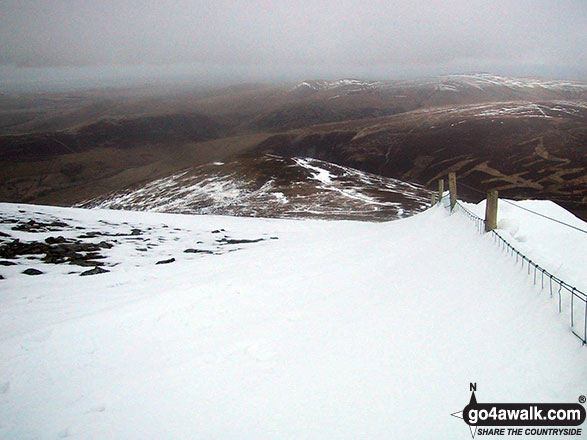
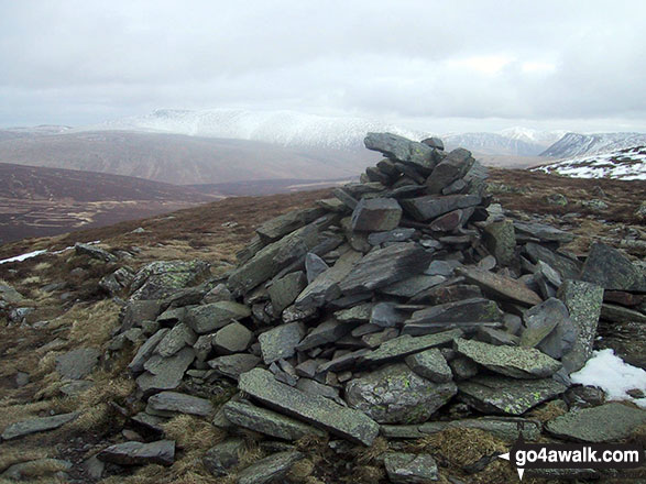
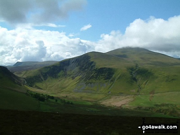
Birkett Edge, Bakestall and Skiddaw (in cloud) from the large cairn on the approach to Great Cockup

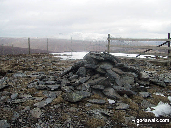
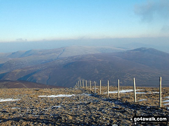
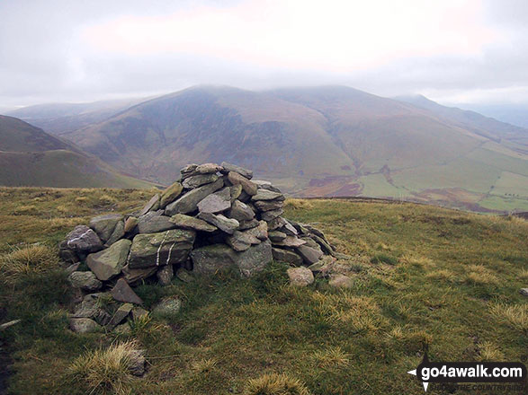
Looking North East to Knott (Uldale Fells), High Pike (Caldbeck) and Carrock Fell from the summit cairn on Bakestall

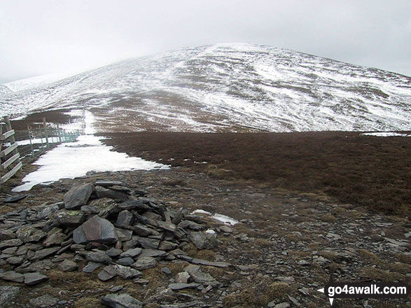
*Bakestall, Great Calva, Skiddaw House, Blencathra (Saddleback) and Lonscale Fell from Skiddaw
. . . see all 10 walk photographs & pictures of views from, on, or of, Bakestall
Send us your photographs and pictures on, of, or from Bakestall
If you would like to add your walk photographs and pictures to this page, please send them as email attachments (configured for any computer) along with your name to:
and we shall do our best to publish them.
(Guide Resolution = 300dpi. At least = 660pixels (wide) x 440 pixels (high).)

You can also submit photos via our Facebook Page.
NB. Please indicate where each photo was taken and whether you wish us to credit your photos with a Username or your First Name/Last Name.


