
![]()
High Stile
807m (2646ft)
The Western Fells, The Lake District, Cumbria, England
Tap/mouse over a coloured circle (1-3 easy walks, 4-6 moderate walks, 7-9 hard walks) and click to select.
Not familiar with this top?
   |
|---|
Vital Statistics:
| Length: | 7.5ml (12km) |
|---|---|
| Ascent: | 3,338ft (1,017m) |
| Time: | 6.25hrs |
| Grade: |  (Moderate) (Moderate) |
Route Summary:
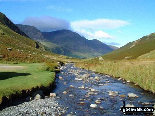
Buttermere - Sourmilk Gill - Bleaberry Tarn - Dodd (Buttermere) - The Saddle - Red Pike (Buttermere) - High Stile - High Crag (Buttermere) - Gamlin End - Seat (Buttermere) - Scarth Gap - Peggy's Bridge - Burtness Wood - Buttermere
|
|---|
Vital Statistics:
| Length: | 8.75ml (14km) |
|---|---|
| Ascent: | 3,390ft (1,033m) |
| Time: | 6.25hrs |
| Grade: |  (Hard) (Hard) |
Route Summary:
Buttermere - Scale Force - Scale Beck - Blea Crag - Lingcomb Edge - Red Pike (Buttermere) - High Stile - High Crag (Buttermere) - Gamlin End - Seat (Buttermere) - Scarth Gap - Burtness Wood - Sourmilk Gill - Buttermere
|
|---|
Vital Statistics:
| Length: | 11.25ml (18km) |
|---|---|
| Ascent: | 4,132ft (1,259m) |
| Time: | 8.25hrs |
| Grade: |  (Hard) (Hard) |
Route Summary:
Buttermere - Scale Force - Scale Beck - Blea Crag - Lingcomb Edge - Red Pike (Buttermere) - High Stile - High Crag (Buttermere) - Gamlin End - Seat (Buttermere) - Scarth Gap - Hay Stacks (Haystacks) - Innominate Tarn - Blackbeck Tarn - Black Beck - Green Crag (Buttermere) - Warnscale Beck - Warnscale Bottom - Gatesgarth - Buttermere
|
|---|
Vital Statistics:
| Length: | 16ml (25.5km) |
|---|---|
| Ascent: | 6,285ft (1,915m) |
| Time: | 12.25hrs |
| Grade: |  (Very Hard) (Very Hard) |
Route Summary:
Buttermere - Scale Force - Scale Beck - Blea Crag - Great Borne - Starling Dodd - Little Dodd (Ennerdale) - Ling Comb - Lingcomb Edge - Red Pike (Buttermere) - Dodd (Buttermere) - Red Pike (Buttermere) - High Stile - High Crag (Buttermere) - Gamlin End - Seat (Buttermere) - Scarth Gap - Hay Stacks (Haystacks) - Innominate Tarn - Blackbeck Tarn - Black Beck - Green Crag (Buttermere) - Warnscale Beck - Dubs Hut - Dubs Quarry - Fleetwith Pike - Honister Crag (Black Star) - Fleetwith Pike - Fleetwith Edge - Gatesgarth - Buttermere
|
|---|
Vital Statistics:
| Length: | 18.75ml (30km) |
|---|---|
| Ascent: | 7,309ft (2,408m) |
| Time: | 14.75hrs |
| Grade: | (Very Hard) |
Route Summary:
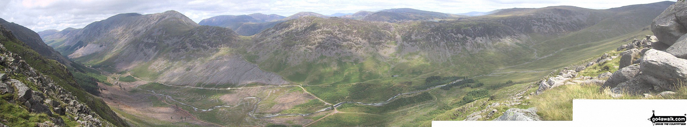
Bowness Knott Car Park Ennerdale - Low Gillerthwaite Field Centre - High Gillerthwaite Yourth Hostel - Red Pike (Buttermere) - High Stile - High Crag (Buttermere) - Seat (Buttermere) - Scarth Gap - Hay Stacks (Haystacks) - Innominate Tarn - Blackbeck Tarn - Black Beck - Green Crag (Buttermere) - Great Round How - Brandreth - Gillercomb Head - Green Gable - Windy Gap - Great Gable - Westmorland Cairn - Beck Head - Beckhead Tarn - Kirk Fell (East Top) - Kirk Fell - Black Sail Pass - Looking Stead (Pillar) - High Level Route - Robinson's Cairn - Pillar - Wind Gap - Black Crag (Pillar) - High Beck - Low Beck - Ennerdale.
See High Stile and the surrounding tops on our free-to-access 'Google Style' Peak Bagging Maps:
The Western Fells of The Lake District National Park
Less data - quicker to download
The Whole of The Lake District National Park
More data - might take a little longer to download
See High Stile and the surrounding tops on our downloadable Peak Bagging Maps in PDF format:

NB: Whether you print off a copy or download it to your phone, these PDF Peak Baggers' Maps might prove incredibly useful when your are up there on the tops and you cannot get a phone signal.
*This version is marked with the walk routes you need to follow to Walk all 214 Wainwrights in just 59 walks.
You can find High Stile & all the walks that climb it on these unique free-to-access Interactive Walk Planning Maps:
1:25,000 scale OS Explorer Map (orange/yellow covers):
1:50,000 scale OS Landranger Map (pink/magenta covers):
 Fellow go4awalkers who have already walked, climbed, summited & bagged High Stile
Christine Shepherd walked up High Stile on May 1st, 2004 [from/via/route] I climbed this from Buttermere via Red Pike [with] On my own [weather] Lovely spring weather - Great views. Climbed this again when I led a group from St George's Church Leeds in July 04. Had another brilliant walk over the Buttermere fells 29.8.17. Climbed again on a very hot day on 13.8.25. Had time to explore the full extent of this summit before dropping down to the ridge to climb High Crag.
Paul Roddam climbed High Stile on July 19th, 2025 [with] Barb, Bri [weather] Muggy
Richard Fulcher bagged High Stile on March 25th, 2025 [from/via/route] Buttermere [with] Jen [weather] Started off with cloud over the tops but cleared around lunchtime. Not much wind but cold gusts every now & then .. generally cold with sunshine. - This was part of a ridge walk taking in Red Pike, High Stile & High Crag. Tough ascents & descents due to steepness & scree.
James Hughes hiked High Stile on June 3rd, 2024 [from/via/route] c207 The High Stile from Buttermere [with] Sara [weather] Misty & wet at times. Poor visibility on tops. - Amazing walk - met three men on Red Pike struggling to navigate. Bounded across tops & added Haystacks at end. Slip on way down from Haystacks. Pint at Bridge Hotel.
Sarah Moore summited High Stile on April 9th, 2023 [from/via/route] My own invention! Wanting not to drive from YHA Ennerdale & to make the most of the High Stile ridge [with] On my own [weather] Not so sunny - good... very windy at times - tough (lots of people coming off the tops / turning back, but glad I didn't) - Loved this - an 8 hour walk really started to test me lengthwise & absolutely adored the lack of people on what I thought would be a crazy busy Easter Sunday. One to remember...
Ian Ashton conquered High Stile on September 24th, 2022 [with] chelle
Richard Marchant scaled High Stile on July 18th, 2022 [from/via/route] Started out from the village of Buttermere making my way along a footpath to the Western end of Buttermere & up the Old Burtness to Bleaberry Tarn from here it was up to the Saddle & on to Red Pike. Then Ridge walked along to High Stile & High Crag does over Seat to Scarth Gap Pass & down the footpath to the South Shores of Buttermere & back to the car. [with] On my Own [weather] Clear hot sunny day with little or no breeze.
Paul Macey walked up High Stile on June 7th, 2022 [from/via/route] C207 [with] Luke [weather] Sunny Intervals
Jeremy Torrance climbed High Stile on October 8th, 2021 [from/via/route] Buttermere [with] Jon Stu [weather] Good autumn
Wayne Baxter bagged High Stile on August 19th, 2021 [from/via/route] From Buttermere car park walk along Buttermere lake & up Scarth Gap Pass. Turn right up to Seat & onto Gamlin End onto High Crag. Followed the path to High Stile & Red Pike. Down the Saddle to Bleaberry Tarn, continue on the path back to Buttermere. [with] Sue [weather] very low cloudy to start once on top cloudy level was good - I wished I have done this walk the other way round, coming down Red Pike not easy.
To add (or remove) your name and experiences on this page - Log On and edit your Personal Mountain Bagging Record
. . . [see more walk reports]
More Photographs & Pictures of views from, on or of High Stile
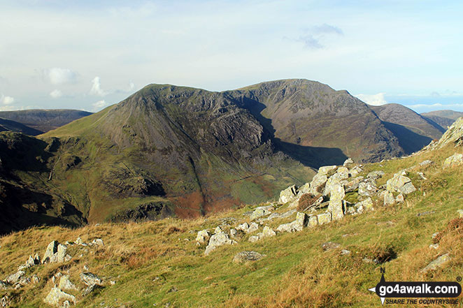
Fleetwith Pike (foreground left) with High Crag, High Stile and Red Pike (Buttermere) beyond towering over Buttermere from Honister Crag (Black Star)
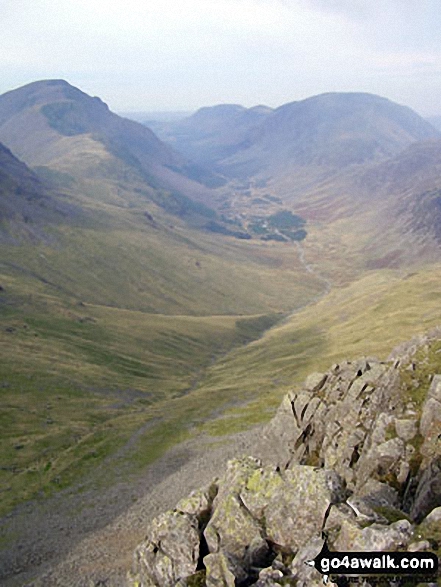
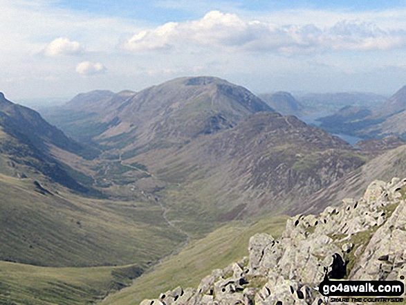
The view north from Looking Stead (Pillar) featuring Ennerdale with Red Pike (Buttermere), High Stile, High Crag, Seat, Scarth Gap, Hay Stacks (Haystacks) and Brandreth (far right)
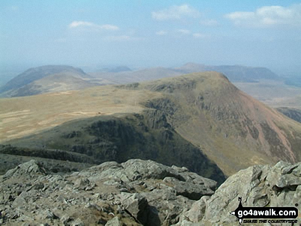
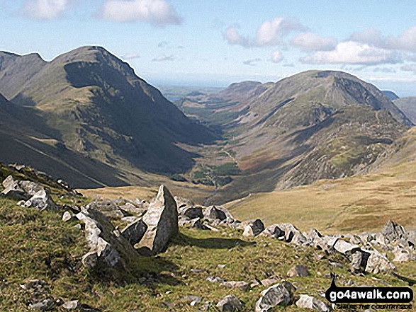
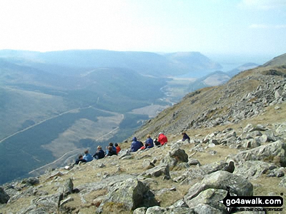
Gatesgarth and Fleetwith Pike (with Robinson and Dale Head (Newlands) beyond) from High Stile
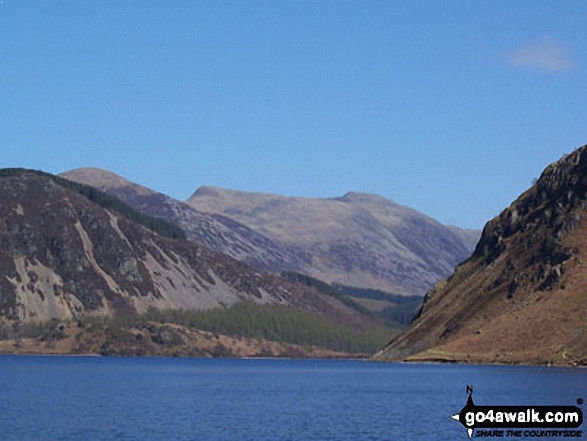
The view is across the Vale of Lorton towards Whiteside (left), High Stile and Red Pike (Buttermere), Mellbreck (centre) and Fellbarrow and Low Fell (right)
Crummock Water and Low Ling Crag - with Rannerdale Knotts (left), Fleetwith Pike (centre) and The High Stile Ridge (right)
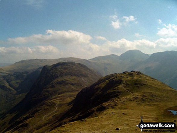
The High Stile ridge (left), Buttermere and the Grasmoor massif (right) from Brandreth
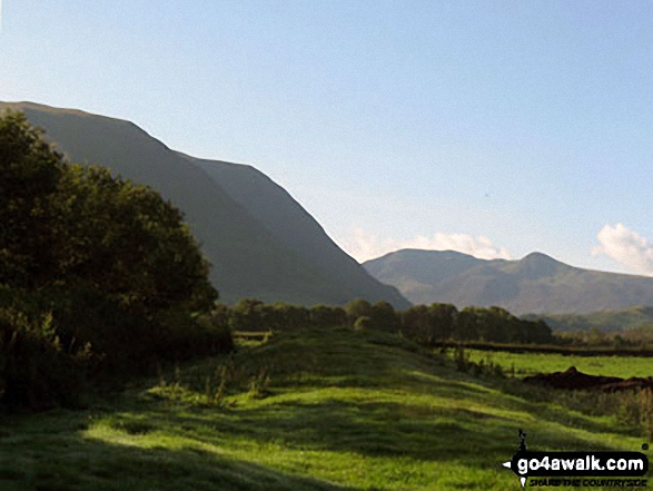
Whiteside (left), High Stile and Red Pike (Buttermere) (right) across the Vale of Lorton
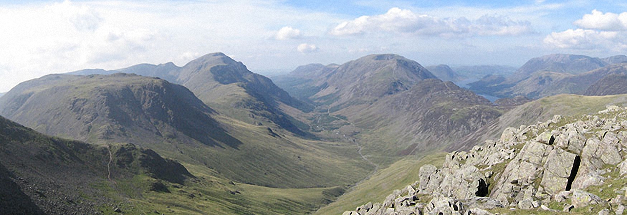
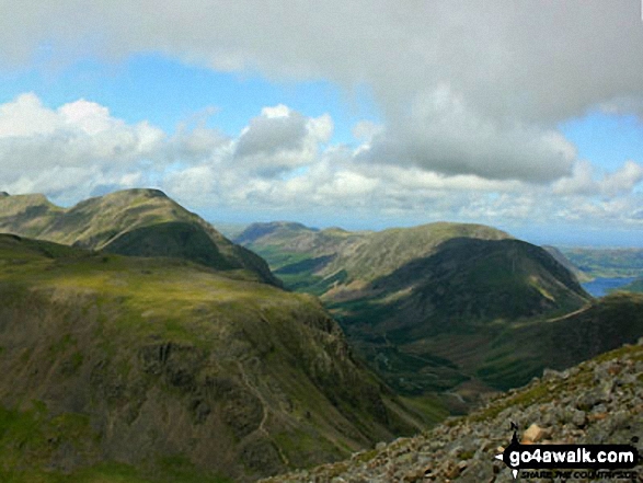
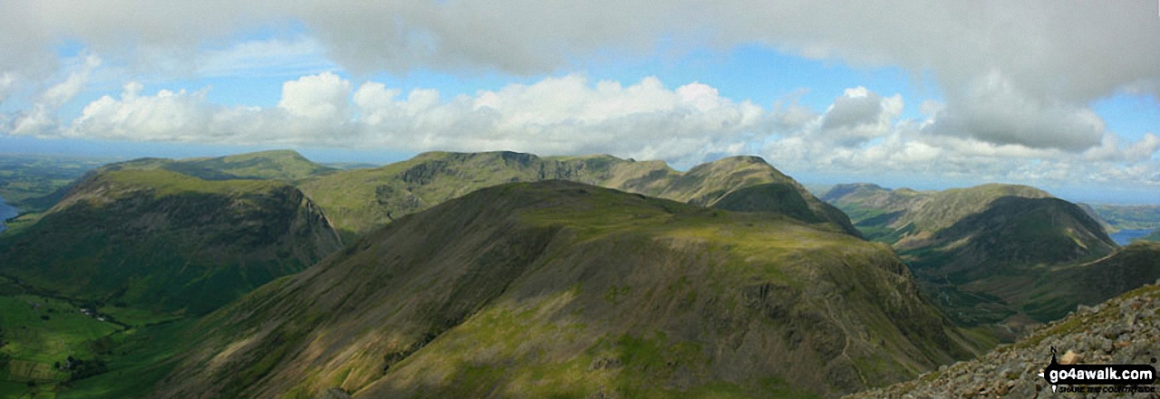
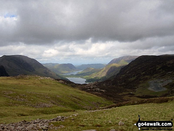
Kirk Fell, Looking Stead & Pillar, Ennerdale, High Stile, High Crag & Hay Stacks, Crummock Water & Buttermere and Grasmoor from Green Gable
Great Gable (far left in the distance), Haystacks, Gamblin End and the Buttermere Fells - High Crag, High Stile and Red Pike (Buttermere) - from Rannerdale Knotts
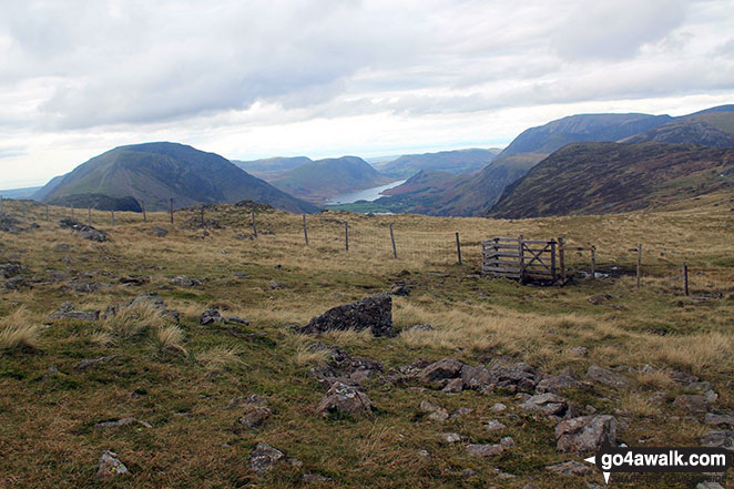
Ennerdale with Hay Stacks (Haystacks) and the High Stile ridge (right) and Looking Stead and Pillar (left) from Brandreth
Kirk Fell (foreground), Pillar, Ennerdale, Red Pike (Buttermere), High Stile, High Crag and Crummock Water (far right) from Westmorland Cairn, Great Gable
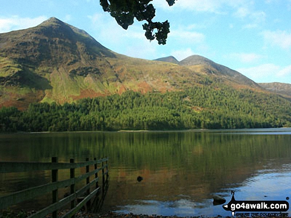
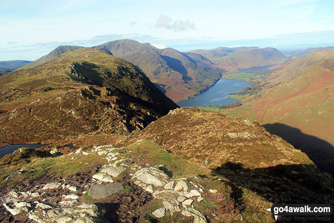
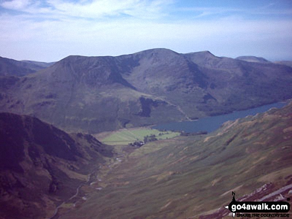
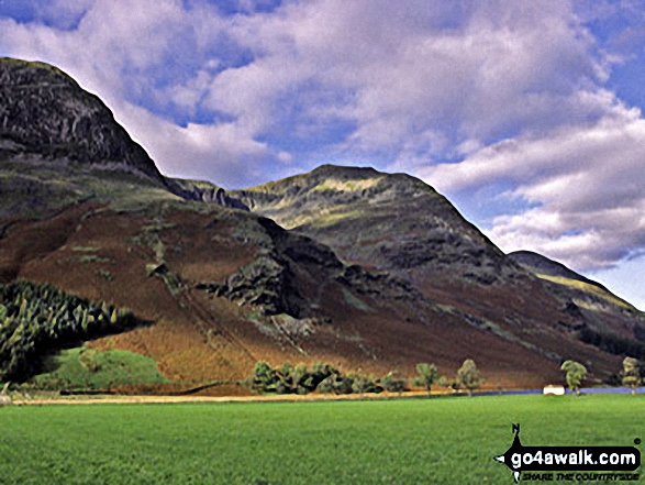
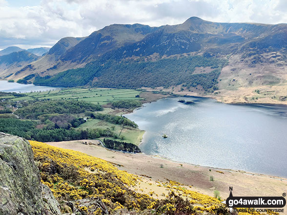
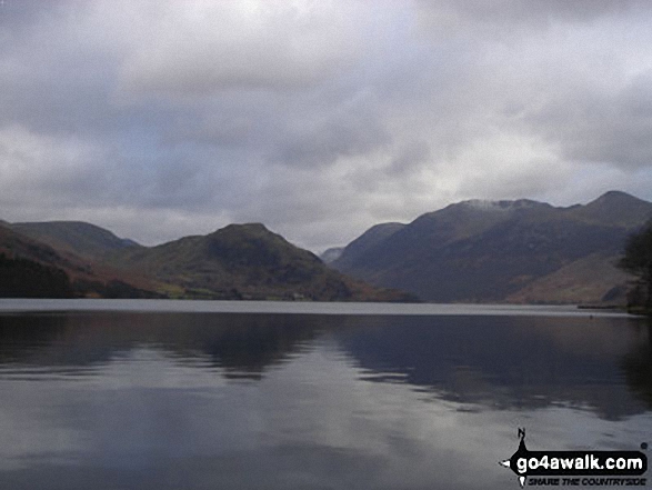
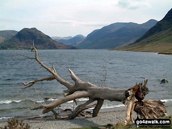
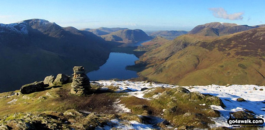
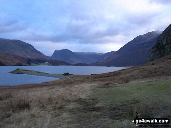
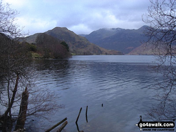
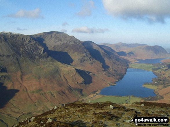
High Stile, Red Pike (Buttermere) and Dodd (Buttermere) from across Buttermere
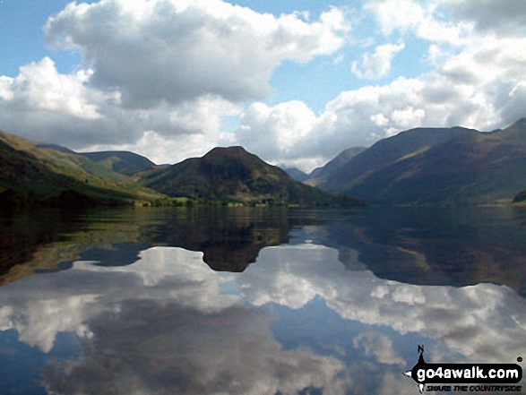
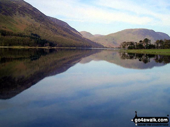
The shoulder of Grasmoor (left), Robinson, Rannerdale Knotts (centre) and the High Stile Ridge (High Crag, High Stile and Red Pike (Buttermere) reflected beautifully in a very still Crummock Water taken from the north west shore below Mellbreak
Crummock Water with Rannerdale Knotts (centre left), The High Stile Ridge (High Crag, High Stile and Red Pike (Buttermere) and the lower slopes of Mellbreak (far right) from Lanthwaite Wood
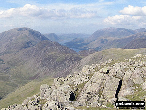
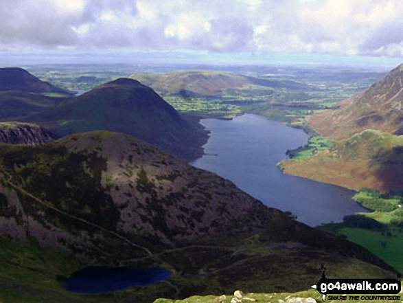
High Stile, High Crag & Hay Stacks, Crummock Water & Buttermere and Grasmoor from the top of Green Gable
Crummock Water, Rannerdale Knotts (left) and The High Stile Ridge from nr Cinderdale Common
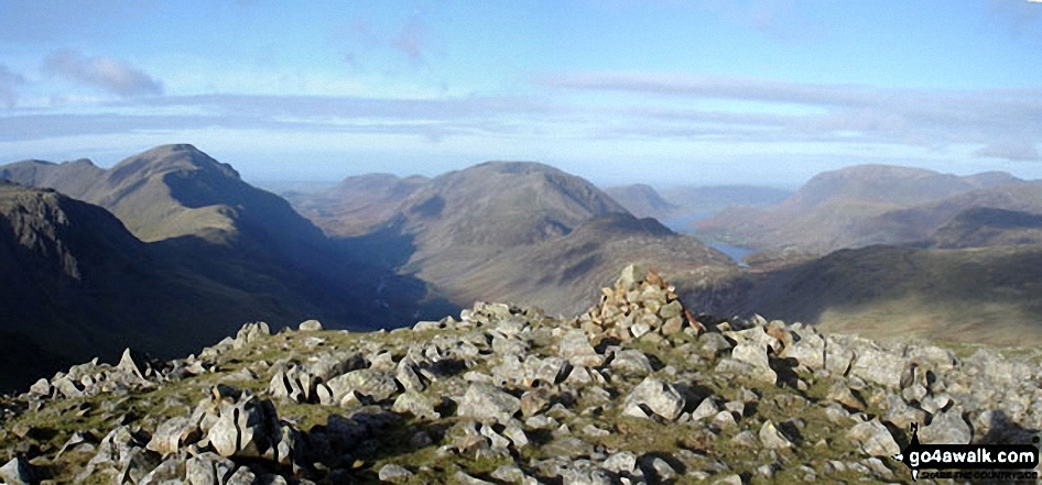
*Pillar (left), High Stile (centre), Ennerdale, Hay Stacks, Crummock Water, Buttermere and Grasmoor (right) from Green Gable
Fleetwith Pike and Haystacks at the end of Buttermere, with the Buttermere Fells - High Crag, High Stile and Red Pike (Buttermere) - from Rannerdale Knotts
Fleetwith Pike and The High Stile massif from the North shore of Crummock Water
Westmorland Cairn, Great Gable panorama featuring Kirk Fell (foreground centre), Wast Water, Wasdale and Yewbarrow with Middle Fell and Seatallan beyond (left), Red Pike (Wasdale), Little Scoat Fell and Pillar behind Kirk Fell (centre) and Ennerdale with Red Pike (Buttermere), High Stile, High Crag and Crummock Water (right)
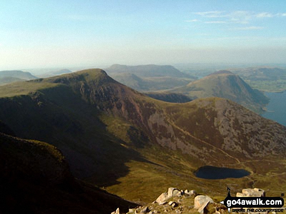
Ennerdale and High Stile, High Crag & Hay Stacks from Green Gable summit
High Stile (left) Buttermere, Mellbreak, Rannerdale Knotts, High Snockrigg, Grasmoor and the shoulder of Robinson (right) from the summit of Fleetwith Pike
The flank of Hay Stacks (Haystacks), High Crag and High Stile (left), Mellbreak, Buttermere and Crummock Water (centre) with Grasmoor and High Snockrigg (right) from Fleetwith Pike
Starling Dodd (left), Red Pike (Buttermere), High Stile and Pillar (right) and Ennerdale Water from the summit of Crag Fell
Crummock Water and Low Ling Crag - with Rannerdale Knotts (left), Fleetwith Pike (centre) and The High Stile Ridge (right)
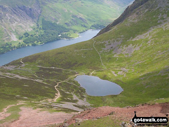
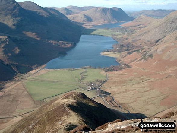
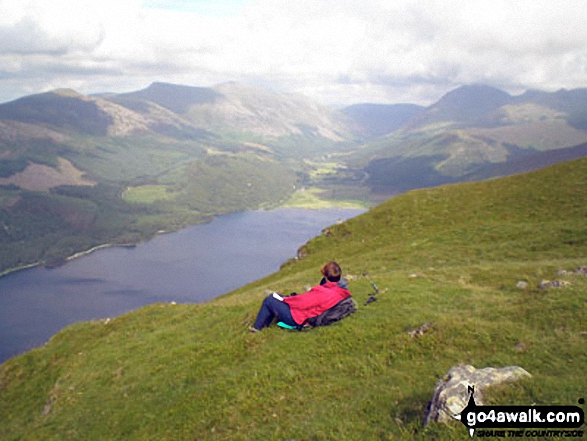
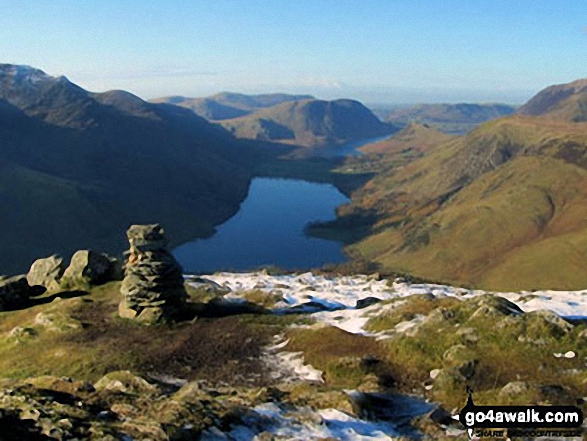
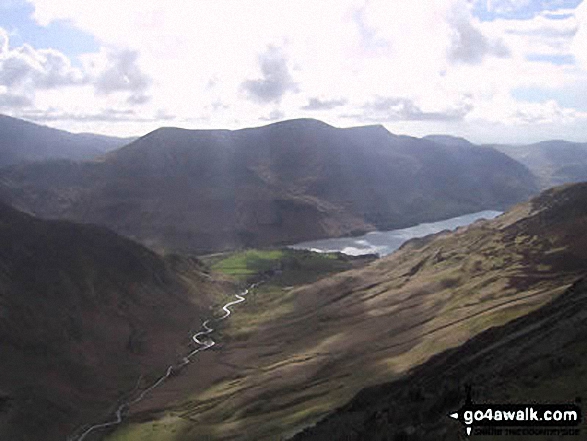
Bleaberry Tarn (bottom left), Mellbreak and Crummock Water from High Stile
High Stile (left) Buttermere, Mellbreak, Rannerdale Knotts, High Snockrigg and Grasmoor (right) from the summit of Fleetwith Pike
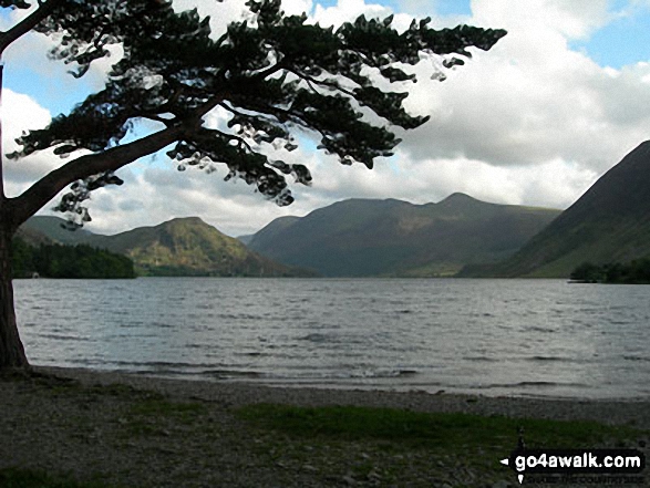
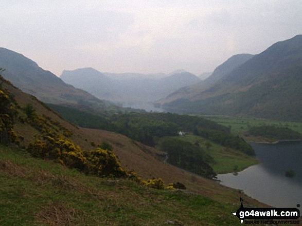
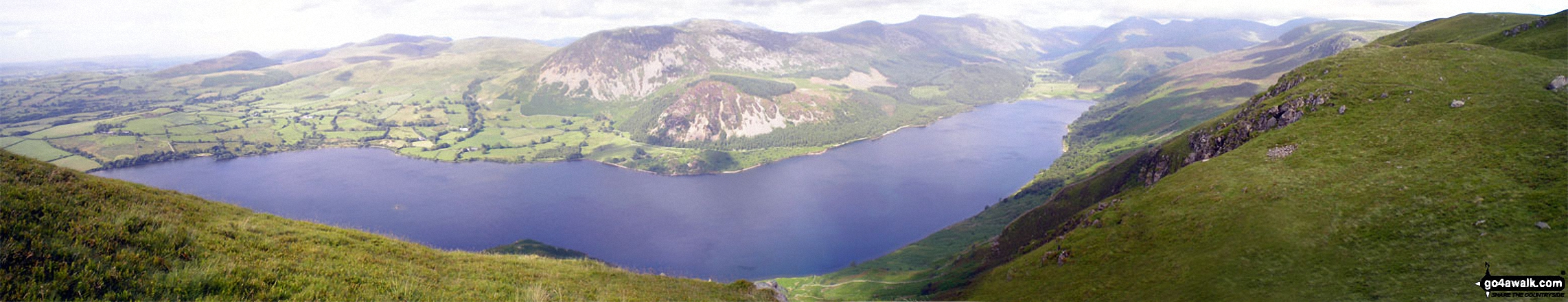
Buttermere Lake - with the lower slopes of High Stile (left), Hen Comb (centre) and Mellbreak (right)
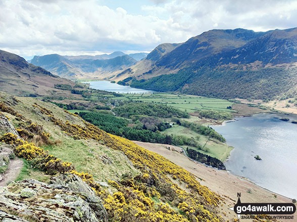
Buttermere, Fleetwith Pike, Hay Stacks and the High Stile Ridge from the lower slopes of Rannerdale Knotts
Crummock Water, Rannerdale Knotts (left) and The High Stile Ridge from Cinderdale Common
High Stile (left), Buttermere, Grasmoor and Fleetwith Pike (right) from near the top of Warnscale Beck
Ennerdale Bridge, Bowness Knott, Great Bourne, Starling Dodd, Red Pike (Buttermere), High Stile and Pillar sourrounding Ennerdale Water from the summit of Crag Fell
Crag Fell summit cairn with Great Borne (left), Starling Dodd (centre), Red Pike (Buttermere) and High Stile in the distance
The High Stile Ridge (High Crag, High Stile and Red Pike) beyond Buttermere from Hindscarth Edge
Scarth Gap (left), Seat (Buttermere), High Crag (Buttermere) and High Stile from Fleetwith Pike
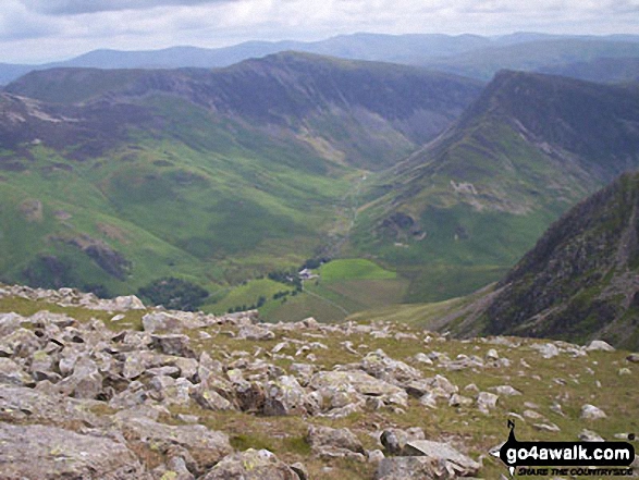
Gatesgarth and Fleetwith Pike (with Robinson and Dale Head (Newlands) beyond) from High Stile
. . . see just 20 walk photographs & pictures of views from, on or of High Stile
Send us your photographs and pictures on, of, or from High Stile
If you would like to add your walk photographs and pictures featuring views from, on or of High Stile to this page, please send them as email attachments (configured for any computer) along with your name to:
and we shall do our best to publish them.
(Guide Resolution = 300dpi. At least = 660pixels (wide) x 440 pixels (high).)

You can also submit photos via our Facebook Page.
NB. Please indicate where each photo was taken and whether you wish us to credit your photos with a Username or your First Name/Last Name.
Not familiar with this top?


