
![]()
Carrock Fell
662m (2173ft)
The Northern Fells, The Lake District, Cumbria, England
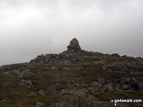
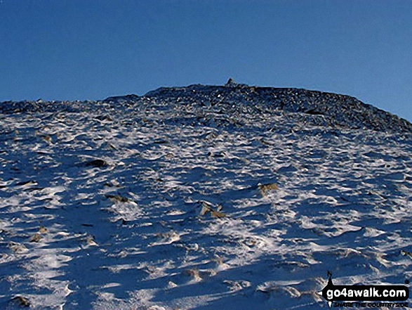
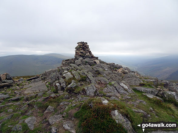
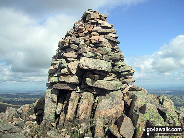
The summit of Carrock Fell is marked by an Ordnance Survey Trig Point.
Not familiar with this top?
Climbing Carrock Fell
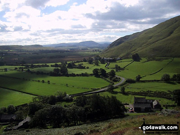
Most walks up Carrock Fell begin from a small, free parking area near Stone Ends Farm called Apronful of Stones, which is situated on the minor road connecting Mosedale and Hesket Newmarket.
The most popular ascent route is via the steep and challenging path known locally as 'Rake Trod.' This route is a direct climb, demanding careful footing due to the frequently loose stone underfoot. As the fell walker and guide author Alfred Wainwright concisely put it, the path is "straightforward, but not necessarily easy." 'Rake Trod' zig-zags aggressively up the fellside, generally following a gully named Further Gill Sike.
The view
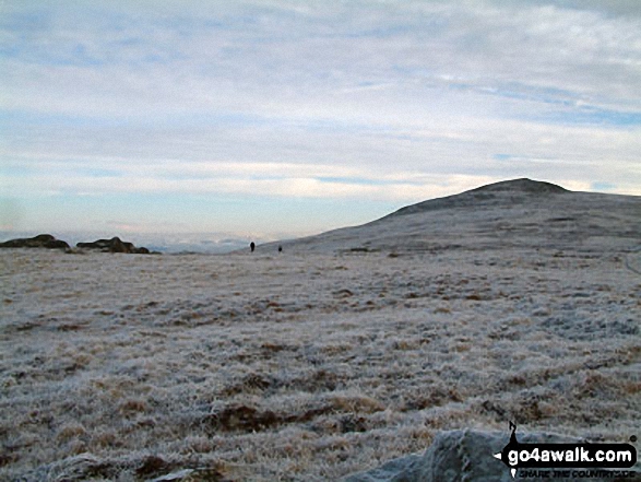
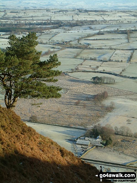
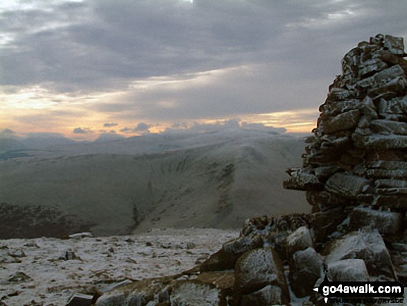
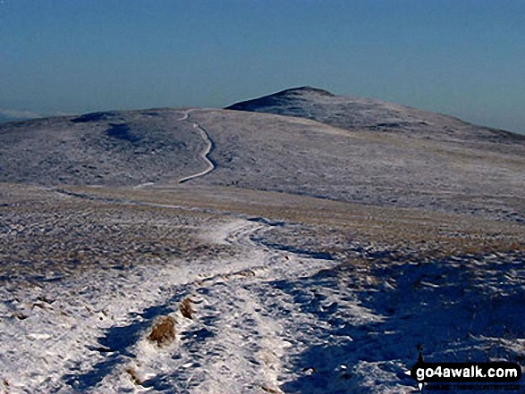
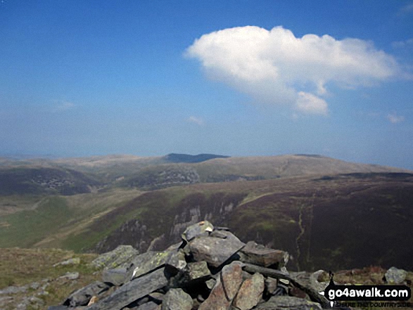
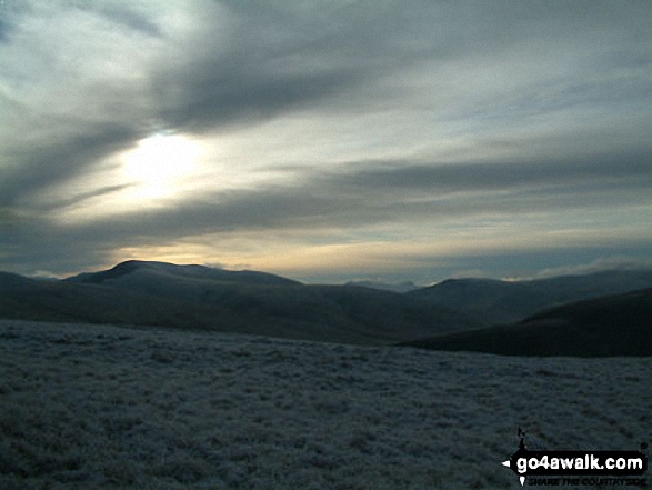
Reaching the summit of Carrock Fell provides an expansive and memorable panorama. The views sweep eastward over the Vale of Eden toward the looming Pennines, while to the west, you are afforded a spectacular perspective of the surrounding Lakeland giants, including the distinctive Blencathra and the broad mass of the Skiddaw range.
Which are the best walks to follow
Rather than simply making an out-and-back trip, most fellwalkers choose to combine the ascent of Carrock Fell with the neighbouring High Pike (Caldbeck). This link-up is achieved by traversing the very minor tops of Round Knott (Caldbeck), Milton Hill, and Drygill Head, creating a longer, yet highly satisfying circular route. The connecting path between the two fells is generally wide but should be navigated with caution as it can be wet and boggy in places. The return leg typically proceeds past Lingy Hut Bothy, before descending alongside Grainsgill Beck and following the River Caldew to Mosedale. There is a tea shop in Mosedale but you will have to check locally for opening times. (Specific details are available via walk c106.
For a much longer day on the fells, the route can be extended to incorporate all, or a combination of, nearby minor summits such as Hare Stones, Great Lingy Hill and Miller Moss before tackling the more sunstantial Knott (Uldale Fells), Little Calva, and Great Calva (refer to walk c200 for these extended options).
Local History
The summit of Carrock Fell is particularly interesting, not just for the views, but for the tangible remains of a prehistoric past: an Iron Age hill fort. Walkers can still trace the vague foundations of massive stone walls that once encircled the highest point, protecting the settlement within. These ruins include what are believed to have been four main entrances to the ancient enclosure.
Important: Key things to consider
The Experience & Solitude
- This is a quiet, less-frequented part of the Lake District, offering a wonderful sense of solitude on the fells that is hard to find on the busier mountains.
- The ascent of Carrock Fell is considered a proper fell walk and requires a good level of fitness.
Gear & Navigation
- Sturdy walking boots are a must as the terrain is rough and rocky in parts. Furthermore, the ground is often wet and muddy, particularly on the traverse between Carrock Fell and High Pike (Caldbeck), so good quality, waterproof footwear will help you enjoy your day.
- Navigation can be tricky, especially in poor visibility. A map and compass are essential, and a dedicated GPS device may also prove useful.
Weather & Supplies
- At 662m (2173ft) above mean sea level, the summit of Carrock Fell will be significantly colder than the valley, and any wind will be much stronger. Since mountain weather can change very quickly, always carry extra layers and full waterproof clothing. Crucially, even on cloudy days, don't forget the sun cream in case the sun breaks through!
- There are no refreshment stops en route, so be sure to carry plenty of food and water for the full duration of your hike.
   |
|---|
Vital Statistics:
| Length: | 9.5ml (15km) |
|---|---|
| Ascent: | 2,140ft (652m) |
| Time: | 5½ hrs |
| Grade: |  (Moderate) (Moderate) |
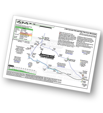
Route Summary:
Stone Ends Farm - Apronful of Stones - Rake Trod - Further Gill Sike - Scurth - The Trough - Carrock Fell - Round Knott (Caldbeck) - Miton Hill (Caldbeck) - Red Gate (Track) - High Pike (Caldbeck) - Hare Stones - Great Lingy Hill - Miller Moss - Lingy Hut - Grainsgill Beck - The Cumbria Way - River Caldew - Swineside - Mosedale (Mungrisdale) - Stone Ends Farm
|
|---|
Vital Statistics:
| Length: | 14ml (22.5km) |
|---|---|
| Ascent: | 2,978ft (908m) |
| Time: | 8.25hrs |
| Grade: |  (Hard) (Hard) |
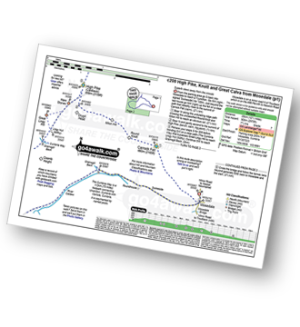
Route Summary:
Stone Ends Farm - Apronful of Stones - Rake Trod - Further Gill Sike - Scurth - The Trough - Carrock Fell - Round Knott (Caldbeck) - Miton Hill (Caldbeck) - Red Gate (Track) - High Pike (Caldbeck) - Hare Stones - Great Lingy Hill - Miller Moss - Lingy Hut - Grainsgill Beck - Knott (Uldale Fells) - Litle Calva - Great Calva - The Cumbria Way - Wiley Beck - River Caldew - Burdell - Gill - Wet Swine Gill - Grainsgill Beck - Swineside - Mosedale (Mungrisdale) - Stone Ends Farm
See Carrock Fell and the surrounding tops on our free-to-access 'Google Style' Peak Bagging Maps:
The Northern Fells of The Lake District National Park
Less data - quicker to download
The Whole of The Lake District National Park
More data - might take a little longer to download
See Carrock Fell and the surrounding tops on our downloadable Peak Bagging Maps in PDF format:

NB: Whether you print off a copy or download it to your phone, these PDF Peak Baggers' Maps might prove incredibly useful when your are up there on the tops and you cannot get a phone signal.
*This version is marked with the walk routes you need to follow to Walk all 214 Wainwrights in just 59 walks.
You can find Carrock Fell & all the walks that climb it on these unique free-to-access Interactive Walk Planning Maps:
1:25,000 scale OS Explorer Map (orange/yellow covers):
1:50,000 scale OS Landranger Map (pink/magenta covers):
 Fellow go4awalkers who have already walked, climbed, summited & bagged Carrock Fell
James Hughes walked up Carrock Fell on May 15th, 2025 [from/via/route] c200 High Pike, Knott & Great Calva [weather] Cold start in morning. Cool on tops with strong breeze on Great Calva. Warm on descent in afternoon. - Parked near Home Farm so needed to walk to Mosedale Bridge. Plenty of parking Quakers Meeting House. Also good parking for direct route up eastern side of Carrock Fell. Walked up from Swineside approach. Good climb then onto flat plateau. Impressive top with cairn. Easy enjoyable walk to High Pike. Return to join Cumbria Way to Linghy Hut & then up to Knott. Fairly easy descent & ascent up to Great Calva. Impressive views & prominence of Fell. Descent not overly enjoyable, steep through heather. Enjoyable lunch stop at Wiley Beck. Feet revived by water dip. Pleasant return via Cumbria Way alongside River Caldew. Stayed at Hudscales Farm & few pints at Old Crown Hesket Newmarket.
Geoff Hand climbed Carrock Fell on May 21st, 2024 [from/via/route] Walk C200 Carrock Fell, Round Knott, Milton, Hill,High Pike, Hare Stones, Gt Lingy, Knott, Littel & Great Calva from Mosedale. Return by River Caldew. [with] Solo [weather] Sunny Intervals, warm in the sun. Breezy from the north east. - Long hard walk with tough climb from the onset. Mose dale valley on the way back beautiful. Chap lost his dog on Round Knott & Milton, but found him. I lost my map & waterbottle!
Angela O'neill bagged Carrock Fell on May 11th, 2024 [from/via/route] From Caldbeck [with] John, Jen & Paul [weather] Dry & Bright & hot
Neil Heywood hiked Carrock Fell on September 2nd, 2014 [with] Logan Heywood David Heywood
Richard Holmes summited Carrock Fell on September 3rd, 2023 [from/via/route] Mosedale [with] Myself. [weather] Very hot, good breeze in places. - Dangerous decent from Carrock Fell
Andrew Thornton conquered Carrock Fell on August 23rd, 2023 [from/via/route] Carrock Beck [with] Jenny [weather] Sunny - Good paths - a few boggy sections.
Paul Macey scaled Carrock Fell on July 17th, 2023 [from/via/route] Using walk c200 in reverse as couldn't find start! [weather] A dry day more sun than cloud about 16 degrees - My 200th Wainwright
Ian Ashton walked up Carrock Fell on June 17th, 2023 [from/via/route] I [with] JPH
Christine Shepherd climbed Carrock Fell on July 23rd, 2008 [from/via/route] Walked from Mosedale using walk c200 [with] On my own [weather] Humid start, clear later. - Climbed this again using walk c106 on 1.9.18. Climbed for a third time repeating walk c200 on a glorious day on 31.5.23
Tim Winn bagged Carrock Fell on March 24th, 2023 [from/via/route] Mosedale [with] Barry, Paul, Roger, Andy and Dave [weather] Wet from the sky & under foot.
To add (or remove) your name and experiences on this page - Log On and edit your Personal Mountain Bagging Record
. . . [see more walk reports]
More Photographs & Pictures of views from, on or of Carrock Fell
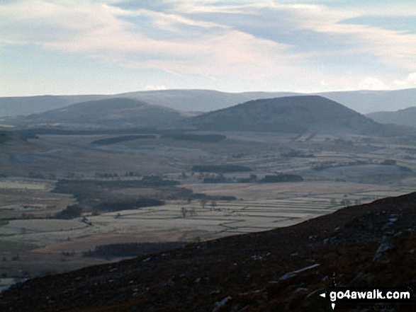
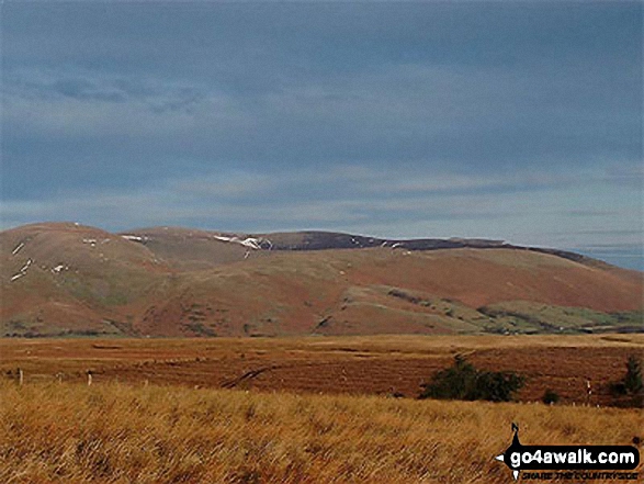
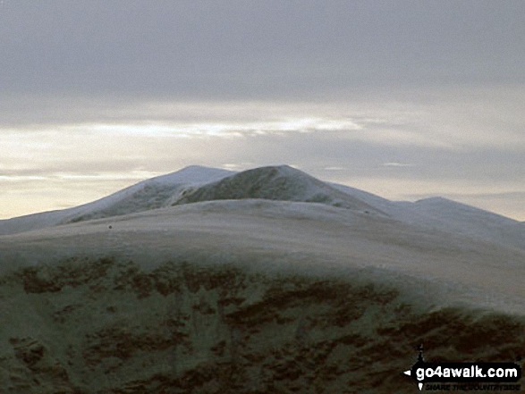
Bowscale Fell, Carrock Fell and Souther Fell from the old coach road nr Barbary Rigg
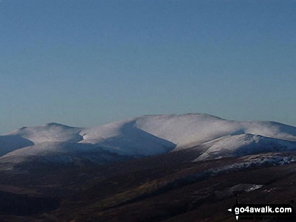
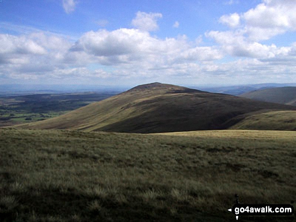
Looking North East to Knott (Uldale Fells), High Pike (Caldbeck) and Carrock Fell from the summit cairn on Bakestall
. . . see just 20 walk photographs & pictures of views from, on or of Carrock Fell
Send us your photographs and pictures on, of, or from Carrock Fell
If you would like to add your walk photographs and pictures featuring views from, on or of Carrock Fell to this page, please send them as email attachments (configured for any computer) along with your name to:
and we shall do our best to publish them.
(Guide Resolution = 300dpi. At least = 660pixels (wide) x 440 pixels (high).)

You can also submit photos via our Facebook Page.
NB. Please indicate where each photo was taken and whether you wish us to credit your photos with a Username or your First Name/Last Name.
Not familiar with this top?


