
![]()
Bannerdale Crags
683m (2242ft)
The Northern Fells, The Lake District, Cumbria, England
Tap/mouse over a coloured circle (1-3 easy walks, 4-6 moderate walks, 7-9 hard walks) and click to select.
Not familiar with this top?
   |
|---|
Vital Statistics:
| Length: | 7.75ml (12.5km) |
|---|---|
| Ascent: | 2,453ft (748m) |
| Time: | 5.25hrs |
| Grade: |  (Moderate) (Moderate) |
Route Summary:
Mungrisdale - Souther Fell - River Glendermackin - Bannerdale Crags - Bowscale Fell - Mungrisdale
|
|---|
Vital Statistics:
| Length: | 9.5ml (15km) |
|---|---|
| Ascent: | 3,070ft (936m) |
| Time: | 6½ hrs |
| Grade: |  (Hard) (Hard) |
Route Summary:
Mungrisdale - Souther Fell - River Glendermackin - Brunt Knott - Scales Beck - Scales Tarn - Sharp Edge - Atkinson Pike - Blencathra or Saddleback (Hallsfell Top) - Foule Crag - Bannerdale Crags - Bowscale Fell - Tarn Crags Top - Raven Crags - Mungrisdale
|
|---|
Vital Statistics:
| Length: | 11ml (17.5km) |
|---|---|
| Ascent: | 3,264ft (995m) |
| Time: | 7.25hrs |
| Grade: | (Hard) |
Route Summary:
Mungrisdale - Souther Fell - River Glendermackin - Brunt Knott - Scales Beck - Scales Tarn - Sharp Edge - Atkinson Pike - Blencathra or Saddleback (Hallsfell Top) - Mungrisdale Common - Bannerdale Crags - Bowscale Fell - Tarn Crags Top - Raven Crags - Mungrisdale
See Bannerdale Crags and the surrounding tops on our free-to-access 'Google Style' Peak Bagging Maps:
The Northern Fells of The Lake District National Park
Less data - quicker to download
The Whole of The Lake District National Park
More data - might take a little longer to download
See Bannerdale Crags and the surrounding tops on our downloadable Peak Bagging Maps in PDF format:

NB: Whether you print off a copy or download it to your phone, these PDF Peak Baggers' Maps might prove incredibly useful when your are up there on the tops and you cannot get a phone signal.
*This version is marked with the walk routes you need to follow to Walk all 214 Wainwrights in just 59 walks.
You can find Bannerdale Crags & all the walks that climb it on these unique free-to-access Interactive Walk Planning Maps:
1:25,000 scale OS Explorer Map (orange/yellow covers):
1:50,000 scale OS Landranger Map (pink/magenta covers):
 Fellow go4awalkers who have already walked, climbed, summited & bagged Bannerdale Crags
James Hughes walked up Bannerdale Crags on May 8th, 2025 [from/via/route] c245 Blencathra from Mungrisdale [weather] Cloudy at times, otherwise sunny. Warm when sheltered. Cool breeze with strong breeze on tops. - Awesome climb up Hall's Fell from White Horse in Scales. Technical in places with good scrambling. Admired Sharp Edge on way to Atkinson Pike. Descent to Mungrisdale Common, peaty in places. Great view across to Skiddaw. Return to Bannerdale Crags before ascent of Bowscale Fell. Easy descent into Mungrisdale before final climb of Souter Fell. Clear path down Mousthwaite Comb & return on road to White Horse. Pint of Corby Blonde.
John Ramsbottom climbed Bannerdale Crags on March 26th, 2025 [from/via/route] Started from Mungrisdale Start from Seatoller, Rosthwaite Fell, Glaramara, Allen Crags & Seathwaite Fell [with] Lola [weather] fine, bit breezy - wild camped on Bowscale
Paul Roddam bagged Bannerdale Crags on April 12th, 2025 [from/via/route] From Mungrisdale [with] Bri, Rice and Barber [weather] bloody lovely
Martin Woods hiked Bannerdale Crags on March 4th, 2023 [from/via/route] From mungrisdale with crusham [with] N/A [weather] Overcast, 10 degerees in the valley cold on the tops
Ian Ashton summited Bannerdale Crags on December 19th, 2024 [with] Solo
David Higginbottom conquered Bannerdale Crags on April 23rd, 2024 [from/via/route] C245 [with] Carolyn [weather] Good
Martin Hartshorne scaled Bannerdale Crags on January 12th, 2024 [from/via/route] Mungrisdale [with] finley [weather] Grey low cloud cold, up thro the clouds blue skies & sunshine, stunning - All you could see was the highest mountain peaks poking out of the cloud
Clare Tait walked up Bannerdale Crags on August 13th, 2023 [from/via/route] Parked opposite village hall in Mungrisdale. Had to wait until pm to start due to weather. Took in Bannerdale Crags too. Easy walking. [with] Charlie - Our no 85 Wainwright.
Paul Macey climbed Bannerdale Crags on July 20th, 2023 [from/via/route] Using Walk 245 [weather] Mostly sunny some cloud towards end but not much 19 degrees at finish
Steve Lucas bagged Bannerdale Crags on September 24th, 2021 [with] On my own
To add (or remove) your name and experiences on this page - Log On and edit your Personal Mountain Bagging Record
. . . [see more walk reports]
More Photographs & Pictures of views from, on or of Bannerdale Crags
Carl Side, Skiddaw and Lonscale Fell (centre left), Great Calva (centre) and Belncathra or Saddleback, Bannerdale Crags and Souther Fell (centre right) from the summit of High Rigg
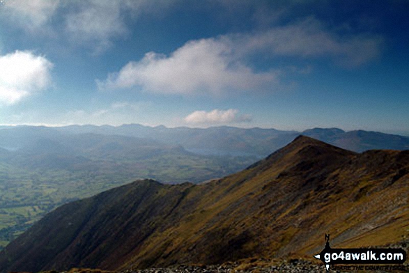
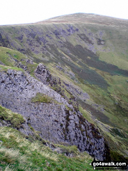
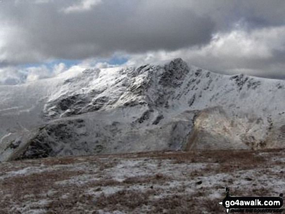
Sharp Edge, Blencathra or Saddleback (Hallsfell Top) from Bannerdale Crags
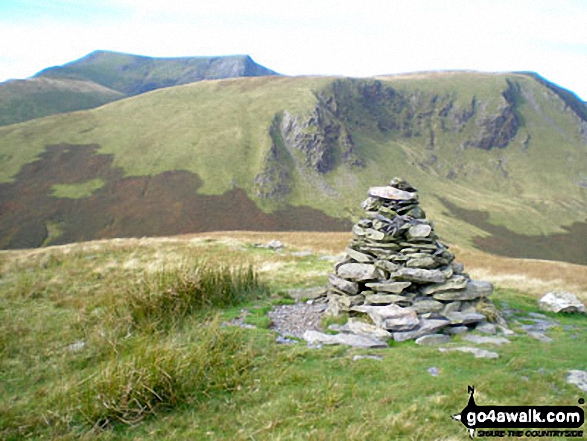
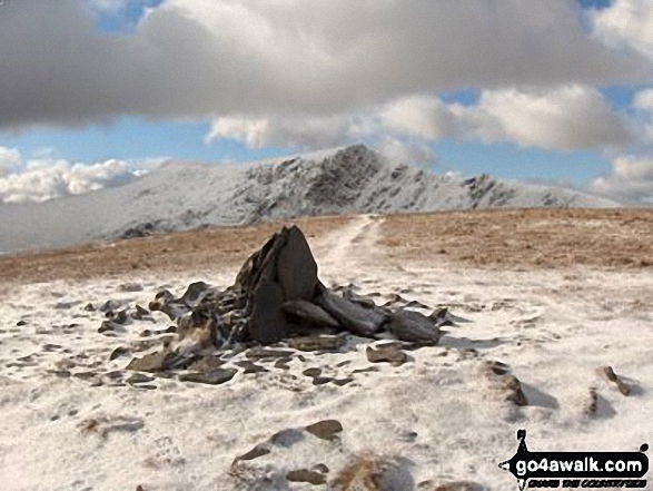
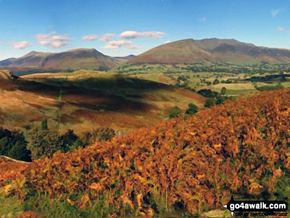
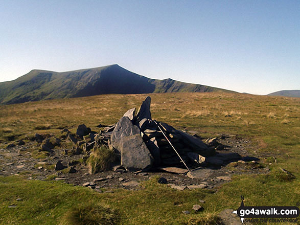
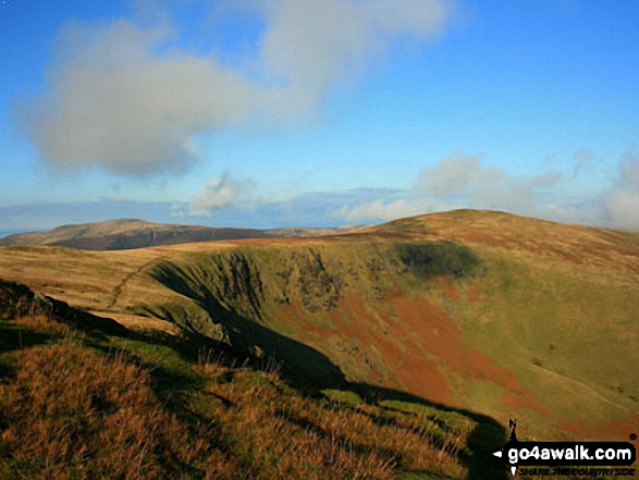
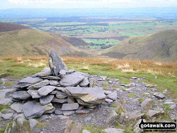
Souther Fell summit cairn with Blencathra (or Saddleback) (distance) and Bannerdale Crags in the background
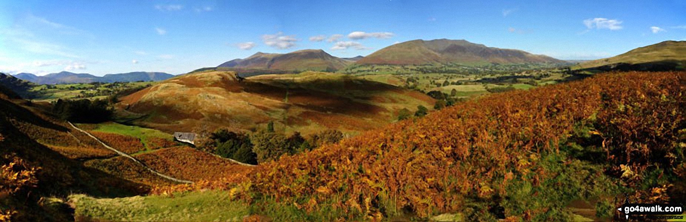
The North Western Fells (far left distance), Carl Side, Skiddaw and Lonscale Fell (centre left), Great Calva (centre) and Belncathra or Saddleback, Bannerdale Crags and Souther Fell (centre right) and the shoulder of Clough Head (far right) from the summit of High Rigg
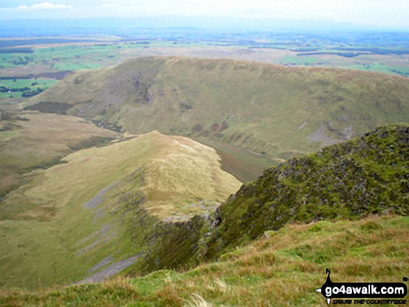
Bannerdale from between The Tongue and the sunlit east ridge of Bannerdale Crags
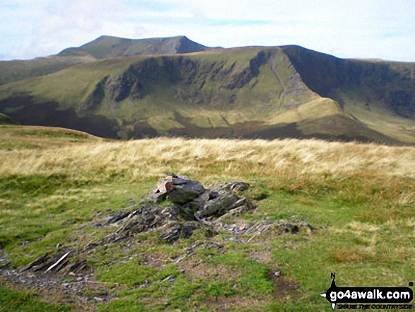
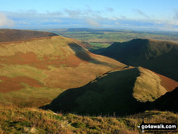
Bannerdale Crags (mid-ground) and Blencathra (or Saddleback) from Souther Fell
Send us your photographs and pictures on, of, or from Bannerdale Crags
If you would like to add your walk photographs and pictures featuring views from, on or of Bannerdale Crags to this page, please send them as email attachments (configured for any computer) along with your name to:
and we shall do our best to publish them.
(Guide Resolution = 300dpi. At least = 660pixels (wide) x 440 pixels (high).)

You can also submit photos via our Facebook Page.
NB. Please indicate where each photo was taken and whether you wish us to credit your photos with a Username or your First Name/Last Name.
Not familiar with this top?


