
![]()
Bowscale Fell
702m (2304ft)
The Northern Fells, The Lake District, Cumbria, England
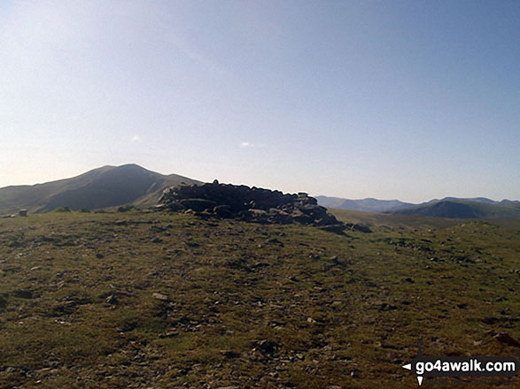
The summit of Bowscale Fell is marked by an Ordnance Survey Trig Point.

Not familiar with this top?
You can walk/hike to the top of Bowscale Fell by using any of these 3 easy‑to‑follow route maps:
Walk c122 Bowscale Fell from Mungrisdale
Quieter alternative to crowded Blencathra
   |
|---|
Vital Statistics:
| Length: | 7.75ml (12.5km) |
|---|---|
| Ascent: | 2,453ft (748m) |
| Time: | 5.25hrs |
| Grade: |  (Moderate) (Moderate) |
Route Summary:
Mungrisdale - Souther Fell - River Glendermackin - Bannerdale Crags - Bowscale Fell - Mungrisdale
Walk c191 The Glendermackin Round from Mungrisdale
Popular round - pick a weekday
|
|---|
Vital Statistics:
| Length: | 9.5ml (15km) |
|---|---|
| Ascent: | 3,070ft (936m) |
| Time: | 6½ hrs |
| Grade: |  (Hard) (Hard) |

Route Summary:
Mungrisdale - Souther Fell - River Glendermackin - Brunt Knott - Scales Beck - Scales Tarn - Sharp Edge - Atkinson Pike - Blencathra or Saddleback (Hallsfell Top) - Foule Crag - Bannerdale Crags - Bowscale Fell - Tarn Crags Top - Raven Crags - Mungrisdale
Walk c245 Blencathra from Mungrisdale
Popular round - pick a weekday
|
|---|
Vital Statistics:
| Length: | 11ml (17.5km) |
|---|---|
| Ascent: | 3,264ft (995m) |
| Time: | 7.25hrs |
| Grade: | (Hard) |

Route Summary:
Mungrisdale - Souther Fell - River Glendermackin - Brunt Knott - Scales Beck - Scales Tarn - Sharp Edge - Atkinson Pike - Blencathra or Saddleback (Hallsfell Top) - Mungrisdale Common - Bannerdale Crags - Bowscale Fell - Tarn Crags Top - Raven Crags - Mungrisdale
See Bowscale Fell and the surrounding tops on our free-to-access 'Google Style' Peak Bagging Maps:
The Northern Fells of The Lake District National Park
Less data - quicker to download
The Whole of The Lake District National Park
More data - might take a little longer to download
See Bowscale Fell and the surrounding tops on our unique, downloadable, PDF Peak Bagging Maps:

NB: Whether you print off a copy or download it to your phone, these PDF Peak Baggers' Maps might prove incredibly useful when your are up there on the tops and you cannot get a phone signal.
*This version is marked with the walk routes you need to follow to Walk all 214 Wainwrights in just 59 walks.
You can find Bowscale Fell & all the walks that climb it on these unique free-to-access Interactive Walk Planning Maps:
1:25,000 scale OS Explorer Map (orange/yellow covers):
1:50,000 scale OS Landranger Map (pink/magenta covers):
 Fellow go4awalkers who have already walked, climbed, scaled, summited, hiked & bagged Bowscale Fell
James Hughes walked up Bowscale Fell on May 8th, 2025 [from/via/route] c245 Blencathra from Mungrisdale [weather] Cloudy at times, otherwise sunny. Warm when sheltered. Cool breeze with strong breeze on tops. - Awesome climb up Hall's Fell from White Horse in Scales. Technical in places with good scrambling. Admired Sharp Edge on way to Atkinson Pike. Descent to Mungrisdale Common, peaty in places. Great view across to Skiddaw. Return to Bannerdale Crags before ascent of Bowscale Fell. Easy descent into Mungrisdale before final climb of Souter Fell. Clear path down Mousthwaite Comb & return on road to White Horse. Pint of Corby Blonde.
John Ramsbottom climbed it on March 26th, 2025 [from/via/route] Started from Mungrisdale Start from Seatoller, Rosthwaite Fell, Glaramara, Allen Crags & Seathwaite Fell [with] Lola [weather] fine, bit breezy - wild camped on Bowscale
Paul Roddam bagged it on April 12th, 2025 [from/via/route] From Mungrisdale [with] Bri, Rice and Barber [weather] bloody lovely
Martin Woods hiked Bowscale Fell on March 4th, 2023 [from/via/route] From mungrisdale with crusham [with] N/A [weather] Overcast, 10 degerees in the valley cold on the tops
Ian Ashton summited on December 19th, 2024 [with] Solo
To add (or remove) your name and experiences on this page - Log On and edit your Personal Mountain Bagging Record
. . . [see more walk reports]
More Photographs & Pictures of views from, on, or of, Bowscale Fell

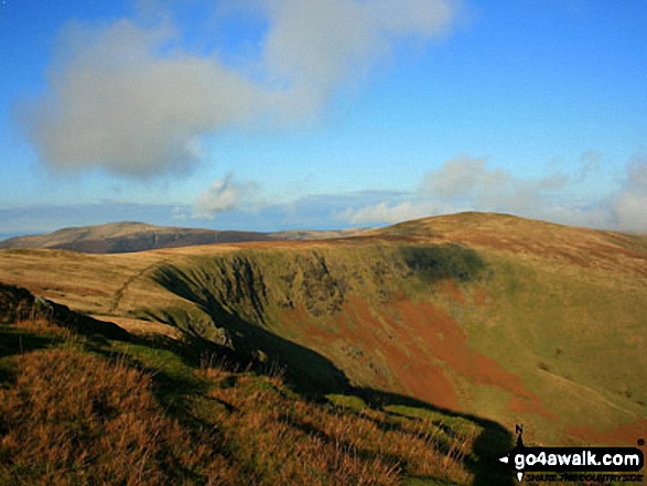
Bowscale Fell (left) and Blencathra or Saddleback with Sharp Edge clearly visible (centre) with a dusting of snow from Skiddaw (Little Man)


Bowscale Fell (left) and Blencathra or Saddleback with Sharp Edge clearly visible (centre right) in the snow from Sale How (Skiddaw)
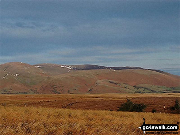
Bowscale Fell, Carrock Fell and Souther Fell from the old coach road nr Barbary Rigg

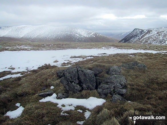
The rocky summit of Sale How (Skiddaw) in the snow with Bowscale Fell (left) and Blencathra or Saddleback with Sharp Edge clearly visible (right) on the horizon

. . . see all 14 walk photographs & pictures of views from, on, or of, Bowscale Fell
Send us your photographs and pictures on, of, or from Bowscale Fell
If you would like to add your walk photographs and pictures to this page, please send them as email attachments (configured for any computer) along with your name to:
and we shall do our best to publish them.
(Guide Resolution = 300dpi. At least = 660pixels (wide) x 440 pixels (high).)

You can also submit photos via our Facebook Page.
NB. Please indicate where each photo was taken and whether you wish us to credit your photos with a Username or your First Name/Last Name.


