
![]()
Carreg yr Ast
579m (1900ft)
The South Western Area, The Cambrian Mountains, Powys, Wales
Tap/mouse over a coloured circle (1-3 easy walks, 4-6 moderate walks, 7-9 hard walks) and click to select.
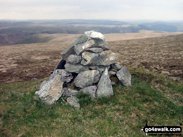
The summit of Carreg yr Ast is marked by a cairn.
Not familiar with this top?
   |
|---|
Vital Statistics:
| Length: | 11mls (17.5km) |
|---|---|
| Ascent: | 1,900ft (579m) |
| Time: | 6 hrs |
| Grade: |  (Moderate) (Moderate) |
Route Summary:
Dolymynach Reservoir - Afon Claerwen - Llanerch Cawr - Llywdnant - Marchnant - Gorllwyn (Pen y Gorllwyn) - Bwlch Ddau Faen - Carnau - Bryn Rhudd - Drygarn Fawr (North East Top) - Drygarn Fawr - Carreg Yr Ast - Nant Paradwys - Rhiwnant - Dolymynach Reservoir
See Carreg yr Ast and the surrounding tops on our free-to-access 'Google Style' Peak Bagging Maps:
The South Western AreaThe South Western Area of Mynyddoedd Cambria (The Cambrian Mountains)
Less data - quicker to download
Mynyddoedd Cambria (The Cambrian Mountains)
Less data - quicker to download
A go4awalk.com downloadable Peak Bagging Map in PDF format featuring Carreg yr Ast should be available soon.
Free-to-access Interactive Walk Planning Maps:
 Fellow go4awalkers who have already walked, climbed, summited & bagged Carreg yr Ast
To add (or remove) your name and experiences on this page - Log On and edit your Personal Mountain Bagging Record
Send us your photographs and pictures on, of, or from Carreg yr Ast
If you would like to add your walk photographs and pictures featuring views from, on or of Carreg yr Ast to this page, please send them as email attachments (configured for any computer) along with your name to:
and we shall do our best to publish them.
(Guide Resolution = 300dpi. At least = 660pixels (wide) x 440 pixels (high).)

You can also submit photos via our Facebook Page.
NB. Please indicate where each photo was taken and whether you wish us to credit your photos with a Username or your First Name/Last Name.
Not familiar with this top?


