Scottish Region 27: The Scottish Borders- - a fully detailed list of all the Mountains, Peaks, Tops and Hills (Page 2 of 3)
Scottish Region 27: The Scottish Borders region is the area enclosed by an imaginary line connecting:
- Glasgow to North Berwick via the Forth and Clyde Canal and the Firth of Forth, Queensferry and Edinburgh to the North;
- North Berwick to Berwick-upon-Tweed via the North Sea to the North East
- Berwick-upon-Tweed to Gretna Green via the border between Scotland & England to the South East
- Gretna Green to Glasgow via the A74(M) past Lockerbie, Moffat, Douglas and Hamilton to the South West
If you count only the Marilyns there are 62 tops to climb, bag & conquer and the highest point is Broad Law at 840m (2,757ft).
To see these Mountains, Peaks, Tops and Hills displayed in different ways - see the options in the left-hand column and towards the bottom of this page.
LOG ON and RELOAD this page to show which Mountains, Peaks, Tops and Hills you have already climbed, bagged & conquered [. . . more details]
See this list in: Alphabetical Order
| Height Order‡
To reverse the order select the link again.
Mountain, Peak, Top or Hill:
Bagged
31. Meikle Says Law
535m (1,756ft)
Meikle Says Law is on interactive maps:
A downloadable go4awalk.com PDF Peak Bagging Map featuring Meikle Says Law will be available soon. |
32. Black Mount
516m (1,694ft)
Black Mount is on interactive maps:
A downloadable go4awalk.com PDF Peak Bagging Map featuring Black Mount will be available soon. |
33. Larriston Fell
512m (1,680ft)
Larriston Fell is on interactive maps:
A downloadable go4awalk.com PDF Peak Bagging Map featuring Larriston Fell will be available soon. |
34. Dungavel Hill (River Clyde)
510m (1,674ft)
Send it in and we'll publish it here.
Dungavel Hill (River Clyde) is on interactive maps:
A downloadable go4awalk.com PDF Peak Bagging Map featuring Dungavel Hill (River Clyde) will be available soon. |
35. Black Hill (Pentland Hills)
501m (1,644ft)
Send it in and we'll publish it here.
Black Hill (Pentland Hills) is on interactive maps:
A downloadable go4awalk.com PDF Peak Bagging Map featuring Black Hill (Pentland Hills) will be available soon. |
36. Law Kneis
498m (1,634ft)
Law Kneis is on interactive maps:
A downloadable go4awalk.com PDF Peak Bagging Map featuring Law Kneis will be available soon. |
37. Allermuir Hill
493m (1,618ft)
Allermuir Hill is on interactive maps:
A downloadable go4awalk.com PDF Peak Bagging Map featuring Allermuir Hill will be available soon. |
38. Lamington Hill
492m (1,615ft)
Lamington Hill is on interactive maps:
A downloadable go4awalk.com PDF Peak Bagging Map featuring Lamington Hill will be available soon. |
39. Wether Law (Cloich Hills)
479m (1,572ft)
Send it in and we'll publish it here.
Wether Law (Cloich Hills) is on interactive maps:
A downloadable go4awalk.com PDF Peak Bagging Map featuring Wether Law (Cloich Hills) will be available soon. |
40. Cacra Hill
471m (1,546ft)
Cacra Hill is on interactive maps:
A downloadable go4awalk.com PDF Peak Bagging Map featuring Cacra Hill will be available soon. |
41. Spartleton
468m (1,536ft)
Spartleton is on interactive maps:
A downloadable go4awalk.com PDF Peak Bagging Map featuring Spartleton will be available soon. |
42. Calkin Rig (Ewe Hill)
451m (1,480ft)
Send it in and we'll publish it here.
Calkin Rig (Ewe Hill) is on interactive maps:
A downloadable go4awalk.com PDF Peak Bagging Map featuring Calkin Rig (Ewe Hill) will be available soon. |
43. Mendick Hill
451m (1,480ft)
Mendick Hill is on interactive maps:
A downloadable go4awalk.com PDF Peak Bagging Map featuring Mendick Hill will be available soon. |
44. Hownam Law
449m (1,474ft)
See the location of Hownam Law and walks up it on a google Map Hownam Law is on interactive maps:
A downloadable go4awalk.com PDF Peak Bagging Map featuring Hownam Law will be available soon. |
45. Blackwood Hill (Arnton Fell)
447m (1,467ft)
Send it in and we'll publish it here.
Blackwood Hill (Arnton Fell) is on interactive maps:
A downloadable go4awalk.com PDF Peak Bagging Map featuring Blackwood Hill (Arnton Fell) will be available soon. |
46. Goseland Hill
435m (1,428ft)
Goseland Hill is on interactive maps:
A downloadable go4awalk.com PDF Peak Bagging Map featuring Goseland Hill will be available soon. |
47. White Meldon
427m (1,401ft)
White Meldon is on interactive maps:
A downloadable go4awalk.com PDF Peak Bagging Map featuring White Meldon will be available soon. |
48. Broomy Law
426m (1,398ft)
Broomy Law is on interactive maps:
A downloadable go4awalk.com PDF Peak Bagging Map featuring Broomy Law will be available soon. |
49. Rubers Law
424m (1,392ft)
Rubers Law is on interactive maps:
A downloadable go4awalk.com PDF Peak Bagging Map featuring Rubers Law will be available soon. |
50. Sell Moor Hill
424m (1,390ft)
Sell Moor Hill is on interactive maps:
A downloadable go4awalk.com PDF Peak Bagging Map featuring Sell Moor Hill will be available soon. |
51. Meigle Hill
423m (1,388ft)
Meigle Hill is on interactive maps:
A downloadable go4awalk.com PDF Peak Bagging Map featuring Meigle Hill will be available soon. |
52. Eildon Hills
422m (1,385ft)
Eildon Hills is on interactive maps:
A downloadable go4awalk.com PDF Peak Bagging Map featuring Eildon Hills will be available soon. |
53. Cademuir Hill
415m (1,362ft)
Cademuir Hill is on interactive maps:
A downloadable go4awalk.com PDF Peak Bagging Map featuring Cademuir Hill will be available soon. |
54. Dirrington Great Law
398m (1,306ft)
Send it in and we'll publish it here.
Dirrington Great Law is on interactive maps:
A downloadable go4awalk.com PDF Peak Bagging Map featuring Dirrington Great Law will be available soon. |
55. Belling Hill
354m (1,162ft)
Belling Hill is on interactive maps:
A downloadable go4awalk.com PDF Peak Bagging Map featuring Belling Hill will be available soon. |
56. Grange Fell (Carruthers Fell)
319m (1,047ft)
Send it in and we'll publish it here.
Grange Fell (Carruthers Fell) is on interactive maps:
A downloadable go4awalk.com PDF Peak Bagging Map featuring Grange Fell (Carruthers Fell) will be available soon. |
57. Black Hill (Galashiels)
314m (1,031ft)
Send it in and we'll publish it here.
Black Hill (Galashiels) is on interactive maps:
A downloadable go4awalk.com PDF Peak Bagging Map featuring Black Hill (Galashiels) will be available soon. |
58. Cairnpapple Hill
312m (1,024ft)
Cairnpapple Hill is on interactive maps:
A downloadable go4awalk.com PDF Peak Bagging Map featuring Cairnpapple Hill will be available soon. |
59. Linton Hill
282m (926ft)
Linton Hill is on interactive maps:
A downloadable go4awalk.com PDF Peak Bagging Map featuring Linton Hill will be available soon. |
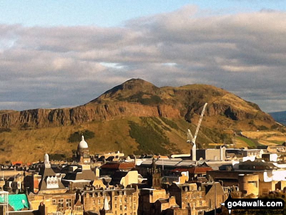
60. Arthur's Seat
251m (824ft)
Arthur's Seat is on interactive maps:
A downloadable go4awalk.com PDF Peak Bagging Map featuring Arthur's Seat will be available soon. |
View these 62 Mountains, Peaks, Tops and Hills:
- On an Interactive Google Map (loads faster)
- On an Interactive Google Map with a list of tops below it.
(makes it easier to locate a particular top) - On a Detailed List in:
Alphabetical Order | Height Order - On one page with 'yet-to-be-bagged' listed 1st & then 'already-bagged' tops listed 2nd in:
Alphabetical Order | Height Order - On one page with 'already-bagged' tops listed 1st & then 'yet-to-be-bagged' tops listed 2nd in:
Alphabetical Order | Height Order
Is there a Mountain, Peak, Top or Hill missing from the above google map or list?
Let us know an we will add it to our database.


