
![]()
Eildon Hills
422m (1385ft)
The Lammermuir Hills, The Scottish Borders, The Borders, Scotland
The summit of Eildon Hills is marked by an Ordnance Survey Trig Point.
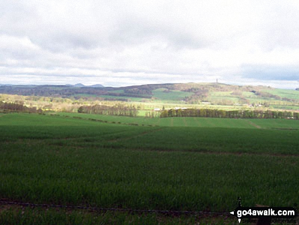
The Eildon Hills and Wellington's Pillar from The St Cuthbert's Way near Chestercleuch Plantation
Not familiar with this top?
See Eildon Hills and the surrounding tops on our free-to-access 'Google Style' Peak Bagging Maps:
The Lammermuir Hills area of Scottish Region 28: The Scottish Borders
Less data - quicker to download
Scottish Region 27: The Scottish Borders
Less data - quicker to download
A go4awalk.com downloadable Peak Bagging Map in PDF format featuring Eildon Hills should be available soon.
Free-to-access Interactive Walk Planning Maps:
1:25,000 scale OS Explorer Map (orange/yellow covers):
An Interactive Walk Planning Map for OS Explorer 338 Galashiels, Selkirk & Melrose is not currently available
1:50,000 scale OS Landranger Map (pink/magenta covers):
An Interactive Walk Planning Map for OS Landranger 73 Peebles, Galashiels & Selkirk, Tweed Valley is not currently available
 Fellow go4awalkers who have already walked, climbed, summited & bagged Eildon Hills
Chris Hughes walked up Eildon Hills on May 22nd, 2023 [from/via/route] Melrose [weather] Sunny
Patrick Rogozinski, Paul Booth and Rob Barklamb have all walked, climbed & bagged Eildon Hills.
To add (or remove) your name and experiences on this page - Log On and edit your Personal Mountain Bagging Record
Send us your photographs and pictures on, of, or from Eildon Hills
If you would like to add your walk photographs and pictures featuring views from, on or of Eildon Hills to this page, please send them as email attachments (configured for any computer) along with your name to:
and we shall do our best to publish them.
(Guide Resolution = 300dpi. At least = 660pixels (wide) x 440 pixels (high).)

You can also submit photos via our Facebook Page.
NB. Please indicate where each photo was taken and whether you wish us to credit your photos with a Username or your First Name/Last Name.
Not familiar with this top?


