The Clwydian Hills area of North Wales - 37 Tops, Peaks and Hills to climb and bag
The Clwydian Hills is the area enclosed by:
- the Irish Sea from the Snowdonia National Park boundary at Conwy to the River Dee to the North;
- the border between Wales and England from the River Dee to Chirk/Y Waun the the East;
- the A5 from Chirk/Y Waun to Druid and then the A494 to Bala to the South;
- and the Snowdonia National Park boundary from Bala to Conwy to the West.
The area includes The Clwydian Range of hills.
There are 37 'tops' to walk up, bag and conquer, the highest point is Moel y Gamelin (Maesrychen Mountain) and the area includes:
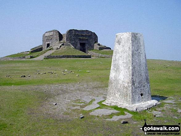 The summit of Moel Famau in The Clwydian Hills
Photo: David OLeary
| 0 | Wainwrights | |
| 0 | Mountains (aka Hewitts) | |
| 12 | Deweys | |
| 0 | Nuttalls | |
| 0 | Wainwright Outlying Fells | |
| 11 | Marilyns | |
| 19 | Hills (aka Bridgets) and | |
| 18 | Mountains, Tops, Peaks or Hills with a Trig Point on or near the top |
View these Mountains, Peaks, Tops and Hills in The Clwydian Hills area of North Wales:
- On an Interactive Google Map with a list of tops below it.
(makes it easier to locate a particular top) - On a Detailed List in:
Alphabetical Order | Height Order - On one page with 'yet-to-be-bagged' listed 1st
& then 'already-bagged' tops listed 2nd in:
Alphabetical Order | Height Order - On one page with 'already-bagged' tops listed 1st
& then 'yet-to-be-bagged' tops listed 2nd in:
Alphabetical Order | Height Order


