The Central area of Mynyddoedd Cambria (The Cambrian Mountains) - 79 Mountains, Tops, Peaks and Hills to climb and bag
The Central Area of The Central area of Mynyddoedd Cambria (The Cambrian Mountains) is the area enclosed by:
- the Snowdonia National Park boundary from Aberdyfi/Aberdovey to Aberangell to the North; the A470 from Aberangell via Glantwymyn to Caersws, the A489 to Newtown, the A483 to Dolfor and then the B4355 to the country border between Wales and England to the North-West;
- the country border between Wales and England from the B4355 to the A44 to the East;
- the A44 from the country border to Rhayader, the A470 to Llangurig, and then the A44 again to Aberystwyth to the South West;
- the Irish Sea from Aberystwyth to Aberdyfi/Aberdovey to the West
There are 79 'tops' to walk up, bag and conquer, the highest point is Pen Pumlumon Fawr (Plynlimon) and the area includes:
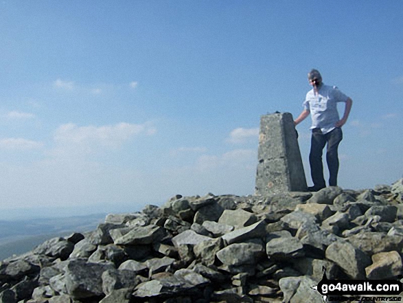 Pen Pumlumon Fawr (Plynlimon) in The Central area of Mynyddoedd Cambria (The Cambrian Mountains)
Photo: Mike Matthews
| 0 | Wainwrights | |
| 4 | Mountains (aka Hewitts) | |
| 33 | Deweys | |
| 5 | Nuttalls | |
| 0 | Wainwright Outlying Fells | |
| 11 | Marilyns | |
| 37 | Hills (aka Bridgets) and | |
| 15 | Mountains, Tops, Peaks or Hills with a Trig Point on or near the top |
View these Mountains, Tops, Peaks and Hills in The Central Cambrian Mountains:-
- On an Interactive Google Map Only (loads faster)
- On an Interactive Google Map with a list of tops below it (makes it easier to locate a particular top)
- On a Detailed List in:
Alphabetical Order | Height Order - On one page with 'yet-to-be-bagged' listed 1st & then 'already-bagged' tops listed 2nd in:
Alphabetical Order | Height Order - On one page with 'already-bagged' tops listed 1st & then 'yet-to-be-bagged' tops listed 2nd in:
Alphabetical Order | Height Order


