Wales - a fully detailed list of all the Mountains, Peaks, Tops and Hills (Page 8 of 9)
Wales is defined as the whole of the principality of Wales which includes the National Parks of Snowdonia, Bannau Brycheiniog (The Brecon Beacons) and The Pembrokeshire Coast as well as Mynyddoedd Cambria (The Cambrian Mountains), Radnor Forest, Anglesey, The Llynn Peninsula, The Preseli Mountains and The Gower Peninsula.
If you count only the Deweys there are 241 tops to climb, bag & conquer and the highest point is Craig Fach at 609m (1,999ft).
To see these Mountains, Peaks, Tops and Hills displayed in different ways - see the options in the left-hand column and towards the bottom of this page.
![]() Your Personal Bagging Record for Wales
Your Personal Bagging Record for Wales
LOG ON and RELOAD this page to show which Mountains, Peaks, Tops and Hills you have already climbed, bagged & conquered [. . . more details]
See this list in: Alphabetical Order
| Height Order‡
To reverse the order select the link again.
Mountain, Peak, Top or Hill:
Bagged

![]()
211. Bwlch Mawr
509m (1,670ft)
Bwlch Mawr is on interactive maps:
A downloadable go4awalk.com PDF Peak Bagging Map featuring Bwlch Mawr will be available soon. |
![]()
212. Camlo Hill
509m (1,670ft)
Camlo Hill is on interactive maps:
A downloadable go4awalk.com PDF Peak Bagging Map featuring Camlo Hill will be available soon. |
![]()
213. Cerrig Llwydion
509m (1,670ft)
Cerrig Llwydion is on interactive maps:
A downloadable go4awalk.com PDF Peak Bagging Map featuring Cerrig Llwydion will be available soon. |
![]()
214. Gopa Uchaf
509m (1,670ft)
Gopa Uchaf is on interactive maps:
A downloadable go4awalk.com PDF Peak Bagging Map featuring Gopa Uchaf will be available soon. |
![]()
215. Red Hill (Rhulen)
509m (1,670ft)
Red Hill (Rhulen) is on interactive maps:
A downloadable go4awalk.com PDF Peak Bagging Map featuring Red Hill (Rhulen) will be available soon. |
![]()
216. Brondre-fawr Hill
508m (1,667ft)
Brondre-fawr Hill is on interactive maps:
A downloadable go4awalk.com PDF Peak Bagging Map featuring Brondre-fawr Hill will be available soon. |
![]()
217. Godre Fynydd
508m (1,667ft)
Godre Fynydd is on interactive maps:
A downloadable go4awalk.com PDF Peak Bagging Map featuring Godre Fynydd will be available soon. |
![]()
218. Moel Cae-Howel
508m (1,667ft)
Moel Cae-Howel is on interactive maps:
Moel Cae-Howel is on downloadable PDF you can Print or Save to your Phone: |
![]()
219. Disgwylfa Fawr
507m (1,664ft)
Disgwylfa Fawr is on interactive maps:
A downloadable go4awalk.com PDF Peak Bagging Map featuring Disgwylfa Fawr will be available soon. |
![]()
220. Esgair Berfa
507m (1,664ft)
Esgair Berfa is on interactive maps:
Esgair Berfa is on downloadable PDF you can Print or Save to your Phone: |
![]()
221. Mynydd Cwmeiddew
507m (1,664ft)
Mynydd Cwmeiddew is on interactive maps:
Mynydd Cwmeiddew is on downloadable PDF you can Print or Save to your Phone: |
![]()
222. Pen Creigiau'r Llan
507m (1,663ft)
Send it in and we'll publish it here.
Pen Creigiau'r Llan is on interactive maps:
A downloadable go4awalk.com PDF Peak Bagging Map featuring Pen Creigiau'r Llan will be available soon. |
![]()
223. Warren Hill (Dildre Bank)
507m (1,663ft)
Send it in and we'll publish it here.
Warren Hill (Dildre Bank) is on interactive maps:
A downloadable go4awalk.com PDF Peak Bagging Map featuring Warren Hill (Dildre Bank) will be available soon. |
![]()
224. Esgair y Maesnant
506m (1,660ft)
Esgair y Maesnant is on interactive maps:
A downloadable go4awalk.com PDF Peak Bagging Map featuring Esgair y Maesnant will be available soon. |
![]()
225. Stanky Hill
506m (1,660ft)
Stanky Hill is on interactive maps:
A downloadable go4awalk.com PDF Peak Bagging Map featuring Stanky Hill will be available soon. |
![]()
226. Coed Nant-yr-hwch
505m (1,657ft)
Coed Nant-yr-hwch is on interactive maps:
A downloadable go4awalk.com PDF Peak Bagging Map featuring Coed Nant-yr-hwch will be available soon. |
![]()
227. Moel Hywel
505m (1,657ft)
Moel Hywel is on interactive maps:
A downloadable go4awalk.com PDF Peak Bagging Map featuring Moel Hywel will be available soon. |
![]()
228. Moel y Gaer (Llantysilio Mountain)
504m (1,654ft)
Send it in and we'll publish it here.
Moel y Gaer (Llantysilio Mountain) is on interactive maps:
A downloadable go4awalk.com PDF Peak Bagging Map featuring Moel y Gaer (Llantysilio Mountain) will be available soon. |
![]()
229. Rhobell-y-big
504m (1,654ft)
Rhobell-y-big is on interactive maps:
Rhobell-y-big is on downloadable PDF you can Print or Save to your Phone: |
![]()
230. Y Domen Fawr
504m (1,654ft)
Y Domen Fawr is on interactive maps:
A downloadable go4awalk.com PDF Peak Bagging Map featuring Y Domen Fawr will be available soon. |
![]()
231. Banc yr Wyn
503m (1,651ft)
Banc yr Wyn is on interactive maps:
A downloadable go4awalk.com PDF Peak Bagging Map featuring Banc yr Wyn will be available soon. |
![]()
232. Moel Oernant
503m (1,651ft)
Moel Oernant is on interactive maps:
Moel Oernant is on downloadable PDF you can Print or Save to your Phone: |
![]()
233. Cefn Cyfarwydd
502m (1,647ft)
Cefn Cyfarwydd is on interactive maps:
Cefn Cyfarwydd is on downloadable PDF you can Print or Save to your Phone: |
![]()
234. Craig Bron-banog
502m (1,647ft)
Craig Bron-banog is on interactive maps:
A downloadable go4awalk.com PDF Peak Bagging Map featuring Craig Bron-banog will be available soon. |
![]()
235. Mynydd Rhyd-galed
502m (1,647ft)
Mynydd Rhyd-galed is on interactive maps:
Mynydd Rhyd-galed is on downloadable PDF you can Print or Save to your Phone: |
![]()
236. Mynydd Ynyscorrwg
502m (1,647ft)
Mynydd Ynyscorrwg is on interactive maps:
A downloadable go4awalk.com PDF Peak Bagging Map featuring Mynydd Ynyscorrwg will be available soon. |
![]()
237. Pen y Bwlch Gwyn
502m (1,647ft)
Pen y Bwlch Gwyn is on interactive maps:
Pen y Bwlch Gwyn is on downloadable PDF you can Print or Save to your Phone: |
![]()
238. Y Garnedd (Llynnau Gamallt)
502m (1,647ft)
Send it in and we'll publish it here.
Y Garnedd (Llynnau Gamallt) is on interactive maps:
Y Garnedd (Llynnau Gamallt) is on downloadable PDF you can Print or Save to your Phone: |
![]()
239. Esgair Greolen
501m (1,644ft)
Esgair Greolen is on interactive maps:
A downloadable go4awalk.com PDF Peak Bagging Map featuring Esgair Greolen will be available soon. |
![]()
240. Ffridd yr Allt-lwyd
500m (1,641ft)
Send it in and we'll publish it here.
Ffridd yr Allt-lwyd is on interactive maps:
Ffridd yr Allt-lwyd is on downloadable PDF you can Print or Save to your Phone: |
View these 241 Mountains, Peaks, Tops and Hills:
- On an Interactive Google Map (loads faster)
- On an Interactive Google Map with a list of tops below it.
(makes it easier to locate a particular top) - On a Detailed List in:
Alphabetical Order | Height Order - On one page with 'yet-to-be-bagged' listed 1st & then 'already-bagged' tops listed 2nd in:
Alphabetical Order | Height Order - On one page with 'already-bagged' tops listed 1st & then 'yet-to-be-bagged' tops listed 2nd in:
Alphabetical Order | Height Order
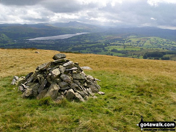
 Snowdon (Yr Wyddfa) in The ArenigsWales
Photo: Don Williams
Is there a Mountain, Peak, Top or Hill missing from the above google map or list?
Let us know an we will add it to our database.

To contribute to go4awalk.com or to contact us about anything at all - see Talk To Us.
For help see Help.
go4awalk.com and go4awalk.co.uk are registered trademarks of TMDH Limited.
Copyright © 2000-2026 TMDH Limited. All rights reserved.
Copyright Terms & Conditions Privacy Statement
A - Z Walks Home Log On/Accounts Photo Gallery Walk Ideas and Collections Fell Facts Hill Skills Walking Questions and Answers Your Stories News Competitions Product Reviews/Gear Tests Walking Gear Guides Peaks and Mountains Peak Bagging Find New Walking Friends Camping GPS Waypoints for Walking Contents Walk Search Talk To Us go4awalk.com Help Free Example Walks Newsletter


