The Mountains, Peaks, Tops and Hills in Scotland as a detailed list

If you count only the Munros there are 282 tops to climb, bag & conquer and the highest point is Ben Nevis at 1,344m (4,411ft).

munro
282/0
Munros

corbett
222/0
Corbetts

graham
219/0
Grahams

donald
89/0
Donalds

murdo
442/0
Murdos

marilyn
1557/0
Scottish
Marilyns

Bridget
0/0
Scottish
Bridgets

Trig Point
1398/0
Trig
Points


To see all Mountains, Peaks, Tops and Hills displayed in different ways - see the options in the left-hand column and towards the bottom of this page.


LOG ON and RELOAD this page to show which Mountains, Peaks, Tops and Hills you have already climbed, bagged & conquered [. . . more]


Page 3 of 10    Go to page: 1 2 3 4 5 6 7 8 9 10 Next Last


See this list in: Alphabetical Order | Height Order
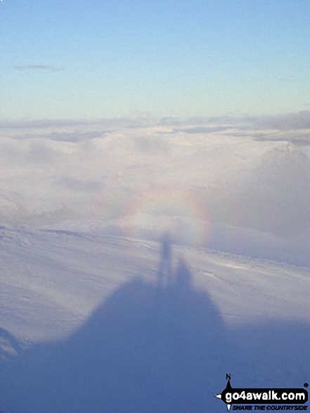
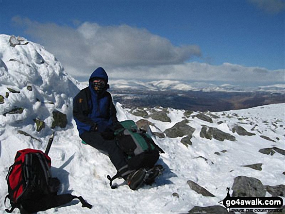
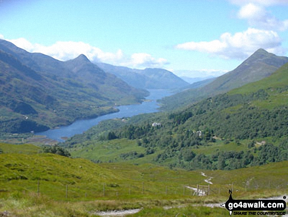
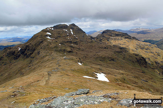
To reverse the order select the link again.


Mountain, Peak, Top or Hill:

Bagged


61. Beinn a' Chreachain (Loch Lyon)

1,081m (3,548ft)

  • Munro (No. 61)
  • Murdo (82nd)
  • Marilyn (47th in Scotland, 48th in GB)

  • We hope to have walks that climb & bag Beinn a' Chreachain (Loch Lyon) very soon

    Google Maps Icon
    See the location of Beinn a' Chreachain (Loch Lyon) and walks up it on a google Map

    Beinn a' Chreachain (Loch Lyon) is on interactive maps:

  • OS Explorer (Orange Covers): OL48 and 377
  • OS Landranger (Pink Covers): 50

  • A go4awalk.com Peak Bagging Map and Hill Tick List featuring Beinn a' Chreachain (Loch Lyon) will be available soon.


    62. Beinn Heasgarnich (Beinn Sheasgarnaich)

    1,078m (3,538ft)

  • Munro (No. 63)
  • Murdo (85th)
  • Marilyn (48th in Scotland, 49th in GB)

  • We hope to have walks that climb & bag Beinn Heasgarnich (Beinn Sheasgarnaich) very soon

    Google Maps Icon
    See the location of Beinn Heasgarnich (Beinn Sheasgarnaich) and walks up it on a google Map

    Beinn Heasgarnich (Beinn Sheasgarnaich) is on interactive maps:

  • OS Explorer (Orange Covers): OL48
  • OS Landranger (Pink Covers): 51

  • A go4awalk.com Peak Bagging Map and Hill Tick List featuring Beinn Heasgarnich (Beinn Sheasgarnaich) will be available soon.


    63. Ben Starav

    1,078m (3,538ft)

  • Munro (No. 62)
  • Murdo (84th)
  • Marilyn (49th in Scotland, 50th in GB)
  • OS Trig Point

  • We hope to have walks that climb & bag Ben Starav very soon

    Google Maps Icon
    See the location of Ben Starav and walks up it on a google Map

    Ben Starav is on interactive maps:

  • OS Explorer (Orange Covers): 377
  • OS Landranger (Pink Covers): 50

  • A go4awalk.com Peak Bagging Map and Hill Tick List featuring Ben Starav will be available soon.


    64. Beinn Dorain (Beinn na Caillich)

    1,076m (3,531ft)

  • Munro (No. 64)
  • Murdo (86th)
  • Marilyn (50th in Scotland, 51st in GB)

  • We hope to have walks that climb & bag Beinn Dorain (Beinn na Caillich) very soon

    Google Maps Icon
    See the location of Beinn Dorain (Beinn na Caillich) and walks up it on a google Map

    Beinn Dorain (Beinn na Caillich) is on interactive maps:

  • OS Explorer (Orange Covers): OL48
  • OS Landranger (Pink Covers): 50

  • A go4awalk.com Peak Bagging Map and Hill Tick List featuring Beinn Dorain (Beinn na Caillich) will be available soon.


    65. Stob Coire Sgreamhach

    1,072m (3,518ft)

  • Munro (No. 65)
  • Murdo (89th)

  • To walk, climb & bag Stob Coire Sgreamhach use either of these easy to follow walks:

    Google Maps Icon
    See the location of Stob Coire Sgreamhach and walks up it on a google Map

    Stob Coire Sgreamhach is on interactive maps:

  • OS Explorer (Orange Covers): 384
  • OS Landranger (Pink Covers): 41

  • A go4awalk.com Peak Bagging Map and Hill Tick List featuring Stob Coire Sgreamhach will be available soon.


    66. Braigh Coire Chruinn-bhalgain

    1,070m (3,512ft)

  • Munro (No. 66)
  • Murdo (91st)
  • Marilyn (51st in Scotland, 52nd in GB)

  • We hope to have walks that climb & bag Braigh Coire Chruinn-bhalgain very soon

    Google Maps Icon
    See the location of Braigh Coire Chruinn-bhalgain and walks up it on a google Map

    Braigh Coire Chruinn-bhalgain is on interactive maps:

  • OS Explorer (Orange Covers): OL51
  • OS Landranger (Pink Covers): 43

  • A go4awalk.com Peak Bagging Map and Hill Tick List featuring Braigh Coire Chruinn-bhalgain will be available soon.


    67. An Socach (Loch Mullardoch)

    1,069m (3,508ft)

  • Munro (No. 68)
  • Murdo (93rd)
  • Marilyn (52nd in Scotland, 53rd in GB)
  • OS Trig Point

  • We hope to have walks that climb & bag An Socach (Loch Mullardoch) very soon

    Google Maps Icon
    See the location of An Socach (Loch Mullardoch) and walks up it on a google Map

    An Socach (Loch Mullardoch) is on interactive maps:

  • OS Explorer (Orange Covers): 430
  • OS Landranger (Pink Covers): 25

  • A go4awalk.com Peak Bagging Map and Hill Tick List featuring An Socach (Loch Mullardoch) will be available soon.


    68. Meall Corranaich

    1,069m (3,508ft)

  • Munro (No. 67)
  • Murdo (92nd)
  • Marilyn (53rd in Scotland, 54th in GB)

  • We hope to have walks that climb & bag Meall Corranaich very soon

    Google Maps Icon
    See the location of Meall Corranaich and walks up it on a google Map

    Meall Corranaich is on interactive maps:

  • OS Explorer (Orange Covers): OL48
  • OS Landranger (Pink Covers): 51

  • A go4awalk.com Peak Bagging Map and Hill Tick List featuring Meall Corranaich will be available soon.


    69. Glas Maol

    1,068m (3,505ft)

  • Munro (No. 69)
  • Murdo (94th)
  • Marilyn (54th in Scotland, 55th in GB)
  • OS Trig Point

  • We hope to have walks that climb & bag Glas Maol very soon

    Google Maps Icon
    See the location of Glas Maol and walks up it on a google Map

    Glas Maol is on interactive maps:

  • OS Explorer (Orange Covers): OL52
  • OS Landranger (Pink Covers): 43

  • A go4awalk.com Peak Bagging Map and Hill Tick List featuring Glas Maol will be available soon.


    70. Sgurr Fhuaran

    1,067m (3,502ft)

  • Munro (No. 70)
  • Murdo (96th)
  • Marilyn (55th in Scotland, 56th in GB)

  • We hope to have walks that climb & bag Sgurr Fhuaran very soon

    Google Maps Icon
    See the location of Sgurr Fhuaran and walks up it on a google Map

    Sgurr Fhuaran is on interactive maps:

  • OS Explorer (Orange Covers): 414
  • OS Landranger (Pink Covers): 33

  • A go4awalk.com Peak Bagging Map and Hill Tick List featuring Sgurr Fhuaran will be available soon.


    71. Cairn of Claise

    1,064m (3,492ft)

  • Munro (No. 71)
  • Murdo (97th)

  • We hope to have walks that climb & bag Cairn of Claise very soon

    Google Maps Icon
    See the location of Cairn of Claise and walks up it on a google Map

    Cairn of Claise is on interactive maps:

  • OS Explorer (Orange Covers): OL52 and OL53
  • OS Landranger (Pink Covers): 43

  • A go4awalk.com Peak Bagging Map and Hill Tick List featuring Cairn of Claise will be available soon.


    72. An Teallach (Bidein a' Ghlas Thuil)

    1,062m (3,485ft)

  • Munro (No. 72)
  • Murdo (98th)
  • Marilyn (56th in Scotland, 58th in GB)
  • OS Trig Point

  • We hope to have walks that climb & bag An Teallach (Bidein a' Ghlas Thuil) very soon

    Google Maps Icon
    See the location of An Teallach (Bidein a' Ghlas Thuil) and walks up it on a google Map

    An Teallach (Bidein a' Ghlas Thuil) is on interactive maps:

  • OS Explorer (Orange Covers): 435
  • OS Landranger (Pink Covers): 19

  • A go4awalk.com Peak Bagging Map and Hill Tick List featuring An Teallach (Bidein a' Ghlas Thuil) will be available soon.


    73. Sgurr Fiona (An Teallach)

    1,060m (3,479ft)

  • Munro (No. 73)
  • Murdo (100th)

  • We hope to have walks that climb & bag Sgurr Fiona (An Teallach) very soon

    Google Maps Icon
    See the location of Sgurr Fiona (An Teallach) and walks up it on a google Map

    Sgurr Fiona (An Teallach) is on interactive maps:

  • OS Explorer (Orange Covers): 435
  • OS Landranger (Pink Covers): 19

  • A go4awalk.com Peak Bagging Map and Hill Tick List featuring Sgurr Fiona (An Teallach) will be available soon.


    74. Na Gruagaichean

    1,056m (3,466ft)

  • Munro (No. 74)
  • Murdo (101st)

  • We hope to have walks that climb & bag Na Gruagaichean very soon

    Google Maps Icon
    See the location of Na Gruagaichean and walks up it on a google Map

    Na Gruagaichean is on interactive maps:

  • OS Explorer (Orange Covers): 392
  • OS Landranger (Pink Covers): 41

  • A go4awalk.com Peak Bagging Map and Hill Tick List featuring Na Gruagaichean will be available soon.


    75. Spidean a' Choire Leith (Liathach)

    1,055m (3,463ft)

  • Munro (No. 75)
  • Murdo (102nd)
  • Marilyn (57th in Scotland, 59th in GB)

  • We hope to have walks that climb & bag Spidean a' Choire Leith (Liathach) very soon

    Google Maps Icon
    See the location of Spidean a' Choire Leith (Liathach) and walks up it on a google Map

    Spidean a' Choire Leith (Liathach) is on interactive maps:

  • OS Explorer (Orange Covers): 433
  • OS Landranger (Pink Covers): 25

  • A go4awalk.com Peak Bagging Map and Hill Tick List featuring Spidean a' Choire Leith (Liathach) will be available soon.


    76. Stob Poite Coire Ardair

    1,054m (3,459ft)

  • Munro (No. 77)
  • Murdo (104th)

  • We hope to have walks that climb & bag Stob Poite Coire Ardair very soon

    Google Maps Icon
    See the location of Stob Poite Coire Ardair and walks up it on a google Map

    Stob Poite Coire Ardair is on interactive maps:

  • OS Explorer (Orange Covers): OL55
  • OS Landranger (Pink Covers): 34

  • A go4awalk.com Peak Bagging Map and Hill Tick List featuring Stob Poite Coire Ardair will be available soon.


    77. Toll Creagach

    1,054m (3,459ft)

  • Munro (No. 76)
  • Murdo (103rd)
  • Marilyn (58th in Scotland, 60th in GB)
  • OS Trig Point

  • We hope to have walks that climb & bag Toll Creagach very soon

    Google Maps Icon
    See the location of Toll Creagach and walks up it on a google Map

    Toll Creagach is on interactive maps:

  • OS Explorer (Orange Covers): 415
  • OS Landranger (Pink Covers): 25

  • A go4awalk.com Peak Bagging Map and Hill Tick List featuring Toll Creagach will be available soon.


    78. Sgurr a' Chaorachain (West Monar Forest)

    1,053m (3,456ft)

  • Munro (No. 78)
  • Murdo (105th)
  • Marilyn (59th in Scotland, 61st in GB)
  • OS Trig Point

  • We hope to have walks that climb & bag Sgurr a' Chaorachain (West Monar Forest) very soon

    Google Maps Icon
    See the location of Sgurr a' Chaorachain (West Monar Forest) and walks up it on a google Map

    Sgurr a' Chaorachain (West Monar Forest) is on interactive maps:

  • OS Explorer (Orange Covers): 430
  • OS Landranger (Pink Covers): 25

  • A go4awalk.com Peak Bagging Map and Hill Tick List featuring Sgurr a' Chaorachain (West Monar Forest) will be available soon.


    79. Glas Tulaichean

    1,051m (3,449ft)

  • Munro (No. 79)
  • Murdo (108th)
  • Marilyn (60th in Scotland, 62nd in GB)
  • OS Trig Point

  • We hope to have walks that climb & bag Glas Tulaichean very soon

    Google Maps Icon
    See the location of Glas Tulaichean and walks up it on a google Map

    Glas Tulaichean is on interactive maps:

  • OS Explorer (Orange Covers): OL52
  • OS Landranger (Pink Covers): 43

  • A go4awalk.com Peak Bagging Map and Hill Tick List featuring Glas Tulaichean will be available soon.


    80. Geal Charn (Mullach Coire an Lubhair)

    1,049m (3,443ft)

  • Munro (No. 80)
  • Murdo (110th)
  • Marilyn (61st in Scotland, 63rd in GB)
  • OS Trig Point

  • We hope to have walks that climb & bag Geal Charn (Mullach Coire an Lubhair) very soon

    Google Maps Icon
    See the location of Geal Charn (Mullach Coire an Lubhair) and walks up it on a google Map

    Geal Charn (Mullach Coire an Lubhair) is on interactive maps:

  • OS Explorer (Orange Covers): OL50
  • OS Landranger (Pink Covers): 42

  • A go4awalk.com Peak Bagging Map and Hill Tick List featuring Geal Charn (Mullach Coire an Lubhair) will be available soon.


    81. Sgurr Fhuar-thuill

    1,049m (3,443ft)

  • Munro (No. 81)
  • Murdo (111th)

  • We hope to have walks that climb & bag Sgurr Fhuar-thuill very soon

    Google Maps Icon
    See the location of Sgurr Fhuar-thuill and walks up it on a google Map

    Sgurr Fhuar-thuill is on interactive maps:

  • OS Explorer (Orange Covers): 430
  • OS Landranger (Pink Covers): 25

  • A go4awalk.com Peak Bagging Map and Hill Tick List featuring Sgurr Fhuar-thuill will be available soon.


    82. Beinn a' Chaorainn (Laggan)

    1,049m (3,442ft)

  • Munro (No. 82)
  • Murdo (112th)
  • Marilyn (62nd in Scotland, 64th in GB)

  • We hope to have walks that climb & bag Beinn a' Chaorainn (Laggan) very soon

    Google Maps Icon
    See the location of Beinn a' Chaorainn (Laggan) and walks up it on a google Map

    Beinn a' Chaorainn (Laggan) is on interactive maps:

  • OS Explorer (Orange Covers): 400
  • OS Landranger (Pink Covers): 34 and 41

  • A go4awalk.com Peak Bagging Map and Hill Tick List featuring Beinn a' Chaorainn (Laggan) will be available soon.


    83. Carn an t-Sagairt Mor

    1,047m (3,436ft)

  • Munro (No. 84)
  • Murdo (114th)

  • We hope to have walks that climb & bag Carn an t-Sagairt Mor very soon

    Google Maps Icon
    See the location of Carn an t-Sagairt Mor and walks up it on a google Map

    Carn an t-Sagairt Mor is on interactive maps:

  • OS Explorer (Orange Covers): OL53
  • OS Landranger (Pink Covers): 44

  • A go4awalk.com Peak Bagging Map and Hill Tick List featuring Carn an t-Sagairt Mor will be available soon.


    84. Creag Mhor (Glen Lochay)

    1,047m (3,436ft)

  • Munro (No. 83)
  • Murdo (113th)
  • Marilyn (63rd in Scotland, 65th in GB)

  • We hope to have walks that climb & bag Creag Mhor (Glen Lochay) very soon

    Google Maps Icon
    See the location of Creag Mhor (Glen Lochay) and walks up it on a google Map

    Creag Mhor (Glen Lochay) is on interactive maps:

  • OS Explorer (Orange Covers): OL48 and 377
  • OS Landranger (Pink Covers): 50

  • A go4awalk.com Peak Bagging Map and Hill Tick List featuring Creag Mhor (Glen Lochay) will be available soon.


    85. Ben Wyvis (Glas Leathad Mor)

    1,046m (3,433ft)

  • Munro (No. 87)
  • Murdo (118th)
  • Marilyn (64th in Scotland, 66th in GB)
  • OS Trig Point

  • To walk, climb & bag Ben Wyvis (Glas Leathad Mor) use this easy to follow walk:

    Google Maps Icon
    See the location of Ben Wyvis (Glas Leathad Mor) and walks up it on a google Map

    Ben Wyvis (Glas Leathad Mor) is on interactive maps:

  • OS Explorer (Orange Covers): 437
  • OS Landranger (Pink Covers): 20

  • A go4awalk.com Peak Bagging Map and Hill Tick List featuring Ben Wyvis (Glas Leathad Mor) will be available soon.


    86. Chno Dearg

    1,046m (3,433ft)

  • Munro (No. 86)
  • Murdo (117th)
  • Marilyn (65th in Scotland, 67th in GB)

  • We hope to have walks that climb & bag Chno Dearg very soon

    Google Maps Icon
    See the location of Chno Dearg and walks up it on a google Map

    Chno Dearg is on interactive maps:

  • OS Explorer (Orange Covers): OL50
  • OS Landranger (Pink Covers): 41

  • A go4awalk.com Peak Bagging Map and Hill Tick List featuring Chno Dearg will be available soon.


    87. Cruach Ardrain

    1,046m (3,433ft)

  • Munro (No. 85)
  • Murdo (116th)
  • Marilyn (66th in Scotland, 68th in GB)

  • We hope to have walks that climb & bag Cruach Ardrain very soon

    Google Maps Icon
    See the location of Cruach Ardrain and walks up it on a google Map

    Cruach Ardrain is on interactive maps:

  • OS Explorer (Orange Covers): OL39
  • OS Landranger (Pink Covers): 51 and 56

  • A go4awalk.com Peak Bagging Map and Hill Tick List featuring Cruach Ardrain will be available soon.


    88. Beinn Iutharn Mhor

    1,045m (3,430ft)

  • Munro (No. 88)
  • Murdo (120th)
  • Marilyn (67th in Scotland, 69th in GB)

  • We hope to have walks that climb & bag Beinn Iutharn Mhor very soon

    Google Maps Icon
    See the location of Beinn Iutharn Mhor and walks up it on a google Map

    Beinn Iutharn Mhor is on interactive maps:

  • OS Explorer (Orange Covers): OL52
  • OS Landranger (Pink Covers): 43

  • A go4awalk.com Peak Bagging Map and Hill Tick List featuring Beinn Iutharn Mhor will be available soon.


    89. Meall nan Tarmachan

    1,044m (3,426ft)

  • Munro (No. 90)
  • Murdo (122nd)
  • Marilyn (68th in Scotland, 70th in GB)

  • We hope to have walks that climb & bag Meall nan Tarmachan very soon

    Google Maps Icon
    See the location of Meall nan Tarmachan and walks up it on a google Map

    Meall nan Tarmachan is on interactive maps:

  • OS Explorer (Orange Covers): OL48
  • OS Landranger (Pink Covers): 51

  • A go4awalk.com Peak Bagging Map and Hill Tick List featuring Meall nan Tarmachan will be available soon.


    90. Stob Coir an Albannaich

    1,044m (3,426ft)

  • Munro (No. 89)
  • Murdo (121st)
  • Marilyn (69th in Scotland, 71st in GB)

  • We hope to have walks that climb & bag Stob Coir an Albannaich very soon

    Google Maps Icon
    See the location of Stob Coir an Albannaich and walks up it on a google Map

    Stob Coir an Albannaich is on interactive maps:

  • OS Explorer (Orange Covers): 377
  • OS Landranger (Pink Covers): 50

  • A go4awalk.com Peak Bagging Map and Hill Tick List featuring Stob Coir an Albannaich will be available soon.


    Page 3 of 10    Go to page: 1 2 3 4 5 6 7 8 9 10 Next Last


    View all 1674 Mountains, Peaks, Tops and Hills in Easter Ross and Cromarty Firth Scottish Region : Loch Leven to Connel Bridge, Strath of Orchy and Glen Lochy:


    Is there a Mountain, Peak, Top or Hill missing from the above google map or list?

    Let us know an we will add it to our database.


    Do not miss our pick of the Best Walks in Britain


    Follow go4awalk.com on Twitter Follow go4awalk.com on Facebook


    Home


    Find new Friends to go walking with

    Walk all 214 Wainwrights in just 59 Walks. Download GPS Waypoints - Great Walks you must not miss!

    Walk The Yorkshire Three Peaks Challenge Walk - All the Latest Route Information, GPS Waypoints and Split Times to keep you on Schedule

    Walk The British Three Peaks Challenge Walk - All the Latest Route Information and GPS Waypoints

    See our pick of The Best Walks in The Lake District - Great Walks you must not miss!

    Walk our pick of the Best Lake District Ridge Walks - Great Walks you must not miss!

    Walk our pick of the Best Lake District Walks to do in the rain - Great Walks you must not miss!

    Walk our pick of The Best Walks in Snowdonia - Great Walks you must not miss!

    Walk our pick of The Best Ridge Walks in Wales - Walks you must not miss!

    Walk our pick of The Best Walks in The Brecon Beacons - Great Walks you must not miss!

    Walk our pick of The Best Walks in The Yorkshire Dales - Walks you must not miss!

    Walk our pick of The Best Walks in The Peak District - Walks you must not miss!

    Walk our pick of The Best Walks in The Forest of Bowland - Walks you must not miss!

    Walk our pick of The Best Walks in Shropshire - Walks you must not miss!

    Walk our pick of The Best Walks in Cheshire - Walks you must not miss!

    Walk our pick of The Best Walks in Lancashire - Walks you must not miss!

    Not sure where to walk next? Try Peak Bagging - Great Walks you must not miss!

    Not sure where to walk next? Walk part of a National Trail - Great Walks you must not miss!

    Walks with Downloadable and Uploadable GPS Waypoint Data

    Walking Kit and Gear Tested by Walkers

    Full Site Search
    Do not miss our pick of the Best Walks in Britain