Walk h118 The Ben Wyvis Massif from Garbat
This 16½ mile, Grade 9 (Very Hard), easy-to-follow, hand-crafted walk, complete with GPS Waypoints, starts at Garbat & will take about 11½ hrs to complete.
   |
Vital Statistics:
| Length: | 16½mls (26.5km) |
| Ascent: | 5,415ft (1,045m) |
| Time: | 11½hrs |
| Grade: |  |
Route outline for walk h118:
Garbat - Garbat Forest - Allt a' Bhealaich Mhoir - Ben Wyvis Nature Reserve - Little Wyvis - Tom na Caillich - Coire na Feithe Riabhaich - An Cabar (Ben Wyvis) - Carn a' Chaiptein - Ben Wyvis (Glas Leathad Mor) - Coire Nan Con - Bealach Tom a' Choinnich - Glas Choire - Choire Mhic Fhearchair - Choire Lochain - Glas Leathad Beag (Ben Wyvis) - Choire Lochain - Choire Mhic Fhearchair - Tom a' Choinnich (Ben Wyvis) - Coire Dubh - Allt a' Choire Dhuibh - Garbat Forest - Garbat
Peaks, Summits and Tops reached on this walk:
 1 Munro |
 1 Corbett |
 0 Grahams |
 3 Murdos |
 0 Donalds |
 2 Scottish Marilyns |
 0 Bridgets |
Peak Bagging Statistics for this walk:
The highest point of this walk is Ben Wyvis (Glas Leathad Mor) at 1046m (3433ft). Ben Wyvis (Glas Leathad Mor) is classified as a Munro (No. 87) and a Scottish Marilyn (64th highest in Scotland, 66th highest in the UK). Ben Wyvis (Glas Leathad Mor) is also known as a Murdo (118th highest in Scotland). The summit of Ben Wyvis (Glas Leathad Mor) is marked by an Ordnance Survey Trig Point.
Completing this walk will also take you to the top of Tom a' Choinnich (Ben Wyvis) at 953m (3128ft). Tom a' Choinnich (Ben Wyvis) is known as a Murdo (322nd highest in Scotland).
You will also reach the summit of An Cabar (Ben Wyvis) at 946m (3105ft). An Cabar (Ben Wyvis) is Unclassified
Along the way you will also bag and tick-off:
- Glas Leathad Beag (Ben Wyvis) at 928m (3046ft). Glas Leathad Beag (Ben Wyvis) is known as a Murdo (390th highest in Scotland).
- Little Wyvis at 763m (2504ft). Little Wyvis is classified as a Corbett (No. 221) and a Scottish Marilyn (425th Scotland, 464th UK)
Free-to-access Interactive Walk Planning Maps:
1:25,000 scale OS Explorer Map (orange/yellow covers):
An Interactive Walk Planning Map for OS Explorer 437 Ben Wyvis & Strathpeffer is not currently available
1:50,000 scale OS Landranger Map (pink/magenta covers):
An Interactive Walk Planning Map for OS Landranger 20 Beinn Dearg & Loch Broom, Ben Wyvis is not currently available
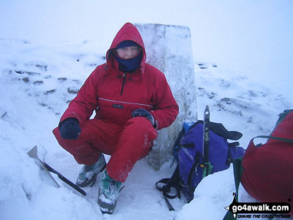
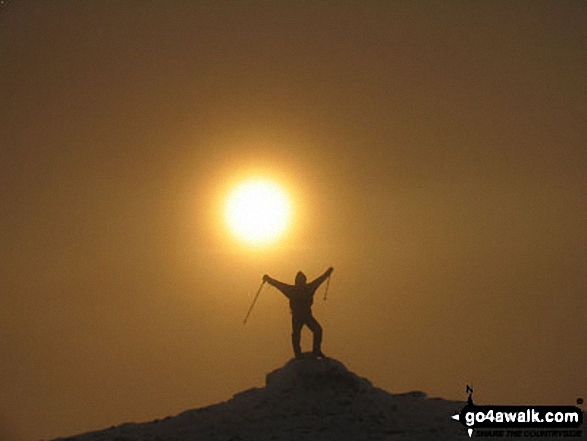
Some Photos and Pictures from Walk h118 The Ben Wyvis Massif from Garbat
In no particular order . . .


Send us your photographs and pictures from your walks and hikes
We would love to see your photographs and pictures from walk h118 The Ben Wyvis Massif from Garbat. Send them in to us as email attachments (configured for any computer) along with your name and where the picture was taken to:
and we shall do our best to publish them.
(Guide Resolution = 300dpi. At least = 660 pixels (wide) x 440 pixels (high).)

You can also submit photos from walk h118 The Ben Wyvis Massif from Garbat via our Facebook Page.
NB. Please indicate where each photo was taken.

To contribute to go4awalk.com or to contact us about anything at all - see Talk To Us.
For help see Help.
go4awalk.com and go4awalk.co.uk are registered trademarks of TMDH Limited.
Copyright © 2000-2026 TMDH Limited. All rights reserved.
Copyright Terms & Conditions Privacy Statement
A - Z Walks Home Log On/Accounts Photo Gallery Walk Ideas and Collections Fell Facts Hill Skills Walking Questions and Answers Your Stories News Competitions Product Reviews/Gear Tests Walking Gear Guides Peaks and Mountains Peak Bagging Find New Walking Friends Camping GPS Waypoints for Walking Contents Walk Search Talk To Us go4awalk.com Help Free Example Walks Newsletter


