The Isle of Man - a fully detailed list of all the Mountains, Peaks, Tops and Hills (Page 1 of 3)
If you count only the Donalds there are 88 tops to climb, bag & conquer and the highest point is Merrick at 843m (2,766ft).
To see these Mountains, Peaks, Tops and Hills displayed in different ways - see the options in the left-hand column and towards the bottom of this page.
LOG ON and RELOAD this page to show which Mountains, Peaks, Tops and Hills you have already climbed, bagged & conquered [. . . more details]
See this list in: Alphabetical Order
| Height Order‡
To reverse the order select the link again.
Mountain, Peak, Top or Hill:
Bagged
1. Innerdownie
610m (2,002ft)
Innerdownie is on interactive maps:
A downloadable go4awalk.com PDF Peak Bagging Map featuring Innerdownie will be available soon. |
2. Earncraig Hill
611m (2,005ft)
Earncraig Hill is on interactive maps:
A downloadable go4awalk.com PDF Peak Bagging Map featuring Earncraig Hill will be available soon. |
3. Herman Law
614m (2,015ft)
See the location of Herman Law and walks up it on a google Map Herman Law is on interactive maps:
A downloadable go4awalk.com PDF Peak Bagging Map featuring Herman Law will be available soon. |
4. Louise Wood Law
619m (2,031ft)
Louise Wood Law is on interactive maps:
A downloadable go4awalk.com PDF Peak Bagging Map featuring Louise Wood Law will be available soon. |
5. Cauldcleuch Head
619m (2,032ft)
Cauldcleuch Head is on interactive maps:
A downloadable go4awalk.com PDF Peak Bagging Map featuring Cauldcleuch Head will be available soon. |
6. Dungeon Hill
620m (2,035ft)
Dungeon Hill is on interactive maps:
A downloadable go4awalk.com PDF Peak Bagging Map featuring Dungeon Hill will be available soon. |
7. Bell Craig
623m (2,045ft)
See the location of Bell Craig and walks up it on a google Map Bell Craig is on interactive maps:
A downloadable go4awalk.com PDF Peak Bagging Map featuring Bell Craig will be available soon. |
8. Coran of Portmark
623m (2,045ft)
Coran of Portmark is on interactive maps:
A downloadable go4awalk.com PDF Peak Bagging Map featuring Coran of Portmark will be available soon. |
9. Dundreich
623m (2,045ft)
Dundreich is on interactive maps:
A downloadable go4awalk.com PDF Peak Bagging Map featuring Dundreich will be available soon. |
10. Whitehope Law
623m (2,045ft)
Whitehope Law is on interactive maps:
A downloadable go4awalk.com PDF Peak Bagging Map featuring Whitehope Law will be available soon. |
11. Bowbeat Hill
626m (2,055ft)
Bowbeat Hill is on interactive maps:
A downloadable go4awalk.com PDF Peak Bagging Map featuring Bowbeat Hill will be available soon. |
12. Hudderstone
626m (2,055ft)
See the location of Hudderstone and walks up it on a google Map Hudderstone is on interactive maps:
A downloadable go4awalk.com PDF Peak Bagging Map featuring Hudderstone will be available soon. |
13. Beinn nan Eun (Beinn Odhar)
631m (2,070ft)
Send it in and we'll publish it here.
Beinn nan Eun (Beinn Odhar) is on interactive maps:
A downloadable go4awalk.com PDF Peak Bagging Map featuring Beinn nan Eun (Beinn Odhar) will be available soon. |
14. Blairdenon Hill
631m (2,071ft)
Blairdenon Hill is on interactive maps:
A downloadable go4awalk.com PDF Peak Bagging Map featuring Blairdenon Hill will be available soon. |
15. East Mount Lowther
631m (2,071ft)
East Mount Lowther is on interactive maps:
A downloadable go4awalk.com PDF Peak Bagging Map featuring East Mount Lowther will be available soon. |
16. Croft Head
637m (2,091ft)
See the location of Croft Head and walks up it on a google Map Croft Head is on interactive maps:
A downloadable go4awalk.com PDF Peak Bagging Map featuring Croft Head will be available soon. |
17. Whitehope Heights
637m (2,091ft)
Whitehope Heights is on interactive maps:
A downloadable go4awalk.com PDF Peak Bagging Map featuring Whitehope Heights will be available soon. |
18. Alhang
642m (2,107ft)
Alhang is on interactive maps:
A downloadable go4awalk.com PDF Peak Bagging Map featuring Alhang will be available soon. |
19. Greenside Law
643m (2,110ft)
Greenside Law is on interactive maps:
A downloadable go4awalk.com PDF Peak Bagging Map featuring Greenside Law will be available soon. |
20. Comb Law
645m (2,117ft)
Comb Law is on interactive maps:
A downloadable go4awalk.com PDF Peak Bagging Map featuring Comb Law will be available soon. |
21. Craignaw
645m (2,117ft)
Craignaw is on interactive maps:
A downloadable go4awalk.com PDF Peak Bagging Map featuring Craignaw will be available soon. |
22. Tarmangie Hill
645m (2,117ft)
Tarmangie Hill is on interactive maps:
A downloadable go4awalk.com PDF Peak Bagging Map featuring Tarmangie Hill will be available soon. |
23. King's Seat Hill
648m (2,127ft)
King's Seat Hill is on interactive maps:
A downloadable go4awalk.com PDF Peak Bagging Map featuring King's Seat Hill will be available soon. |
24. Moorbrock Hill
650m (2,133ft)
See the location of Moorbrock Hill and walks up it on a google Map Moorbrock Hill is on interactive maps:
A downloadable go4awalk.com PDF Peak Bagging Map featuring Moorbrock Hill will be available soon. |
25. Blackhope Scar
651m (2,137ft)
Blackhope Scar is on interactive maps:
A downloadable go4awalk.com PDF Peak Bagging Map featuring Blackhope Scar will be available soon. |
26. Hillshaw Head
652m (2,140ft)
Hillshaw Head is on interactive maps:
A downloadable go4awalk.com PDF Peak Bagging Map featuring Hillshaw Head will be available soon. |
27. Millfore
657m (2,156ft)
Millfore is on interactive maps:
A downloadable go4awalk.com PDF Peak Bagging Map featuring Millfore will be available soon. |
28. Cairnsgarroch
659m (2,163ft)
Cairnsgarroch is on interactive maps:
A downloadable go4awalk.com PDF Peak Bagging Map featuring Cairnsgarroch will be available soon. |
29. Windlestraw Law
659m (2,163ft)
Windlestraw Law is on interactive maps:
A downloadable go4awalk.com PDF Peak Bagging Map featuring Windlestraw Law will be available soon. |
30. Birkscairn Hill
661m (2,169ft)
Birkscairn Hill is on interactive maps:
A downloadable go4awalk.com PDF Peak Bagging Map featuring Birkscairn Hill will be available soon. |
View these 88 Mountains, Peaks, Tops and Hills:
- On an Interactive Google Map (loads faster)
- On an Interactive Google Map with a list of tops below it.
(makes it easier to locate a particular top) - On a Detailed List in:
Alphabetical Order | Height Order - On one page with 'yet-to-be-bagged' listed 1st & then 'already-bagged' tops listed 2nd in:
Alphabetical Order | Height Order - On one page with 'already-bagged' tops listed 1st & then 'yet-to-be-bagged' tops listed 2nd in:
Alphabetical Order | Height Order
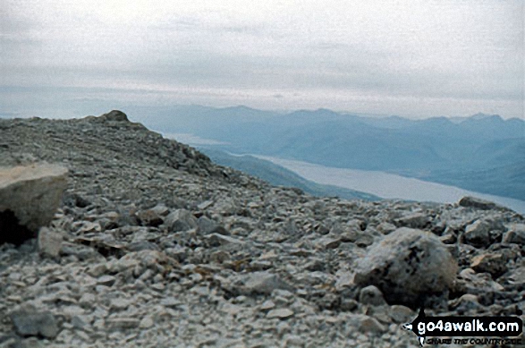 The summit of Ben Nevis in The Scottish BordersScotland
Photo: John Reed
Is there a Mountain, Peak, Top or Hill missing from the above google map or list?
Let us know an we will add it to our database.

