UK Postcode CH45 - The 30 nearest easy-to-follow, circular walk route maps to you
The thirty nearest easy-to-follow, circular walk route maps to you in UK Postcode CH45 in Walk Grade Order
The UK cities, towns and villages in Merseyside, England that have CH45 in their UK Postcode include:
• New Brighton • Wallasey •
Not familiar with the area around CH45?
See these 30 nearest walks to UK Postcode CH45 on a google map
   |
Vital Statistics:
| Length: | 6.25 miles (10 km) |
| Ascent: | 128ft (39m) |
| Time: | 2½ hrs |
| Grade: |  |
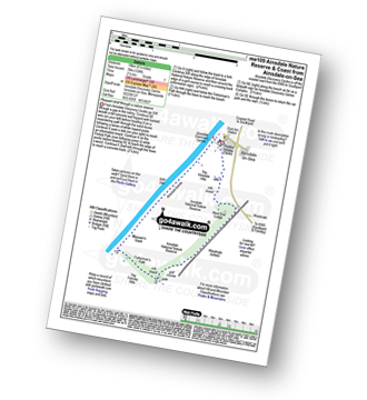
Route Summary:
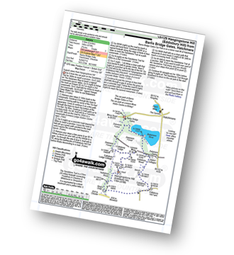
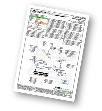
Ainsdale-on-Sea - Ainsdale Discovery Centre - Ainsdale Nature Reserve - Ainsdale Hills - West End Lodge - Woodvale Airfield - The Formby Hills - Massam's Slack - Irish Sea - Ainsdale Sands - Ainsdale-on-Sea
|
Vital Statistics:
| Length: | 4 miles (6.5 km) |
| Ascent: | 417ft (127m) |
| Time: | 2 hrs |
| Grade: |  |
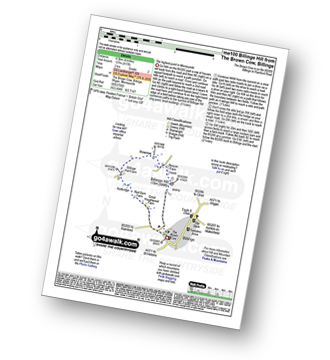
Route Summary:
Billinge - Billinge Hill - Beacon Farm - Brownlow - Billinge Hall Farm - Red Barn Farm - Great Houghwood Farm - Billinge
|
Vital Statistics:
| Length: | 10.75 miles (17 km) |
| Ascent: | 916ft (279m) |
| Time: | 4.75hrs |
| Grade: |  |
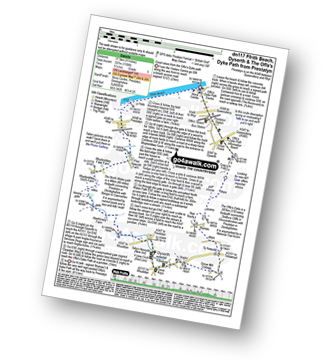
Route Summary:
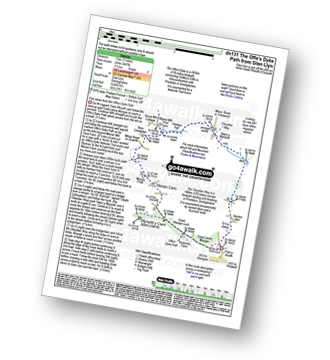
Prestatyn - Ffrith Beach - Plas Newydd Farm - Rhydorddwy Goch Farm - Aberkinsey Farm - Dyserth - Dyserth Waterfall - The Offa's Dyke Path - Ty Newydd - Bryniau - Red Roofs - Crag y Fran - Prestatyn
|
Vital Statistics:
| Length: | 9.75 miles (15.5 km) |
| Ascent: | 1,303ft (397m) |
| Time: | 4.75hrs |
| Grade: | |
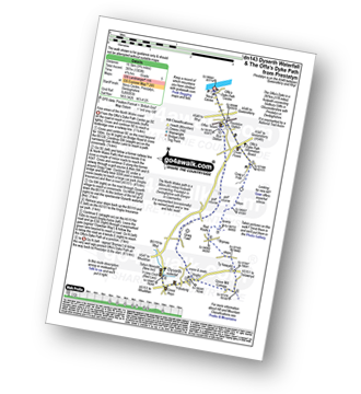
Route Summary:
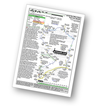
Prestatyn - The North Wales Path - Dyserth - Dyserth Waterfall - The Offa's Dyke Path - Ty Newydd - Bryniau - Red Roofs - Crag y Fran - Prestatyn
|
Vital Statistics:
| Length: | 7 miles (11 km) |
| Ascent: | 847ft (258m) |
| Time: | 3½ hrs |
| Grade: |  |
Route Summary:
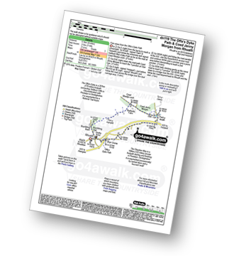
Glan Llyn - Coed Jenny Morgan - The Offa's Dyke Path - Coed Rhedyn-coch - Mynydd y Cwm (Coed Cwm) - Marian Cwm - Marian Ffrith - Bryn Cnewyllyn - Marian Mill Trout Farm - Henfryn Hall - The Clwydian Way - Swyn y Mynydd - Hendre Fawr - Glan Llyn
|
Vital Statistics:
| Length: | 6.25 miles (10 km) |
| Ascent: | 1,254ft (382m) |
| Time: | 3½ hrs |
| Grade: | |
Route Summary:
Frodsham - Beacon Hill (Frodsham) - Frodsham Golf Course - Dunsdale Wood - Tong Dean - Helsby Hill Fort - Helsby Hill - The Longster Trail - Harmers Wood - The Sandstone Trail - Snidley Moor and Woodhouse Hill - Snidley Moor Wood - Beacon Hill (Frodsham) - Frodsham
|
Vital Statistics:
| Length: | 4 miles (6.5 km) |
| Ascent: | 715ft (218m) |
| Time: | 2.25hrs |
| Grade: |  |
Route Summary:
Rhuallt - The Offa's Dyke Path - Brynllithrig Hall - Pen-y-mynydd - Coed Jenny Morgan - Glan Llyn - Bryn Gronw - Rhuallt
|
Vital Statistics:
| Length: | 9.5 miles (15 km) |
| Ascent: | 1,359ft (141m) |
| Time: | 4.75hrs |
| Grade: | |
Route Summary:
Rhuallt - The Offa's Dyke Path - Brynllithrig Hall - Pen-y-mynydd - Coed Rhedyn-coch - Mynydd y Cwm (Coed Cwm) - Marian Cwm - Marian Ffrith - Bryn Cnewyllyn - Marian Mill Trout Farm - Henfryn Hall - The Clwydian Way - Swyn y Mynydd - Hendre Fawr - Glan Llyn - Bryn Gronw - Rhuallt
|
Vital Statistics:
| Length: | 7.5 miles (12 km) |
| Ascent: | 962ft (293m) |
| Time: | 3.75hrs |
| Grade: | |
Route Summary:
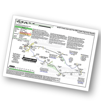
Rhuallt - The Offa's Dyke Path - A55 - Bryn Gronw - Cobweb Cottage - Ty Hir - Rhos Onnen - Croes-wian - Ffrith Farm - Bryngwyn Hall - Coed Bron-fawr - The Offa's Dyke Path - Bryn Gronw - A55 - Rhuallt
|
Vital Statistics:
| Length: | 8.25 miles (13 km) |
| Ascent: | 1,943ft (592m) |
| Time: | 5 hrs |
| Grade: |  |
Route Summary:
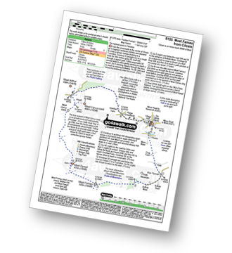
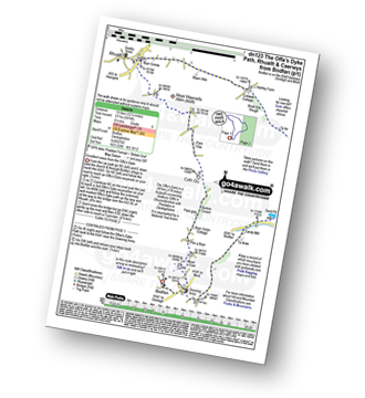
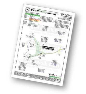
Cilcain - Y Pentre - Crug Farm - Ffrith - Bryn Fynnon - Moel Famau Country Park - Moel Famau - The Offa's Dyke Path - Moel Dywyll - Moel Llys-y-coed - Bwlch Arthur - Gronfoel Farm - Cilcain
|
Vital Statistics:
| Length: | 5 miles (8 km) |
| Ascent: | 994ft (303m) |
| Time: | 3 hrs |
| Grade: | |
|
Vital Statistics:
| Length: | 9.75 miles (15.5 km) |
| Ascent: | 1,447ft (441m) |
| Time: | 5 hrs |
| Grade: | |
Route Summary:
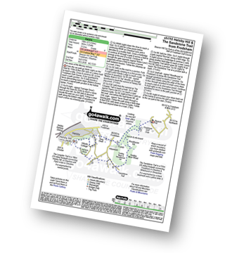
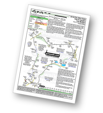
Bodfari - The Offa's Dyke Path - Moel-y-Gaer - Pen y Bryn - Sodom Covert - Cefn Du - Pant Glas - Coed Bron-fawr - Bryngwyn Hall - Ffrith Farm - Croes-wian - Caerwys - Maes-mynan Hall - Candy Mill - Ty-draw - The Offa's Dyke Path - Bodfari
|
Vital Statistics:
| Length: | 12.25 miles (19.5 km) |
| Ascent: | 1,874ft (571m) |
| Time: | 6.25hrs |
| Grade: | |
Route Summary:
Bodfari - The Offa's Dyke Path - Moel-y-Gaer - Pen y Bryn - Sodom Covert - Cefn Du - Pant Glas - Moel Maenefa - Bryn Gronw - Cobweb Cottage - Brick Kiln Rough - Ty Hir - Rhos Onnen - Croes-wian - Caerwys - Maes-mynan Hall - Candy Mill - Ty-draw - The Offa's Dyke Path - Bodfari
|
Vital Statistics:
| Length: | 7.5 miles (12 km) |
| Ascent: | 1,746ft (532m) |
| Time: | 4½ hrs |
| Grade: | |
Route Summary:
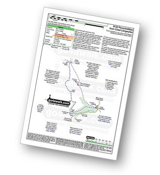
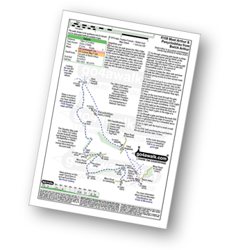
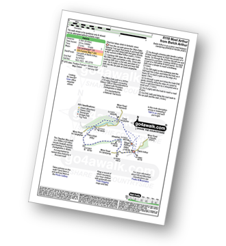
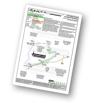
Bwlch Arthur - Moel Arthur - Coed Llangwyfan - Penycloddiau - Nant Coed-y-mynydd - Pen-y-bryn - Bwlch Arthur
|
Vital Statistics:
| Length: | 4 miles (6.5 km) |
| Ascent: | 1,086ft (331m) |
| Time: | 2½ hrs |
| Grade: | |
Not familiar with the area around CH45?
See these 30 nearest walks to UK Postcode CH45 on a google map
|
Vital Statistics:
| Length: | 6.25 miles (10 km) |
| Ascent: | 400ft (122m) |
| Time: | 2.75hrs |
| Grade: | |
Route Summary:
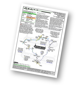
Higher Walton - The Bridgewater Canal - Hillfoot Farm - The Mersey Valley Way - Bellfield Farm - Dennow Cottage - Dennow Farm - Hatton - Blue Coat Farm - Row's Wood - Moore - The Bridgewater Canal - Walton Hall - Higher Walton
|
Vital Statistics:
| Length: | 6 miles (9.5 km) |
| Ascent: | 479ft (146m) |
| Time: | 2.75hrs |
| Grade: | |
Route Summary:
Hatchmere - Barns Bridge Gate - Delamere Forest - The Sandstone Way - The Delamere Way - Blakemere Moss - Linmere Visitor Centre - Eddisbury Hill - Eddisbury Hill Fort - Eddisbury Hill Farm - Hangingstone Hill (Eddisbury Hill) - Nettleford Wood - The Sandstone Way - Eddisbury Lodge Cottage - Eddisbury Lodge - Delamere Forest - Barns Bridge Gate - Hatchmere
|
Vital Statistics:
| Length: | 3.75 miles (6 km) |
| Ascent: | 197ft (60m) |
| Time: | 1.75hrs |
| Grade: | |
Route Summary:
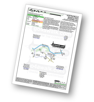
Pickerings Lock - The Weaver Navigation - The Belt - Hall O' The' Hey Farm - Crewood Lodge - The Hurst - Oakwell Farm - Pickerings Lock
|
Vital Statistics:
| Length: | 4 miles (6.5 km) |
| Ascent: | 233ft (71m) |
| Time: | 1.75hrs |
| Grade: | |
Route Summary:
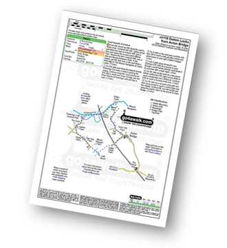
Acton Bridge - Manor Farm - Dutton Locks - River Weaver - Pickerings Cut - Dutton Viaduct - Pickerings Lock - Oakhill Farm - Cliff Brook - Lower Green Farm - Acton Bridge
|
Vital Statistics:
| Length: | 7.25 miles (11.5 km) |
| Ascent: | 384ft (117m) |
| Time: | 3 hrs |
| Grade: | |
Route Summary:
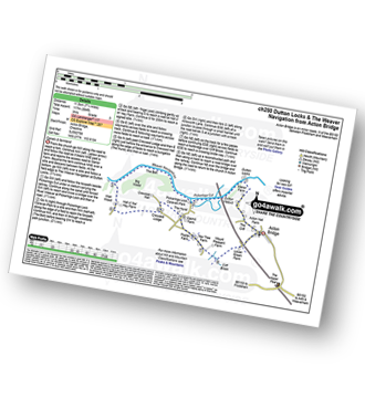
Acton Bridge - Manor Farm - Dutton Locks - River Weaver - Pickerings Cut - Dutton Viaduct - Pickerings Lock - The Weaver Navigation - The Belt - Hall O' The' Hey Farm - Crewood Lodge - Oakhill Farm - Cliff Brook - Lower Green Farm - Acton Bridge
|
Vital Statistics:
| Length: | 3.75 miles (6 km) |
| Ascent: | 961ft (293m) |
| Time: | 2½ hrs |
| Grade: | |
|
Vital Statistics:
| Length: | 11 miles (17.5 km) |
| Ascent: | 2,389ft (728m) |
| Time: | 6½ hrs |
| Grade: | |
Route Summary:
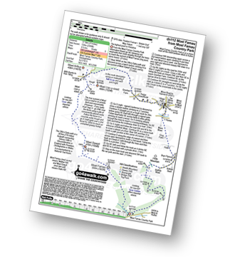
Moel Famau Country Park - Moel Famau - The Offa's Dyke Path - Moel Dywyll - Moel Llys-y-coed - Bwlch Arthur - Gronfoel Farm - Cilcain - Y Pentre - Crug Farm - Ffrith - Bryn Fynnon - Moel Famau Country Park
|
Vital Statistics:
| Length: | 12 miles (19 km) |
| Ascent: | 2,409ft (734m) |
| Time: | 6.75hrs |
| Grade: |  |
Route Summary:
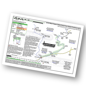
Bwlch Penbarras - The Offa's Dyke Path - Moel Famau - Moel Dywyll - Moel Llys-y-coed - Bwlch Arthur - Gronfoel Farm - Cilcain - Y Pentre - Crug Farm - Ffrith - Bryn Fynnon - Moel Famua Country Park - Bwlch Penbarras
|
Vital Statistics:
| Length: | 5.5 miles (9 km) |
| Ascent: | 1,362ft (415m) |
| Time: | 3½ hrs |
| Grade: | |
|
Vital Statistics:
| Length: | 5 miles (8 km) |
| Ascent: | 338ft (103m) |
| Time: | 2.25hrs |
| Grade: | |
Route Summary:
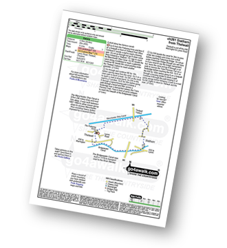
Little Leigh - Friar's Rough - Trent and Mersey Canal - Bardleymeadow Wood - Daleford House - Saltersford Tunnel - Barnton - Stone Heyes Farm - Desley Heath Farm - Claterwick Farm - Little Leigh
|
Vital Statistics:
| Length: | 4.5 miles (7 km) |
| Ascent: | 190ft (58m) |
| Time: | 1.75hrs |
| Grade: | |
Route Summary:
Thelwall - Manchester Ship Canal - Thelwall Viaduct - Statham - The Bridgewater Canal - The Cheshire Ring Canal Walk - Thelwall
|
Vital Statistics:
| Length: | 3.75 miles (6 km) |
| Ascent: | 204ft (62m) |
| Time: | 2 hrs |
| Grade: | |
Route Summary:
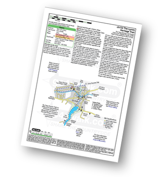
The Trans Pennine Trail (Lymm) - Lymm - The Bridgewater Canal - The Cheshire Ring Canal Walk - Lymm Village - The Dingle - Lymm Dam - The Bongs - Crosfield Bridge - Lymm Dam - The Dingle - Lymm Cross - The Bridgewater Canal - The Cheshire Ring Canal Walk - Slitten Gorge - The Trans Pennine Trail - Lymm.
|
Vital Statistics:
| Length: | 11 miles (17.5 km) |
| Ascent: | 269ft (82m) |
| Time: | 4½ hrs |
| Grade: | |
Route Summary:
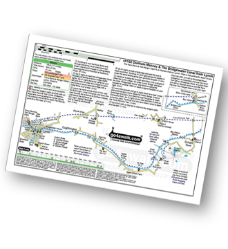
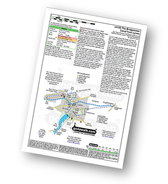
The Trans Pennine Trail (Lymm) - Lymm - Carr Green - Oldfield Brow - Altrincham - The Bridgewater Canal - The Cheshire Ring Canal Walk - Dunham Town - Dunham Massey - Little Bollington - The Bridgewater Canal - The Cheshire Ring Canal Walk - Agden Bridge - Oughtrington - Lymm Village - Slitten Gorge - The Trans Pennine Trail - Lymm.
|
Vital Statistics:
| Length: | 5.25 miles (8.5 km) |
| Ascent: | 246ft (75m) |
| Time: | 2.25hrs |
| Grade: | |
Route Summary:
The Trans Pennine Trail (Lymm) - Lymm - The Bridgewater Canal - The Cheshire Ring Canal Walk - Lymm Village - The Dingle - Lymm Dam - The Bongs - Crosfield Bridge - Oughtrington - The Bridgewater Canal - The Cheshire Ring Canal Walk - Rushgreen - Slitten Gorge - The Trans Pennine Trail - Lymm.
|
Vital Statistics:
| Length: | 3.75 miles (6 km) |
| Ascent: | 253ft (77m) |
| Time: | 2 hrs |
| Grade: | |
Route Summary:
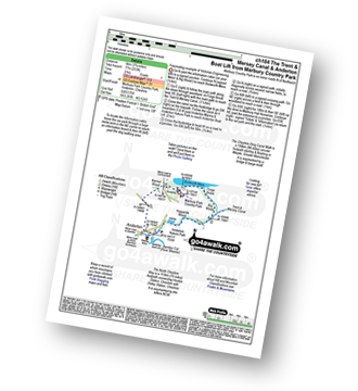
Marbury Country Park - Forge Brook - Big Wood - Trent and Mersey Canal - The Cheshire Ring Walk - Anderton - Anderton Boat Lift - Kennel Wood - The North Cheshire Way - Marbury Country Park.
Not familiar with the area around CH45?
See these 30 nearest walks to UK Postcode CH45 on a google map


