
![]()
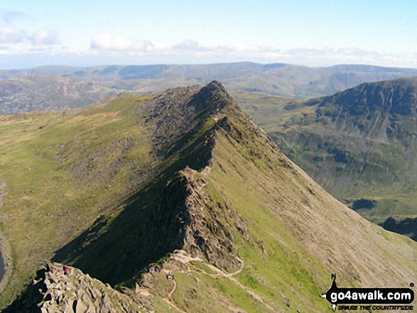
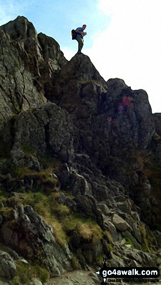
Striding Edge
863m (2831ft)
The Eastern Fells, The Lake District, Cumbria, England
Striding Edge (High Spying How) gained Mountain (Hewitt) status in September, 2018.
You can find Striding Edge & all the walks that climb it on these unique free-to-access Interactive Walk Planning Maps: (click/TAP to select)
1:25,000 scale OS Explorer Map (the ones with orange/yellow covers):
1:50,000 scale OS Landranger Map (the ones with pink/magenta covers):
See Striding Edge and the surrounding tops on our free-to-access 'Google Style' Peak Bagging Maps:
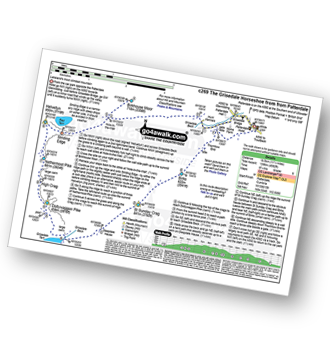
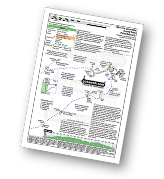
See Striding Edge and the surrounding tops on our downloadable PDF Peak Bagging Map:
   |
|---|
Vital Statistics:
| Length: | 8ml (12.5km) |
|---|---|
| Ascent: | 2,990ft (911m) |
| Time: | 6 hrs |
| Grade: |  (Moderate) (Moderate) |
Route Summary:
Patterdale - Patterdale Church - Grisedale Bridge - Grisedale Beck - Brownend Plantation - Lanty's Tarn - Hole-in-the-Wall - Red Tarn (Helvellyn) - Bleaberry Crag - Low Spying How - High Spying How - Striding Edge - Helvellyn - Swirral Edge (optional) - Hole-in-the-Wall - Grisedale Beck - Patterdale
|
|---|
Vital Statistics:
| Length: | 8.5ml (13.5km) |
|---|---|
| Ascent: | 3,278ft (999m) |
| Time: | 6½ hrs |
| Grade: |  (Hard) (Hard) |
Route Summary:
Glenridding - Birkhouse Moor - Hole-in-the-Wall - Red Tarn (Helvellyn) - Bleaberry Crag - Low Spying How - High Spying How - Striding Edge - Helvellyn - Swirral Edge - Catstye Cam - Hole-in-the-Wall - Brownend Plantation - Grisedale Beck - Lanty's Tarn - Keldas - Glenridding
|
|---|
Vital Statistics:
| Length: | 10ml (16km) |
|---|---|
| Ascent: | 3,382ft (1,031m) |
| Time: | 7 hrs |
| Grade: | (Hard) |
Route Summary:
Glenridding - Birkhouse Moor - Hole-in-the-Wall - Red Tarn (Helvellyn) - Bleaberry Crag - Low Spying How - High Spying How - Striding Edge - Helvellyn - Nethermost Pike - High Crag (Helvellyn) - Dollywaggon Pike - Grisdale Tarn - Ruthwaite Lodge - Grisedale Beck - Brownend Plantation - Lanty's Tarn - Keldas - Glenridding
|
|---|
Vital Statistics:
| Length: | 11.5ml (18.5km) |
|---|---|
| Ascent: | 4,582ft (1,396m) |
| Time: | 8.75hrs |
| Grade: |  (Hard) (Hard) |
Route Summary:
Patterdale - Grisedale Bridge - Grisedale Beck - Brownends Plantation - Hole-in-the-Wall - Birkhouse Moor - Hole-in-the-Wall - Red Tarn (Helvellyn) - Bleaberry Crag - Low Spying How - High Spying How - Striding Edge - Helvellyn - Nethermost Pike - High Crag (Helvellyn) - Dollywaggon Pike - Grisedale Tarn - Deepdale Hause - St Sunday Crag - Birks - Patterdale
|
|---|
Vital Statistics:
| Length: | 13.25ml (21km) |
|---|---|
| Ascent: | 5,189ft (1,581m) |
| Time: | 10 hrs |
| Grade: |  (Very Hard) (Very Hard) |
Route Summary:
Patterdale - Grisedale Bridge - Grisedale Beck - Brownend Plantation - Hole-in-the-Wall - Birkhouse Moor - Hole-in-the-Wall - Red Tarn (Helvellyn) - Bleaberry Crag - Low Spying How - High Spying How - Striding Edge - Helvellyn - Nethermost Pike - High Crag (Helvellyn) - Dollywaggon Pike - Seat Sandal - Grisedale Tarn - St Sunday Crag - Birks - Arnison Crag - Patterdale
 Fellow go4awalkers who have already walked, climbed, summited & bagged Striding Edge
Neil Walker walked up on June 1st, 1982 [from/via/route] Enroute to Helvellyn [with] Doddridge Church - 1st Mountain
Nick Tippins climbed it on December 31st, 2019 [from/via/route] Helvellyn Circular from Glenridding via Birkhouse Moor, Striding Edge, & Catstye Cam [with] Fran
Neil Heywood bagged it on September 9th, 2024 [from/via/route] Glenridding
Chris Faulkner hiked it on August 19th, 2011 [from/via/route] Patterdale [with] Michelle Chandler [weather] Bright & blustery.
Christina Lander summited on June 3rd, 2017 [from/via/route] Glenridding - Striding Edge - Helvellyn - Raise - Sticks Pass - Glenridding [with] Dick [weather] Perfect sunny day during our 1st holiday at Wordsworth Barn, Patterdale
Chris Hughes conquered it on June 28th, 2023 [from/via/route] Thirlmere car park [weather] mist / drizzle
Darren Mortimer scaled on April 20th, 2019 [from/via/route] Walked this many times but didn't know it was a mountain. [with] Dermot Palmer [weather] Warm & sunny.
Melfyn Parry walked up on May 23rd, 2023 [from/via/route] Started walk from the car park at the Patterdale Hotel, followed route C427 with a couple of changes. Climbed over Striding Edge & then on to Helvellyn but then took a detour to walk out to Lower Man then doubled back to Helvellyn before descending Swirral Edge to then climb too summit of Catstye Cam. From here we descended to Hole in the Wall & then went out to Birkhouse Moor & rather than doubling back to Hole in the Wall to repeat the path back to the carpark we continued beyond the summit along easy to follow paths which led back down to join the return route at NY377158, making a total of 16.4Km [with] With DS [weather] Sunny spells & quite warm at times especially on uphill sections when in lea of the breeze. On the tops the breeze was chilly. - Stunning views in all directions.
Claire Kirk climbed it on September 1st, 2010 [from/via/route] Patterdale [with] Larry [weather] Warm, clear day
Caroline Winter bagged it on August 9th, 2018 [from/via/route] Glenridding, Stiding Edge, Helvellyn, Swirral Edge, Catsye Cam [with] Becky [weather] Warm, clear skies, light breeze - After battling with the new Ticket machine at Glenridding CP for 20 mins, we eventually got away. Hot & sticky long ascent. Rather than doubling back, should have taken a direct line to hole in the wall. Third time lucky, due to poor weather, did Striding-perfect conditions. No problem for Becky on tricky climb section. Others struggling! Made for Dolly Waggon Pike, but time & energy against us, so came back to top Helvellyn, & Catsye Cam via Swirral. Enjoyed a needed drink in Hole in the Wall cafe at YH. My boots painful-time for a new Pair.
To add (or remove) your name and experiences on this page - Log On and edit your Personal Mountain Bagging Record
. . . [see more walk reports]
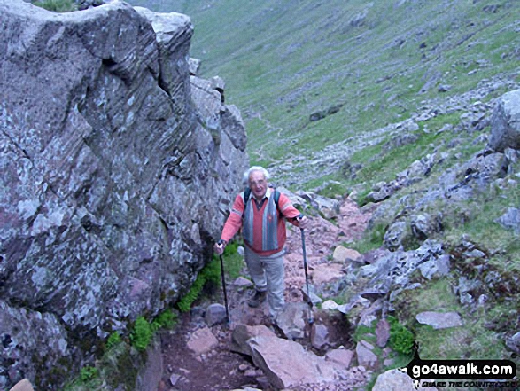
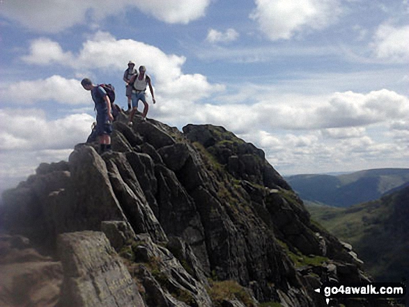
More Photographs & Pictures of views from, on or of Striding Edge
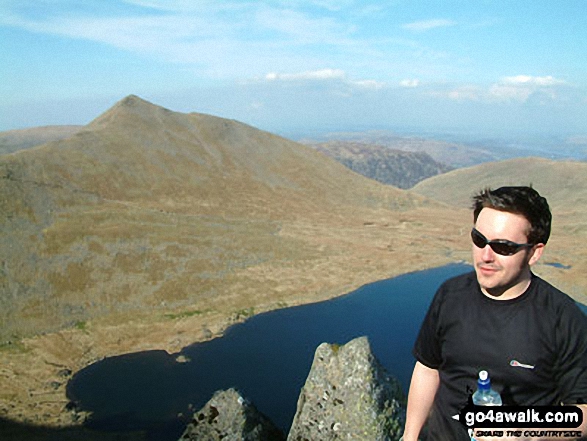
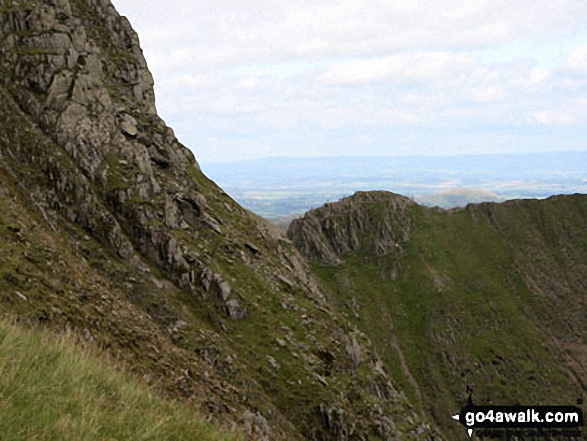
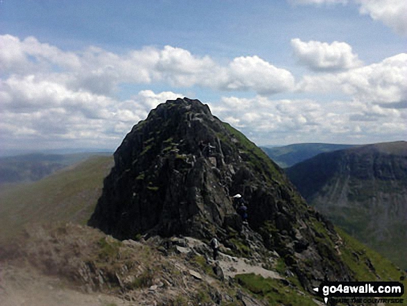
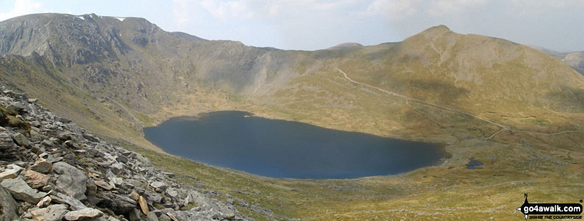
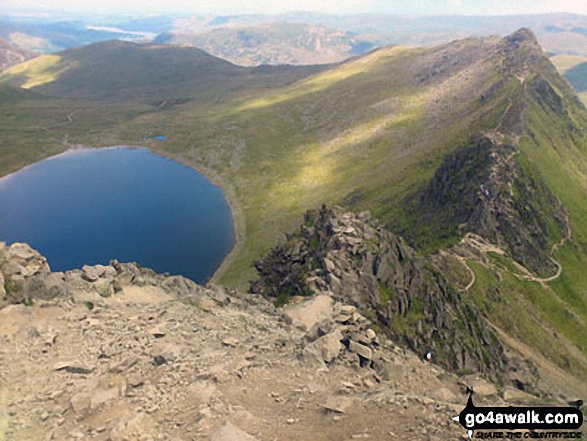
Red Tarn (Helvellyn) and Striding Edge in all it's glory from Helvellyn
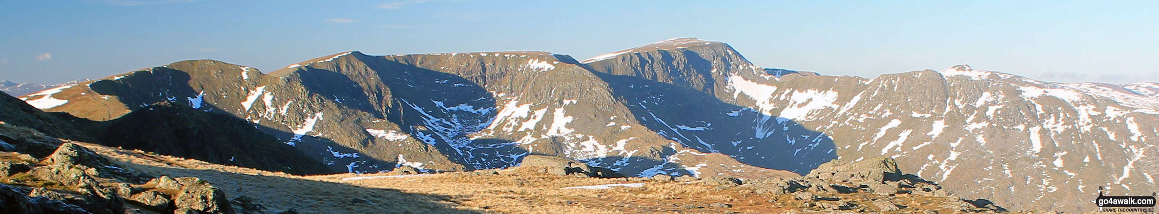
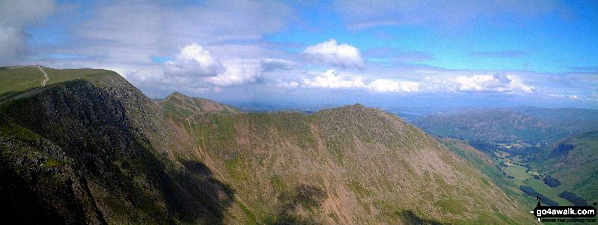
The Helvellyn Ridge featuring Dollywaggon Pike, Nethermost Pike, Helvellyn and Striding Edge from Fairfield
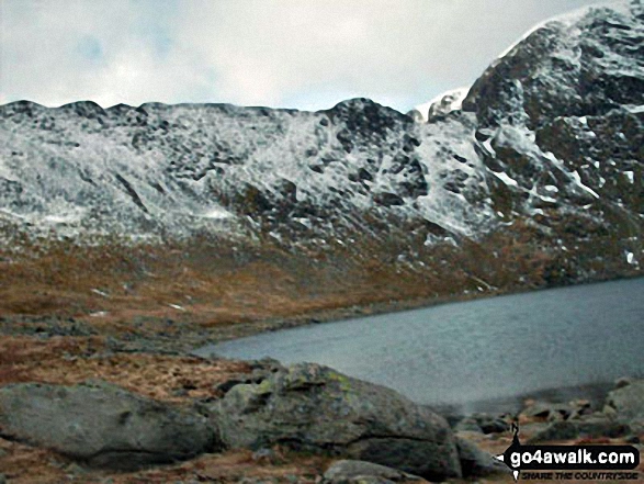
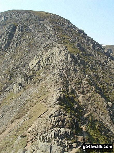
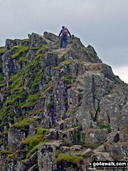
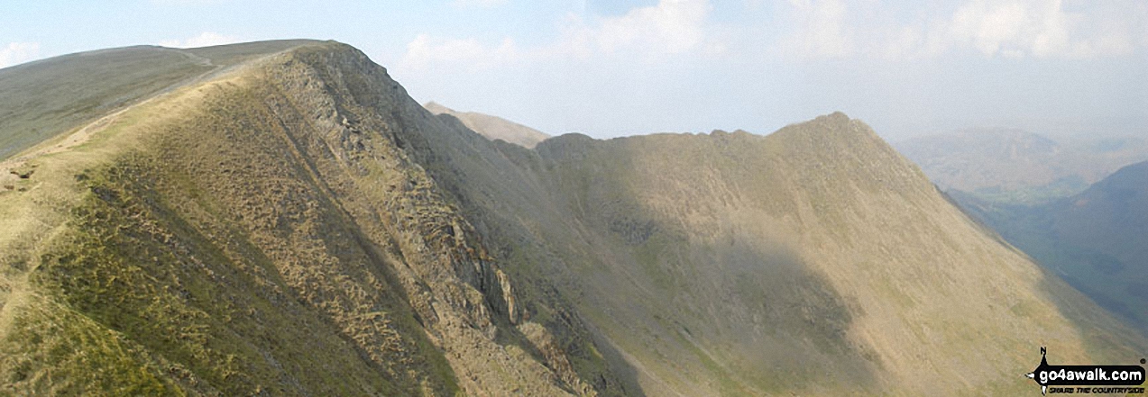
*Striding Edge (left), Helvellyn, Swirral Edge and Catstye Cam (far right) from near Hole-in-the-wall
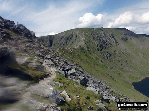
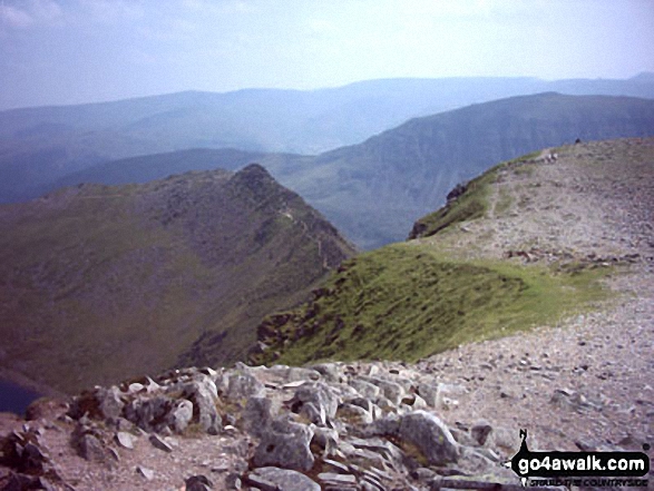
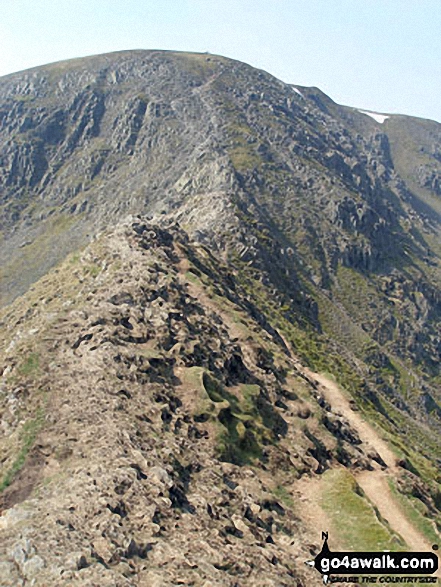
Approaching Striding Edge and Helvellyn via Low Spying How and Bleaberry Crag
. . . see all 119 walk photographs & pictures of views from, on or of Striding Edge
Send us your photographs and pictures on, of, or from Striding Edge
If you would like to add your walk photographs and pictures featuring views from, on or of Striding Edge to this page, please send them as email attachments (configured for any computer) along with your name to:
and we shall do our best to publish them.
(Guide Resolution = 300dpi. At least = 660pixels (wide) x 440 pixels (high).)

You can also submit photos via our Facebook Page.
NB. Please indicate where each photo was taken.


