
![]()
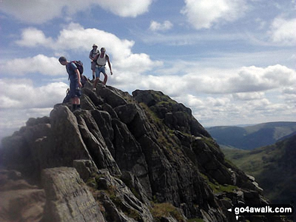
Striding Edge (High Spying How)
863m (2831ft)
The Eastern Fells, The Lake District, Cumbria, England
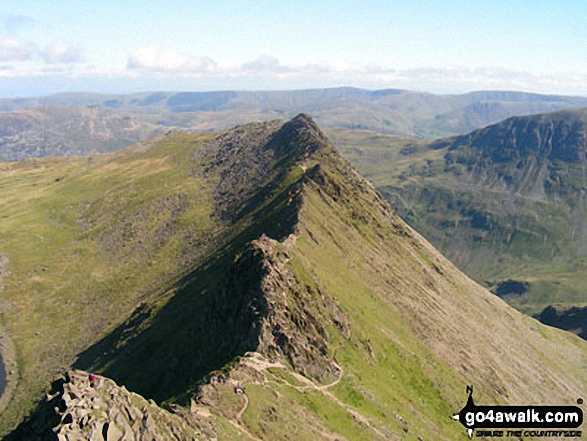
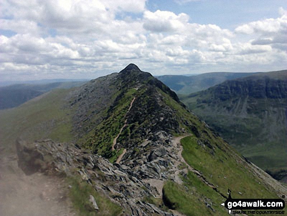
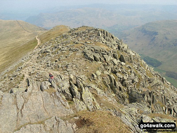
Striding Edge (High Spying How) basking in glorious September Sun viewed from Helvellyn
Striding Edge (High Spying How) gained Mountain (Hewitt) status in September, 2018.
Not familiar with this top?
   |
|---|
Vital Statistics:
| Length: | 8ml (12.5km) |
|---|---|
| Ascent: | 2,990ft (911m) |
| Time: | 6 hrs |
| Grade: |  (Moderate) (Moderate) |
Route Summary:
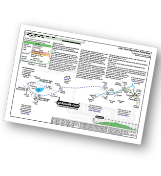
Patterdale - Patterdale Church - Grisedale Bridge - Grisedale Beck - Brownend Plantation - Lanty's Tarn - Hole-in-the-Wall - Red Tarn (Helvellyn) - Bleaberry Crag - Low Spying How - High Spying How - Striding Edge (High Spying How) - Helvellyn - Swirral Edge (optional) - Hole-in-the-Wall - Grisedale Beck - Patterdale
|
|---|
Vital Statistics:
| Length: | 8.5ml (13.5km) |
|---|---|
| Ascent: | 3,278ft (999m) |
| Time: | 6½ hrs |
| Grade: |  (Hard) (Hard) |
Route Summary:
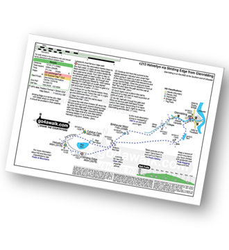
Glenridding - Birkhouse Moor - Hole-in-the-Wall - Red Tarn (Helvellyn) - Bleaberry Crag - Low Spying How - High Spying How - Striding Edge (High Spying How) - Helvellyn - Swirral Edge - Catstye Cam - Hole-in-the-Wall - Brownend Plantation - Grisedale Beck - Lanty's Tarn - Keldas - Glenridding
|
|---|
Vital Statistics:
| Length: | 10ml (16km) |
|---|---|
| Ascent: | 3,382ft (1,031m) |
| Time: | 7 hrs |
| Grade: | (Hard) |
Route Summary:
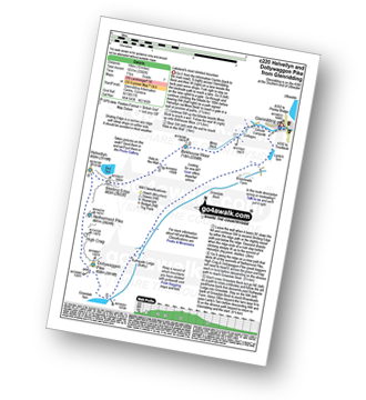
Glenridding - Birkhouse Moor - Hole-in-the-Wall - Red Tarn (Helvellyn) - Bleaberry Crag - Low Spying How - High Spying How - Striding Edge (High Spying How) - Helvellyn - Nethermost Pike - High Crag (Helvellyn) - Dollywaggon Pike - Grisdale Tarn - Ruthwaite Lodge - Grisedale Beck - Brownend Plantation - Lanty's Tarn - Keldas - Glenridding
|
|---|
Vital Statistics:
| Length: | 11.5ml (18.5km) |
|---|---|
| Ascent: | 4,582ft (1,396m) |
| Time: | 8.75hrs |
| Grade: |  (Hard) (Hard) |
Route Summary:
Patterdale - Grisedale Bridge - Grisedale Beck - Brownends Plantation - Hole-in-the-Wall - Birkhouse Moor - Hole-in-the-Wall - Red Tarn (Helvellyn) - Bleaberry Crag - Low Spying How - High Spying How - Striding Edge (High Spying How) - Helvellyn - Nethermost Pike - High Crag (Helvellyn) - Dollywaggon Pike - Grisedale Tarn - Deepdale Hause - St Sunday Crag - Birks - Patterdale
|
|---|
Vital Statistics:
| Length: | 13.25ml (21km) |
|---|---|
| Ascent: | 5,189ft (1,581m) |
| Time: | 10 hrs |
| Grade: |  (Very Hard) (Very Hard) |
Route Summary:
Patterdale - Grisedale Bridge - Grisedale Beck - Brownend Plantation - Hole-in-the-Wall - Birkhouse Moor - Hole-in-the-Wall - Red Tarn (Helvellyn) - Bleaberry Crag - Low Spying How - High Spying How - Striding Edge (High Spying How) - Helvellyn - Nethermost Pike - High Crag (Helvellyn) - Dollywaggon Pike - Seat Sandal - Grisedale Tarn - St Sunday Crag - Birks - Arnison Crag - Patterdale
See Striding Edge (High Spying How) and the surrounding tops on our free-to-access 'Google Style' Peak Bagging Maps:
The Eastern Fells of The Lake District National Park
Less data - quicker to download
The Whole of The Lake District National Park
More data - might take a little longer to download
See Striding Edge (High Spying How) and the surrounding tops on our downloadable Peak Bagging Maps in PDF format:

NB: Whether you print off a copy or download it to your phone, these PDF Peak Baggers' Maps might prove incredibly useful when your are up there on the tops and you cannot get a phone signal.
*This version is marked with the walk routes you need to follow to Walk all 214 Wainwrights in just 59 walks.
You can find Striding Edge (High Spying How) & all the walks that climb it on these unique free-to-access Interactive Walk Planning Maps:
1:25,000 scale OS Explorer Map (orange/yellow covers):
1:50,000 scale OS Landranger Map (pink/magenta covers):
 Fellow go4awalkers who have already walked, climbed, summited & bagged Striding Edge (High Spying How)
Neil Walker walked up Striding Edge (High Spying How) on June 1st, 1982 [from/via/route] Enroute to Helvellyn [with] Doddridge Church - 1st Mountain
Nick Tippins climbed Striding Edge (High Spying How) on December 31st, 2019 [from/via/route] Helvellyn Circular from Glenridding via Birkhouse Moor, Striding Edge, & Catstye Cam [with] Fran
Neil Heywood bagged Striding Edge (High Spying How) on September 9th, 2024 [from/via/route] Glenridding
Chris Faulkner hiked Striding Edge (High Spying How) on August 19th, 2011 [from/via/route] Patterdale [with] Michelle Chandler [weather] Bright & blustery.
Christina Lander summited Striding Edge (High Spying How) on June 3rd, 2017 [from/via/route] Glenridding - Striding Edge - Helvellyn - Raise - Sticks Pass - Glenridding [with] Dick [weather] Perfect sunny day during our 1st holiday at Wordsworth Barn, Patterdale
Chris Hughes conquered Striding Edge (High Spying How) on June 28th, 2023 [from/via/route] Thirlmere car park [weather] mist / drizzle
Darren Mortimer scaled Striding Edge (High Spying How) on April 20th, 2019 [from/via/route] Walked this many times but didn't know it was a mountain. [with] Dermot Palmer [weather] Warm & sunny.
Melfyn Parry walked up Striding Edge (High Spying How) on May 23rd, 2023 [from/via/route] Started walk from the car park at the Patterdale Hotel, followed route C427 with a couple of changes. Climbed over Striding Edge & then on to Helvellyn but then took a detour to walk out to Lower Man then doubled back to Helvellyn before descending Swirral Edge to then climb too summit of Catstye Cam. From here we descended to Hole in the Wall & then went out to Birkhouse Moor & rather than doubling back to Hole in the Wall to repeat the path back to the carpark we continued beyond the summit along easy to follow paths which led back down to join the return route at NY377158, making a total of 16.4Km [with] With DS [weather] Sunny spells & quite warm at times especially on uphill sections when in lea of the breeze. On the tops the breeze was chilly. - Stunning views in all directions.
Claire Kirk climbed Striding Edge (High Spying How) on September 1st, 2010 [from/via/route] Patterdale [with] Larry [weather] Warm, clear day
Caroline Winter bagged Striding Edge (High Spying How) on August 9th, 2018 [from/via/route] Glenridding, Stiding Edge, Helvellyn, Swirral Edge, Catsye Cam [with] Becky [weather] Warm, clear skies, light breeze - After battling with the new Ticket machine at Glenridding CP for 20 mins, we eventually got away. Hot & sticky long ascent. Rather than doubling back, should have taken a direct line to hole in the wall. Third time lucky, due to poor weather, did Striding-perfect conditions. No problem for Becky on tricky climb section. Others struggling! Made for Dolly Waggon Pike, but time & energy against us, so came back to top Helvellyn, & Catsye Cam via Swirral. Enjoyed a needed drink in Hole in the Wall cafe at YH. My boots painful-time for a new Pair.
Angela Haworth hiked Striding Edge (High Spying How) on September 26th, 1999 [from/via/route] From Glenridding Birkhouse Moor - Striding Edge- Helvellyn- Swirral Edge - Catstycam [with] children [weather] Dry - .
Andrew Flynn summited Striding Edge (High Spying How) on October 10th, 2020 [from/via/route] C213 Hellvellyn via Striding edge [with] Nicola and some Pumas [weather] Nice day at ground level but foul at the top.
Sarah Culverhouse conquered Striding Edge (High Spying How) on September 18th, 2020 [from/via/route] Glenridding [weather] glorious sunshine
Kevin Foster scaled Striding Edge (High Spying How) on October 24th, 2019 [from/via/route] Patterdale [with] By myself. [weather] Blue skies (cloud developing later on Striding Edge & Helvellyn). - An easy scramble over rocks takes you to the summit of High Spying How. The cloud had descended a little by this time & the rocks were a bit slippy so I 'chickened out' of sticking strictly to the ridgeline & took the path that runs a few feet below. I even managed to avoid the difficult chimney section at the end of 'The Edge' for the first time ever! The final scramble to the summit was fun though!
Clare Tait walked up Striding Edge (High Spying How) on September 12th, 2014 [from/via/route] Parked at Swirls & took bus to Dunmail Raise. Good paths & great views. On to Helvellyn & back down to Swirls. Good route. [with] Charlie [weather] Sunshine - Beautiful views.
Lucy Perchard climbed Striding Edge (High Spying How) on September 17th, 2017 [from/via/route] From Birkhouse Moor on the way to Helvellyn [with] Tony [weather] Sunny spells & fortunately not windy - First scramble & loved it
Simon Myerscough bagged Striding Edge (High Spying How) on November 13th, 2005 [from/via/route] C220
Ken Davies hiked Striding Edge (High Spying How) on March 18th, 2017 [from/via/route] Glenridding [with] Bev [weather] Snowy - return fron Helvellyn
John Tippins has summited Striding Edge (High Spying How) [from/via/route] Glenridding [with] Solo, with one or two companions, with a group of adults and kids. - Walked Helvellyn (and Lower Man) at least ten times, this first in 1968?
Mark Davidson conquered Striding Edge (High Spying How) on May 7th, 2008 [with] Alone - though I had Jack's ashes in an urn in my rucksack which I scattered on Helvellyn as were his wishes [weather] Nice & sunny
Leona Skelton scaled Striding Edge (High Spying How) on October 11th, 2009 [from/via/route] Glenridding [weather] Misty - Yikes!
Iain Taylor walked up Striding Edge (High Spying How) on June 5th, 2011 [from/via/route] Glenridding (NY 38992 16932)
Ray O'hara climbed Striding Edge (High Spying How) on August 15th, 2010 [from/via/route] St Bee's Head to Robin Hood's Bay [weather] Clear & sunny - On the Coast to Coast walk. Camped at Grisedale Tarn, then set off up Helvellyn & down Striding Edge to Patterdale at first light. Had both pretty much to myself.
Christine Shepherd bagged Striding Edge (High Spying How) on August 17th, 1997 [from/via/route] Walked from Glenridding [with] My husband Peter [weather] Hot & sunny - A brilliant ridge which I have done twice since. Exciting stuff but manageable with care.
David Smith, Patrick Rogozinski, Paul Roddam, Wendy Sockett, Daniel Wynn, Mr M A Blanchard, Craig Lewis, James Brocken, Linda Walker, Matthew Thomas and John Reynolds have all walked, climbed & bagged Striding Edge (High Spying How).
To add (or remove) your name and experiences on this page - Log On and edit your Personal Mountain Bagging Record
. . . [see less walk reports]
More Photographs & Pictures of views from, on or of Striding Edge (High Spying How)
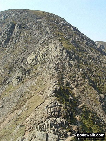
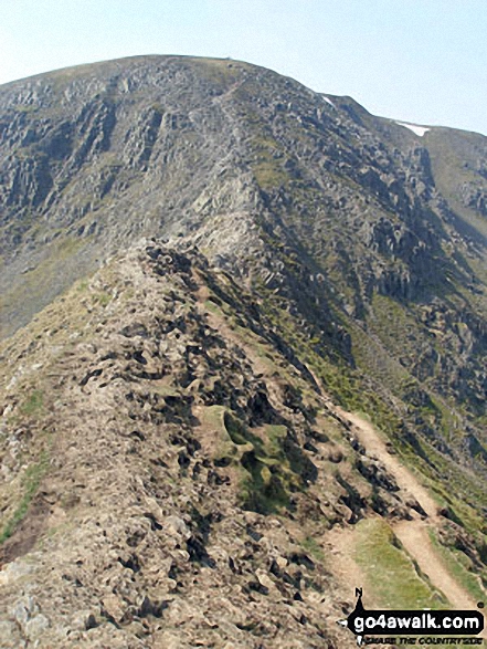
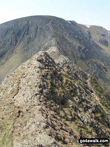
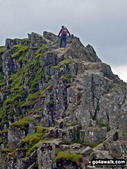
Helvellyn from the 'Bad Step' at the western end of Striding Edge (High Spying How)
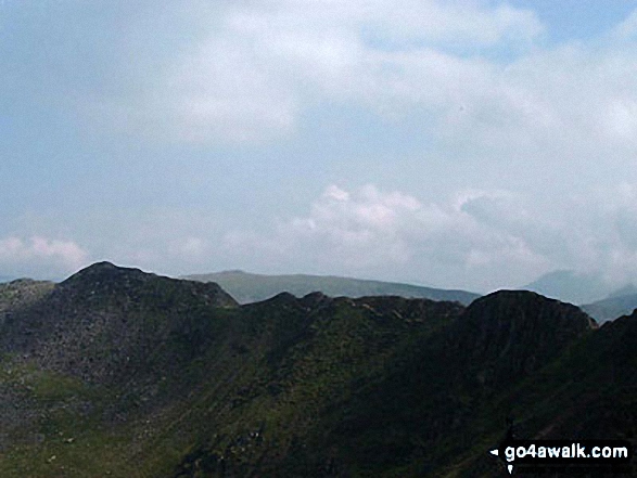
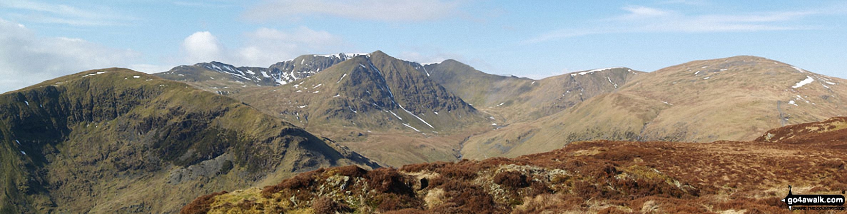
Birkhouse Moor (foreground left), Catstye Cam (foreground centre), White Side (centre right) and Raise (Helvellyn) (right) with Striding Edge (High Spying How), Helvellyn and Lower Man (Helvellyn) in the background from Sheffield Pike
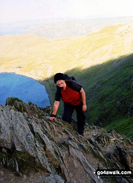
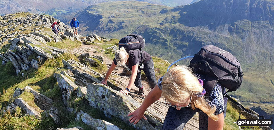
This is me scrambling to the summit of Helvellyn after surviving Striding Edge (High Spying How)!
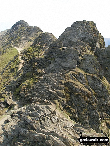

Pete approaching one of the high points of Striding Edge (High Spying How)
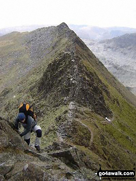
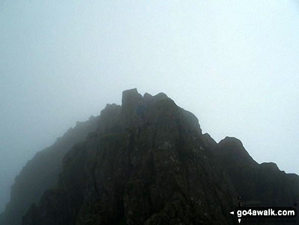
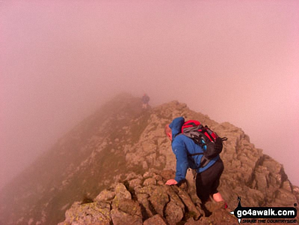
Starting the climb from Striding Edge (High Spying How) up onto Helvellyn
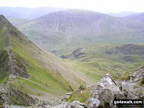
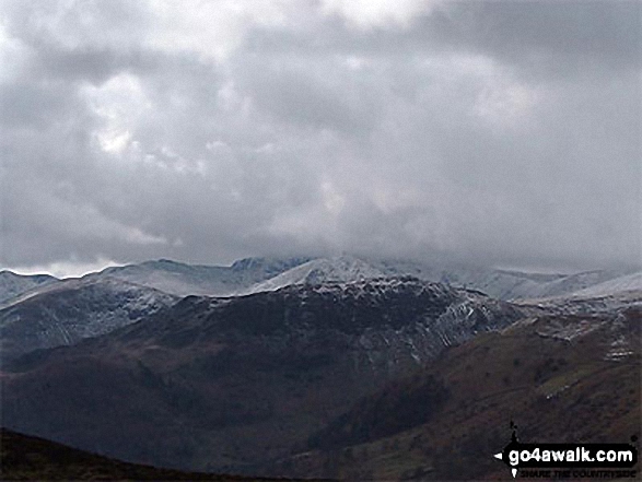
Striding Edge (High Spying How) and Helvellyn (in mist) with Birkhouse Moor in front, Catstycam and Sheffield Pike from Gowbarrow Fell (Airy Crag)
. . . see all 119 walk photographs & pictures of views from, on or of Striding Edge (High Spying How)
Send us your photographs and pictures on, of, or from Striding Edge (High Spying How)
If you would like to add your walk photographs and pictures featuring views from, on or of Striding Edge (High Spying How) to this page, please send them as email attachments (configured for any computer) along with your name to:
and we shall do our best to publish them.
(Guide Resolution = 300dpi. At least = 660pixels (wide) x 440 pixels (high).)

You can also submit photos via our Facebook Page.
NB. Please indicate where each photo was taken and whether you wish us to credit your photos with a Username or your First Name/Last Name.
Not familiar with this top?


