
![]()
Sca Fell
964m (3163ft)
The Southern Fells, The Lake District, Cumbria, England
Not familiar with this top?
   |
|---|
Vital Statistics:
| Length: | 7.5ml (12km) |
|---|---|
| Ascent: | 4,195ft (1,279m) |
| Time: | 7 hrs |
| Grade: |  (Hard) (Hard) |
Route Summary:
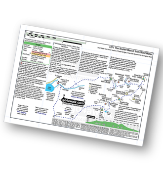
Wasdale Head - (National Trust Campsite) - Wast Water - Lingmell - Corridor Route - Scafell Pike - Mickledore - Foxes Tarn - Symonds Knott - Sca Fell - Lingmell Gill - Wasdale Head - Wast Water.
|
|---|
Vital Statistics:
| Length: | 10ml (16km) |
|---|---|
| Ascent: | 3,428ft (1,045m) |
| Time: | 7 hrs |
| Grade: | (Hard) |
Route Summary:
Eskdale - Wha House Farm - Hare Crag - Quagrigg Moss - Slight Side - Sca Fell - Symonds Knott - Foxes Tarn - Cam Spout Crag - River Esk - Great Moss - Lingcove Bridge - Brotherilkeld - Hardknott Pass - Eskdale
|
|---|
Vital Statistics:
| Length: | 10ml (16km) |
|---|---|
| Ascent: | 3,401ft (1,037m) |
| Time: | 7 hrs |
| Grade: | (Hard) |
Route Summary:
Eskdale - Wha House Farm - Hare Crag - Goat Crag - Dawsonground Crags - Cat Crag - Quagrigg Moss - Slight Side - Sca Fell - Symonds Knott - Hard Rigg - Burnmoor Tarn - Eel Tarn - Christcliff - Wha House Farm - Eskdale
|
|---|
Vital Statistics:
| Length: | 9.75ml (15.5km) |
|---|---|
| Ascent: | 5,140ft (1,567m) |
| Time: | 8.75hrs |
| Grade: |  (Hard) (Hard) |
Route Summary:
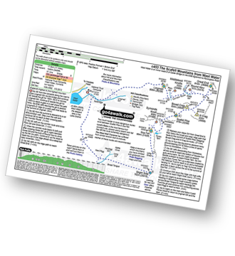
Wasdale Head - (National Trust Campsite) - Wast Water - Lingmell - Middleboot Knotts - Round How (Scafell) - Great End - Ill Crag - Broad Crag - Scafell Pike - Mickledore - Foxes Tarn - Symonds Knott - Sca Fell - Wast Water.
|
|---|
Vital Statistics:
| Length: | 11ml (17.5km) |
|---|---|
| Ascent: | 5,409ft (1,648m) |
| Time: | 9½ hrs |
| Grade: | (Hard) |
Route Summary:
Wasdale Head - (National Trust Campsite) - Wast Water - Lingmell - Corridor Route - Great End - Ill Crag - Broad Crag - Scafell Pike - Mickledore - Foxes Tarn - Symonds Knott - Sca Fell - Slight Side - Broad Tongue - Hardrigg Gill - Wasdale Head - Wast Water.
|
|---|
Vital Statistics:
| Length: | 13.75ml (22km) |
|---|---|
| Ascent: | 4,982ft (1,519m) |
| Time: | 10 hrs |
| Grade: |  (Very Hard) (Very Hard) |

Route Summary:
Eskdale - Wha House Farm - Hare Crag - Quagrigg Moss - Slight Side - Sca Fell - Symonds Knott - Scafell Pike - Broad Crag - Ill Crag - Great End - Esk Hause - Lingcove Bridge - Great Moss - Eskdale
|
|---|
Vital Statistics:
| Length: | 14ml (22.5km) |
|---|---|
| Ascent: | 6,009ft (1,832m) |
| Time: | 9 hrs |
| Grade: | (Very Hard) |
Route Summary:
Eskdale - Wha House Farm - Hare Crag - Quagrigg Moss - Slight Side - Sca Fell - Symonds Knott - Mickledore - Scafell Pike - Broad Crag - Ill Crag - Great End - Esk Hause - Esk Pike - Ore Gap - Bow Fell (Bowfell) (North Top) - Bow Fell (Bowfell) - Bowfell Buttress - Cambridge Crag - Flat Crag - Climbers' Traverse (optional) - Three Tarns - Great Moss - Brotherikeld - Eskdale
See Sca Fell and the surrounding tops on our free-to-access 'Google Style' Peak Bagging Maps:
The Southern Fells of The Lake District National Park
Less data - quicker to download
The Whole of The Lake District National Park
More data - might take a little longer to download
See Sca Fell and the surrounding tops on our downloadable Peak Bagging Maps in PDF format:

NB: Whether you print off a copy or download it to your phone, these PDF Peak Baggers' Maps might prove incredibly useful when your are up there on the tops and you cannot get a phone signal.
*This version is marked with the walk routes you need to follow to Walk all 214 Wainwrights in just 59 walks.
You can find Sca Fell & all the walks that climb it on these unique free-to-access Interactive Walk Planning Maps:
1:25,000 scale OS Explorer Map (orange/yellow covers):
1:50,000 scale OS Landranger Maps (pink/magenta covers):
 Fellow go4awalkers who have already walked, climbed, summited & bagged Sca Fell
Pete George walked up Sca Fell on July 26th, 2025 [from/via/route] Eskdale [with] Roco [weather] Wet underfoot, foggy on tops
James Hughes climbed Sca Fell on May 1st, 2025 [from/via/route] c175 Slight Side & Sca Fell from Eskdale [weather] Glorious sunny day. Warm & clear. - Decided to derive from original plan. Amazing walk from Woolpack Inn to Cam Spout via Sampson Stones. Some effort to locate path to left of Cam Spout, but was obvious once located. Fun climb up Gully to Foxes Tarn & then up scree to Symonds Knott. Return from summit via Slight Side. Multiple wanders from path to Catcove then over to Stony Tarn & Eel Tarn. Boggy AF & not overly enjoyable. Return to Woolpack Inn. Jarl & tasty Mutton curry.
Ian Ashton bagged Sca Fell on July 28th, 2024 [with] Solo - Ì
Jason Mcmillan hiked Sca Fell on April 28th, 2023 [from/via/route] Lingmell, Scafell Pike & Scafell
David Higginbottom summited Sca Fell on November 15th, 2018 [with] Carolyn [weather] Good
Geoff Hand conquered Sca Fell on May 12th, 2023 [from/via/route] Recce of the Second half of Bob Graham Round leg 3. Set out from the NT Carpark at Wasdale Head. Went up Lingmell Beck to Sty Head then Esk Hause from there we went to 1great End, Ill Crag, Broad Crag. from there onto Scafell Pike, the down to Broad S & round to Foxes Tarn & Up Scafell. Then straight down to Wasdale Head [with] Ran Mackay, Alfi and Tess. [weather] Started cloudy & cleared into a beautiful sunny afternoon - It was the toughest day out in the fells I've had to date.
John Tippins scaled Sca Fell on May 5th, 2023 [from/via/route] From Eskdale to Wasdale [with] Alone [weather] Warm & sunny in the valley, intermittent sun throughout the day.
Richard Beardsley walked up Sca Fell on June 2nd, 2022 [from/via/route] Used route C233. [with] Myself, Paula, Andy and Dylan. [weather] Nice fine day with some cloud but not too hot. - Parked at the NT car park, (probably got one of the last spaces) & commenced hiking at 0920hrs. Followed the crowd up towards Scafell Pike but veered off left to summit Lingmell first. Rejoined main path & summited Scafell Pike. After our sandwiches it was off west, descending rocky ground, to roughly follow the suggested route. Eventually summited Sca Fell. Then it was the 5km downward slog back to the car park arriving there at 1710hrs. Total time taken - 7hrs 40mins. Shattered but thoroughly enjoyable.
Kevin Foster climbed Sca Fell on May 19th, 2022 [from/via/route] National Trust car park, Brackenclose, Wasdale Head. [with] By myself. [weather] Early cloud on Scafells lifting by midday then sunny. - Dropping down the screes on the Eskdale side of Mickledore I found the rocky gully leading up to Foxes Tarn. I saw a climber doing Broad Stand earlier whilst having my lunch but on close inspection I didn't fancy it so I took the Foxes Tarn route which apart from all the height I had to give up I must say I enjoyed. I didn't reach the summit until 05:30pm so I had the summit of England's second highest mountain all to myself! Scafell Pike blocks out a large portion of the view towards the north but the views south & west towards the Irish Sea were superlative.
Andrew Johnson bagged Sca Fell on July 1st, 2021 [from/via/route] Wasdale [weather] Fair weather
To add (or remove) your name and experiences on this page - Log On and edit your Personal Mountain Bagging Record
. . . [see more walk reports]
More Photographs & Pictures of views from, on or of Sca Fell
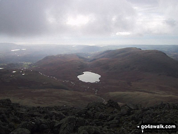
Haycock, Little Scoat Fell, Red Pike (Wasdale), Pillar, Top of Stirrup Crag, Kirk Fell, Great Gable, Great End, Lingmell, Scafell Pike, Sca Fell, Slightside, Harter Fell (Eskdale) and Burnmoor Tarn from the summit of Yewbarrow
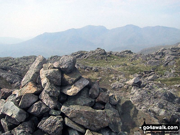
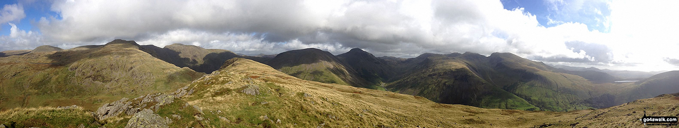
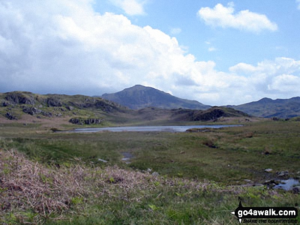
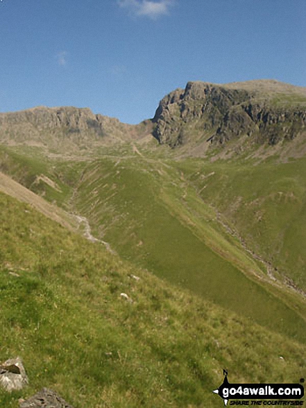
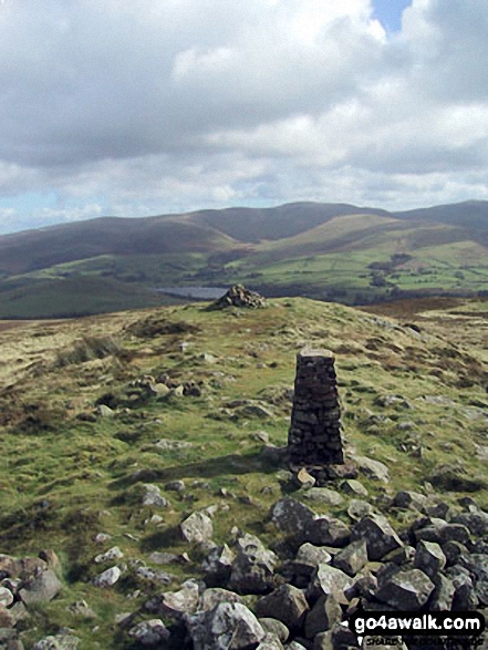
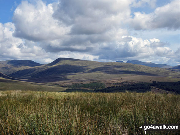
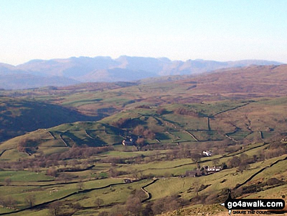
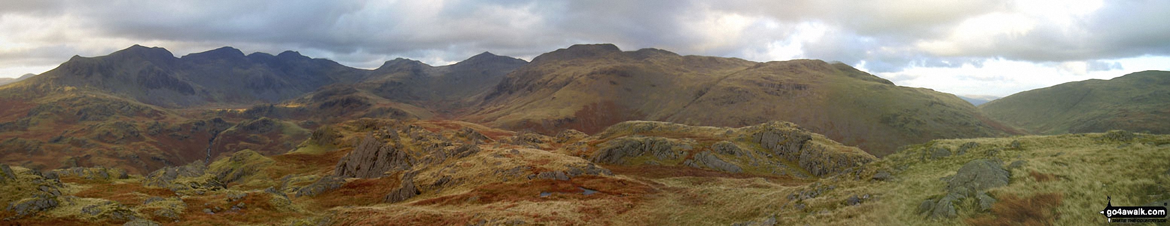
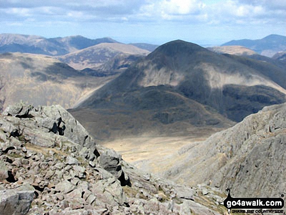
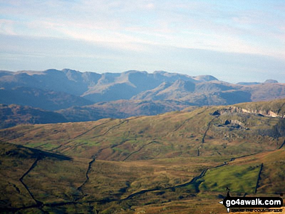
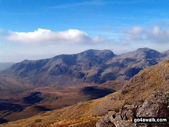
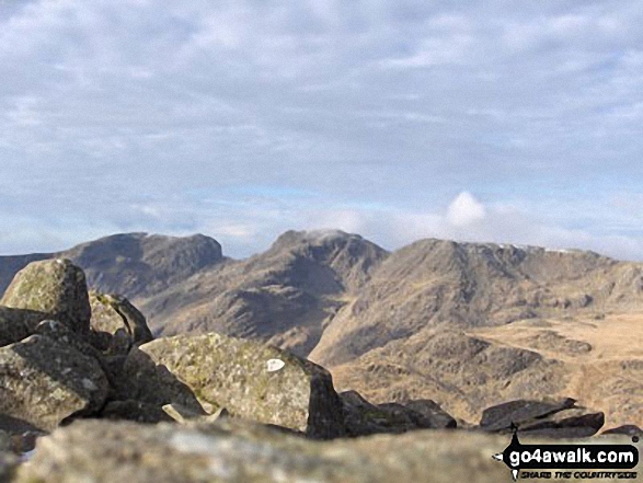
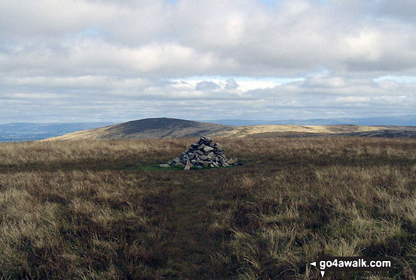
The Scafell Massif - Slight Side, Sca Fell, Symonds Knott, Mickledore, Scafell Pike, Ill Crag and Great End - from the summit of Little Stand
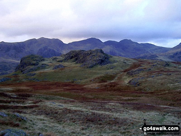
The Scafell Massif - Slight Side, Sca Fell, Symonds Knott, Mickledore, Scafell Pike, Ill Crag and Great End from Crinkle Crags (Long Top)
*From Left to right: Caw Fell, Seatallan, Red Pike, Pillar, Yewbarrow, Kirk Fell, Great Gable, Lingmell and Sca Fell and Wast Water (foreground) from Illgill Head (NB. Scafell Pike is largely hidden behind Sca Fell)
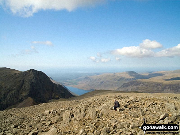
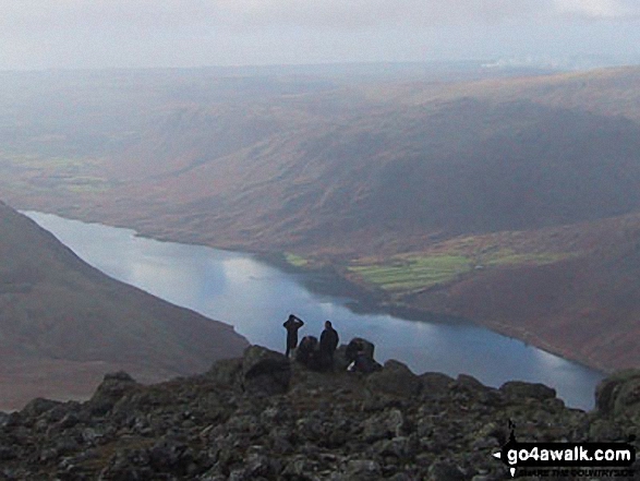
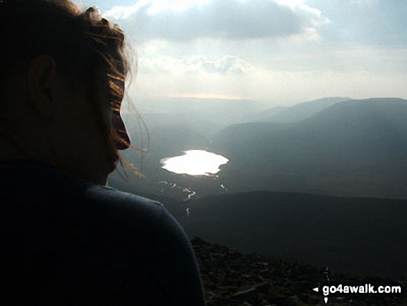
Lone fell walker on Scafell Pike with Symonds Knott and Sca Fell (left), Wast Water and Seatallen (right) beyond
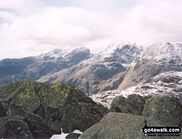
*Northernly Panorama from the summit of Hard Knott featuring Sca Fell, Scafell Pike, Esk Pike, Bow Fell (Bowfell), Gunson Knott, Crinkle Crags (Long Top) and Crinkle Crags (South Top)
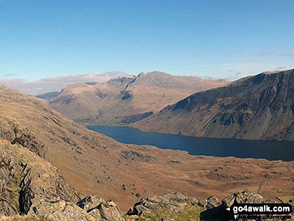
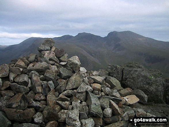
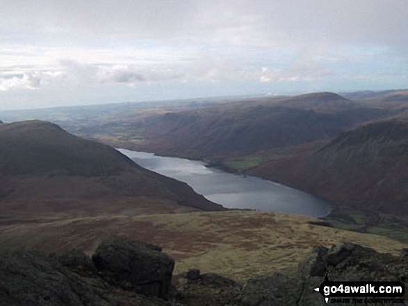
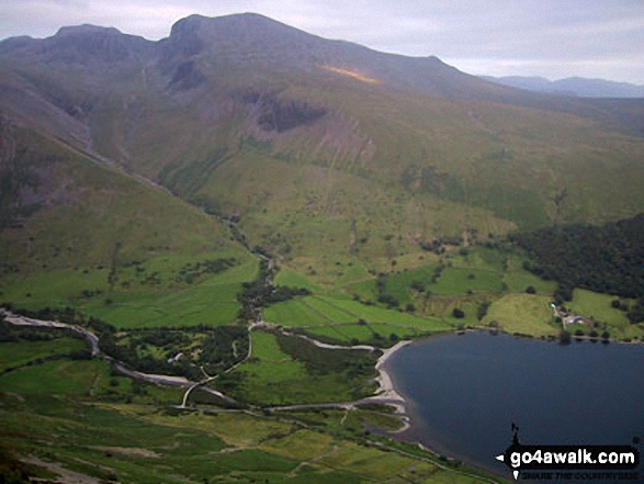
The Scafel Massive featuring Ling Mell, Great End, Broad Crag, Ill Crag, Scafell Pike, Symonds Knott and Sca Fell above Wast Water from Buckbarrow
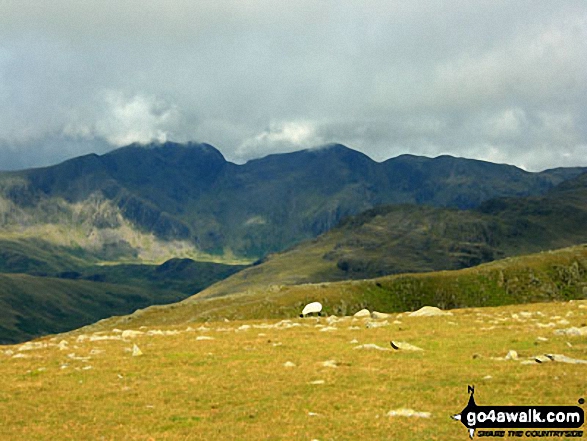
The Scafell Massif featuring Scafell Pike (centre) and Sca Fell (centre left) from Swirl Band between Swirl How and Levers Hawse
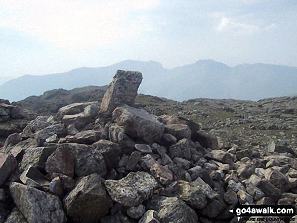
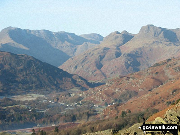
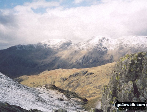
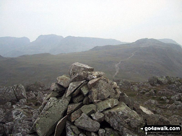
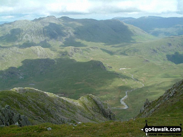
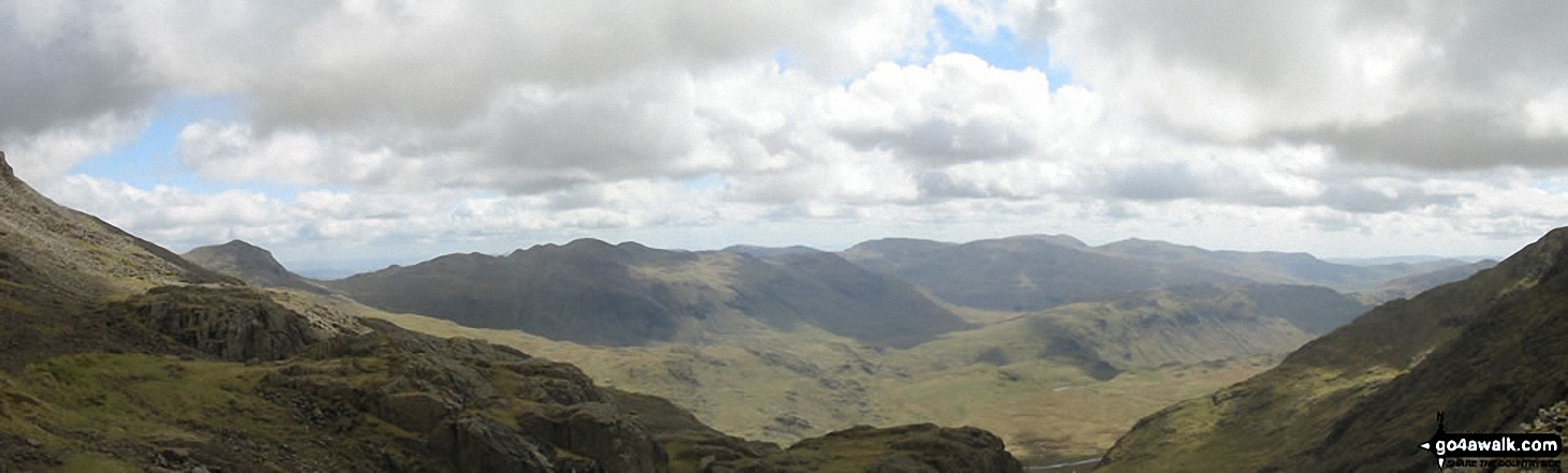
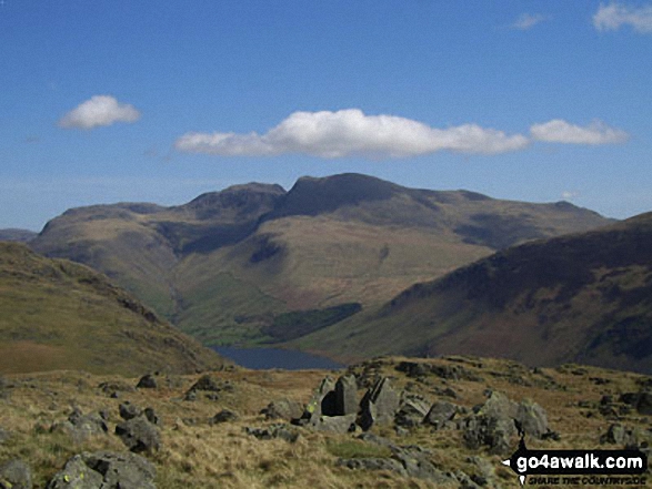
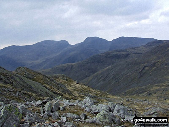
The Scafell Massiff from Bowfell - with Sca Fell to the left, Mickledore in the centre and Scafell Pike to the right
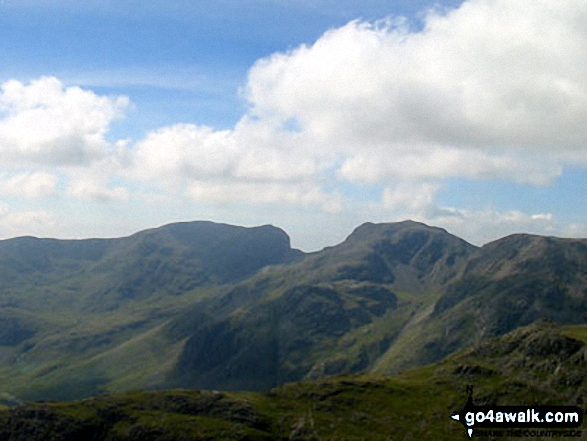
Scafell Pike (right) and Sca Fell (left) with Mickledore (centre) from Bow Fell (Bowfell)
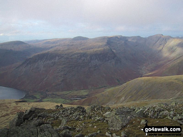
Wast Water with the Scafel Massive (far left- featuring Ling Mell, Great End, Broad Crag, Ill Crag, Scafell Pike, Symonds Knott and Sca Fell) and Illgill Head (centre) and Whin Rigg (centre right) above the Wast Water screes from Buckbarrow
Crinkle Crags (Crinkle Crags (South Top), Crinkle Crags (Long Top), & Gunson Knott), Bow Fell (Bowfell), Esk Pike & The Langdale Pikes from Loughrigg
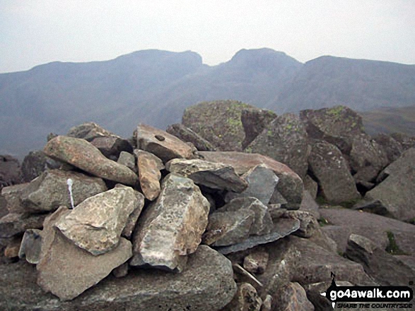
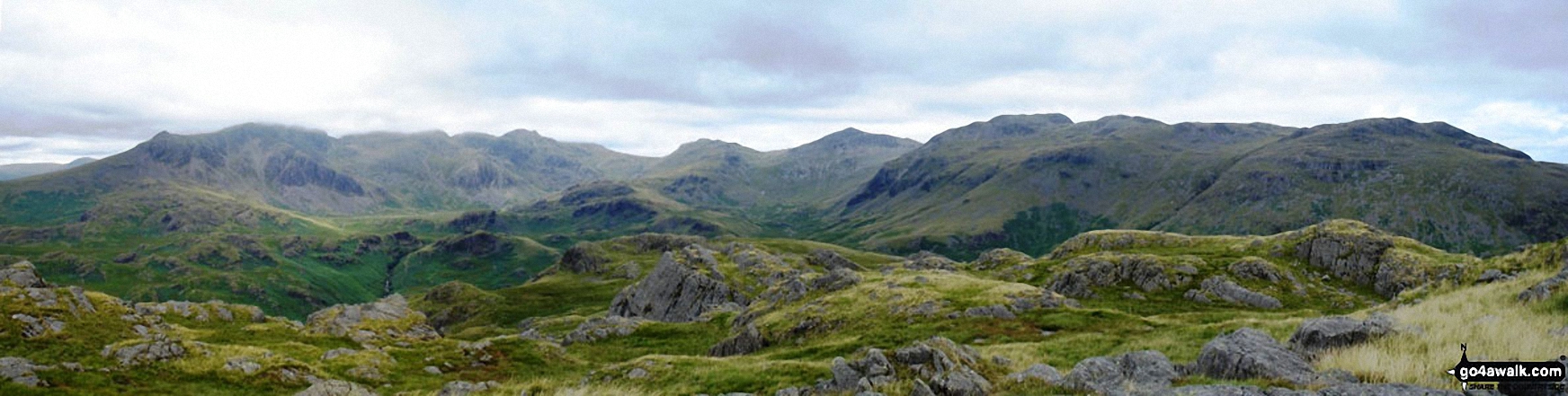
The Scafell Massif - Slight Side, Sca Fell, Symonds Knott, Mickledore, Scafell Pike and Ill Crag - from the summit of Bow Fell (Bowfell)
The Scafell Massif - Sca Fell, Symonds Knott, Mickledore, Scafell Pike, Ill Crag & Great End - with Bow Fell (Bowfell) in the right foreground from the summit of Bow Fell (Bowfell) (North Top)
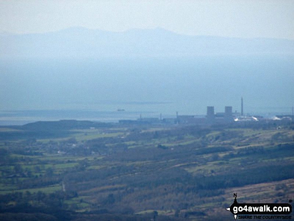
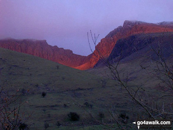
Looking towards the Isle of Man (Sellafield rather spoils the view) from Sca Fell
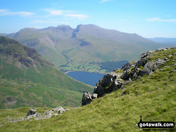
Lingmell, Scafell Pike, Mickledore and Sca Fell above Wast Water from near Middle Fell (Wasdale)
Yewbarrow, Wasdale Head, Wast Water, Lingmell, Scafell Pike, Mickledore and Sca Fell, Illgill Head and Whin Rigg from below Middle Fell (Wasdale)
Binsey Trig Point and cairn with The Uldale Fells (Brae Fell, Great Sca Fell and Knott) beyond
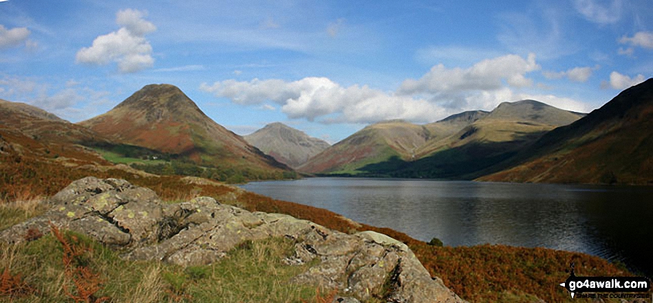
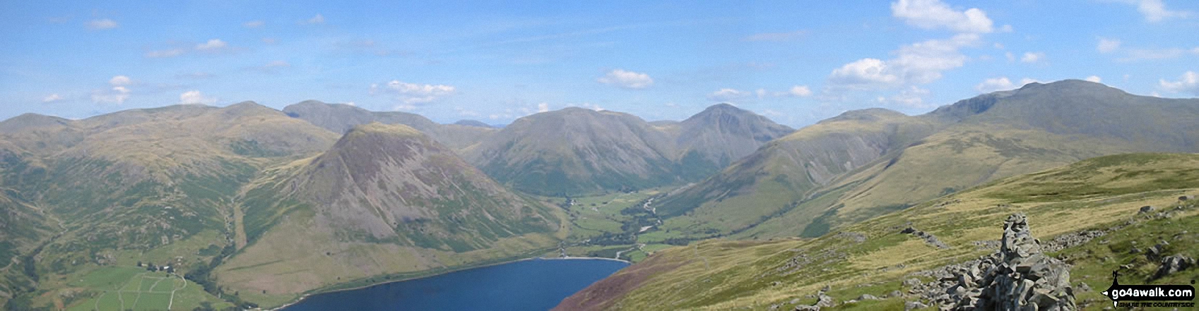
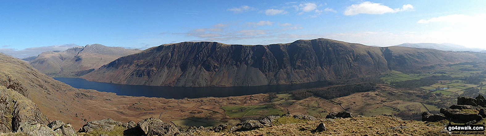
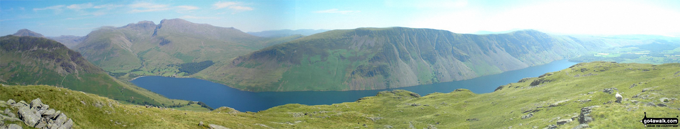
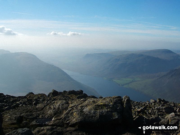
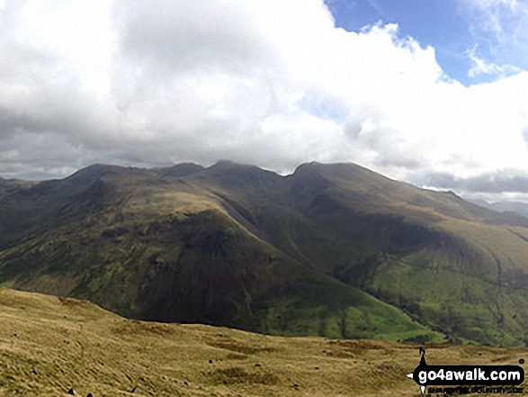
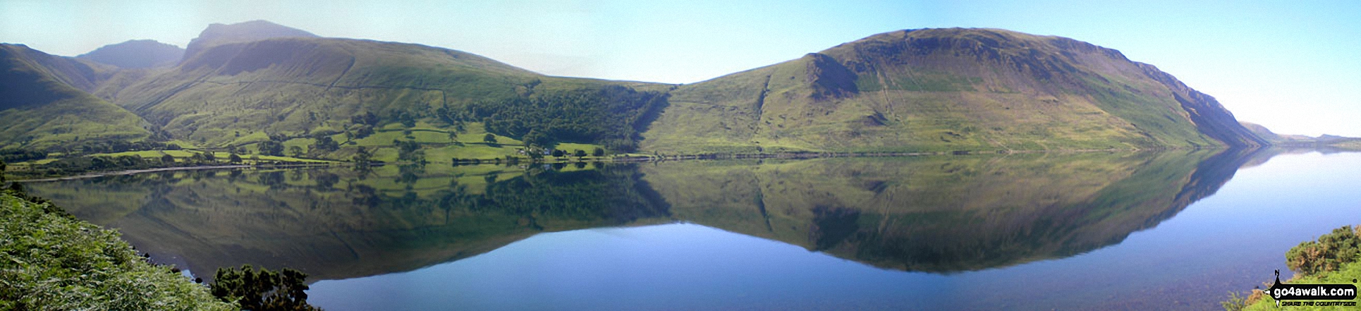
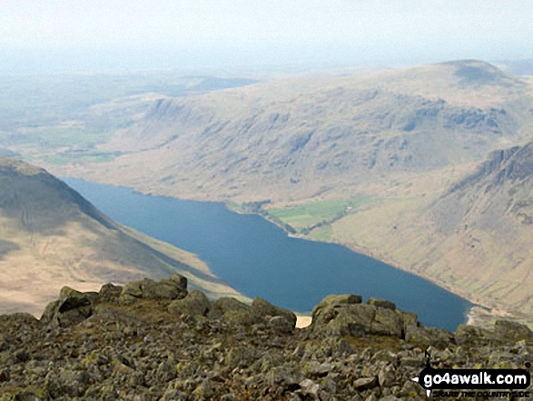
Britain's Favourite View - Yewbarrow, Great Gable, Lingmell, Great End, Sca Fell and the shoulder of Illgill Head (far right) from Wast Water
Looking down Mosedale to Wasdale Head from Little Scoat Fell with Red Pike (Wasdale) on the right in shadow and the Scafell Massif (featuring Great End, Broad Crag, Lingmell, Scafell Pike, Symonds Knott and Sca Fell) across the valley
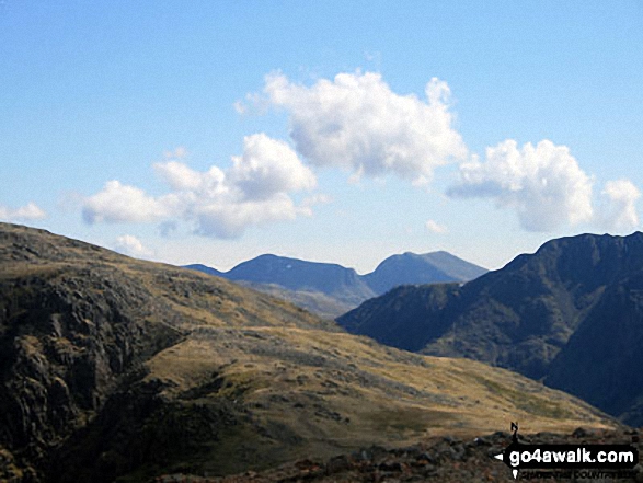
Seatallan (centre left) and you can just make out Scafell Pike, Mickledore and Sca Fell (centre right in the distance) from Ponsonby Fell summit
The Scafell Massif - Slight Side, Sca Fell, Symonds Knott, Mickledore, Scafell Pike, Ill Crag and Great End - from the summit cairn on Crinkle Crags (South Top)
Great End, Lingmell, Scafell Pike, Sca Fell and Slightside from the summit of Yewbarrow
From left to right: Slight Side and Sca Fell, Mickledore, Scafell Pike, Ill Crag and Great End, Esk Hause, Esk Pike, Bow Fell (Bowfell), Crinkle Crags (Long Top), Cold Pike, Little Stand and finally the shoulder of Grey Friar from the summit of Hard Knott
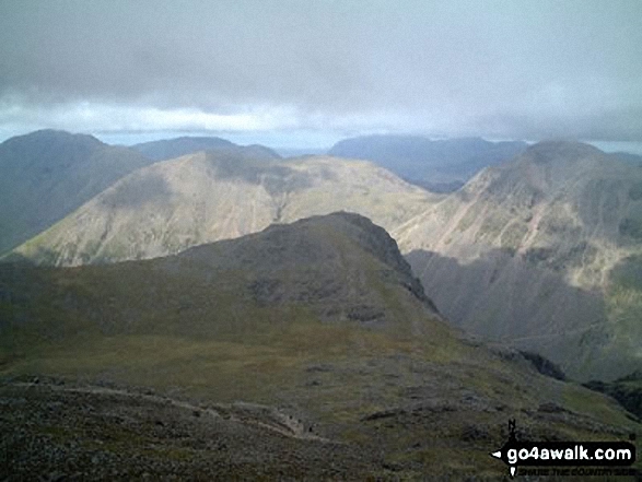
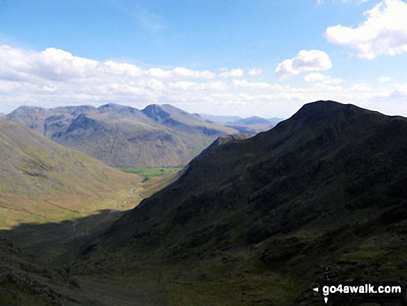
*Bow Fell (Bowfell), Crinkle Crags (Long Top), Gunson Knott and Crinkle Crags (South Top) from Mickledore (between Scafell Pike and Sca Fell)
Lingmell (far right), Scafel Pike, Mickledore, Sca Fell and Illgill Head (centre right) from across Overbeck Bridge, Wast Water
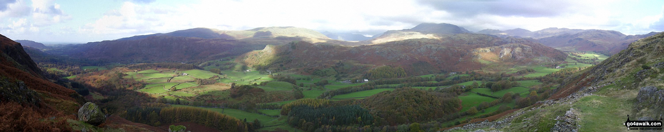
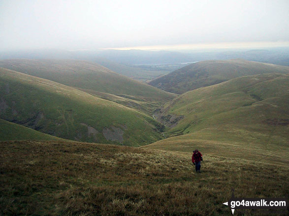
Eskdale from Birker Force (Waterfall) with Illgill Head (centre left) and Sca Fell (centre right) on the horizon
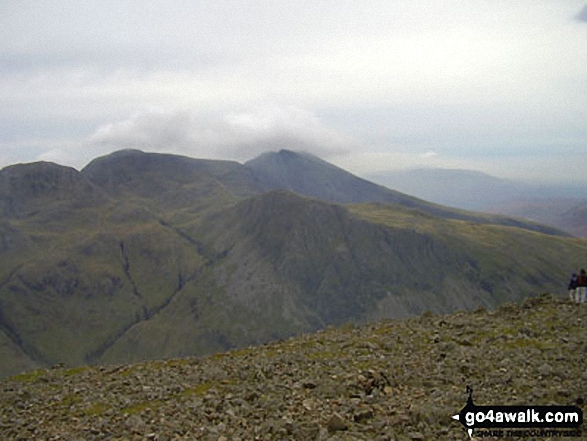
Great End, Scafell Pike and Sca Fell from near the summit of Red Pike (Buttermere)
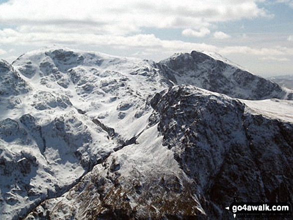
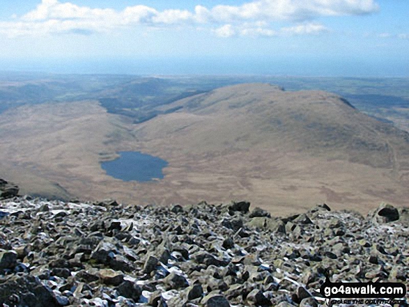
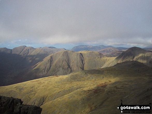
Snow on Scafell Pike (left), Sca Fell (right top) and Lingmell (right centre) from Westmorland Cairn on Great Gable
Scafell Pike, Mickledore and Sca Fell above Wasdale Head from Yewbarrow
Sca Fell, Scafell Pike and the dome of Great Gable in the distance beyond Crinkle Crags and Bow Fell (Bowfell) with The Langdale Pikes in the mid distance from Yoke
Sca Fell (centre), Mickledore and Scafell Pike (right) from Crinkle Crags

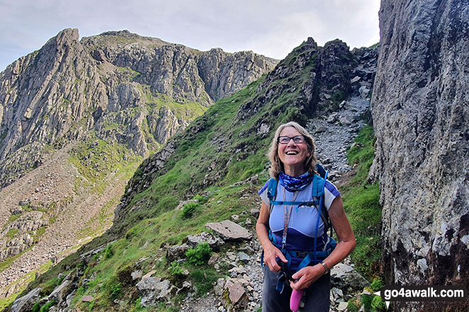
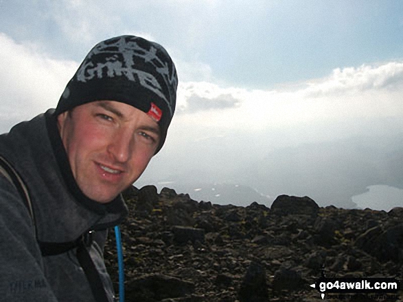
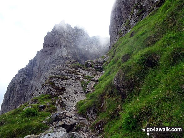
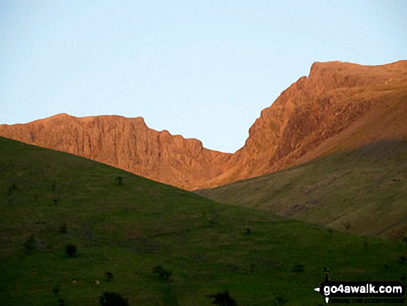
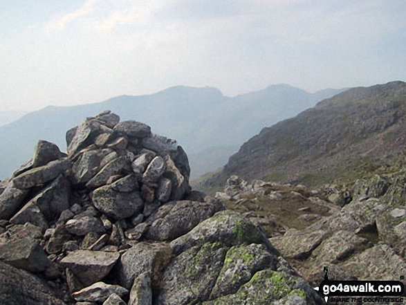
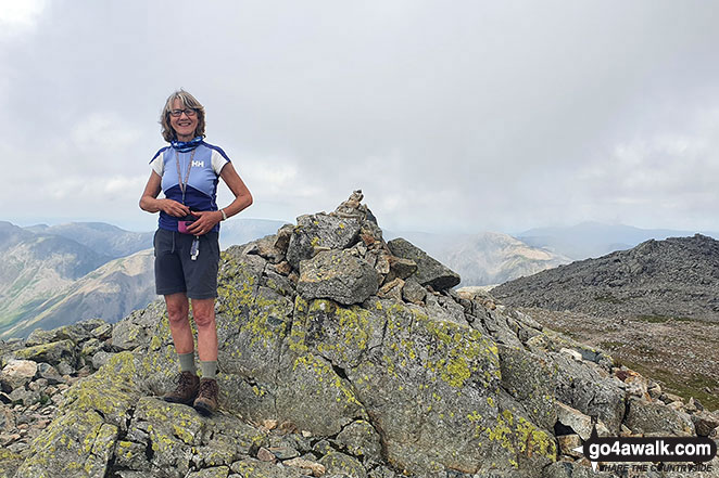
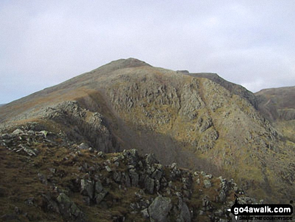
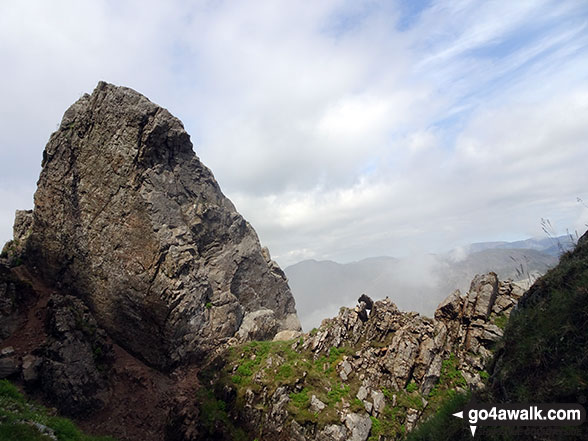
Me looking up the West Wall Traverse between Sca Fell and Scafell Pike
Sca Fell (left), Mickledore (centre), Scafell Pike (centre-right) and Ill Crag (right) from Crinkle Crags (Long Top)
Slight Side and Sca Fell, Mickledore, Scafell Pike, Ill Crag, Great End and Esk Hause from Lingcove Bridge
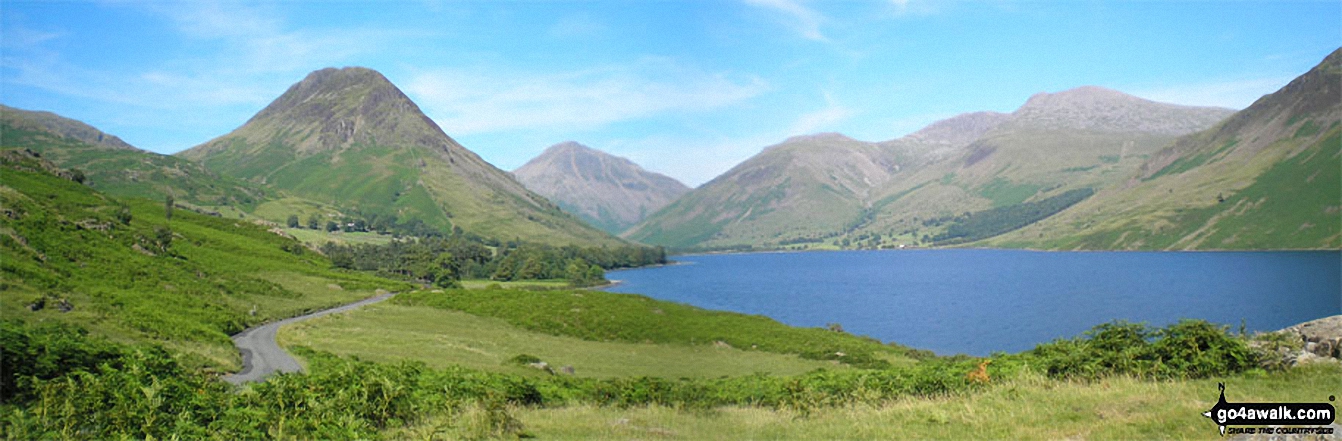
Yewbarrow, Great Gable, Lingmell, Scafell Pike and Sca Fell from Wast Water
Sca Fell (centre left), Mickledore, Scafell Pike and Ill Crag from Three Tarns
. . . see just 20 walk photographs & pictures of views from, on or of Sca Fell
Send us your photographs and pictures on, of, or from Sca Fell
If you would like to add your walk photographs and pictures featuring views from, on or of Sca Fell to this page, please send them as email attachments (configured for any computer) along with your name to:
and we shall do our best to publish them.
(Guide Resolution = 300dpi. At least = 660pixels (wide) x 440 pixels (high).)

You can also submit photos via our Facebook Page.
NB. Please indicate where each photo was taken and whether you wish us to credit your photos with a Username or your First Name/Last Name.
Not familiar with this top?


