
![]()
Raise (Helvellyn)
883m (2898ft)
The Eastern Fells, The Lake District, Cumbria, England
Tap/mouse over a coloured circle (1-3 easy walks, 4-6 moderate walks, 7-9 hard walks) and click to select.
Not familiar with this top?
   |
|---|
Vital Statistics:
| Length: | 8.75ml (14km) |
|---|---|
| Ascent: | 3,296ft (1,005m) |
| Time: | 6½ hrs |
| Grade: |  (Hard) (Hard) |
Route Summary:
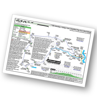
The Swirls Car Park Thirlmere - Browncove Crags - Lower Man (Helvellyn) - Helvellyn - White Side - Raise (Helvellyn) - Sticks Pass - Sticks Gill - Stanah Gill - Legburthwaite - Thirlmere - Thirlspot - The Swirls Car Park Thirlmere.
|
|---|
Vital Statistics:
| Length: | 10.5ml (17km) |
|---|---|
| Ascent: | 3,575ft (1,090m) |
| Time: | 7½ hrs |
| Grade: | (Hard) |
Route Summary:
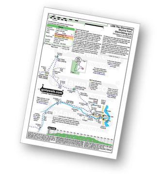
The Swirls Car Park Thirlmere - Browncove Crags - Lower Man (Helvellyn) - Helvellyn - White Side - Raise (Helvellyn) - Sticks Pass - Stybarrow Dodd - Watson's Dodd - Great Dodd - Legburthwaite - Thirlmere - Thirlspot - The Swirls Car Park Thirlmere.
|
|---|
Vital Statistics:
| Length: | 10.75ml (17km) |
|---|---|
| Ascent: | 3,449ft (1,051m) |
| Time: | 7.25hrs |
| Grade: | (Hard) |
Route Summary:
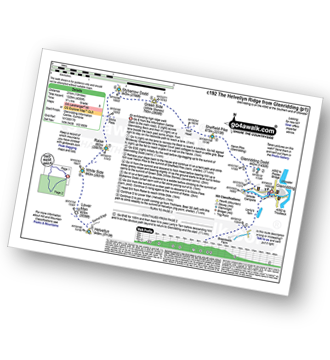
Glenridding - Birkhouse Moor - Hole-in-the-Wall - Red Tarn (Helvellyn) - Catstye Cam - Swirral Edge - Helvellyn - Lower Man (Helvellyn) - White Side - Raise (Helvellyn) - Sticks Pass - Lucy's Tongue - Glenridding Beck - Glenridding
|
|---|
Vital Statistics:
| Length: | 10ml (16km) |
|---|---|
| Ascent: | 4,020ft (1,225m) |
| Time: | 8 hrs |
| Grade: |  (Hard) (Hard) |
Route Summary:
Glenridding - Glenridding Dodd - Sheffield Pike - Nick Head - Sticks Pass - Raise (Helvellyn) - White Side - Lower Man (Helvellyn) - Helvellyn - Swirral Edge - Catstye Cam - Glenridding Beck - Glenridding Youth Hostel - Glenridding
|
|---|
Vital Statistics:
| Length: | 11.5ml (18.5km) |
|---|---|
| Ascent: | 4,418ft (1,346m) |
| Time: | 8½ hrs |
| Grade: | (Hard) |
Route Summary:
Glenridding - Glenridding Dodd - Sheffield Pike - Nick Head - Glencoyne Head - Hart Side - Green Side (White Stones) - Stybarrow Dodd - Sticks Pass - Raise (Helvellyn) - White Side - Lower Man (Helvellyn) - Helvellyn - Swirral Edge - Catstye Cam - Red Tarn Beck - Glenridding Beck - Glenridding Youth Hostel - Glenridding
|
|---|
Vital Statistics:
| Length: | 13ml (21km) |
|---|---|
| Ascent: | 4,359ft (1,329m) |
| Time: | 9.25hrs |
| Grade: | (Hard) |
Route Summary:
Glenridding - Glenridding Dodd - Sheffield Pike - Green Side - Stybarrow Dodd - Sticks Pass - Raise (Helvellyn) - White Side - Lower Man (Helvellyn) - Helvellyn - Nethermost Pike - High Crag (Helvellyn) - Dollywaggon Pike - Grisdale Tarn - Grisedale Beck - Brownend Plantation - Lanty's Tarn - Keldas - Glenridding
See Raise (Helvellyn) and the surrounding tops on our free-to-access 'Google Style' Peak Bagging Maps:
The Eastern Fells of The Lake District National Park
Less data - quicker to download
The Whole of The Lake District National Park
More data - might take a little longer to download
See Raise (Helvellyn) and the surrounding tops on our downloadable Peak Bagging Maps in PDF format:

NB: Whether you print off a copy or download it to your phone, these PDF Peak Baggers' Maps might prove incredibly useful when your are up there on the tops and you cannot get a phone signal.
*This version is marked with the walk routes you need to follow to Walk all 214 Wainwrights in just 59 walks.
You can find Raise (Helvellyn) & all the walks that climb it on these unique free-to-access Interactive Walk Planning Maps:
1:25,000 scale OS Explorer Map (orange/yellow covers):
1:50,000 scale OS Landranger Map (pink/magenta covers):
 Fellow go4awalkers who have already walked, climbed, summited & bagged Raise (Helvellyn)
Neil Bennett walked up Raise (Helvellyn) on August 18th, 2024 [from/via/route] From the small parking area on Stanah Lane, just off the A591, we made the long & arduous ascent up to Sticks Pass. Turning right at the crossroads, we made our way up to Raise & on to White Side. Our descent skirted past Brown Crag (Birkett) before crossing Fisher Gill & back to the car. We went for a bite eat afterwards at The Swan in Grasmere. [with] Pam Bennett, Oliver Bennett, Thomas Bennett. [weather] Dry with sunny intervals. Windy on the tops.
Christina Lander climbed Raise (Helvellyn) on June 5th, 2018 [from/via/route] Glenridding - Birkhouse Moor - Helvellyn - Helvellyn Lower Man - White Side - Raise - Sticks Pass - Nick Head - Sheffield Pike - Glenridding Dodd - Glenridding [with] Dick [weather] A perfect sunny day on the high fells
Kate Peacock bagged Raise (Helvellyn) on May 25th, 2024 [from/via/route] Parked at Wanthwaite as well as leaving a car at the end. Up via Clough Head. [with] Me, Sheila & Skye [weather] Sunny at times, breezy & cold when the sun was behind the clouds - Longest hike to date
Richard Fulcher hiked Raise (Helvellyn) on May 20th, 2024 [from/via/route] Parked in Glenridding & set off along the path that follows Glenridding Beck on it's south side. Following the is path around the bend at the Youth Hostel this becomes the Red Tarn Beck path. I turned off this & ascended Catstycam up it's eastern shoulder whilst Jen took the easier Swirral Edge path. We met up on Swirral Edge & climbed over the steep rocky terrain up to the ridge & across to Helvellyn. After watching the cricket match in the mist (!) we then walked along to Nethermost Pike & further to Dollywaggon Pike (this was a mistake as it extended the walk too far for us & our level of fitness. We then returned to Helvellyn by the well trodden path along the ridge & then down to Lower Man & down & up to White Side. Jen then took the zigzag path down the side of Keppel Cove whilst I trudged up to Raise to bag my sixth Wainwright of this outing. I returned back down & followed Jen down the Keppel Cove path (right knee complaining). I eventually caught up with Jen at a bridge near to the old mine. We then completed the day's hike with a well deserved pint & meal (uhhg) at the Travellers Rest pub in Glenridding. A 12 hour walk … very tired with every muscle aching … but what a great day on the fells! [with] Jen [weather] Very sunny & warm to start with, turning cloudy & misty on the tops later.
Andrew Gayne summited Raise (Helvellyn) on May 20th, 2024 [with] Becky Gayne [weather] Cloudy Day on top - Walked up from Thirlmere, Swizels Car Park, cloudy at the top of Helvellyn. Bizarrely a cricket match at the top going on for charity. Walked to Whiteside & Raise & dropped back down to Thirlmere.
Christine Shepherd conquered Raise (Helvellyn) on June 6th, 2006 [from/via/route] Walked from Glenridding using walk c394 Repeated this walk solo on 15.4.21 on a glorious day. Climbed this again on 7.5.22 when it was my last fell before descending to Thirlmere via Sticks Pass [with] My daughter Rebecca [weather] Hot & sunny
Ian Ashton scaled Raise (Helvellyn) on January 6th, 2024 [with] Solo
Martin Hartshorne walked up Raise (Helvellyn) on November 17th, 2023 [from/via/route] Legburthwaite [with] finley [weather] Autumn sunshine then low cloud, turned cold - Nice low clouds in the valleys
James Hughes climbed Raise (Helvellyn) on May 29th, 2023 [from/via/route] Glenridding Dodd, Sheffield Pike, Raise, White Side, Hellvellyn Swirral Edge, Catstye Cam [with] Solo [weather] Beautiful day, clear, warm. blue skies & no wind. - Pearler of a day...
John Tippins bagged Raise (Helvellyn) on May 9th, 2023 [from/via/route] From Glenridding via Greenside Road & Sticks Pass [with] Alone [weather] Warm & sunny, some cloud on summits, intermittent sun throughout the day.
To add (or remove) your name and experiences on this page - Log On and edit your Personal Mountain Bagging Record
. . . [see more walk reports]
More Photographs & Pictures of views from, on or of Raise (Helvellyn)
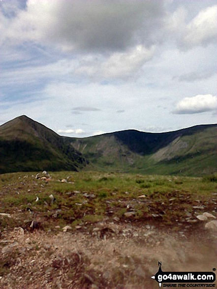
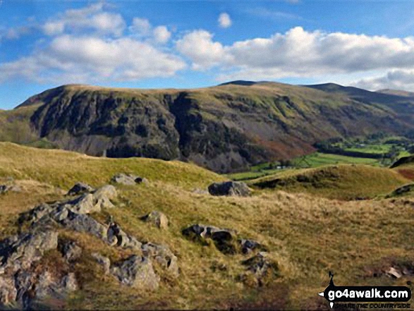
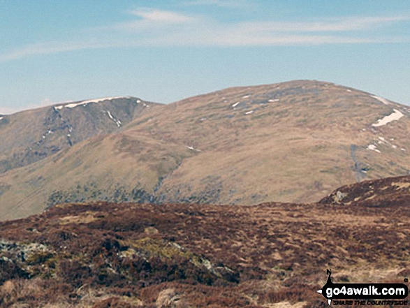
Catstye Cam, White Side and Raise (Helvellyn) from the summit of Birkhouse Moor
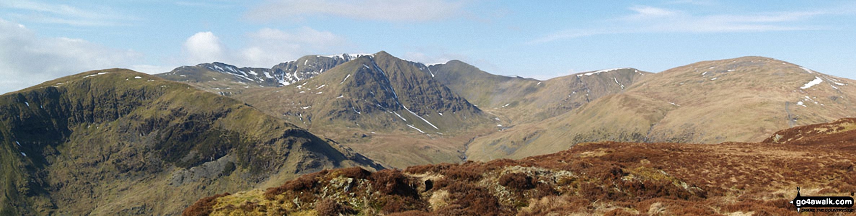
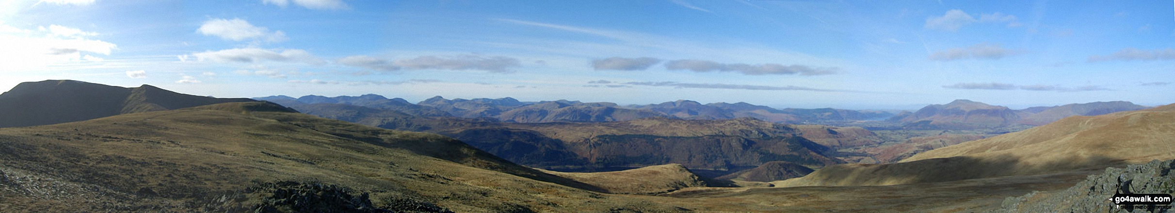
Blencathra or Saddleback (left), Clough Head, Fisher's Wife's Rake, Calfhow Pike, Great Dodd, Watson's Dodd, Stybarrow Dodd, Raise (Helvellyn) and Helvellyn in the centre with a glimpse of Thirlmere (right) from the summit of High Rigg
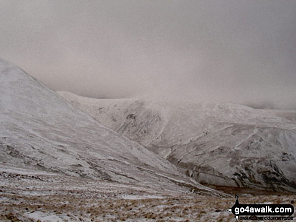
Catstye Cam (shoulder left) and Raise (Helvellyn) above Keppel Cove from Red Tarn Beck in the snow
Clough Head, Fisher's Wife's Rake, Calfhow Pike, Great Dodd, Watson's Dodd, Stybarrow Dodd, Raise (Helvellyn) and Helvellyn from the summit of High Rigg
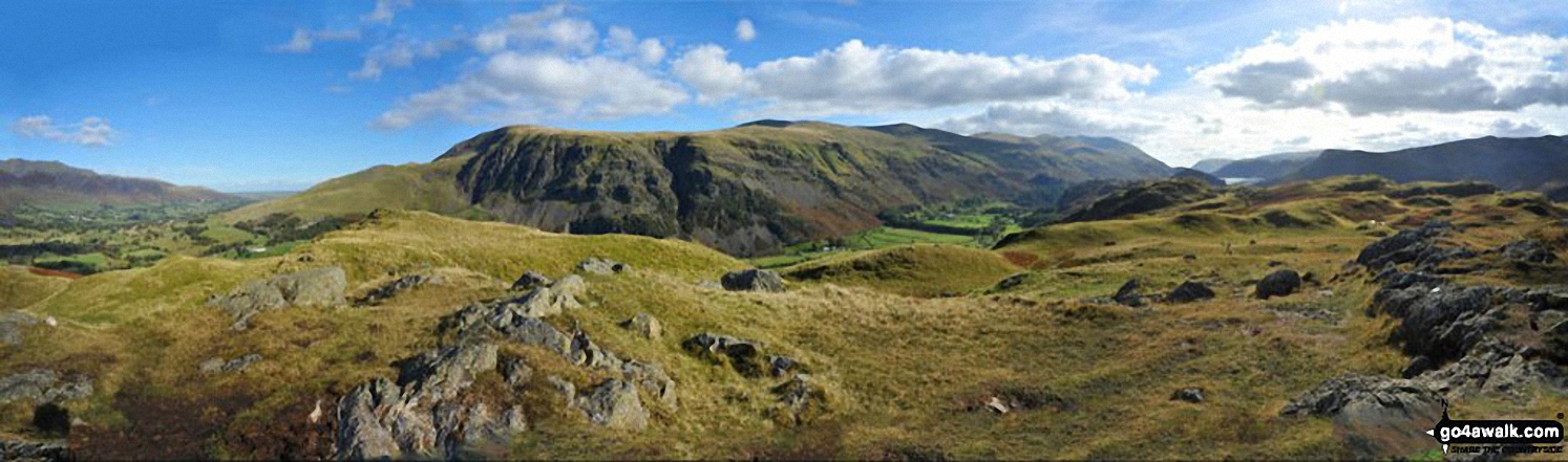
Birkhouse Moor (foreground left), Catstye Cam (foreground centre), White Side (centre right) and Raise (Helvellyn) (right) with Striding Edge (High Spying How), Helvellyn and Lower Man (Helvellyn) in the background from Sheffield Pike
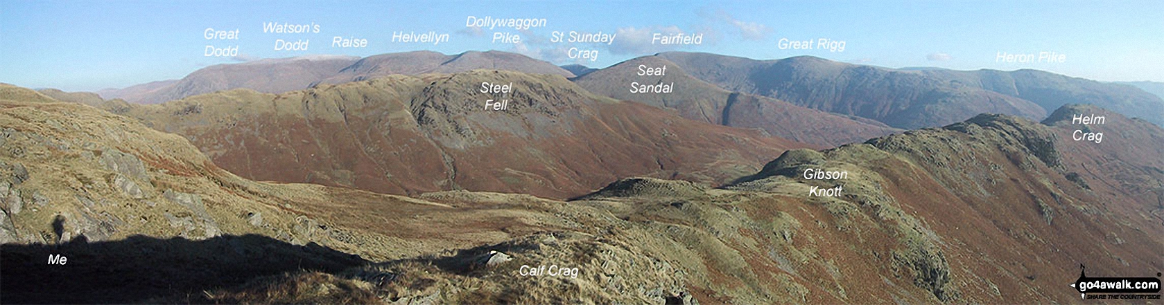
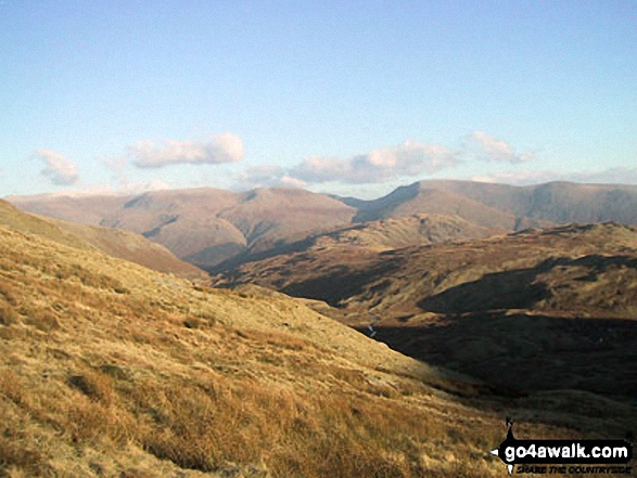
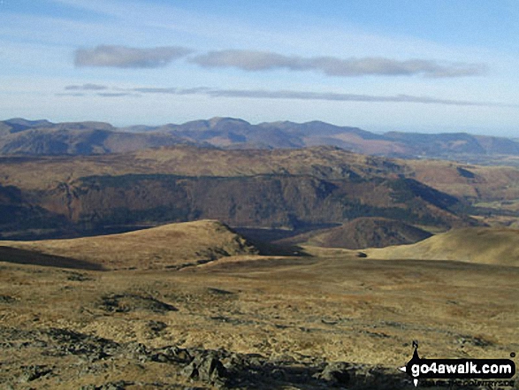
The Helvellyn Ridge featuring: Great Dodd, Watson's Dodd, Stybarrow Dodd, Raise (Helvellyn), White Side, Helvellyn, Nethermost Pike, Dollywaggon Pike, St Sunday Crag, Fairfield, Great Rigg and Heron Pike with Steel Fell (mid distance) and Calf Crag, Gibson Knott and Helm Crag (foreground) from Brownrigg Moss
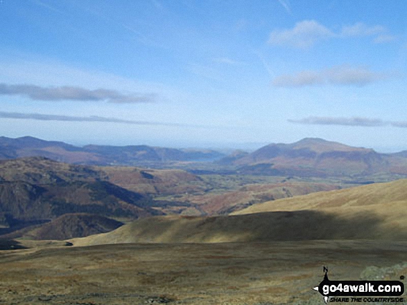
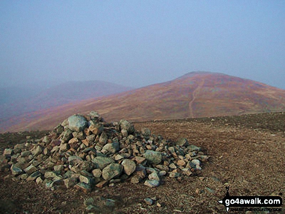
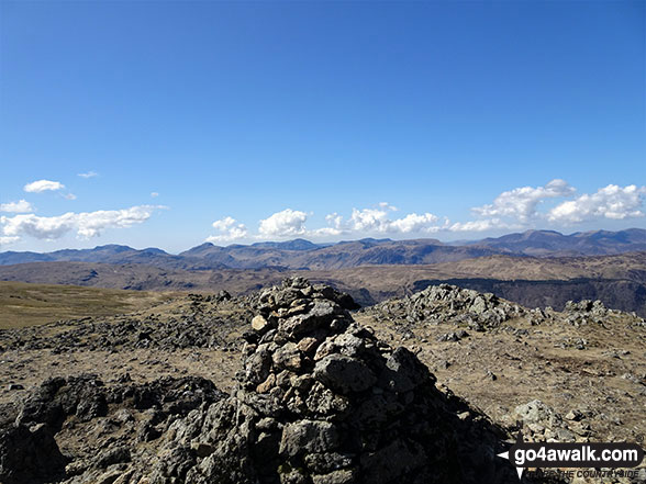
*The Helvellyn summit ridge, Whiteside, Thirlmere and Watson's Dodd from Raise (Helvellyn) summit
Send us your photographs and pictures on, of, or from Raise (Helvellyn)
If you would like to add your walk photographs and pictures featuring views from, on or of Raise (Helvellyn) to this page, please send them as email attachments (configured for any computer) along with your name to:
and we shall do our best to publish them.
(Guide Resolution = 300dpi. At least = 660pixels (wide) x 440 pixels (high).)

You can also submit photos via our Facebook Page.
NB. Please indicate where each photo was taken and whether you wish us to credit your photos with a Username or your First Name/Last Name.
Not familiar with this top?


