
![]()
Hallin Fell
388m (1273ft)
The Far Eastern Fells, The Lake District, Cumbria, England
Not familiar with this top?
   |
|---|
Vital Statistics:
| Length: | 4.75ml (7.5km) |
|---|---|
| Ascent: | 1,292ft (394m) |
| Time: | 3 hrs |
| Grade: |  (Moderate) (Moderate) |
Route Summary:
Howtown - St Peter's Church - Hallin Fell - Geordie's Crag - Hallinhag Wood - Sandwick - Sandwick Beck - Howtown
See Hallin Fell and the surrounding tops on our free-to-access 'Google Style' Peak Bagging Maps:
The Far Eastern Fells of The Lake District National Park
Less data - quicker to download
The Whole of The Lake District National Park
More data - might take a little longer to download
See Hallin Fell and the surrounding tops on our downloadable Peak Bagging Maps in PDF format:

NB: Whether you print off a copy or download it to your phone, these PDF Peak Baggers' Maps might prove incredibly useful when your are up there on the tops and you cannot get a phone signal.
*This version is marked with the walk routes you need to follow to Walk all 214 Wainwrights in just 59 walks.
You can find Hallin Fell & all the walks that climb it on these unique free-to-access Interactive Walk Planning Maps:
1:25,000 scale OS Explorer Map (orange/yellow covers):
1:50,000 scale OS Landranger Map (pink/magenta covers):
 Fellow go4awalkers who have already walked, climbed, summited & bagged Hallin Fell
Andrew Gayne walked up Hallin Fell on September 6th, 2025 [from/via/route] Howtown Pier [with] Becky Gayne, Will, Dan, Ben & Meg [weather] A cloudy but relatively warm day with the sun breaking out occasionally - Stayed at Graythwaite estate Friday through to Monday. Drove across to Glenridding & caught a steamer to Howtown completing the lakeside walk back to Glenridding with a detour up Hallin Fell
Geoff Hand climbed Hallin Fell on July 25th, 2025 [from/via/route] Walk 304. Walked from St Peters Church to Christy Bridge then along the ridge to Beda Head, carried on South from there to Angletarn Pikes,(2 pikes) then heading North Again & upto Place Fell. Down & up took us to High Dodd then down to Sandwick & into Hallinhag Wood. We finally climbed through the ferns to reachHallin Fell. [with] Richard MaCillwaine. [weather] Cloud increasing as the morning progressed ending up foggy & drissly on Place fell, then clearing as we reduced height. - Last of the fells completed in the Far East section.
James Hughes bagged Hallin Fell on March 16th, 2025 [from/via/route] c304 Return to complete Beda Head round - High Dodd, Place Fell & Hallin Fell [weather] Clear, cold & blustery. - Walked in morning to avoid deterioration in weather in afternoon. Steady climb over High Dodd to Place Fell. Descent into Boredale valley & finish up Hallin Fell. Pint of Wainwright in the Sun - Pooley Bridge. Saw a Red Squirrel.
Christine Shepherd hiked Hallin Fell on February 19th, 2010 [from/via/route] From Howtown [with] On my own [weather] Very cold but clear - Bagged this fell onto a day in which I had bagged a very icy Angletarn Pikes. Climbed again on a lovely day, 24.7.20 from St Peter's Church after a long walk above Ullswater. Climbed for a third time on 30.01.23 after doing walk c112. Made a fourth ascent after getting off the ferry before walking back to Glennridding on the Ullswater Way on 30.1.25
Ian Ashton summited Hallin Fell on August 2nd, 2024 [with] Solo - Ì
Mr M A Blanchard conquered Hallin Fell on April 23rd, 2024 [from/via/route] With all the mutts apart from Ted [with] Florence, Millie and Woodie [weather] Cold, bright
Claire Kirk scaled Hallin Fell on June 3rd, 2023 [from/via/route] Martindale [with] Alone
Claire Rigg walked up Hallin Fell on February 18th, 2024 [with] Heidi [weather] Sunny
Andrew Peate climbed Hallin Fell on August 15th, 2023 [from/via/route] From Howton off Ullswater Steamer [weather] Clear, breezy
Adrian Howard bagged Hallin Fell on June 5th, 2023 [from/via/route] From St Peter's Church & straight up & down, then onto Steel Knotts (Pikewassa)
To add (or remove) your name and experiences on this page - Log On and edit your Personal Mountain Bagging Record
. . . [see more walk reports]
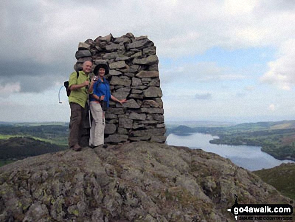
More Photographs & Pictures of views from, on or of Hallin Fell
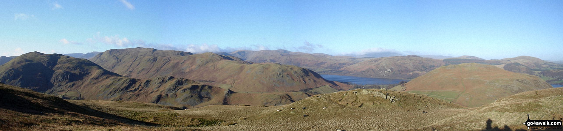
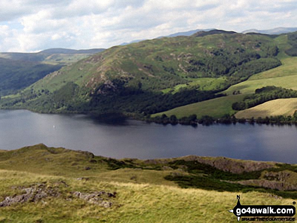
*Beda Head (Beda Fell) with Place Fell beyond (left), Ullswater and Hallin Fell (right) from Steel Knotts (Pikeawassa)
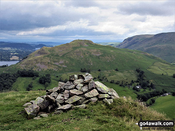
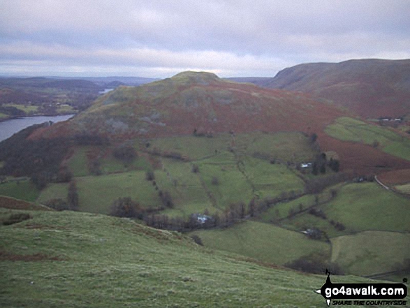
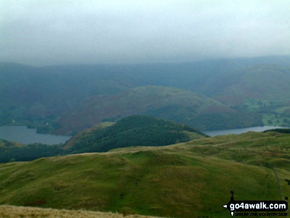
Hallin Fell from a viewpoint on the descent from High Dodd (Sleet Fell)
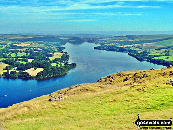
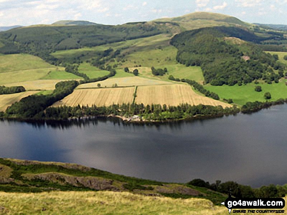
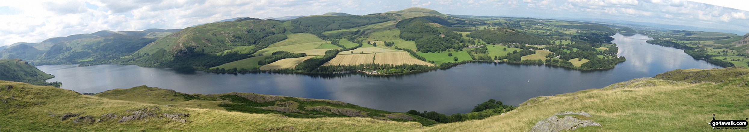
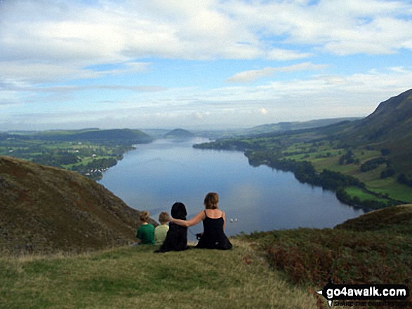
Ullswater featuring Patterdale & Glenridding (left), Gowbarrow Fell (Airy Crag) (centre left), Great Mell Fell (centre), Little Mell Fell (centre right) and Pooley Bridge (right) from Hallin Fell summit
Send us your photographs and pictures on, of, or from Hallin Fell
If you would like to add your walk photographs and pictures featuring views from, on or of Hallin Fell to this page, please send them as email attachments (configured for any computer) along with your name to:
and we shall do our best to publish them.
(Guide Resolution = 300dpi. At least = 660pixels (wide) x 440 pixels (high).)

You can also submit photos via our Facebook Page.
NB. Please indicate where each photo was taken and whether you wish us to credit your photos with a Username or your First Name/Last Name.
Not familiar with this top?


