
![]()
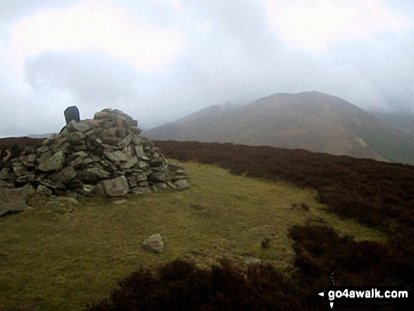
Graystones
452m (1483ft)
The North Western Fells, The Lake District, Cumbria, England

Not familiar with this top?
You can walk/hike to the top of Graystones by using either of these 2 easy‑to‑follow route maps:
Walk c183 Lord's Seat and Graystones from Whinlatter Forest Park
Lovely walk on some of the quieter fells
   |
|---|
Vital Statistics:
| Length: | 10ml (16km) |
|---|---|
| Ascent: | 3,039ft (926m) |
| Time: | 6.75hrs |
| Grade: |  (Hard) (Hard) |

Route Summary:
Whinlatter Forest Park - Thwaitehill Knotts - Beckstone Plantation - Beckstone Gill - Barf - Lord's Seat (Whinlatter) - Broom Fell - Graystones - Scawgill Bridge - Whinlatter (Brown How) - Whinlatter (Whinlatter Top) - Whinlatter Forest Park
Walk c360 The Lorton and Wythop Fells from Whinlatter Forest Park
Long walk on some of the quieter fells
|
|---|
Vital Statistics:
| Length: | 14.5ml (23km) |
|---|---|
| Ascent: | 4,703ft (1,433m) |
| Time: | 10 hrs |
| Grade: |  (Very Hard) (Very Hard) |

Route Summary:
Whinlatter Forest Park - Thwaitehill Knotts - Beckstone Plantation - Beckstone Gill - Barf - Lord's Seat (Whinlatter) - Broom Fell - Low Burthwaite Wood - Kelswick Farm - Sale Fell - Dodd Crag - Eskin Farm - Corpse Road - Ling Fell (Wythop) - Wythop Moss - Graystones - Scawgill Bridge - Whinlatter (Brown How) - - Whinlatter (Whinlatter Top) - Whinlatter Forest Park
See Graystones and the surrounding tops on our free-to-access 'Google Style' Peak Bagging Maps:
The North Western Fells of The Lake District National Park
Less data - quicker to download
The Whole of The Lake District National Park
More data - might take a little longer to download
See Graystones and the surrounding tops on our unique, downloadable, PDF Peak Bagging Maps:

NB: Whether you print off a copy or download it to your phone, these PDF Peak Baggers' Maps might prove incredibly useful when your are up there on the tops and you cannot get a phone signal.
*This version is marked with the walk routes you need to follow to Walk all 214 Wainwrights in just 59 walks.
You can find Graystones & all the walks that climb it on these unique free-to-access Interactive Walk Planning Maps:
1:25,000 scale OS Explorer Map (orange/yellow covers):
1:50,000 scale OS Landranger Maps (pink/magenta covers):
 Fellow go4awalkers who have already walked, climbed, scaled, summited, hiked & bagged Graystones
Paul Roddam walked up Graystones on September 28th, 2025 [with] Barb [weather] glorious
James Hughes climbed it on June 11th, 2025 [from/via/route] c183 Lord's Seat & Graystones from Whinlatter Forest [weather] Warm sunny day - Walk from Whinlatter Forest car park (expensive). Difficult working out tracks up towards Barf & ended up going to Lord's Seat first, which involved out & back to Barf. Fairly easy ascent across to Broom Fell. Short steep climb up to Graystones & steep descent to halfway path into forest. Wound way up to Whinlatter, but route not clear. Involved steep ascent on trods to find ridge path - not great. Path continues to forest fence then back to start. Pint at Coledale Inn - Force Crag.
Caroline Winter bagged it on April 6th, 2025 [from/via/route] Spout force CP, forest road, Lords Seat, Barf, Broom Fell, Graystones [with] Yusef [weather] Great spell of warm weather- 16 degrees. - Steep descent
Martin Hartshorne hiked Graystones on February 13th, 2025 [from/via/route] Spout force car park [with] finley [weather] Clear hill tops, bit grey & bitterly cold. Sunny breaks later in the day
David Higginbottom summited on January 31st, 2025 [with] Carolyn [weather] Misty & cold - Nice walk , doing as missed when we did the loop by mistake
To add (or remove) your name and experiences on this page - Log On and edit your Personal Mountain Bagging Record
. . . [see more walk reports]
More Photographs & Pictures of views from, on, or of, Graystones

Looking down Lorton Vale from Graystones featuring Whiteside and Grasmoor (left - in mist) and Mellbreak (centre)


Vale of Lorton viewed from the lower southern slopes of Graystones above Darling How Plantation

Send us your photographs and pictures on, of, or from Graystones
If you would like to add your walk photographs and pictures to this page, please send them as email attachments (configured for any computer) along with your name to:
and we shall do our best to publish them.
(Guide Resolution = 300dpi. At least = 660pixels (wide) x 440 pixels (high).)

You can also submit photos via our Facebook Page.
NB. Please indicate where each photo was taken and whether you wish us to credit your photos with a Username or your First Name/Last Name.


