
![]()
Fendrith Hill
697m (2287ft)
The North Pennines, County Durham, England
Tap/mouse over a coloured circle (1-3 easy walks, 4-6 moderate walks, 7-9 hard walks) and click to select.
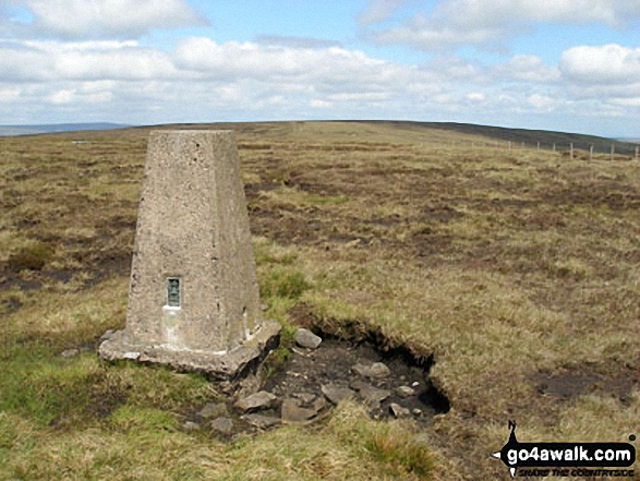
The summit of Fendrith Hill is marked by an Ordnance Survey Trig Point.
Not familiar with this top?
   |
|---|
Vital Statistics:
| Length: | 9ml (14.5km) |
|---|---|
| Ascent: | 1,651ft (503m) |
| Time: | 5 hrs |
| Grade: |  (Moderate) (Moderate) |
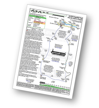
Route Summary:
St John's Chapel - Thatch Mires - Chapelfell Top - Fendrith Hill - Swinhope Moor - Dora's Seat - Swinhope Head - Swinside House - Daddry Shield - River Wear - Weardale - The Weardale Way - St John's Chapel
|
|---|
Vital Statistics:
| Length: | 14ml (22.5km) |
|---|---|
| Ascent: | 1,979ft (603m) |
| Time: | 7 hrs |
| Grade: |  (Hard) (Hard) |
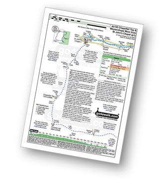
Route Summary:
St John's Chapel - Thatch Mires - Chapelfell Top - Fendrith Hill - Swinhope Moor - Dora's Seat - Swinhope Head - Westernhope Moor - Black Hill (Westernhope Moor) - Littlewood Farm - Brotherlee - Shield - River Wear - Weardale - The Weardale Way - Westgate - Daddry - St John's Chapel
See Fendrith Hill and the surrounding tops on our free-to-access 'Google Style' Peak Bagging Map:
The North Pennines
Less data - quicker to download
See Fendrith Hill and the surrounding tops on our downloadable Peak Bagging Map in PDF format:

NB: Whether you print off a copy or download it to your phone, this PDF Peak Baggers' Map might prove incredibly useful when your are up there on the tops and you cannot get a phone signal.
You can find Fendrith Hill & all the walks that climb it on these unique free-to-access Interactive Walk Planning Maps:
1:25,000 scale OS Explorer Map (orange/yellow covers):
1:50,000 scale OS Landranger Maps (pink/magenta covers):
 Fellow go4awalkers who have already walked, climbed, summited & bagged Fendrith Hill
Kevin Foster walked up Fendrith Hill on September 15th, 2018 [from/via/route] Walk du145 from Saint John's Chapel. [with] Henry. [weather] Sunny to start but then clouded over. - The walk begins with a direct but very pleasant approach to Chapelfell Top via a lane immediately behind the Golden Lion pub. After the lane is left the going does get tough for a while but eases a bit when the man made gulley cut through the peat hags directs you to the small summit cairn itself. This gutter which is very wide in places is then followed to a shallow col & a slight rise of barely 50 feet to the next top, Fendrith Hill,which has The nicest views of the whole walk into Teesdale. The second half of the walk over Westernhope Moor & the descent over Black Hill is a bit of a slog but the return along the river Wear to the starting point following the Weardale Way more than compensates for it.
Mark Davidson climbed Fendrith Hill on May 25th, 2007 [with] Alone [weather] Sunny, warm & dry - just lovely
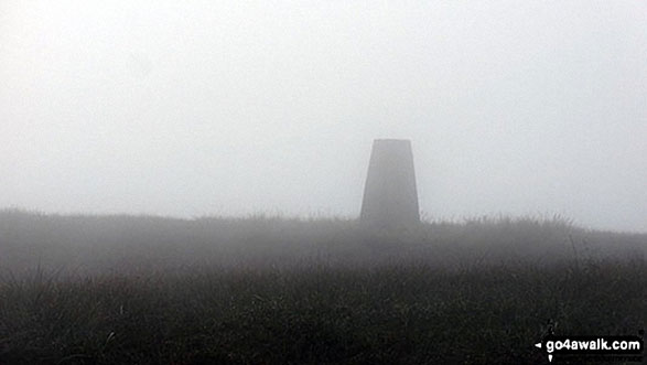
Christine Shepherd bagged Fendrith Hill on September 14th, 2016 [from/via/route] Walked from St. John's Chapel using walks du 145 & du129 [with] On my own [weather] Warm but thick mist all day. - This summit is easy to find from Chapel Fell Top with the help of a wide gully & a fence that leads all the way to the trig point. No view today.
Ray O'hara hiked Fendrith Hill on February 4th, 2013 [weather] Ground frozen, 60MPH winds,
Patrick Rogozinski, Paul Booth and Trevor Williams have all walked, climbed & bagged Fendrith Hill.
To add (or remove) your name and experiences on this page - Log On and edit your Personal Mountain Bagging Record
More Photographs & Pictures of views from, on or of Fendrith Hill
Send us your photographs and pictures on, of, or from Fendrith Hill
If you would like to add your walk photographs and pictures featuring views from, on or of Fendrith Hill to this page, please send them as email attachments (configured for any computer) along with your name to:
and we shall do our best to publish them.
(Guide Resolution = 300dpi. At least = 660pixels (wide) x 440 pixels (high).)

You can also submit photos via our Facebook Page.
NB. Please indicate where each photo was taken and whether you wish us to credit your photos with a Username or your First Name/Last Name.
Not familiar with this top?


