![]()
Sugar Loaf (Horse Head Moor)
609m (1999ft)
The Southern Dales Area, The Yorkshire Dales, North Yorkshire, England England
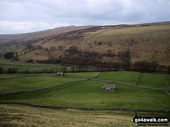
Littondale with Horse Head Moor beyond from Wilson's Pasture on the lower slopes of Darnbrook Fell
Not familiar with this top?
   |
|---|
Vital Statistics:
| Length: | 12.5ml (20km) |
|---|---|
| Ascent: | 2,099ft (640m) |
| Time: | 6.75hrs |
| Grade: |  (Moderate) (Moderate) |
Route Summary:
Buckden - Rakes Wood - Buckden Rake - Cray Gill - Cray - Crook Gill - Todd's Wood - Scar House - Strans Gill - Strans Wood - Yockenthwaite - Horse Head (Horse Head Moor) - Sugar Loaf (Horse Head Moor) - High Combe Stoop - Birks Fell - Birks Tarn - Firth Fell - Redmire Farm - Buckden
See Sugar Loaf (Horse Head Moor) and the surrounding tops on our free-to-access 'Google Style' Peak Bagging Maps:
The Southern Dales Area of The Yorkshire Dales National Park
Less data - quicker to download
The Whole of The Yorkshire Dales National Park
More data - might take a little longer to download
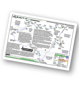
See Sugar Loaf (Horse Head Moor) and the surrounding tops on our downloadable Peak Bagging Map in PDF format:

NB: Whether you print off a copy or download it to your phone, this PDF Peak Baggers' Map might prove incredibly useful when your are up there on the tops and you cannot get a phone signal.
You can find Sugar Loaf (Horse Head Moor) & all the walks that climb it on these unique free-to-access Interactive Walk Planning Maps:
1:25,000 scale OS Explorer Map (orange/yellow covers):
1:50,000 scale OS Landranger Map (pink/magenta covers):
 Fellow go4awalkers who have already walked, climbed, summited & bagged Sugar Loaf (Horse Head Moor)
Mark Davidson walked up it on March 18th, 2004 [from/via/route] Walk ny153 Sugar Loaf (Horse Head Moor) & Firth Fell from Buckden [with] Alone [weather] Bit rainy & swirly mist
Christine Shepherd climbed it on January 28th, 2019 [from/via/route] Walked from Yockenthwaite, up the bridleway from Raise Gill, North along the ridge & then down into Beckermonds & back to Yockenthwaite on The Dale's Way. [with] On my own [weather] Glorious winter sunshine & blue skies but very, very cold on the summit & along the ridge path. - A really enjoyable walk with wonderful views of the three peaks covered in snow. I could even see the Lake District today.
Margaret Richards bagged it on August 18th, 2016 [from/via/route] Langstrothdale via Horse Head Moor from Halton Gill [with] Don
Tony Rogerson hiked it on June 1st, 2014 [from/via/route] Halton Gill & Langstrothdale [with] Darren Floss Robbie & Ruby [weather] Sunny
Darren Mortimer summited on July 25th, 2015 [from/via/route] Hubberholme [with] Dermot Palmer [weather] Warm & sunny
Patrick Rogozinski has walked, climbed & bagged Sugar Loaf (Horse Head Moor).
To add (or remove) your name and experiences on this page - Log On and edit your Personal Mountain Bagging Record
More Photographs & Pictures of views from, on or of Sugar Loaf (Horse Head Moor)
Send us your photographs and pictures on, of, or from Sugar Loaf (Horse Head Moor)
If you would like to add your walk photographs and pictures to this page, please send them as email attachments (configured for any computer) along with your name to:
and we shall do our best to publish them.
(Guide Resolution = 300dpi. At least = 660pixels (wide) x 440 pixels (high).)

You can also submit photos via our Facebook Page.
NB. Please indicate where each photo was taken and whether you wish us to credit your photos with a Username or your First Name/Last Name.
Not familiar with this top?