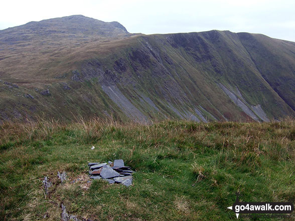
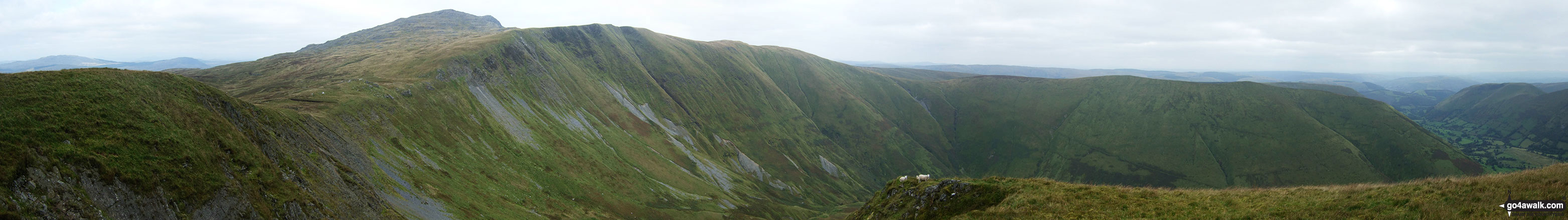
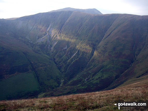
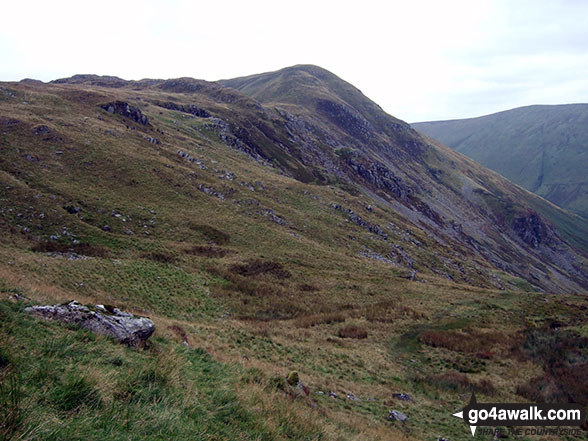
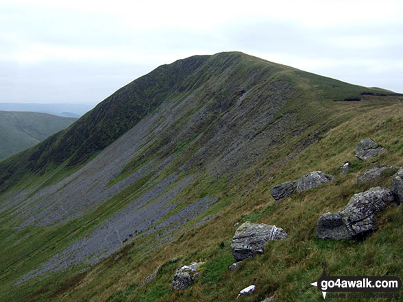
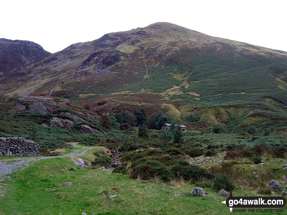
Mountain (Hewitt) & Nuttall Icon

Gwaun y Llwyni
685m (2247ft)


The Arans, Gwynedd, Wales

*Gwaun y Llwyni is actually just outside of The National Park Boundary


Record Gwaun y Llwyni as Bagged, Climbed & Conquered

Welsh Mountain Icon

Welsh Mountain
76th highest in Wales,
189th in England & Wales

Welsh Nuttall Icon

Welsh Nuttall
100th highest in Wales,
247th in England & Wales

Walk Gwaun y Llwyni walking UK Mountains in The Arans Snowdonia National Park*<br> Gwyneddn, Wales

The small pile of stones marking the summit of Gwaun y Llwyni

Photo: Mark Kissipie


Not familiar with this top?

How is Gwaun y Llwyni classified?

Download 1 easy-to-follow, circular walk that include Gwaun y Llwyni

See the location of Gwaun y Llwyni and the walk on an interactive Google Map

See the location of Gwaun y Llwyni on an interactive Google Bagging Map

See the location of Gwaun y Llwyni and the walk on our unique free-to-access Interactive Walk Planning Maps (worth a look if you've never seen these)

Read walk reports from hikers who have already bagged Gwaun y Llwyni

View more photographs & pictures of views from, on or of Gwaun y Llwyni


You can walk to the top of Gwaun y Llwyni by using this easy‑to‑follow route map:
Walking Boot Print Icon

Walk gw185 Gwaun y Llwyni, Aran Fawddwy, Erw y Ddafad-ddu, Aran Benllyn and Pen yr Allt Uchaf from Cwm Cywarch

Glorious views, gloriously quiet

Walk GPS Icon
Walk GPX Icon
Walk PDF Icon

Vital Statistics:

Length: 12ml (19km)
Ascent:4,050ft (1,234m)
Time:8½ hrs
Grade:Walk Grade 8 Icon (Hard)

See Gwaun y Llwyni and the surrounding tops on our free-to-access 'Google Style' Peak Bagging Map:

Find Google Maps Peak Bagging Map Icon

The Arans of Snowdonia National Park
Less data - quicker to download


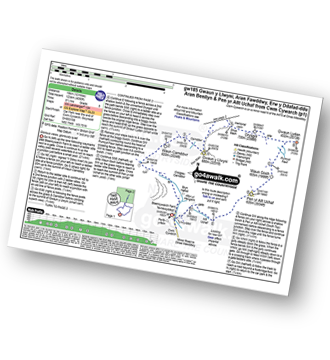
See Gwaun y Llwyni and the surrounding tops on our downloadable Peak Bagging Map in PDF format:

Find PDF Peak Bagging Map Icon

The Arans area of Snowdonia National Park

NB: Whether you print off a copy or download it to your phone, this PDF Peak Baggers' Map might prove incredibly useful when your are up there on the tops and you cannot get a phone signal.


You can find Gwaun y Llwyni & all the walks that climb it on these unique free-to-access Interactive Walk Planning Maps:


1:25,000 scale OS Explorer Map (orange/yellow covers):

OS Explorer OL23 Cadair Idris & Bala Lake/Llyn Tegid


1:50,000 scale OS Landranger Map (pink/magenta covers):

OS Landranger 124 Dolgellau & Porthmadog


Top


Other walkers who hiked, climbed, bagged and summited Gwaun y Llwyni Fellow go4awalkers who have already walked, climbed, summited & bagged Gwaun y Llwyni

Christina Lander walked up Gwaun y Llwyni on August 30th, 2024 [from/via/route] Cwm Cywarch - Waun Camddwr - Gwaun y Llwyni - Aran Fawddwy - Drysgol - Gwaun Lydan - Waun Goch - Pen yr Allt Uchaf - Cwm Cywarch [with] Dick [weather] A beautiful day, cloudy at times - Long weekend staying in Corris

Donovan Suddell climbed Gwaun y Llwyni on March 20th, 2022 [from/via/route] Cwm Cywarch [with] wife and grandson [weather] beautiful sunny weather , blustery at the top

Mark Hanley bagged Gwaun y Llwyni on July 21st, 2018 [from/via/route] Cwm Cywarch [with] alone [weather] cloudy

Mark Davidson hiked Gwaun y Llwyni on September 17th, 2009 [with] Alone [weather] Bit grey really but the tops were clear

Trevor Williams summited Gwaun y Llwyni on February 19th, 2015 [weather] wet

Robert Taylor-Marriott conquered Gwaun y Llwyni on April 11th, 2014 [from/via/route] Route 56: Waun Camddwr. Gwaun Llwyni. Gwaun Lydon. Moel y Cerrig Duon. Aran Fawddwy. (WGA) Completed 11.04.14 [with] Vince Wetton, Adam 7 Robert Taylor-Marriott. [weather] Sunny.

Vince Wetton scaled Gwaun y Llwyni on April 11th, 2014 [from/via/route] GW185 less 2 Northermost peaks [with] RTM + ADAM [weather] Lovely sunny day

Alberto Lopes walked up Gwaun y Llwyni on March 26th, 2012 [from/via/route] gw185 from Cwm Cywarch [with] Rachel [weather] sunny

Paul Booth has walked, climbed & bagged Gwaun y Llwyni.

To add (or remove) your name and experiences on this page - Log On and edit your Personal Mountain Bagging Record

Top


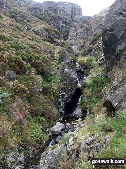
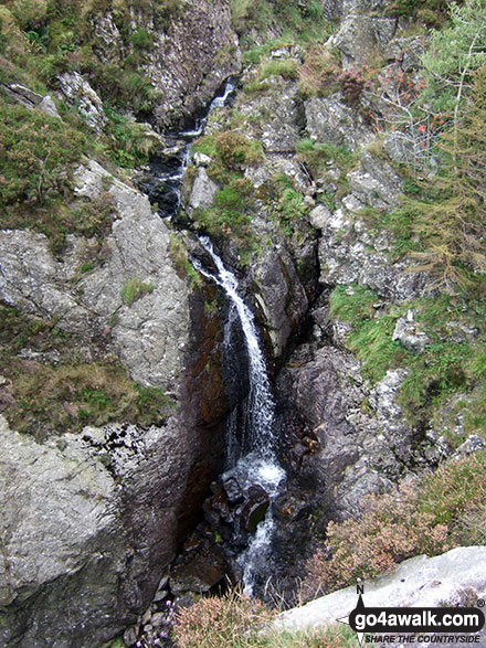
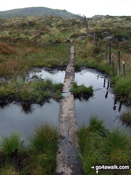
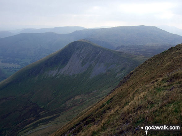
More Photographs & Pictures of views from, on or of Gwaun y Llwyni

Hafoty'r Hengwm (in the bottom  of the valley), Gwaun y Llwyni (midground) and Aran Fawddwy (background) from Waun Goch

Hafoty'r Hengwm (in the bottom of the valley), Gwaun y Llwyni (midground) and Aran Fawddwy (background) from Waun Goch

Photo: Mark Kissipie (311)

Top

Gwaun y Llwyni from the bwlch between Glasgwm and Gwaun y Llwyni

Gwaun y Llwyni from the bwlch between Glasgwm and Gwaun y Llwyni

Photo: Mark Kissipie (285)

Top

Footbridge on the approach to the bwlch between Glasgwm and Gwaun y Llwyni

Footbridge on the approach to the bwlch between Glasgwm and Gwaun y Llwyni

Photo: Mark Kissipie (279)

Top

Waterfalls on the unnamed stream up to the bwlch between Glasgwm and Gwaun y Llwyni

Waterfalls on the unnamed stream up to the bwlch between Glasgwm and Gwaun y Llwyni

Photo: Mark Kissipie (282)

Top

Panorama featuring Aran Fawddwy,  Drws Bach, Drysgol, Gwaun Lydan, Waun Goch and Pen yr Allt Uchaf from the summit of Gwaun y Llwyni

Panorama featuring Aran Fawddwy, Drws Bach, Drysgol, Gwaun Lydan, Waun Goch and Pen yr Allt Uchaf from the summit of Gwaun y Llwyni

Photo: Mark Kissipie (291)

Top

Gwaun y Llwyni from the north

Gwaun y Llwyni from the north

Photo: Mark Kissipie (292)

Top

Ruin on the bwlch between Glasgwm and Gwaun y Llwyni

Ruin on the bwlch between Glasgwm and Gwaun y Llwyni

Photo: Mark Kissipie (284)

Top

More (very welcome) duckboards between Waun Camddwr and Gwaun y Llwyni

More (very welcome) duckboards between Waun Camddwr and Gwaun y Llwyni

Photo: Mark Kissipie (289)

Top

Gwaun y Llwyni (with Glasgwm in the distance right) from the RAF Memorial on Drws Bach

Gwaun y Llwyni (with Glasgwm in the distance right) from the RAF Memorial on Drws Bach

Photo: Mark Kissipie (305)

Top

Gwaun y Llwyni from the head of Cwm Cywarch

Gwaun y Llwyni from the head of Cwm Cywarch

Photo: Mark Kissipie (275)

Top

Looking back down to Cwm Cywarch from the bwlch between Glasgwm and Gwaun y Llwyni

Looking back down to Cwm Cywarch from the bwlch between Glasgwm and Gwaun y Llwyni

Photo: Mark Kissipie (283)

Top

Following this unnamed stream up to the bwlch between Glasgwm and Gwaun y Llwyni

Following this unnamed stream up to the bwlch between Glasgwm and Gwaun y Llwyni

Photo: Mark Kissipie (281)

Top

Following this unnamed stream up to the bwlch between Glasgwm and Gwaun y Llwyni

Following this unnamed stream up to the bwlch between Glasgwm and Gwaun y Llwyni

Photo: Mark Kissipie (280)

Top


Send us your photographs and pictures on, of, or from Gwaun y Llwyni

If you would like to add your walk photographs and pictures featuring views from, on or of Gwaun y Llwyni to this page, please send them as email attachments (configured for any computer) along with your name to:


and we shall do our best to publish them.

(Guide Resolution = 300dpi. At least = 660pixels (wide) x 440 pixels (high).)

Send us your photographs and pictures on, of, or from Gwaun y Llwyni via Facebook

You can also submit photos via our Facebook Page.

NB. Please indicate where each photo was taken and whether you wish us to credit your photos with a Username or your First Name/Last Name.

Top


Not familiar with this top?

How is Gwaun y Llwyni classified?

Download 1 easy-to-follow, circular walk that include Gwaun y Llwyni

See the location of Gwaun y Llwyni and the walk on an interactive Google Map

See the location of Gwaun y Llwyni on an interactive Google Bagging Map

See the location of Gwaun y Llwyni and the walk on our unique free-to-access Interactive Walk Planning Maps (worth a look if you've never seen these)

Read walk reports from hikers who have already bagged Gwaun y Llwyni

View more photographs & pictures of views from, on or of Gwaun y Llwyni


Follow go4awalk.com on Twitter Follow go4awalk.com on Facebook


Home


Find new Friends to go walking with

Walk all 214 Wainwrights in just 59 Walks. Download GPS Waypoints - Great Walks you must not miss!

Walk The Yorkshire Three Peaks Challenge Walk - All the Latest Route Information, GPS Waypoints and Split Times to keep you on Schedule

Walk The British Three Peaks Challenge Walk - All the Latest Route Information and GPS Waypoints

See our pick of The Best Walks in The Lake District - Great Walks you must not miss!

Walk our pick of the Best Lake District Ridge Walks - Great Walks you must not miss!

Walk our pick of the Best Lake District Walks to do in the rain - Great Walks you must not miss!

Walk our pick of The Best Walks in Snowdonia - Great Walks you must not miss!

Walk our pick of The Best Ridge Walks in Wales - Walks you must not miss!

Walk our pick of The Best Walks in The Brecon Beacons - Great Walks you must not miss!

Walk our pick of The Best Walks in The Yorkshire Dales - Walks you must not miss!

Walk our pick of The Best Walks in The Peak District - Walks you must not miss!

Walk our pick of The Best Walks in The Forest of Bowland - Walks you must not miss!

Walk our pick of The Best Walks in Shropshire - Walks you must not miss!

Walk our pick of The Best Walks in Cheshire - Walks you must not miss!

Walk our pick of The Best Walks in Lancashire - Walks you must not miss!

Not sure where to walk next? Try Peak Bagging - Great Walks you must not miss!

Not sure where to walk next? Walk part of a National Trail - Great Walks you must not miss!

Walks with Downloadable and Uploadable GPS Waypoint Data

Walking Kit and Gear Tested by Walkers

Full Site Search