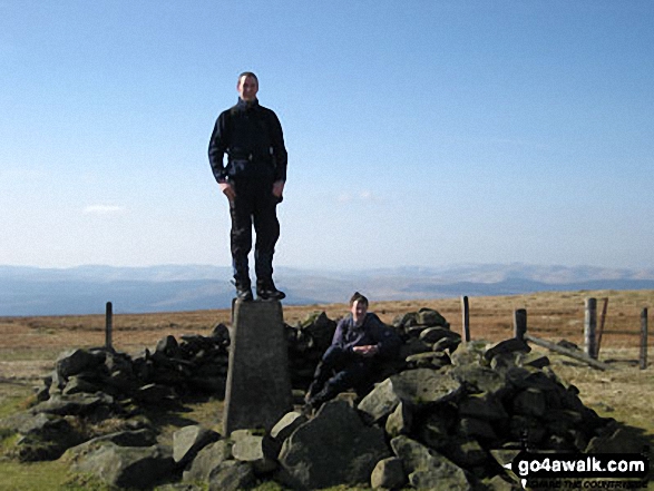
All The Mountains, Peaks, Tops and Hills in Scottish Region 27: Scottish Region 27: The Scottish Borders as a detailed list

Scottish Region 27: The Scottish Borders region is the area enclosed by an imaginary line connecting:


If you count only the Donalds there are 45 tops to climb, bag & conquer and the highest point is Broad Law at 840m (2,757ft).

munro
0/0
Munros

corbett
3/0
Corbetts

graham
11/0
Grahams

donald
45/0
Donalds

murdo
0/0
Murdos

marilyn
62/0
Scottish
Marilyns

Bridget
26/0
Scottish
Bridgets

Trig Point
66/0
Trig
Points


To see all Mountains, Peaks, Tops and Hills displayed in different ways - see the options in the left-hand column and towards the bottom of this page.


LOG ON and RELOAD this page to show which Mountains, Peaks, Tops and Hills you have already climbed, bagged & conquered [. . . more]


Page 1 of 2    Go to page: 1 2


See this list in: Alphabetical Order‡ | Height Order
To reverse the order select the link again.


Mountain, Peak, Top or Hill:

Bagged


1. Windy Gyle

619m (2,031ft)

  • Mountain (169th in England, 296th in England & Wales)
  • Nuttall (236th in England, 411th in England & Wales)
  • Donald (85th)
  • OS Trig Point
  • Since Windy Gyle lies on the border between England & Scotland it has the distinction of being classified as an English Mountain (Hewitt), an English Nuttall and a Scottish Donald.


    To walk, climb & bag Windy Gyle use any of these easy to follow walks:

    Google Maps Icon
    See the location of Windy Gyle and walks up it on a google Map

    Windy Gyle is on interactive maps:

  • OS Explorer (Orange Covers): OL16
  • OS Landranger (Pink Covers): 80

  • A go4awalk.com Peak Bagging Map and Hill Tick List featuring Windy Gyle will be available soon.


    2. Windlestraw Law

    659m (2,163ft)

  • Graham (160th)
  • Donald (60th)
  • Marilyn (586th in Scotland, 676th in GB)
  • OS Trig Point

  • We hope to have walks that climb & bag Windlestraw Law very soon

    Google Maps Icon
    See the location of Windlestraw Law and walks up it on a google Map

    Windlestraw Law is on interactive maps:

  • OS Explorer (Orange Covers): 337
  • OS Landranger (Pink Covers): 73

  • A go4awalk.com Peak Bagging Map and Hill Tick List featuring Windlestraw Law will be available soon.


    3. Wind Fell

    665m (2,183ft)

  • Donald (56th)

  • We hope to have walks that climb & bag Wind Fell very soon

    Google Maps Icon
    See the location of Wind Fell and walks up it on a google Map

    Wind Fell is on interactive maps:

  • OS Explorer (Orange Covers): 330
  • OS Landranger (Pink Covers): 79

  • A go4awalk.com Peak Bagging Map and Hill Tick List featuring Wind Fell will be available soon.


    4. Whitehope Law

    623m (2,045ft)

  • Donald (79th)

  • We hope to have walks that climb & bag Whitehope Law very soon

    Google Maps Icon
    See the location of Whitehope Law and walks up it on a google Map

    Whitehope Law is on interactive maps:

  • OS Explorer (Orange Covers): 337
  • OS Landranger (Pink Covers): 73

  • A go4awalk.com Peak Bagging Map and Hill Tick List featuring Whitehope Law will be available soon.


    5. Whitehope Heights

    637m (2,091ft)

  • Donald (73rd)

  • We hope to have walks that climb & bag Whitehope Heights very soon

    Google Maps Icon
    See the location of Whitehope Heights and walks up it on a google Map

    Whitehope Heights is on interactive maps:

  • OS Explorer (Orange Covers): 330
  • OS Landranger (Pink Covers): 78

  • A go4awalk.com Peak Bagging Map and Hill Tick List featuring Whitehope Heights will be available soon.


    6. White Coomb

    821m (2,695ft)

  • Corbett (123rd)
  • Donald (4th)
  • Marilyn (326th in Scotland, 351st in GB)

  • We hope to have walks that climb & bag White Coomb very soon

    Google Maps Icon
    See the location of White Coomb and walks up it on a google Map

    White Coomb is on interactive maps:

  • OS Explorer (Orange Covers): 330
  • OS Landranger (Pink Covers): 79

  • A go4awalk.com Peak Bagging Map and Hill Tick List featuring White Coomb will be available soon.


    7. Under Saddle Yoke

    745m (2,445ft)

  • Donald (16th)

  • To walk, climb & bag Under Saddle Yoke use this easy to follow walk:

    Google Maps Icon
    See the location of Under Saddle Yoke and walks up it on a google Map

    Under Saddle Yoke is on interactive maps:

  • OS Explorer (Orange Covers): 330
  • OS Landranger (Pink Covers): 78

  • A go4awalk.com Peak Bagging Map and Hill Tick List featuring Under Saddle Yoke will be available soon.


    8. Tinto

    711m (2,333ft)

  • Graham (78th)
  • Donald (29th)
  • Marilyn (504th in Scotland, 563rd in GB)
  • OS Trig Point

  • We hope to have walks that climb & bag Tinto very soon

    Google Maps Icon
    See the location of Tinto and walks up it on a google Map

    Tinto is on interactive maps:

  • OS Explorer (Orange Covers): 335
  • OS Landranger (Pink Covers): 72

  • A go4awalk.com Peak Bagging Map and Hill Tick List featuring Tinto will be available soon.


    9. Talla Cleuch Head

    690m (2,265ft)

  • Donald (40th)

  • We hope to have walks that climb & bag Talla Cleuch Head very soon

    Google Maps Icon
    See the location of Talla Cleuch Head and walks up it on a google Map

    Talla Cleuch Head is on interactive maps:

  • OS Explorer (Orange Covers): 330
  • OS Landranger (Pink Covers): 72

  • A go4awalk.com Peak Bagging Map and Hill Tick List featuring Talla Cleuch Head will be available soon.


    10. Swatte Fell

    729m (2,393ft)

  • Donald (22nd)

  • To walk, climb & bag Swatte Fell use this easy to follow walk:

    Google Maps Icon
    See the location of Swatte Fell and walks up it on a google Map

    Swatte Fell is on interactive maps:

  • OS Explorer (Orange Covers): 330
  • OS Landranger (Pink Covers): 78

  • A go4awalk.com Peak Bagging Map and Hill Tick List featuring Swatte Fell will be available soon.


    11. Stob Law

    676m (2,219ft)

  • Donald (49th)

  • We hope to have walks that climb & bag Stob Law very soon

    Google Maps Icon
    See the location of Stob Law and walks up it on a google Map

    Stob Law is on interactive maps:

  • OS Explorer (Orange Covers): 337
  • OS Landranger (Pink Covers): 73

  • A go4awalk.com Peak Bagging Map and Hill Tick List featuring Stob Law will be available soon.


    12. Pykestone Hill

    737m (2,419ft)

  • Donald (19th)
  • OS Trig Point

  • We hope to have walks that climb & bag Pykestone Hill very soon

    Google Maps Icon
    See the location of Pykestone Hill and walks up it on a google Map

    Pykestone Hill is on interactive maps:

  • OS Explorer (Orange Covers): 336
  • OS Landranger (Pink Covers): 72

  • A go4awalk.com Peak Bagging Map and Hill Tick List featuring Pykestone Hill will be available soon.


    13. Molls Cleuch Dod

    785m (2,576ft)

  • Donald (12th)

  • We hope to have walks that climb & bag Molls Cleuch Dod very soon

    Google Maps Icon
    See the location of Molls Cleuch Dod and walks up it on a google Map

    Molls Cleuch Dod is on interactive maps:

  • OS Explorer (Orange Covers): 330
  • OS Landranger (Pink Covers): 79

  • A go4awalk.com Peak Bagging Map and Hill Tick List featuring Molls Cleuch Dod will be available soon.


    14. Middle Hill (Manor Hills)

    716m (2,350ft)

  • Donald (27th)

  • We hope to have walks that climb & bag Middle Hill (Manor Hills) very soon

    Google Maps Icon
    See the location of Middle Hill (Manor Hills) and walks up it on a google Map

    Middle Hill (Manor Hills) is on interactive maps:

  • OS Explorer (Orange Covers): 336
  • OS Landranger (Pink Covers): 72

  • A go4awalk.com Peak Bagging Map and Hill Tick List featuring Middle Hill (Manor Hills) will be available soon.


    15. Lochcraig Head

    800m (2,626ft)

  • Donald (9th)

  • We hope to have walks that climb & bag Lochcraig Head very soon

    Google Maps Icon
    See the location of Lochcraig Head and walks up it on a google Map

    Lochcraig Head is on interactive maps:

  • OS Explorer (Orange Covers): 330
  • OS Landranger (Pink Covers): 79

  • A go4awalk.com Peak Bagging Map and Hill Tick List featuring Lochcraig Head will be available soon.


    16. Loch Fell

    688m (2,258ft)

  • Donald (44th)
  • OS Trig Point

  • To walk, climb & bag Loch Fell use this easy to follow walk:

    Google Maps Icon
    See the location of Loch Fell and walks up it on a google Map

    Loch Fell is on interactive maps:

  • OS Explorer (Orange Covers): 330
  • OS Landranger (Pink Covers): 79

  • A go4awalk.com Peak Bagging Map and Hill Tick List featuring Loch Fell will be available soon.


    17. Hudderstone

    626m (2,055ft)

  • Donald (77th)

  • To walk, climb & bag Hudderstone use this easy to follow walk:

    Google Maps Icon
    See the location of Hudderstone and walks up it on a google Map

    Hudderstone is on interactive maps:

  • OS Explorer (Orange Covers): 336
  • OS Landranger (Pink Covers): 72

  • A go4awalk.com Peak Bagging Map and Hill Tick List featuring Hudderstone will be available soon.


    18. Hillshaw Head

    652m (2,140ft)

  • Donald (63rd)

  • We hope to have walks that climb & bag Hillshaw Head very soon

    Google Maps Icon
    See the location of Hillshaw Head and walks up it on a google Map

    Hillshaw Head is on interactive maps:

  • OS Explorer (Orange Covers): 336
  • OS Landranger (Pink Covers): 72

  • A go4awalk.com Peak Bagging Map and Hill Tick List featuring Hillshaw Head will be available soon.


    19. Herman Law

    614m (2,015ft)

  • Donald (87th)

  • To walk, climb & bag Herman Law use this easy to follow walk:

    Google Maps Icon
    See the location of Herman Law and walks up it on a google Map

    Herman Law is on interactive maps:

  • OS Explorer (Orange Covers): 330
  • OS Landranger (Pink Covers): 79

  • A go4awalk.com Peak Bagging Map and Hill Tick List featuring Herman Law will be available soon.


    20. Hart Fell (Moffat)

    808m (2,652ft)

  • Corbett (146th)
  • Donald (7th)
  • Marilyn (349th in Scotland, 376th in GB)

  • We hope to have walks that climb & bag Hart Fell (Moffat) very soon

    Google Maps Icon
    See the location of Hart Fell (Moffat) and walks up it on a google Map

    Hart Fell (Moffat) is on interactive maps:

  • OS Explorer (Orange Covers): 330
  • OS Landranger (Pink Covers): 78

  • A go4awalk.com Peak Bagging Map and Hill Tick List featuring Hart Fell (Moffat) will be available soon.


    21. Greenside Law

    643m (2,110ft)

  • Donald (70th)

  • We hope to have walks that climb & bag Greenside Law very soon

    Google Maps Icon
    See the location of Greenside Law and walks up it on a google Map

    Greenside Law is on interactive maps:

  • OS Explorer (Orange Covers): 336
  • OS Landranger (Pink Covers): 72

  • A go4awalk.com Peak Bagging Map and Hill Tick List featuring Greenside Law will be available soon.


    22. Glenrath Heights (Middle Hill)

    732m (2,402ft)

  • Donald (21st)

  • We hope to have walks that climb & bag Glenrath Heights (Middle Hill) very soon

    Google Maps Icon
    See the location of Glenrath Heights (Middle Hill) and walks up it on a google Map

    Glenrath Heights (Middle Hill) is on interactive maps:

  • OS Explorer (Orange Covers): 337
  • OS Landranger (Pink Covers): 73

  • A go4awalk.com Peak Bagging Map and Hill Tick List featuring Glenrath Heights (Middle Hill) will be available soon.


    23. Gathersnow Hill

    688m (2,258ft)

  • Graham (120th)
  • Donald (43rd)
  • Marilyn (546th in Scotland, 617th in GB)

  • We hope to have walks that climb & bag Gathersnow Hill very soon

    Google Maps Icon
    See the location of Gathersnow Hill and walks up it on a google Map

    Gathersnow Hill is on interactive maps:

  • OS Explorer (Orange Covers): 336
  • OS Landranger (Pink Covers): 72

  • A go4awalk.com Peak Bagging Map and Hill Tick List featuring Gathersnow Hill will be available soon.


    24. Garelet Dod

    698m (2,291ft)

  • Donald (32nd)

  • We hope to have walks that climb & bag Garelet Dod very soon

    Google Maps Icon
    See the location of Garelet Dod and walks up it on a google Map

    Garelet Dod is on interactive maps:

  • OS Explorer (Orange Covers): 330
  • OS Landranger (Pink Covers): 78

  • A go4awalk.com Peak Bagging Map and Hill Tick List featuring Garelet Dod will be available soon.


    25. Ettrick Pen

    692m (2,271ft)

  • Graham (112th)
  • Donald (38th)
  • Marilyn (540th in Scotland, 609th in GB)

  • We hope to have walks that climb & bag Ettrick Pen very soon

    Google Maps Icon
    See the location of Ettrick Pen and walks up it on a google Map

    Ettrick Pen is on interactive maps:

  • OS Explorer (Orange Covers): 330
  • OS Landranger (Pink Covers): 79

  • A go4awalk.com Peak Bagging Map and Hill Tick List featuring Ettrick Pen will be available soon.


    26. Erie Hill

    690m (2,265ft)

  • Donald (41st)

  • We hope to have walks that climb & bag Erie Hill very soon

    Google Maps Icon
    See the location of Erie Hill and walks up it on a google Map

    Erie Hill is on interactive maps:

  • OS Explorer (Orange Covers): 330
  • OS Landranger (Pink Covers): 78

  • A go4awalk.com Peak Bagging Map and Hill Tick List featuring Erie Hill will be available soon.


    27. Dundreich

    623m (2,045ft)

  • Donald (80th)
  • OS Trig Point

  • We hope to have walks that climb & bag Dundreich very soon

    Google Maps Icon
    See the location of Dundreich and walks up it on a google Map

    Dundreich is on interactive maps:

  • OS Explorer (Orange Covers): 337 and 344
  • OS Landranger (Pink Covers): 73

  • A go4awalk.com Peak Bagging Map and Hill Tick List featuring Dundreich will be available soon.


    28. Dun Rig

    744m (2,442ft)

  • Graham (20th)
  • Donald (17th)
  • Marilyn (445th in Scotland, 492nd in GB)
  • OS Trig Point

  • We hope to have walks that climb & bag Dun Rig very soon

    Google Maps Icon
    See the location of Dun Rig and walks up it on a google Map

    Dun Rig is on interactive maps:

  • OS Explorer (Orange Covers):
  • OS Landranger (Pink Covers): 73

  • A go4awalk.com Peak Bagging Map and Hill Tick List featuring Dun Rig will be available soon.


    29. Drumelzier Law

    668m (2,192ft)

  • Donald (54th)

  • We hope to have walks that climb & bag Drumelzier Law very soon

    Google Maps Icon
    See the location of Drumelzier Law and walks up it on a google Map

    Drumelzier Law is on interactive maps:

  • OS Explorer (Orange Covers): 336
  • OS Landranger (Pink Covers): 72

  • A go4awalk.com Peak Bagging Map and Hill Tick List featuring Drumelzier Law will be available soon.


    30. Dollar Law

    817m (2,681ft)

  • Donald (5th)

  • We hope to have walks that climb & bag Dollar Law very soon

    Google Maps Icon
    See the location of Dollar Law and walks up it on a google Map

    Dollar Law is on interactive maps:

  • OS Explorer (Orange Covers): 336
  • OS Landranger (Pink Covers): 72

  • A go4awalk.com Peak Bagging Map and Hill Tick List featuring Dollar Law will be available soon.


    Page 1 of 2    Go to page: 1 2


    View all 117 Mountains, Peaks, Tops and Hills in Scottish Region 27: The Scottish Borders:


    Is there a Mountain, Peak, Top or Hill missing from the above google map or list?

    Let us know an we will add it to our database.


    Follow go4awalk.com on Twitter Follow go4awalk.com on Facebook


    Home


    Find new Friends to go walking with

    Walk all 214 Wainwrights in just 59 Walks. Download GPS Waypoints - Great Walks you must not miss!

    Walk The Yorkshire Three Peaks Challenge Walk - All the Latest Route Information, GPS Waypoints and Split Times to keep you on Schedule

    Walk The British Three Peaks Challenge Walk - All the Latest Route Information and GPS Waypoints

    See our pick of The Best Walks in The Lake District - Great Walks you must not miss!

    Walk our pick of the Best Lake District Ridge Walks - Great Walks you must not miss!

    Walk our pick of the Best Lake District Walks to do in the rain - Great Walks you must not miss!

    Walk our pick of The Best Walks in Snowdonia - Great Walks you must not miss!

    Walk our pick of The Best Ridge Walks in Wales - Walks you must not miss!

    Walk our pick of The Best Walks in The Brecon Beacons - Great Walks you must not miss!

    Walk our pick of The Best Walks in The Yorkshire Dales - Walks you must not miss!

    Walk our pick of The Best Walks in The Peak District - Walks you must not miss!

    Walk our pick of The Best Walks in The Forest of Bowland - Walks you must not miss!

    Walk our pick of The Best Walks in Shropshire - Walks you must not miss!

    Walk our pick of The Best Walks in Cheshire - Walks you must not miss!

    Walk our pick of The Best Walks in Lancashire - Walks you must not miss!

    Not sure where to walk next? Try Peak Bagging - Great Walks you must not miss!

    Not sure where to walk next? Walk part of a National Trail - Great Walks you must not miss!

    Walks with Downloadable and Uploadable GPS Waypoint Data

    Walking Kit and Gear Tested by Walkers

    Full Site Search
    Do not miss our pick of the Best Walks in Britain