Scottish Region 26: The Southern Uplands- - a fully detailed list of all the Mountains, Peaks, Tops and Hills (Page 2 of 2)
Scottish Region 26: The Southern Uplands region is the area enclosed by an imaginary line connecting:
- Cloch Point to Glasgow via the Firth of Clyde and the River Clyde to the North
- Glasgow to Gretna Green via the River Clyde to Larkhill and then the M74 via Douglas, Moffat and Lockerbie to the North East
- Gretna Green to Mull of Galloway via the Solway Firth to the South
- Mull of Galloway to Cloch Point via the North Chanel past Portpatrick, Ballantrae, Ailsa Craig, Girvan, Ayr and Irvine and then the Firth of Clyde to the East
If you count only the Marilyns there are 60 tops to climb, bag & conquer and the highest point is Merrick at 843m (2,766ft).
To see these Mountains, Peaks, Tops and Hills displayed in different ways - see the options in the left-hand column and towards the bottom of this page.
LOG ON and RELOAD this page to show which Mountains, Peaks, Tops and Hills you have already climbed, bagged & conquered [. . . more details]
Page 2 of 2 Go to page: 1 2 |
See this list in: Alphabetical Order
| Height Order‡
To reverse the order select the link again.
Mountain, Peak, Top or Hill:
Bagged
31. Craignell
477m (1,566ft)
Craignell is on interactive maps:
A downloadable go4awalk.com PDF Peak Bagging Map featuring Craignell will be available soon. |
32. Fell of Fleet
470m (1,543ft)
Fell of Fleet is on interactive maps:
A downloadable go4awalk.com PDF Peak Bagging Map featuring Fell of Fleet will be available soon. |
33. Middlefield Law
466m (1,529ft)
Middlefield Law is on interactive maps:
A downloadable go4awalk.com PDF Peak Bagging Map featuring Middlefield Law will be available soon. |
34. Benbeoch
464m (1,523ft)
Benbeoch is on interactive maps:
A downloadable go4awalk.com PDF Peak Bagging Map featuring Benbeoch will be available soon. |
35. Cairnharrow
457m (1,499ft)
Cairnharrow is on interactive maps:
A downloadable go4awalk.com PDF Peak Bagging Map featuring Cairnharrow will be available soon. |
36. Cairn Hill (Lowther Hills)
451m (1,480ft)
Send it in and we'll publish it here.
Cairn Hill (Lowther Hills) is on interactive maps:
A downloadable go4awalk.com PDF Peak Bagging Map featuring Cairn Hill (Lowther Hills) will be available soon. |
37. Beneraird
439m (1,441ft)
Beneraird is on interactive maps:
A downloadable go4awalk.com PDF Peak Bagging Map featuring Beneraird will be available soon. |
38. Bogrie Hill
432m (1,418ft)
Bogrie Hill is on interactive maps:
A downloadable go4awalk.com PDF Peak Bagging Map featuring Bogrie Hill will be available soon. |
39. Fell Hill (Glenkens)
417m (1,369ft)
Send it in and we'll publish it here.
Fell Hill (Glenkens) is on interactive maps:
A downloadable go4awalk.com PDF Peak Bagging Map featuring Fell Hill (Glenkens) will be available soon. |
40. Blaeloch Hill
407m (1,336ft)
Blaeloch Hill is on interactive maps:
A downloadable go4awalk.com PDF Peak Bagging Map featuring Blaeloch Hill will be available soon. |
41. Bennan
398m (1,306ft)
Bennan is on interactive maps:
A downloadable go4awalk.com PDF Peak Bagging Map featuring Bennan will be available soon. |
42. Bishop Forest Hill
392m (1,287ft)
Bishop Forest Hill is on interactive maps:
A downloadable go4awalk.com PDF Peak Bagging Map featuring Bishop Forest Hill will be available soon. |
43. Bengairn
391m (1,283ft)
Bengairn is on interactive maps:
A downloadable go4awalk.com PDF Peak Bagging Map featuring Bengairn will be available soon. |
44. Pibble Hill
383m (1,257ft)
Pibble Hill is on interactive maps:
A downloadable go4awalk.com PDF Peak Bagging Map featuring Pibble Hill will be available soon. |
45. Corse Hill (Cunninghame)
376m (1,234ft)
Send it in and we'll publish it here.
Corse Hill (Cunninghame) is on interactive maps:
A downloadable go4awalk.com PDF Peak Bagging Map featuring Corse Hill (Cunninghame) will be available soon. |
46. Green Hill (Lowther Hills)
588m (1,229ft)
Send it in and we'll publish it here.
Green Hill (Lowther Hills) is on interactive maps:
|
47. Bengray
366m (1,201ft)
Bengray is on interactive maps:
A downloadable go4awalk.com PDF Peak Bagging Map featuring Bengray will be available soon. |
48. Wauk Hill
357m (1,172ft)
Wauk Hill is on interactive maps:
A downloadable go4awalk.com PDF Peak Bagging Map featuring Wauk Hill will be available soon. |
49. White Top of Culreoch
344m (1,129ft)
Send it in and we'll publish it here.
White Top of Culreoch is on interactive maps:
A downloadable go4awalk.com PDF Peak Bagging Map featuring White Top of Culreoch will be available soon. |
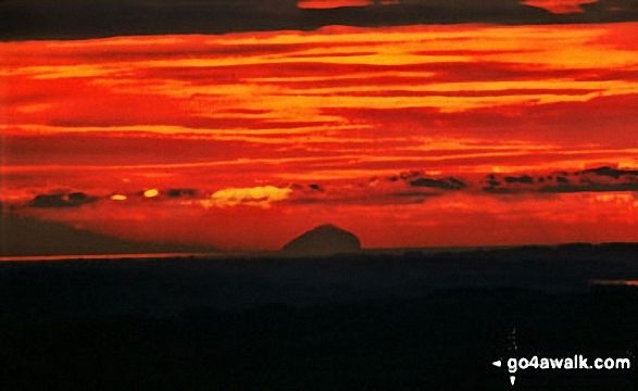
50. Ailsa Craig
340m (1,115ft)
Ailsa Craig is on interactive maps:
A downloadable go4awalk.com PDF Peak Bagging Map featuring Ailsa Craig will be available soon. |
51. Mochrum Fell
317m (1,040ft)
Mochrum Fell is on interactive maps:
A downloadable go4awalk.com PDF Peak Bagging Map featuring Mochrum Fell will be available soon. |
52. Grey Hill
297m (975ft)
Grey Hill is on interactive maps:
A downloadable go4awalk.com PDF Peak Bagging Map featuring Grey Hill will be available soon. |
53. Bainloch Hill
287m (942ft)
Bainloch Hill is on interactive maps:
A downloadable go4awalk.com PDF Peak Bagging Map featuring Bainloch Hill will be available soon. |
54. Brown Carrick Hill
287m (942ft)
Brown Carrick Hill is on interactive maps:
A downloadable go4awalk.com PDF Peak Bagging Map featuring Brown Carrick Hill will be available soon. |
55. Knockdolian
265m (870ft)
Knockdolian is on interactive maps:
A downloadable go4awalk.com PDF Peak Bagging Map featuring Knockdolian will be available soon. |
56. Woodhead Hill
258m (847ft)
Woodhead Hill is on interactive maps:
A downloadable go4awalk.com PDF Peak Bagging Map featuring Woodhead Hill will be available soon. |
57. Hightown Hill
250m (821ft)
Hightown Hill is on interactive maps:
A downloadable go4awalk.com PDF Peak Bagging Map featuring Hightown Hill will be available soon. |
58. See Morris Hill
240m (788ft)
See Morris Hill is on interactive maps:
A downloadable go4awalk.com PDF Peak Bagging Map featuring See Morris Hill will be available soon. |
59. Killyleoch Hill
240m (786ft)
Killyleoch Hill is on interactive maps:
A downloadable go4awalk.com PDF Peak Bagging Map featuring Killyleoch Hill will be available soon. |
60. Cairn Pat
182m (597ft)
Cairn Pat is on interactive maps:
A downloadable go4awalk.com PDF Peak Bagging Map featuring Cairn Pat will be available soon. |
Page 2 of 2 Go to page: 1 2 |
View these 60 Mountains, Peaks, Tops and Hills:
- On an Interactive Google Map (loads faster)
- On an Interactive Google Map with a list of tops below it.
(makes it easier to locate a particular top) - On a Detailed List in:
Alphabetical Order | Height Order - On one page with 'yet-to-be-bagged' listed 1st & then 'already-bagged' tops listed 2nd in:
Alphabetical Order | Height Order - On one page with 'already-bagged' tops listed 1st & then 'yet-to-be-bagged' tops listed 2nd in:
Alphabetical Order | Height Order
Is there a Mountain, Peak, Top or Hill missing from the above google map or list?
Let us know an we will add it to our database.

