Scottish Region 26: The Southern Uplands- - a fully detailed list of all the Mountains, Peaks, Tops and Hills (Page 1 of 2)
Scottish Region 26: The Southern Uplands region is the area enclosed by an imaginary line connecting:
- Cloch Point to Glasgow via the Firth of Clyde and the River Clyde to the North
- Glasgow to Gretna Green via the River Clyde to Larkhill and then the M74 via Douglas, Moffat and Lockerbie to the North East
- Gretna Green to Mull of Galloway via the Solway Firth to the South
- Mull of Galloway to Cloch Point via the North Chanel past Portpatrick, Ballantrae, Ailsa Craig, Girvan, Ayr and Irvine and then the Firth of Clyde to the East
If you count only the Marilyns there are 60 tops to climb, bag & conquer and the highest point is Merrick at 843m (2,766ft).
To see these Mountains, Peaks, Tops and Hills displayed in different ways - see the options in the left-hand column and towards the bottom of this page.
![]() Your Personal Bagging Record for Scottish Region 26: The Southern Uplands
Your Personal Bagging Record for Scottish Region 26: The Southern Uplands
LOG ON and RELOAD this page to show which Mountains, Peaks, Tops and Hills you have already climbed, bagged & conquered [. . . more details]
Page 1 of 2 Go to page: 1 2 |
See this list in: Alphabetical Order‡
| Height Order
To reverse the order select the link again.
Mountain, Peak, Top or Hill:
Bagged

![]()
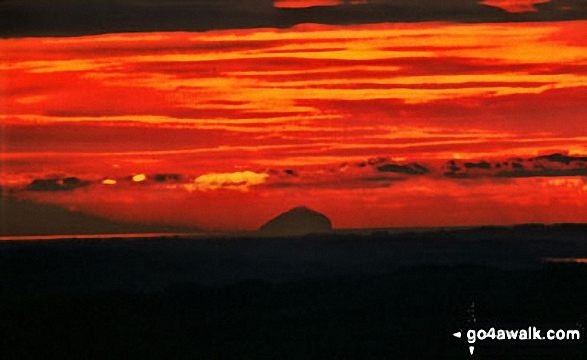
1. Ailsa Craig
340m (1,115ft)
Ailsa Craig is on interactive maps:
A downloadable go4awalk.com PDF Peak Bagging Map featuring Ailsa Craig will be available soon. |
![]()
2. Bainloch Hill
287m (942ft)
Bainloch Hill is on interactive maps:
A downloadable go4awalk.com PDF Peak Bagging Map featuring Bainloch Hill will be available soon. |
![]()
3. Ballencleuch Law
689m (2,261ft)
Ballencleuch Law is on interactive maps:
A downloadable go4awalk.com PDF Peak Bagging Map featuring Ballencleuch Law will be available soon. |
![]()
4. Benbeoch
464m (1,523ft)
Benbeoch is on interactive maps:
A downloadable go4awalk.com PDF Peak Bagging Map featuring Benbeoch will be available soon. |
![]()
5. Beneraird
439m (1,441ft)
Beneraird is on interactive maps:
A downloadable go4awalk.com PDF Peak Bagging Map featuring Beneraird will be available soon. |
![]()
6. Bengairn
391m (1,283ft)
Bengairn is on interactive maps:
A downloadable go4awalk.com PDF Peak Bagging Map featuring Bengairn will be available soon. |
![]()
7. Bengray
366m (1,201ft)
Bengray is on interactive maps:
A downloadable go4awalk.com PDF Peak Bagging Map featuring Bengray will be available soon. |
![]()
8. Bennan
398m (1,306ft)
Bennan is on interactive maps:
A downloadable go4awalk.com PDF Peak Bagging Map featuring Bennan will be available soon. |
![]()
9. Bishop Forest Hill
392m (1,287ft)
Bishop Forest Hill is on interactive maps:
A downloadable go4awalk.com PDF Peak Bagging Map featuring Bishop Forest Hill will be available soon. |
![]()
10. Blackcraig Hill (Glen Afton)
701m (2,300ft)
Send it in and we'll publish it here.
Blackcraig Hill (Glen Afton) is on interactive maps:
A downloadable go4awalk.com PDF Peak Bagging Map featuring Blackcraig Hill (Glen Afton) will be available soon. |
![]()
11. Blaeloch Hill
407m (1,336ft)
Blaeloch Hill is on interactive maps:
A downloadable go4awalk.com PDF Peak Bagging Map featuring Blaeloch Hill will be available soon. |
![]()
12. Bogrie Hill
432m (1,418ft)
Bogrie Hill is on interactive maps:
A downloadable go4awalk.com PDF Peak Bagging Map featuring Bogrie Hill will be available soon. |
![]()
13. Brown Carrick Hill
287m (942ft)
Brown Carrick Hill is on interactive maps:
A downloadable go4awalk.com PDF Peak Bagging Map featuring Brown Carrick Hill will be available soon. |
![]()
14. Cairn Hill (Lowther Hills)
451m (1,480ft)
Send it in and we'll publish it here.
Cairn Hill (Lowther Hills) is on interactive maps:
A downloadable go4awalk.com PDF Peak Bagging Map featuring Cairn Hill (Lowther Hills) will be available soon. |
![]()
15. Cairn Pat
182m (597ft)
Cairn Pat is on interactive maps:
A downloadable go4awalk.com PDF Peak Bagging Map featuring Cairn Pat will be available soon. |
![]()
16. Cairn Table
593m (1,946ft)
Cairn Table is on interactive maps:
A downloadable go4awalk.com PDF Peak Bagging Map featuring Cairn Table will be available soon. |
![]()
17. Cairnharrow
457m (1,499ft)
Cairnharrow is on interactive maps:
A downloadable go4awalk.com PDF Peak Bagging Map featuring Cairnharrow will be available soon. |
![]()
18. Cairnkinna Hill
554m (1,818ft)
Cairnkinna Hill is on interactive maps:
A downloadable go4awalk.com PDF Peak Bagging Map featuring Cairnkinna Hill will be available soon. |
![]()
19. Cairnsmore (Black Craig of Dee)
493m (1,618ft)
Send it in and we'll publish it here.
Cairnsmore (Black Craig of Dee) is on interactive maps:
A downloadable go4awalk.com PDF Peak Bagging Map featuring Cairnsmore (Black Craig of Dee) will be available soon. |
![]()
20. Cairnsmore of Carsphairn
797m (2,615ft)
Send it in and we'll publish it here.
Cairnsmore of Carsphairn is on interactive maps:
A downloadable go4awalk.com PDF Peak Bagging Map featuring Cairnsmore of Carsphairn will be available soon. |
![]()
21. Cairnsmore of Fleet
711m (2,334ft)
Cairnsmore of Fleet is on interactive maps:
A downloadable go4awalk.com PDF Peak Bagging Map featuring Cairnsmore of Fleet will be available soon. |
![]()
22. Colt Hill
598m (1,963ft)
Colt Hill is on interactive maps:
A downloadable go4awalk.com PDF Peak Bagging Map featuring Colt Hill will be available soon. |
![]()
23. Common Hill
488m (1,602ft)
Common Hill is on interactive maps:
A downloadable go4awalk.com PDF Peak Bagging Map featuring Common Hill will be available soon. |
![]()
24. Corse Hill (Cunninghame)
376m (1,234ft)
Send it in and we'll publish it here.
Corse Hill (Cunninghame) is on interactive maps:
A downloadable go4awalk.com PDF Peak Bagging Map featuring Corse Hill (Cunninghame) will be available soon. |
![]()
25. Corserine
814m (2,672ft)
Corserine is on interactive maps:
A downloadable go4awalk.com PDF Peak Bagging Map featuring Corserine will be available soon. |
![]()
26. Craigenreoch
565m (1,854ft)
Craigenreoch is on interactive maps:
A downloadable go4awalk.com PDF Peak Bagging Map featuring Craigenreoch will be available soon. |
![]()
27. Craiglee (Loch Dee)
531m (1,743ft)
Send it in and we'll publish it here.
Craiglee (Loch Dee) is on interactive maps:
A downloadable go4awalk.com PDF Peak Bagging Map featuring Craiglee (Loch Dee) will be available soon. |
![]()
28. Craiglee (Loch Doon)
523m (1,716ft)
Send it in and we'll publish it here.
Craiglee (Loch Doon) is on interactive maps:
A downloadable go4awalk.com PDF Peak Bagging Map featuring Craiglee (Loch Doon) will be available soon. |
![]()
29. Craignaw
645m (2,117ft)
Craignaw is on interactive maps:
A downloadable go4awalk.com PDF Peak Bagging Map featuring Craignaw will be available soon. |
![]()
30. Craignell
477m (1,566ft)
Craignell is on interactive maps:
A downloadable go4awalk.com PDF Peak Bagging Map featuring Craignell will be available soon. |
Page 1 of 2 Go to page: 1 2 |
View these 60 Mountains, Peaks, Tops and Hills:
- On an Interactive Google Map (loads faster)
- On an Interactive Google Map with a list of tops below it.
(makes it easier to locate a particular top) - On a Detailed List in:
Alphabetical Order | Height Order - On one page with 'yet-to-be-bagged' listed 1st & then 'already-bagged' tops listed 2nd in:
Alphabetical Order | Height Order - On one page with 'already-bagged' tops listed 1st & then 'yet-to-be-bagged' tops listed 2nd in:
Alphabetical Order | Height Order
Is there a Mountain, Peak, Top or Hill missing from the above google map or list?
Let us know an we will add it to our database.

To contribute to go4awalk.com or to contact us about anything at all - see Talk To Us.
For help see Help.
go4awalk.com and go4awalk.co.uk are registered trademarks of TMDH Limited.
Copyright © 2000-2025 TMDH Limited. All rights reserved.
Copyright Terms & Conditions Privacy Statement
A - Z Walks Home Log On/Accounts Photo Gallery Walk Ideas and Collections Fell Facts Hill Skills Walking Questions and Answers Your Stories News Competitions Product Reviews/Gear Tests Walking Gear Guides Peaks and Mountains Peak Bagging Find New Walking Friends Camping GPS Waypoints for Walking Contents Walk Search Talk To Us go4awalk.com Help Free Example Walks Newsletter


