A Google Peak Bagging Map of The Central Area of Mynyddoedd Cambria (The Cambrian Mountains) in Reverse Alphabetical Order
The Central Area of The Central area of Mynyddoedd Cambria (The Cambrian Mountains) , Powys is the area enclosed by:
- the Snowdonia National Park boundary from Aberdyfi/Aberdovey to Aberangell to the North; the A470 from Aberangell via Glantwymyn to Caersws, the A489 to Newtown, the A483 to Dolfor and then the B4355 to the country border between Wales and England to the North-West;
- the country border between Wales and England from the B4355 to the A44 to the East;
- the A44 from the country border to Rhayader, the A470 to Llangurig, and then the A44 again to Aberystwyth to the South West;
- the Irish Sea from Aberystwyth to Aberdyfi/Aberdovey to the West
If you include all the Mountains (Hewitts), the Deweys, the Nuttalls, the Marilyns, the Bridgets (Hills) and all the Mountains, Tops, Peaks and Hills with a Trig Point on them there are 79 tops to climb, bag & conquer and the highest point is Pen Pumlumon Fawr (Plynlimon) at 752m (2,468ft).
To see these Mountains, Peaks, Tops and Hills displayed in different ways - see the options in the left-hand column and towards the bottom of this page.
![]() Your Personal Bagging Record for The Central Area of The Central area of Mynyddoedd Cambria (The Cambrian Mountains)
Your Personal Bagging Record for The Central Area of The Central area of Mynyddoedd Cambria (The Cambrian Mountains)
LOG ON and RELOAD this page to show which Mountains, Peaks, Tops and Hills you have already climbed, bagged & conquered [. . . more details]
NB. If a Google Map does not appear below, or the icons do not respond, click here to refresh the page. If that doesn't work, try deleting your browser's cache.
Scroll down this list of mountains, peaks, tops & hills below and tap/click on each name (in blue) to locate it's position on the map above.
See this list in: Alphabetical Order‡ | Height Order
To reverse the order select the link again.
Mountain, Peak, Top or Hill:
Bagged

![]()
1. Ysgwd-ffordd
440m (1,444ft)
Bridget and Trig Point
See more details, photos, trip reports and easy-to-follow walks up Ysgwd-ffordd

![]()
2. Y Glog (Draws Drum)
574m (1,883ft)
Bridget
See more details, photos, trip reports and easy-to-follow walks up Y Glog (Draws Drum)

![]()
3. Y Garn (Pumlumon)
684m (2,245ft)
Mountain (Hewitt) and Nuttall
See more details, photos, trip reports and easy-to-follow walks up Y Garn (Pumlumon)

![]()
4. Y Foel (Pant Mawr)
546m (1,791ft)
Dewey
See more details, photos, trip reports and easy-to-follow walks up Y Foel (Pant Mawr)
![]()
5. Y Foel (Glen Feinion)
435m (1,427ft)
Bridget
See more details, photos, trip reports and easy-to-follow walks up Y Foel (Glen Feinion)
![]()
6. Stanner Hill
349m (1,145ft)
Bridget
See more details, photos, trip reports and easy-to-follow walks up Stanner Hill

![]()
7. Pumlumon Fach
664m (2,179ft)
Nuttall
See more details, photos, trip reports and easy-to-follow walks up Pumlumon Fach
![]()
8. Penglais
151m (495ft)
Bridget
See more details, photos, trip reports and easy-to-follow walks up Penglais
![]()
9. Pen yr Allt-fawr
316m (1,037ft)
Bridget
See more details, photos, trip reports and easy-to-follow walks up Pen yr Allt-fawr
![]()
10. Pen y Darren (Moel Hyddgen)
529m (1,736ft)
Dewey
See more details, photos, trip reports and easy-to-follow walks up Pen y Darren (Moel Hyddgen)
![]()
11. Pen Pumlumon Llygad-bychan
727m (2,386ft)
Mountain (Hewitt) and Nuttall
See more details, photos, trip reports and easy-to-follow walks up Pen Pumlumon Llygad-bychan

![]()
12. Pen Pumlumon Fawr (Plynlimon)
752m (2,468ft)
Mountain (Hewitt), Nuttall, Marilyn and Trig Point
See more details, photos, trip reports and easy-to-follow walks up Pen Pumlumon Fawr (Plynlimon)
![]()
13. Pen Pumlumon Arwystli
741m (2,431ft)
Mountain (Hewitt) and Nuttall
See more details, photos, trip reports and easy-to-follow walks up Pen Pumlumon Arwystli
![]()
14. Pen Felin-wynt
372m (1,220ft)
Bridget
See more details, photos, trip reports and easy-to-follow walks up Pen Felin-wynt
![]()
15. Pen Creigiau'r Llan
507m (1,663ft)
Dewey
See more details, photos, trip reports and easy-to-follow walks up Pen Creigiau'r Llan
![]()
16. Pen Carreg Gopa
447m (1,467ft)
Bridget
See more details, photos, trip reports and easy-to-follow walks up Pen Carreg Gopa

![]()
17. Pegwn Mawr
586m (1,923ft)
Dewey, Marilyn and Trig Point
See more details, photos, trip reports and easy-to-follow walks up Pegwn Mawr
![]()
18. Oldchapel Hill
426m (1,398ft)
Bridget
See more details, photos, trip reports and easy-to-follow walks up Oldchapel Hill
![]()
19. Newydd Fynyddog
427m (1,401ft)
Bridget
See more details, photos, trip reports and easy-to-follow walks up Newydd Fynyddog
![]()
20. Mynydd Garth-Gwynion
228m (748ft)
Bridget
See more details, photos, trip reports and easy-to-follow walks up Mynydd Garth-Gwynion
![]()
21. Mynydd Bach
373m (1,224ft)
Bridget and Trig Point
See more details, photos, trip reports and easy-to-follow walks up Mynydd Bach
![]()
22. Moelfre (Waun Tyisaf)
469m (1,539ft)
Bridget
See more details, photos, trip reports and easy-to-follow walks up Moelfre (Waun Tyisaf)
![]()
23. Moelfre (Llanidloes)
429m (1,407ft)
Bridget
See more details, photos, trip reports and easy-to-follow walks up Moelfre (Llanidloes)

![]()
24. Moel y Llyn (Cambrian Mountains)
521m (1,709ft)
Dewey and Trig Point
See more details, photos, trip reports and easy-to-follow walks up Moel y Llyn (Cambrian Mountains)
![]()
25. Moel Hywel
505m (1,657ft)
Dewey and Trig Point
See more details, photos, trip reports and easy-to-follow walks up Moel Hywel
![]()
26. Llechwedd y Glyn (Hafren Forest)
481m (1,578ft)
Bridget
See more details, photos, trip reports and easy-to-follow walks up Llechwedd y Glyn (Hafren Forest)
![]()
27. Llechwedd Hirgoed (South East Top)
535m (1,755ft)
Dewey
![]()
28. Llechwedd Hirgoed
538m (1,765ft)
Dewey
See more details, photos, trip reports and easy-to-follow walks up Llechwedd Hirgoed
![]()
29. Llan-wen Hill
417m (1,368ft)
Bridget and Trig Point
See more details, photos, trip reports and easy-to-follow walks up Llan-wen Hill

![]()
30. Garreg Lwyd
499m (1,637ft)
Marilyn
See more details, photos, trip reports and easy-to-follow walks up Garreg Lwyd
![]()
31. Gamallt (Afon Gwy)
475m (1,558ft)
Bridget
See more details, photos, trip reports and easy-to-follow walks up Gamallt (Afon Gwy)
![]()
32. Gaer (LLanddewi Ystradenni)
417m (1,368ft)
Bridget
See more details, photos, trip reports and easy-to-follow walks up Gaer (LLanddewi Ystradenni)
![]()
33. Fron Goch
289m (948ft)
Bridget
See more details, photos, trip reports and easy-to-follow walks up Fron Goch
![]()
34. Foel Uchaf (Cambrian Mountains)
565m (1,854ft)
Dewey
See more details, photos, trip reports and easy-to-follow walks up Foel Uchaf (Cambrian Mountains)
![]()
35. Foel Grafiau
493m (1,618ft)
Dewey
See more details, photos, trip reports and easy-to-follow walks up Foel Grafiau
![]()
36. Foel Fras (Mynyddoedd Cambria)
529m (1,736ft)
Dewey
See more details, photos, trip reports and easy-to-follow walks up Foel Fras (Mynyddoedd Cambria)
![]()
37. Foel Fadian
564m (1,851ft)
Dewey and Trig Point
See more details, photos, trip reports and easy-to-follow walks up Foel Fadian
![]()
38. Ffridd Pen-y-Graig
297m (974ft)
Bridget
See more details, photos, trip reports and easy-to-follow walks up Ffridd Pen-y-Graig
![]()
39. Ffridd Esgair-yr-owen (Cefn Coch)
285m (935ft)
Bridget
See more details, photos, trip reports and easy-to-follow walks up Ffridd Esgair-yr-owen (Cefn Coch)
![]()
40. Ffinnant (Yr Allt)
516m (1,693ft)
Bridget and Trig Point
See more details, photos, trip reports and easy-to-follow walks up Ffinnant (Yr Allt)
![]()
41. Esgair y Maesnant
506m (1,660ft)
Dewey
See more details, photos, trip reports and easy-to-follow walks up Esgair y Maesnant
![]()
42. Esgair Greolen
501m (1,644ft)
Dewey
See more details, photos, trip reports and easy-to-follow walks up Esgair Greolen
![]()
43. Drybedd
566m (1,857ft)
Dewey
See more details, photos, trip reports and easy-to-follow walks up Drybedd

![]()
44. Drosgol (Pumlumon)
550m (1,805ft)
Dewey and Marilyn
See more details, photos, trip reports and easy-to-follow walks up Drosgol (Pumlumon)
![]()
45. Draws Drum (Y Glog)
574m (1,883ft)
Dewey
See more details, photos, trip reports and easy-to-follow walks up Draws Drum (Y Glog)
![]()
46. Disgwylfa Fawr
507m (1,664ft)
Dewey and Marilyn
See more details, photos, trip reports and easy-to-follow walks up Disgwylfa Fawr
![]()
47. Dinas (Llyn Clywedog)
445m (1,460ft)
Bridget
See more details, photos, trip reports and easy-to-follow walks up Dinas (Llyn Clywedog)
![]()
48. Crugyn Llwyd
571m (1,874ft)
Dewey
See more details, photos, trip reports and easy-to-follow walks up Crugyn Llwyd
![]()
49. Corndon Hill (Corndon Beacon)
513m (1,683ft)
Dewey, Marilyn and Trig Point
See more details, photos, trip reports and easy-to-follow walks up Corndon Hill (Corndon Beacon)
![]()
50. Coed y Gaer
360m (1,181ft)
Bridget
See more details, photos, trip reports and easy-to-follow walks up Coed y Gaer
![]()
51. Clipyn Du (Siambr Trawsfynydd)
582m (1,910ft)
Dewey
See more details, photos, trip reports and easy-to-follow walks up Clipyn Du (Siambr Trawsfynydd)
![]()
52. Cilfaesty Hill
528m (1,732ft)
Dewey
See more details, photos, trip reports and easy-to-follow walks up Cilfaesty Hill
![]()
53. Cefn Coch (Darowen)
285m (935ft)
Bridget
See more details, photos, trip reports and easy-to-follow walks up Cefn Coch (Darowen)
![]()
54. Cefn Cenarth
460m (1,509ft)
Marilyn
See more details, photos, trip reports and easy-to-follow walks up Cefn Cenarth
![]()
55. Cefn Blewog
341m (1,119ft)
Bridget
See more details, photos, trip reports and easy-to-follow walks up Cefn Blewog
![]()
56. Castle Hill (Rhayader)
388m (1,273ft)
Bridget
See more details, photos, trip reports and easy-to-follow walks up Castle Hill (Rhayader)
![]()
57. Carn Gwilym (Carn Hyddgen)
566m (1,858ft)
Dewey
See more details, photos, trip reports and easy-to-follow walks up Carn Gwilym (Carn Hyddgen)
![]()
58. Camlo Hill
509m (1,670ft)
Dewey
See more details, photos, trip reports and easy-to-follow walks up Camlo Hill
![]()
59. Burfa Bank
313m (1,027ft)
Bridget
See more details, photos, trip reports and easy-to-follow walks up Burfa Bank
![]()
60. Bryn-y-tail
403m (1,322ft)
Bridget
See more details, photos, trip reports and easy-to-follow walks up Bryn-y-tail
![]()
61. Bryn-y-Brain
294m (964ft)
Bridget
See more details, photos, trip reports and easy-to-follow walks up Bryn-y-Brain
![]()
62. Bryn-hir
179m (587ft)
Bridget
See more details, photos, trip reports and easy-to-follow walks up Bryn-hir
![]()
63. Bryn yr wyn
501m (1,644ft)
Bridget
See more details, photos, trip reports and easy-to-follow walks up Bryn yr wyn
![]()
64. Bryn y Fedwen
544m (1,785ft)
Dewey
See more details, photos, trip reports and easy-to-follow walks up Bryn y Fedwen

![]()
65. Bryn y Fan (Van Hill)
482m (1,582ft)
Marilyn and Trig Point
See more details, photos, trip reports and easy-to-follow walks up Bryn y Fan (Van Hill)
![]()
66. Bryn Mawr (Cwmbelan)
405m (1,329ft)
Bridget
See more details, photos, trip reports and easy-to-follow walks up Bryn Mawr (Cwmbelan)
![]()
67. Bryn Gelli Hir (Rhos Fawr)
308m (1,007ft)
Bridget
See more details, photos, trip reports and easy-to-follow walks up Bryn Gelli Hir (Rhos Fawr)
![]()
68. Bryn Coch
518m (1,700ft)
Dewey
See more details, photos, trip reports and easy-to-follow walks up Bryn Coch
![]()
69. Bryn Amlwg (Trannon)
488m (1,602ft)
Marilyn and Trig Point
See more details, photos, trip reports and easy-to-follow walks up Bryn Amlwg (Trannon)
![]()
70. Brondre-fawr Hill
508m (1,667ft)
Dewey
See more details, photos, trip reports and easy-to-follow walks up Brondre-fawr Hill
![]()
71. Beddugre Hill
419m (1,375ft)
Bridget
See more details, photos, trip reports and easy-to-follow walks up Beddugre Hill
![]()
72. Beacon Hill (Beguildy Beacon)
547m (1,795ft)
Dewey, Marilyn and Trig Point
See more details, photos, trip reports and easy-to-follow walks up Beacon Hill (Beguildy Beacon)
![]()
73. Banc yr Wyn
503m (1,651ft)
Dewey
See more details, photos, trip reports and easy-to-follow walks up Banc yr Wyn
![]()
74. Banc y Garn
437m (1,434ft)
Bridget and Trig Point
See more details, photos, trip reports and easy-to-follow walks up Banc y Garn
![]()
75. Banc Mynyddgorddu
311m (1,020ft)
Bridget and Trig Point
See more details, photos, trip reports and easy-to-follow walks up Banc Mynyddgorddu
![]()
76. Banc Llechwedd-mawr
560m (1,837ft)
Dewey and Marilyn
See more details, photos, trip reports and easy-to-follow walks up Banc Llechwedd-mawr
![]()
77. Banc Bwlchygarreg (West Top)
510m (1,674ft)
Dewey
See more details, photos, trip reports and easy-to-follow walks up Banc Bwlchygarreg (West Top)
![]()
78. Banc Bwlchygarreg
516m (1,694ft)
Dewey
See more details, photos, trip reports and easy-to-follow walks up Banc Bwlchygarreg
![]()
79. Banc Bugeilyn
551m (1,808ft)
Dewey
See more details, photos, trip reports and easy-to-follow walks up Banc Bugeilyn
See this list in: Alphabetical Order‡ | Height Order
To reverse the order select the link again.
View these 79 Mountains, Peaks, Tops and Hills:
- On an Interactive Google Map (loads faster)
- On an Interactive Google Map with a list of tops below it.
(makes it easier to locate a particular top) - On a Detailed List in:
Alphabetical Order | Height Order - On one page with 'yet-to-be-bagged' listed 1st & then 'already-bagged' tops listed 2nd in:
Alphabetical Order | Height Order - On one page with 'already-bagged' tops listed 1st & then 'yet-to-be-bagged' tops listed 2nd in:
Alphabetical Order | Height Order
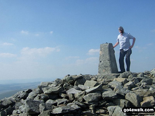 Pen Pumlumon Fawr (Plynlimon) in The Central area of Mynyddoedd Cambria (The Cambrian Mountains)
Photo: Mike Matthews
Is there a Mountain, Peak, Top or Hill missing from the above google map or list?
Let us know an we will add it to our database.
To contribute to go4awalk.com or to contact us about anything at all - see Talk To Us.
For help see Help.
go4awalk.com and go4awalk.co.uk are registered trademarks of TMDH Limited.
Copyright © 2000-2025 TMDH Limited. All rights reserved.
Copyright Terms & Conditions Privacy Statement
A - Z Walks Home Log On/Accounts Photo Gallery Walk Ideas and Collections Fell Facts Hill Skills Walking Questions and Answers Your Stories News Competitions Product Reviews/Gear Tests Walking Gear Guides Peaks and Mountains Peak Bagging Find New Walking Friends Camping GPS Waypoints for Walking Contents Walk Search Talk To Us go4awalk.com Help Free Example Walks Newsletter


