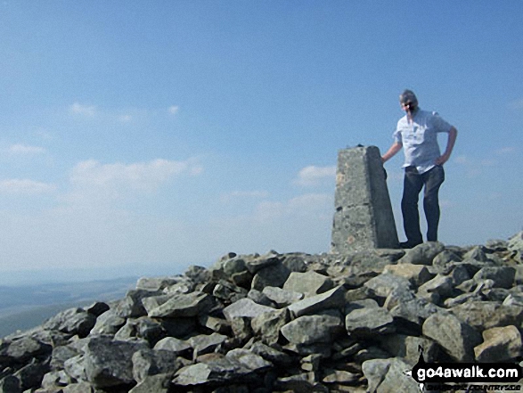
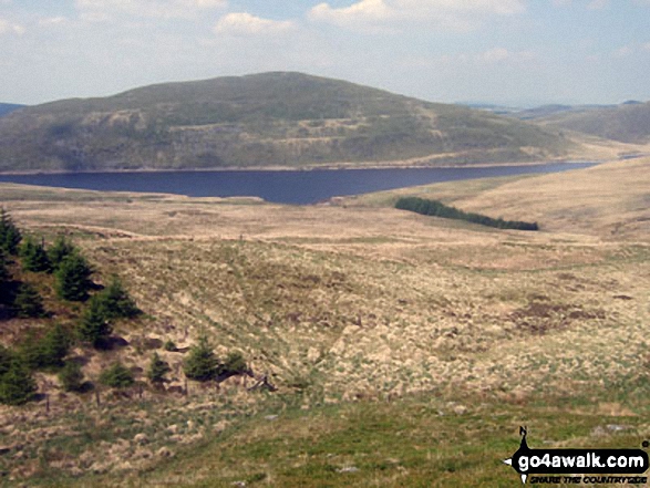
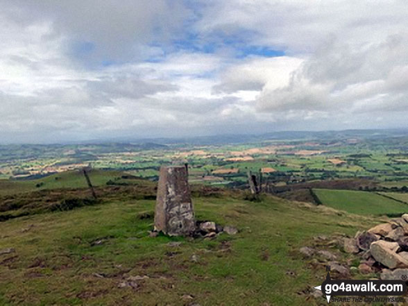
All the Mountains, Peaks, Tops and Hills in The Central Area of Mynyddoedd Cambria (The Cambrian Mountains) displayed as a detailed list

The Central Area of Mynyddoedd Cambria (The Cambrian Mountains), Powys is the area enclosed by:


If you include all the Mountains (Hewitts), the Deweys, the Nuttalls, the Marilyns, the Bridgets (Hills) and all the Mountains, Tops, Peaks and Hills with a Trig Point on them there are 79 tops to climb, bag & conquer and the highest point is Pen Pumlumon Fawr (Plynlimon) at 752m (2,468ft).


Wainwright
0/0
Wainwrights
Hewitt
4/0
Welsh
Mountains
Dewey
33/0
Welsh
Deweys
nuttall
5/0
Welsh
Nuttalls
Wainwright Outlying Fell
0/0
Wainwright
Outlying Fells
marilyn
11/0
Welsh
Marilyns
Bridget
37/0
Welsh
Bridgets
Trig Point
15/0
Trig
Points


To see all Mountains, Peaks, Tops and Hills displayed in different ways - see the options in the left-hand column and towards the bottom of this page.


LOG ON and RELOAD this page to show which Mountains, Peaks, Tops and Hills you have already climbed, bagged & conquered [. . . more]


Page 2 of 3    Go to page: 1 2 3


See this list in: Alphabetical Order‡ | Height Order
To reverse the order select the link again.


Mountain, Peak, Top or Hill:

Bagged


31. Gamallt (Afon Gwy)

475m (1,558ft)


Got a good photo of
Gamallt (Afon Gwy)?

Send it in and we'll publish it here.

Photo
Submission
Details

  • Bridget

  • We hope to have walks that climb & bag Gamallt (Afon Gwy) very soon

    Google Maps Icon
    See the location of Gamallt (Afon Gwy) and walks up it on a google Map

    Gamallt (Afon Gwy) is on interactive maps:

  • OS Explorer (Orange Covers): 200
  • OS Landranger (Pink Covers): 136 and 147

  • A go4awalk.com Peak Bagging Map and Hill Tick List featuring Gamallt (Afon Gwy) will be available soon.


    32. Gaer (LLanddewi Ystradenni)

    417m (1,368ft)


    Got a good photo of
    Gaer (LLanddewi Ystradenni)?

    Send it in and we'll publish it here.

    Photo
    Submission
    Details

  • Bridget

  • We hope to have walks that climb & bag Gaer (LLanddewi Ystradenni) very soon

    Google Maps Icon
    See the location of Gaer (LLanddewi Ystradenni) and walks up it on a google Map

    Gaer (LLanddewi Ystradenni) is on interactive maps:

  • OS Explorer (Orange Covers): 200
  • OS Landranger (Pink Covers): 136 and 148

  • A go4awalk.com Peak Bagging Map and Hill Tick List featuring Gaer (LLanddewi Ystradenni) will be available soon.


    33. Fron Goch

    289m (948ft)


    Got a good photo of
    Fron Goch?

    Send it in and we'll publish it here.

    Photo
    Submission
    Details

  • Bridget

  • We hope to have walks that climb & bag Fron Goch very soon

    Google Maps Icon
    See the location of Fron Goch and walks up it on a google Map

    Fron Goch is on interactive maps:

  • OS Explorer (Orange Covers): 215
  • OS Landranger (Pink Covers): 135 and 136

  • A go4awalk.com Peak Bagging Map and Hill Tick List featuring Fron Goch will be available soon.


    34. Foel Uchaf (Cambrian Mountains)

    565m (1,854ft)


    Got a good photo of
    Foel Uchaf (Cambrian Mountains)?

    Send it in and we'll publish it here.

    Photo
    Submission
    Details

  • Dewey (60th in Wales, 108th in England & Wales)

  • We hope to have walks that climb & bag Foel Uchaf (Cambrian Mountains) very soon

    Google Maps Icon
    See the location of Foel Uchaf (Cambrian Mountains) and walks up it on a google Map

    Foel Uchaf (Cambrian Mountains) is on interactive maps:

  • OS Explorer (Orange Covers): 214 and 215
  • OS Landranger (Pink Covers): 135 and 136

  • A go4awalk.com Peak Bagging Map and Hill Tick List featuring Foel Uchaf (Cambrian Mountains) will be available soon.


    35. Foel Grafiau

    493m (1,618ft)


    Got a good photo of
    Foel Grafiau?

    Send it in and we'll publish it here.

    Photo
    Submission
    Details

  • Dewey (241st in Wales, 422nd in England & Wales)

  • We hope to have walks that climb & bag Foel Grafiau very soon

    Google Maps Icon
    See the location of Foel Grafiau and walks up it on a google Map

    Foel Grafiau is on interactive maps:

  • OS Explorer (Orange Covers): OL23 and 215
  • OS Landranger (Pink Covers): 135

  • A go4awalk.com Peak Bagging Map and Hill Tick List featuring Foel Grafiau will be available soon.


    36. Foel Fras

    529m (1,736ft)


    Got a good photo of
    Foel Fras?

    Send it in and we'll publish it here.

    Photo
    Submission
    Details

  • Dewey (152nd in Wales, 267th in England & Wales)

  • We hope to have walks that climb & bag Foel Fras very soon

    Google Maps Icon
    See the location of Foel Fras and walks up it on a google Map

    Foel Fras is on interactive maps:

  • OS Explorer (Orange Covers): OL23 and 215
  • OS Landranger (Pink Covers): 135

  • A go4awalk.com Peak Bagging Map and Hill Tick List featuring Foel Fras will be available soon.


    37. Foel Fadian

    564m (1,851ft)


    Got a good photo of
    Foel Fadian?

    Send it in and we'll publish it here.

    Photo
    Submission
    Details

  • Dewey (63rd in Wales, 111th in England & Wales)
  • OS Trig Point

  • We hope to have walks that climb & bag Foel Fadian very soon

    Google Maps Icon
    See the location of Foel Fadian and walks up it on a google Map

    Foel Fadian is on interactive maps:

  • OS Explorer (Orange Covers): 215
  • OS Landranger (Pink Covers): 135 and 136

  • A go4awalk.com Peak Bagging Map and Hill Tick List featuring Foel Fadian will be available soon.


    38. Ffridd Pen-y-Graig

    297m (974ft)


    Got a good photo of
    Ffridd Pen-y-Graig?

    Send it in and we'll publish it here.

    Photo
    Submission
    Details

  • Bridget

  • We hope to have walks that climb & bag Ffridd Pen-y-Graig very soon

    Google Maps Icon
    See the location of Ffridd Pen-y-Graig and walks up it on a google Map

    Ffridd Pen-y-Graig is on interactive maps:

  • OS Explorer (Orange Covers): 215
  • OS Landranger (Pink Covers): 135 and 136

  • A go4awalk.com Peak Bagging Map and Hill Tick List featuring Ffridd Pen-y-Graig will be available soon.


    39. Ffridd Esgair-yr-owen (Cefn Coch)

    285m (935ft)


    Got a good photo of
    Ffridd Esgair-yr-owen (Cefn Coch)?

    Send it in and we'll publish it here.

    Photo
    Submission
    Details

  • Bridget

  • We hope to have walks that climb & bag Ffridd Esgair-yr-owen (Cefn Coch) very soon

    Google Maps Icon
    See the location of Ffridd Esgair-yr-owen (Cefn Coch) and walks up it on a google Map

    Ffridd Esgair-yr-owen (Cefn Coch) is on interactive maps:

  • OS Explorer (Orange Covers): 215
  • OS Landranger (Pink Covers): 135 and 136

  • A go4awalk.com Peak Bagging Map and Hill Tick List featuring Ffridd Esgair-yr-owen (Cefn Coch) will be available soon.


    40. Ffinnant (Yr Allt)

    516m (1,693ft)


    Got a good photo of
    Ffinnant (Yr Allt)?

    Send it in and we'll publish it here.

    Photo
    Submission
    Details

  • Bridget
  • OS Trig Point

  • We hope to have walks that climb & bag Ffinnant (Yr Allt) very soon

    Google Maps Icon
    See the location of Ffinnant (Yr Allt) and walks up it on a google Map

    Ffinnant (Yr Allt) is on interactive maps:

  • OS Explorer (Orange Covers): 214
  • OS Landranger (Pink Covers): 136

  • 41. Esgair y Maesnant

    506m (1,660ft)


    Got a good photo of
    Esgair y Maesnant?

    Send it in and we'll publish it here.

    Photo
    Submission
    Details

  • Dewey (224th in Wales, 396th in England & Wales)

  • We hope to have walks that climb & bag Esgair y Maesnant very soon

    Google Maps Icon
    See the location of Esgair y Maesnant and walks up it on a google Map

    Esgair y Maesnant is on interactive maps:

  • OS Explorer (Orange Covers): 214
  • OS Landranger (Pink Covers): 135 and 136

  • A go4awalk.com Peak Bagging Map and Hill Tick List featuring Esgair y Maesnant will be available soon.


    42. Esgair Greolen

    501m (1,644ft)


    Got a good photo of
    Esgair Greolen?

    Send it in and we'll publish it here.

    Photo
    Submission
    Details

  • Dewey (239th in Wales, 419th in England & Wales)

  • We hope to have walks that climb & bag Esgair Greolen very soon

    Google Maps Icon
    See the location of Esgair Greolen and walks up it on a google Map

    Esgair Greolen is on interactive maps:

  • OS Explorer (Orange Covers): 214 and 215
  • OS Landranger (Pink Covers): 135 and 136

  • A go4awalk.com Peak Bagging Map and Hill Tick List featuring Esgair Greolen will be available soon.


    43. Drybedd

    566m (1,857ft)


    Got a good photo of
    Drybedd?

    Send it in and we'll publish it here.

    Photo
    Submission
    Details

  • Dewey (57th in Wales, 103rd in England & Wales)

  • We hope to have walks that climb & bag Drybedd very soon

    Google Maps Icon
    See the location of Drybedd and walks up it on a google Map

    Drybedd is on interactive maps:

  • OS Explorer (Orange Covers): 213
  • OS Landranger (Pink Covers): 135

  • A go4awalk.com Peak Bagging Map and Hill Tick List featuring Drybedd will be available soon.


    44. Drosgol (Pumlumon)

    550m (1,805ft)

  • Dewey (91st in Wales, 163rd in England & Wales)
  • Marilyn (69th in Wales, 874th in GB)

  • We hope to have walks that climb & bag Drosgol (Pumlumon) very soon

    Google Maps Icon
    See the location of Drosgol (Pumlumon) and walks up it on a google Map

    Drosgol (Pumlumon) is on interactive maps:

  • OS Explorer (Orange Covers): 213
  • OS Landranger (Pink Covers): 135

  • A go4awalk.com Peak Bagging Map and Hill Tick List featuring Drosgol (Pumlumon) will be available soon.


    45. Draws Drum (Y Glog)

    574m (1,883ft)


    Got a good photo of
    Draws Drum (Y Glog)?

    Send it in and we'll publish it here.

    Photo
    Submission
    Details

  • Dewey (45th in Wales, 81st in England & Wales)

  • We hope to have walks that climb & bag Draws Drum (Y Glog) very soon

    Google Maps Icon
    See the location of Draws Drum (Y Glog) and walks up it on a google Map

    Draws Drum (Y Glog) is on interactive maps:

  • OS Explorer (Orange Covers): 213
  • OS Landranger (Pink Covers): 135

  • A go4awalk.com Peak Bagging Map and Hill Tick List featuring Draws Drum (Y Glog) will be available soon.


    46. Disgwylfa Fawr

    507m (1,664ft)


    Got a good photo of
    Disgwylfa Fawr?

    Send it in and we'll publish it here.

    Photo
    Submission
    Details

  • Dewey (219th in Wales, 387th in England & Wales)
  • Marilyn (83rd in Wales, 976th in GB)

  • We hope to have walks that climb & bag Disgwylfa Fawr very soon

    Google Maps Icon
    See the location of Disgwylfa Fawr and walks up it on a google Map

    Disgwylfa Fawr is on interactive maps:

  • OS Explorer (Orange Covers): 213
  • OS Landranger (Pink Covers): 135

  • A go4awalk.com Peak Bagging Map and Hill Tick List featuring Disgwylfa Fawr will be available soon.


    47. Dinas (Llyn Clywedog)

    445m (1,460ft)


    Got a good photo of
    Dinas (Llyn Clywedog)?

    Send it in and we'll publish it here.

    Photo
    Submission
    Details

  • Bridget

  • We hope to have walks that climb & bag Dinas (Llyn Clywedog) very soon

    Google Maps Icon
    See the location of Dinas (Llyn Clywedog) and walks up it on a google Map

    Dinas (Llyn Clywedog) is on interactive maps:

  • OS Explorer (Orange Covers): 214
  • OS Landranger (Pink Covers): 136

  • A go4awalk.com Peak Bagging Map and Hill Tick List featuring Dinas (Llyn Clywedog) will be available soon.


    48. Crugyn Llwyd

    571m (1,874ft)


    Got a good photo of
    Crugyn Llwyd?

    Send it in and we'll publish it here.

    Photo
    Submission
    Details

  • Dewey (50th in Wales, 90th in England & Wales)

  • We hope to have walks that climb & bag Crugyn Llwyd very soon

    Google Maps Icon
    See the location of Crugyn Llwyd and walks up it on a google Map

    Crugyn Llwyd is on interactive maps:

  • OS Explorer (Orange Covers): 214
  • OS Landranger (Pink Covers): 136 and 147

  • A go4awalk.com Peak Bagging Map and Hill Tick List featuring Crugyn Llwyd will be available soon.


    49. Corndon Hill (Corndon Beacon)

    513m (1,683ft)

  • Dewey (200th in Wales, 355th in England & Wales)
  • Marilyn (81st in Wales, 955th in GB)
  • OS Trig Point

  • We hope to have walks that climb & bag Corndon Hill (Corndon Beacon) very soon

    Google Maps Icon
    See the location of Corndon Hill (Corndon Beacon) and walks up it on a google Map

    Corndon Hill (Corndon Beacon) is on interactive maps:

  • OS Explorer (Orange Covers): 216
  • OS Landranger (Pink Covers): 137

  • A go4awalk.com Peak Bagging Map and Hill Tick List featuring Corndon Hill (Corndon Beacon) will be available soon.


    50. Coed y Gaer

    360m (1,181ft)


    Got a good photo of
    Coed y Gaer?

    Send it in and we'll publish it here.

    Photo
    Submission
    Details

  • Bridget

  • We hope to have walks that climb & bag Coed y Gaer very soon

    Google Maps Icon
    See the location of Coed y Gaer and walks up it on a google Map

    Coed y Gaer is on interactive maps:

  • OS Explorer (Orange Covers): 214
  • OS Landranger (Pink Covers): 136

  • A go4awalk.com Peak Bagging Map and Hill Tick List featuring Coed y Gaer will be available soon.


    51. Clipyn Du (Siambr Trawsfynydd)

    582m (1,910ft)


    Got a good photo of
    Clipyn Du (Siambr Trawsfynydd)?

    Send it in and we'll publish it here.

    Photo
    Submission
    Details

  • Dewey (39th in Wales, 67th in England & Wales)

  • We hope to have walks that climb & bag Clipyn Du (Siambr Trawsfynydd) very soon

    Google Maps Icon
    See the location of Clipyn Du (Siambr Trawsfynydd) and walks up it on a google Map

    Clipyn Du (Siambr Trawsfynydd) is on interactive maps:

  • OS Explorer (Orange Covers): 215
  • OS Landranger (Pink Covers): 135

  • A go4awalk.com Peak Bagging Map and Hill Tick List featuring Clipyn Du (Siambr Trawsfynydd) will be available soon.


    52. Cilfaesty Hill

    528m (1,732ft)


    Got a good photo of
    Cilfaesty Hill?

    Send it in and we'll publish it here.

    Photo
    Submission
    Details

  • Dewey (155th in Wales, 271st in England & Wales)

  • We hope to have walks that climb & bag Cilfaesty Hill very soon

    Google Maps Icon
    See the location of Cilfaesty Hill and walks up it on a google Map

    Cilfaesty Hill is on interactive maps:

  • OS Explorer (Orange Covers): 214
  • OS Landranger (Pink Covers): 136

  • A go4awalk.com Peak Bagging Map and Hill Tick List featuring Cilfaesty Hill will be available soon.


    53. Cefn Coch (Darowen)

    285m (935ft)


    Got a good photo of
    Cefn Coch (Darowen)?

    Send it in and we'll publish it here.

    Photo
    Submission
    Details

  • Bridget

  • We hope to have walks that climb & bag Cefn Coch (Darowen) very soon

    Google Maps Icon
    See the location of Cefn Coch (Darowen) and walks up it on a google Map

    Cefn Coch (Darowen) is on interactive maps:

  • OS Explorer (Orange Covers): 215
  • OS Landranger (Pink Covers): 135 and 136

  • A go4awalk.com Peak Bagging Map and Hill Tick List featuring Cefn Coch (Darowen) will be available soon.


    54. Cefn Cenarth

    460m (1,509ft)


    Got a good photo of
    Cefn Cenarth?

    Send it in and we'll publish it here.

    Photo
    Submission
    Details

  • Marilyn (99th in Wales, 1081st in GB)

  • We hope to have walks that climb & bag Cefn Cenarth very soon

    Google Maps Icon
    See the location of Cefn Cenarth and walks up it on a google Map

    Cefn Cenarth is on interactive maps:

  • OS Explorer (Orange Covers): 214
  • OS Landranger (Pink Covers): 136 and 147

  • A go4awalk.com Peak Bagging Map and Hill Tick List featuring Cefn Cenarth will be available soon.


    55. Cefn Blewog

    341m (1,119ft)


    Got a good photo of
    Cefn Blewog?

    Send it in and we'll publish it here.

    Photo
    Submission
    Details

  • Bridget

  • We hope to have walks that climb & bag Cefn Blewog very soon

    Google Maps Icon
    See the location of Cefn Blewog and walks up it on a google Map

    Cefn Blewog is on interactive maps:

  • OS Explorer (Orange Covers): 213
  • OS Landranger (Pink Covers): 135 and 147

  • A go4awalk.com Peak Bagging Map and Hill Tick List featuring Cefn Blewog will be available soon.


    56. Castle Hill (Rhayader)

    388m (1,273ft)


    Got a good photo of
    Castle Hill (Rhayader)?

    Send it in and we'll publish it here.

    Photo
    Submission
    Details

  • Bridget

  • We hope to have walks that climb & bag Castle Hill (Rhayader) very soon

    Google Maps Icon
    See the location of Castle Hill (Rhayader) and walks up it on a google Map

    Castle Hill (Rhayader) is on interactive maps:

  • OS Explorer (Orange Covers): 200
  • OS Landranger (Pink Covers): 136 and 147

  • A go4awalk.com Peak Bagging Map and Hill Tick List featuring Castle Hill (Rhayader) will be available soon.


    57. Carn Gwilym (Carn Hyddgen)

    566m (1,858ft)


    Got a good photo of
    Carn Gwilym (Carn Hyddgen)?

    Send it in and we'll publish it here.

    Photo
    Submission
    Details

  • Dewey (56th in Wales, 101st in England & Wales)

  • We hope to have walks that climb & bag Carn Gwilym (Carn Hyddgen) very soon

    Google Maps Icon
    See the location of Carn Gwilym (Carn Hyddgen) and walks up it on a google Map

    Carn Gwilym (Carn Hyddgen) is on interactive maps:

  • OS Explorer (Orange Covers): 215
  • OS Landranger (Pink Covers): 135

  • A go4awalk.com Peak Bagging Map and Hill Tick List featuring Carn Gwilym (Carn Hyddgen) will be available soon.


    58. Camlo Hill

    509m (1,670ft)


    Got a good photo of
    Camlo Hill?

    Send it in and we'll publish it here.

    Photo
    Submission
    Details

  • Dewey (212th in Wales, 377th in England & Wales)

  • We hope to have walks that climb & bag Camlo Hill very soon

    Google Maps Icon
    See the location of Camlo Hill and walks up it on a google Map

    Camlo Hill is on interactive maps:

  • OS Explorer (Orange Covers): 200
  • OS Landranger (Pink Covers): 136 and 147

  • A go4awalk.com Peak Bagging Map and Hill Tick List featuring Camlo Hill will be available soon.


    59. Burfa Bank

    313m (1,027ft)


    Got a good photo of
    Burfa Bank?

    Send it in and we'll publish it here.

    Photo
    Submission
    Details

  • Bridget

  • We hope to have walks that climb & bag Burfa Bank very soon

    Google Maps Icon
    See the location of Burfa Bank and walks up it on a google Map

    Burfa Bank is on interactive maps:

  • OS Explorer (Orange Covers): 201
  • OS Landranger (Pink Covers): 137 and 148

  • A go4awalk.com Peak Bagging Map and Hill Tick List featuring Burfa Bank will be available soon.


    60. Bryn-y-tail

    403m (1,322ft)


    Got a good photo of
    Bryn-y-tail?

    Send it in and we'll publish it here.

    Photo
    Submission
    Details

  • Bridget

  • We hope to have walks that climb & bag Bryn-y-tail very soon

    Google Maps Icon
    See the location of Bryn-y-tail and walks up it on a google Map

    Bryn-y-tail is on interactive maps:

  • OS Explorer (Orange Covers): 214
  • OS Landranger (Pink Covers): 136

  • A go4awalk.com Peak Bagging Map and Hill Tick List featuring Bryn-y-tail will be available soon.


    Page 2 of 3    Go to page: 1 2 3


    View all 79 Mountains, Peaks, Tops and Hills in Mynyddoedd Cambria (The Cambrian Mountains):


    Is there a Mountain, Peak, Top or Hill missing from the above google map or list?

    Let us know an we will add it to our database.


    Do not miss our pick of the Best Walks in Britain


    Follow go4awalk.com on Twitter Follow go4awalk.com on Facebook


    Home


    Find new Friends to go walking with

    Walk all 214 Wainwrights in just 59 Walks. Download GPS Waypoints - Great Walks you must not miss!

    Walk The Yorkshire Three Peaks Challenge Walk - All the Latest Route Information, GPS Waypoints and Split Times to keep you on Schedule

    Walk The British Three Peaks Challenge Walk - All the Latest Route Information and GPS Waypoints

    See our pick of The Best Walks in The Lake District - Great Walks you must not miss!

    Walk our pick of the Best Lake District Ridge Walks - Great Walks you must not miss!

    Walk our pick of the Best Lake District Walks to do in the rain - Great Walks you must not miss!

    Walk our pick of The Best Walks in Snowdonia - Great Walks you must not miss!

    Walk our pick of The Best Ridge Walks in Wales - Walks you must not miss!

    Walk our pick of The Best Walks in The Brecon Beacons - Great Walks you must not miss!

    Walk our pick of The Best Walks in The Yorkshire Dales - Walks you must not miss!

    Walk our pick of The Best Walks in The Peak District - Walks you must not miss!

    Walk our pick of The Best Walks in The Forest of Bowland - Walks you must not miss!

    Walk our pick of The Best Walks in Shropshire - Walks you must not miss!

    Walk our pick of The Best Walks in Cheshire - Walks you must not miss!

    Walk our pick of The Best Walks in Lancashire - Walks you must not miss!

    Not sure where to walk next? Try Peak Bagging - Great Walks you must not miss!

    Not sure where to walk next? Walk part of a National Trail - Great Walks you must not miss!

    Walks with Downloadable and Uploadable GPS Waypoint Data

    Walking Kit and Gear Tested by Walkers

    Full Site Search