The Mountains, Peaks, Tops and Hills in Scotland as a detailed list
If you count only the Munros there are 282 tops to climb, bag & conquer and the highest point is Ben Nevis at 1,344m (4,411ft).
To see all Mountains, Peaks, Tops and Hills displayed in different ways - see the options in the left-hand column and towards the bottom of this page.
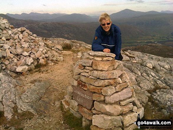
![]() Your Personal Bagging Record for Scotland
Your Personal Bagging Record for Scotland
When logged on, you can mark each Mountain, Peak, Top or Hill as 'bagged' by either:
- if you opt to display the tops in this area using a google map, click or tap on its symbol on the map below. This will open a text window. Click or tap on the 'Record [mountain name] as Bagged, Climbed & Conquered' link towards the bottom of the text window, or
- if you opt to display the tops in this area as a list, click or tap on the red 'not yet' symbol to the right of the name of each 'top'
Either method will open a new page where you can complete all your details such as:
- when you bagged the Mountain, Peak, Top or Hill;
- which route you took
- who you went with
- what the weather was like
- any other comment that will remind you of the day
Once you have completed your details and click or tap the submit button, you will automatically return to this page and the top you bagged will show with a green tick.
NB. None of the above fields are 'mandatory' - you can leave them blank if you wish.
NNB. You also have the option whether to display your peak bagging exploits to other users of this site or keep them private so only you can see them when you are logged on.
Furthermore, since you can also access your Personal Mountain & Hill Bagging Record via go4awalk Mobile you can quickly & easily record, edit and view your achievements - whether you are at home/work on your desktop computer or in the pub/at the top of a mountain with your Mobile Phone. (You can even download your Personal Mountain & Hill Bagging Record as a .csv file for importing into and saving with spreadsheet software like Excel or NeoOffice!)
This facility costs one credit to initially access your personal bagging record. Once accessed, all other interactions, such as recording other Mountains, Peaks, Tops and Hills as 'bagged' or altering an existing bagging record, are free.
Click REGISTER to register and purchase credits.
LOG ON and RELOAD this page to show which Mountains, Peaks, Tops and Hills you have already climbed, bagged & conquered. [ . . . remove this text]
See this list in: Alphabetical Order
| Height Order‡
To reverse the order select the link again.
Mountain, Peak, Top or Hill:
Bagged

![]()
151. Spidean Coire nan Clach (Beinn Eighe)
993m (3,259ft)
Spidean Coire nan Clach (Beinn Eighe) is on interactive maps:
A go4awalk.com Peak Bagging Map and Hill Tick List featuring Spidean Coire nan Clach (Beinn Eighe) will be available soon. |
![]()
152. Carn nan Gobhar (Glen Orrin)
992m (3,256ft)
Send it in and we'll publish it here.
Carn nan Gobhar (Glen Orrin) is on interactive maps:
A go4awalk.com Peak Bagging Map and Hill Tick List featuring Carn nan Gobhar (Glen Orrin) will be available soon. |
![]()
153. Carn nan Gobhar (Glencannich Forest)
992m (3,256ft)
Send it in and we'll publish it here.
Carn nan Gobhar (Glencannich Forest) is on interactive maps:
A go4awalk.com Peak Bagging Map and Hill Tick List featuring Carn nan Gobhar (Glencannich Forest) will be available soon. |
![]()
154. Sgurr Alasdair
992m (3,256ft)
Sgurr Alasdair is on interactive maps:
A go4awalk.com Peak Bagging Map and Hill Tick List featuring Sgurr Alasdair will be available soon. |
![]()
155. Sgairneach Mhor
991m (3,252ft)
Sgairneach Mhor is on interactive maps:
A go4awalk.com Peak Bagging Map and Hill Tick List featuring Sgairneach Mhor will be available soon. |
![]()
156. Beinn Eunaich
989m (3,246ft)
Beinn Eunaich is on interactive maps:
A go4awalk.com Peak Bagging Map and Hill Tick List featuring Beinn Eunaich will be available soon. |
![]()
157. Sgurr Ban (Fionn Loch)
989m (3,246ft)
Send it in and we'll publish it here.
Sgurr Ban (Fionn Loch) is on interactive maps:
A go4awalk.com Peak Bagging Map and Hill Tick List featuring Sgurr Ban (Fionn Loch) will be available soon. |
![]()
158. Conival
987m (3,239ft)
Conival is on interactive maps:
A go4awalk.com Peak Bagging Map and Hill Tick List featuring Conival will be available soon. |
![]()
159. Creag Leacach
987m (3,239ft)
Creag Leacach is on interactive maps:
A go4awalk.com Peak Bagging Map and Hill Tick List featuring Creag Leacach will be available soon. |
![]()
160. Druim Shionnach
987m (3,239ft)
Druim Shionnach is on interactive maps:
A go4awalk.com Peak Bagging Map and Hill Tick List featuring Druim Shionnach will be available soon. |
![]()
161. Gaor Bheinn (Gulvain)
987m (3,239ft)
Send it in and we'll publish it here.
Gaor Bheinn (Gulvain) is on interactive maps:
A go4awalk.com Peak Bagging Map and Hill Tick List featuring Gaor Bheinn (Gulvain) will be available soon. |
![]()
162. Lurg Mhor
986m (3,236ft)
Lurg Mhor is on interactive maps:
A go4awalk.com Peak Bagging Map and Hill Tick List featuring Lurg Mhor will be available soon. |
![]()
163. Sgurr Dearg (Inaccessible Pinnacle)
986m (3,236ft)
Sgurr Dearg (Inaccessible Pinnacle) is on interactive maps:
A go4awalk.com Peak Bagging Map and Hill Tick List featuring Sgurr Dearg (Inaccessible Pinnacle) will be available soon. |
![]()
164. Sgurr Mhor (Beinn Alligin)
986m (3,236ft)
Sgurr Mhor (Beinn Alligin) is on interactive maps:
A go4awalk.com Peak Bagging Map and Hill Tick List featuring Sgurr Mhor (Beinn Alligin) will be available soon. |
![]()
165. Ben Vorlich (Coire Garbh)
985m (3,233ft)
Ben Vorlich (Coire Garbh) is on interactive maps:
A go4awalk.com Peak Bagging Map and Hill Tick List featuring Ben Vorlich (Coire Garbh) will be available soon. |
![]()
166. An Gearanach
982m (3,223ft)
An Gearanach is on interactive maps:
A go4awalk.com Peak Bagging Map and Hill Tick List featuring An Gearanach will be available soon. |
![]()
167. Mullach na Dheiragain
982m (3,223ft)
Send it in and we'll publish it here.
Mullach na Dheiragain is on interactive maps:
A go4awalk.com Peak Bagging Map and Hill Tick List featuring Mullach na Dheiragain will be available soon. |
![]()
168. Stob Coire a' Chairn
982m (3,223ft)
Stob Coire a' Chairn is on interactive maps:
A go4awalk.com Peak Bagging Map and Hill Tick List featuring Stob Coire a' Chairn will be available soon. |
![]()
169. Creag Mhor (Meall na Aighean)
981m (3,220ft)
Send it in and we'll publish it here.
Creag Mhor (Meall na Aighean) is on interactive maps:
A go4awalk.com Peak Bagging Map and Hill Tick List featuring Creag Mhor (Meall na Aighean) will be available soon. |
![]()
170. Maol Chinn-dearg
981m (3,220ft)
Maol Chinn-dearg is on interactive maps:
A go4awalk.com Peak Bagging Map and Hill Tick List featuring Maol Chinn-dearg will be available soon. |
![]()
171. Slioch
981m (3,220ft)
Slioch is on interactive maps:
A go4awalk.com Peak Bagging Map and Hill Tick List featuring Slioch will be available soon. |
![]()
172. Ciste Dhubh
981m (3,219ft)
Ciste Dhubh is on interactive maps:
A go4awalk.com Peak Bagging Map and Hill Tick List featuring Ciste Dhubh will be available soon. |
![]()
173. Beinn a' Chochuill
980m (3,216ft)
Beinn a' Chochuill is on interactive maps:
A go4awalk.com Peak Bagging Map and Hill Tick List featuring Beinn a' Chochuill will be available soon. |
![]()
174. Stob Coire Sgriodain
979m (3,213ft)
Stob Coire Sgriodain is on interactive maps:
A go4awalk.com Peak Bagging Map and Hill Tick List featuring Stob Coire Sgriodain will be available soon. |
![]()
175. Cona' Mheall
978m (3,210ft)
Cona' Mheall is on interactive maps:
A go4awalk.com Peak Bagging Map and Hill Tick List featuring Cona' Mheall will be available soon. |
![]()
176. Beinn Dubhchraig
978m (3,209ft)
Beinn Dubhchraig is on interactive maps:
A go4awalk.com Peak Bagging Map and Hill Tick List featuring Beinn Dubhchraig will be available soon. |
![]()
177. Meall nan Ceapraichean
977m (3,207ft)
Send it in and we'll publish it here.
Meall nan Ceapraichean is on interactive maps:
A go4awalk.com Peak Bagging Map and Hill Tick List featuring Meall nan Ceapraichean will be available soon. |
![]()
178. Stob Ban (Grey Corries)
977m (3,207ft)
Send it in and we'll publish it here.
Stob Ban (Grey Corries) is on interactive maps:
A go4awalk.com Peak Bagging Map and Hill Tick List featuring Stob Ban (Grey Corries) will be available soon. |
![]()
179. A' Mharconaich
975m (3,200ft)
A' Mharconaich is on interactive maps:
A go4awalk.com Peak Bagging Map and Hill Tick List featuring A' Mharconaich will be available soon. |
![]()
180. Carn a' Gheoidh
975m (3,200ft)
Carn a' Gheoidh is on interactive maps:
A go4awalk.com Peak Bagging Map and Hill Tick List featuring Carn a' Gheoidh will be available soon. |
View all 1682 Mountains, Peaks, Tops and Hills in Scottish Region : The West Mounth - Blair Atholl to Braemar and Blairgowrie:
- On an Interactive Google Map (loads faster)
- On an Interactive Google Map with a list of tops below it (makes it easier to locate a particular top)
- On a Detailed List in:
Alphabetical Order | Height Order - On one page with 'yet-to-be-bagged' listed 1st & then 'already-bagged' tops listed 2nd in:
Alphabetical Order | Height Order (must be logged on) - On one page with 'already-bagged' tops listed 1st & then 'yet-to-be-bagged' tops listed 2nd in:
Alphabetical Order | Height Order (must be logged on)
 The summit of Ben Nevis in The West Mounth - Blair Atholl to Braemar and BlairgowrieScotland
Photo: John Reed
Is there a Mountain, Peak, Top or Hill missing from the above google map or list?
Let us know an we will add it to our database.

To contribute to go4awalk.com or to contact us about anything at all - see Talk To Us.
For help see Help.
go4awalk.com and go4awalk.co.uk are registered trademarks of TMDH Limited.
Copyright © 2000-2025 TMDH Limited. All rights reserved.
Copyright Terms & Conditions Privacy Statement
A - Z Walks Home Log On/Accounts Photo Gallery Walk Ideas and Collections Fell Facts Hill Skills Walking Questions and Answers Your Stories News Competitions Product Reviews/Gear Tests Walking Gear Guides Peaks and Mountains Peak Bagging Find New Walking Friends Camping GPS Waypoints for Walking Contents Walk Search Talk To Us go4awalk.com Help Free Example Walks Newsletter


