The Mountains, Peaks, Tops and Hills in Scotland as a detailed list

If you count only the Munros there are 282 tops to climb, bag & conquer and the highest point is Ben Nevis at 1,344m (4,411ft).

munro
282/0
Munros

corbett
222/0
Corbetts

graham
219/0
Grahams

donald
89/0
Donalds

murdo
442/0
Murdos

marilyn
1557/0
Scottish
Marilyns

Bridget
0/0
Scottish
Bridgets

Trig Point
1398/0
Trig
Points


To see all Mountains, Peaks, Tops and Hills displayed in different ways - see the options in the left-hand column and towards the bottom of this page.
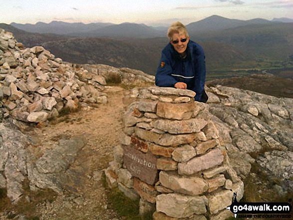

LOG ON and RELOAD this page to show which Mountains, Peaks, Tops and Hills you have already climbed, bagged & conquered [. . . more]


Page 6 of 10    Go to page: 1 2 3 4 5 6 7 8 9 10 Next Last


See this list in: Alphabetical Order | Height Order
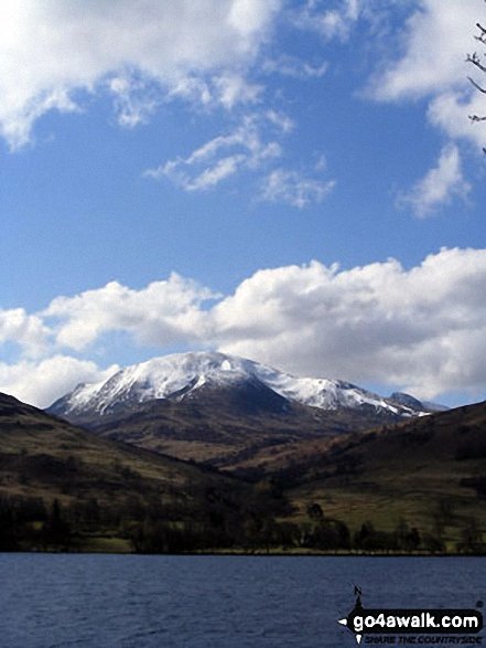
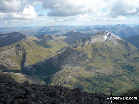
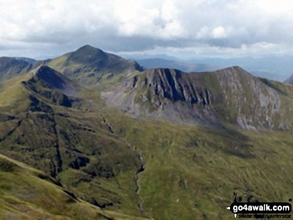
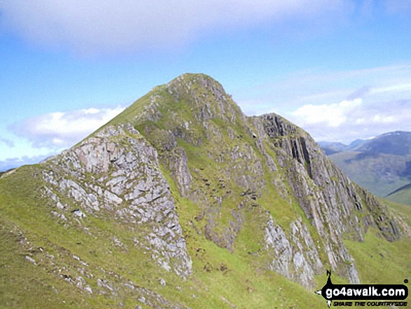
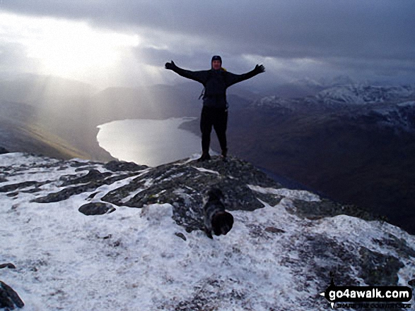
To reverse the order select the link again.


Mountain, Peak, Top or Hill:

Bagged


151. Spidean Coire nan Clach (Beinn Eighe)

993m (3,259ft)

  • Munro (No. 151)
  • Murdo (214th)
  • Marilyn (119th in Scotland, 122nd in GB)
  • OS Trig Point

  • We hope to have walks that climb & bag Spidean Coire nan Clach (Beinn Eighe) very soon

    Google Maps Icon
    See the location of Spidean Coire nan Clach (Beinn Eighe) and walks up it on a google Map

    Spidean Coire nan Clach (Beinn Eighe) is on interactive maps:

  • OS Explorer (Orange Covers): 433
  • OS Landranger (Pink Covers): 25

  • A go4awalk.com Peak Bagging Map and Hill Tick List featuring Spidean Coire nan Clach (Beinn Eighe) will be available soon.


    152. Carn nan Gobhar (Glen Orrin)

    992m (3,256ft)

  • Munro (No. 154)
  • Murdo (218th)

  • We hope to have walks that climb & bag Carn nan Gobhar (Glen Orrin) very soon

    Google Maps Icon
    See the location of Carn nan Gobhar (Glen Orrin) and walks up it on a google Map

    Carn nan Gobhar (Glen Orrin) is on interactive maps:

  • OS Explorer (Orange Covers): 430
  • OS Landranger (Pink Covers): 25

  • A go4awalk.com Peak Bagging Map and Hill Tick List featuring Carn nan Gobhar (Glen Orrin) will be available soon.


    153. Carn nan Gobhar (Glencannich Forest)

    992m (3,256ft)

  • Munro (No. 152)
  • Murdo (216th)
  • Marilyn (120th in Scotland, 123rd in GB)

  • We hope to have walks that climb & bag Carn nan Gobhar (Glencannich Forest) very soon

    Google Maps Icon
    See the location of Carn nan Gobhar (Glencannich Forest) and walks up it on a google Map

    Carn nan Gobhar (Glencannich Forest) is on interactive maps:

  • OS Explorer (Orange Covers): 430
  • OS Landranger (Pink Covers): 25

  • A go4awalk.com Peak Bagging Map and Hill Tick List featuring Carn nan Gobhar (Glencannich Forest) will be available soon.


    154. Sgurr Alasdair

    992m (3,256ft)

  • Munro (No. 153)
  • Murdo (217th)
  • Marilyn (121st in Scotland, 124th in GB)

  • We hope to have walks that climb & bag Sgurr Alasdair very soon

    Google Maps Icon
    See the location of Sgurr Alasdair and walks up it on a google Map

    Sgurr Alasdair is on interactive maps:

  • OS Explorer (Orange Covers): 411
  • OS Landranger (Pink Covers): 32

  • A go4awalk.com Peak Bagging Map and Hill Tick List featuring Sgurr Alasdair will be available soon.


    155. Sgairneach Mhor

    991m (3,252ft)

  • Munro (No. 155)
  • Murdo (219th)
  • Marilyn (122nd in Scotland, 125th in GB)
  • OS Trig Point

  • We hope to have walks that climb & bag Sgairneach Mhor very soon

    Google Maps Icon
    See the location of Sgairneach Mhor and walks up it on a google Map

    Sgairneach Mhor is on interactive maps:

  • OS Explorer (Orange Covers): OL50
  • OS Landranger (Pink Covers): 42

  • A go4awalk.com Peak Bagging Map and Hill Tick List featuring Sgairneach Mhor will be available soon.


    156. Beinn Eunaich

    989m (3,246ft)

  • Munro (No. 156)
  • Murdo (222nd)
  • Marilyn (123rd in Scotland, 126th in GB)

  • To walk, climb & bag Beinn Eunaich use this easy to follow walk:

    Google Maps Icon
    See the location of Beinn Eunaich and walks up it on a google Map

    Beinn Eunaich is on interactive maps:

  • OS Explorer (Orange Covers): 377
  • OS Landranger (Pink Covers): 50

  • A go4awalk.com Peak Bagging Map and Hill Tick List featuring Beinn Eunaich will be available soon.


    157. Sgurr Ban (Fionn Loch)

    989m (3,246ft)

  • Munro (No. 157)
  • Murdo (223rd)
  • Marilyn (124th in Scotland, 127th in GB)

  • We hope to have walks that climb & bag Sgurr Ban (Fionn Loch) very soon

    Google Maps Icon
    See the location of Sgurr Ban (Fionn Loch) and walks up it on a google Map

    Sgurr Ban (Fionn Loch) is on interactive maps:

  • OS Explorer (Orange Covers): 433
  • OS Landranger (Pink Covers): 19

  • A go4awalk.com Peak Bagging Map and Hill Tick List featuring Sgurr Ban (Fionn Loch) will be available soon.


    158. Conival

    987m (3,239ft)

  • Munro (No. 161)
  • Murdo (227th)
  • OS Trig Point

  • We hope to have walks that climb & bag Conival very soon

    Google Maps Icon
    See the location of Conival and walks up it on a google Map

    Conival is on interactive maps:

  • OS Explorer (Orange Covers): 442
  • OS Landranger (Pink Covers): 15

  • A go4awalk.com Peak Bagging Map and Hill Tick List featuring Conival will be available soon.


    159. Creag Leacach

    987m (3,239ft)

  • Munro (No. 159)
  • Murdo (225th)

  • We hope to have walks that climb & bag Creag Leacach very soon

    Google Maps Icon
    See the location of Creag Leacach and walks up it on a google Map

    Creag Leacach is on interactive maps:

  • OS Explorer (Orange Covers): OL52
  • OS Landranger (Pink Covers): 43

  • A go4awalk.com Peak Bagging Map and Hill Tick List featuring Creag Leacach will be available soon.


    160. Druim Shionnach

    987m (3,239ft)

  • Munro (No. 160)
  • Murdo (226th)

  • We hope to have walks that climb & bag Druim Shionnach very soon

    Google Maps Icon
    See the location of Druim Shionnach and walks up it on a google Map

    Druim Shionnach is on interactive maps:

  • OS Explorer (Orange Covers): 414
  • OS Landranger (Pink Covers): 33

  • A go4awalk.com Peak Bagging Map and Hill Tick List featuring Druim Shionnach will be available soon.


    161. Gaor Bheinn (Gulvain)

    987m (3,239ft)

  • Munro (No. 158)
  • Murdo (224th)
  • Marilyn (125th in Scotland, 128th in GB)

  • We hope to have walks that climb & bag Gaor Bheinn (Gulvain) very soon

    Google Maps Icon
    See the location of Gaor Bheinn (Gulvain) and walks up it on a google Map

    Gaor Bheinn (Gulvain) is on interactive maps:

  • OS Explorer (Orange Covers): 399
  • OS Landranger (Pink Covers): 41

  • A go4awalk.com Peak Bagging Map and Hill Tick List featuring Gaor Bheinn (Gulvain) will be available soon.


    162. Lurg Mhor

    986m (3,236ft)

  • Munro (No. 162)
  • Murdo (229th)
  • Marilyn (126th in Scotland, 129th in GB)

  • We hope to have walks that climb & bag Lurg Mhor very soon

    Google Maps Icon
    See the location of Lurg Mhor and walks up it on a google Map

    Lurg Mhor is on interactive maps:

  • OS Explorer (Orange Covers): 429
  • OS Landranger (Pink Covers): 25

  • A go4awalk.com Peak Bagging Map and Hill Tick List featuring Lurg Mhor will be available soon.


    163. Sgurr Dearg (Inaccessible Pinnacle)

    986m (3,236ft)

  • Munro (No. 164)
  • Murdo (231st)
  • Marilyn (127th in Scotland, 130th in GB)

  • We hope to have walks that climb & bag Sgurr Dearg (Inaccessible Pinnacle) very soon

    Google Maps Icon
    See the location of Sgurr Dearg (Inaccessible Pinnacle) and walks up it on a google Map

    Sgurr Dearg (Inaccessible Pinnacle) is on interactive maps:

  • OS Explorer (Orange Covers): 411
  • OS Landranger (Pink Covers): 32

  • A go4awalk.com Peak Bagging Map and Hill Tick List featuring Sgurr Dearg (Inaccessible Pinnacle) will be available soon.


    164. Sgurr Mhor (Beinn Alligin)

    986m (3,236ft)

  • Munro (No. 163)
  • Murdo (230th)
  • Marilyn (128th in Scotland, 131st in GB)

  • We hope to have walks that climb & bag Sgurr Mhor (Beinn Alligin) very soon

    Google Maps Icon
    See the location of Sgurr Mhor (Beinn Alligin) and walks up it on a google Map

    Sgurr Mhor (Beinn Alligin) is on interactive maps:

  • OS Explorer (Orange Covers): 433
  • OS Landranger (Pink Covers): 19 and 24

  • A go4awalk.com Peak Bagging Map and Hill Tick List featuring Sgurr Mhor (Beinn Alligin) will be available soon.


    165. Ben Vorlich (Coire Garbh)

    985m (3,233ft)

  • Munro (No. 165)
  • Murdo (233rd)
  • Marilyn (129th in Scotland, 132nd in GB)
  • OS Trig Point

  • We hope to have walks that climb & bag Ben Vorlich (Coire Garbh) very soon

    Google Maps Icon
    See the location of Ben Vorlich (Coire Garbh) and walks up it on a google Map

    Ben Vorlich (Coire Garbh) is on interactive maps:

  • OS Explorer (Orange Covers): OL46 and OL47
  • OS Landranger (Pink Covers): 57

  • A go4awalk.com Peak Bagging Map and Hill Tick List featuring Ben Vorlich (Coire Garbh) will be available soon.


    166. An Gearanach

    982m (3,223ft)

  • Munro (No. 166)
  • Murdo (237th)
  • Marilyn (130th in Scotland, 133rd in GB)

  • We hope to have walks that climb & bag An Gearanach very soon

    Google Maps Icon
    See the location of An Gearanach and walks up it on a google Map

    An Gearanach is on interactive maps:

  • OS Explorer (Orange Covers): 392
  • OS Landranger (Pink Covers): 41

  • A go4awalk.com Peak Bagging Map and Hill Tick List featuring An Gearanach will be available soon.


    167. Mullach na Dheiragain

    982m (3,223ft)

  • Munro (No. 167)
  • Murdo (238th)

  • We hope to have walks that climb & bag Mullach na Dheiragain very soon

    Google Maps Icon
    See the location of Mullach na Dheiragain and walks up it on a google Map

    Mullach na Dheiragain is on interactive maps:

  • OS Explorer (Orange Covers): 414
  • OS Landranger (Pink Covers): 25 and 33

  • A go4awalk.com Peak Bagging Map and Hill Tick List featuring Mullach na Dheiragain will be available soon.


    168. Stob Coire a' Chairn

    982m (3,223ft)

  • Munro (No. 168)
  • Murdo (239th)

  • We hope to have walks that climb & bag Stob Coire a' Chairn very soon

    Google Maps Icon
    See the location of Stob Coire a' Chairn and walks up it on a google Map

    Stob Coire a' Chairn is on interactive maps:

  • OS Explorer (Orange Covers): 392
  • OS Landranger (Pink Covers): 41

  • A go4awalk.com Peak Bagging Map and Hill Tick List featuring Stob Coire a' Chairn will be available soon.


    169. Creag Mhor (Meall na Aighean)

    981m (3,220ft)

  • Munro (No. 171)
  • Murdo (242nd)

  • We hope to have walks that climb & bag Creag Mhor (Meall na Aighean) very soon

    Google Maps Icon
    See the location of Creag Mhor (Meall na Aighean) and walks up it on a google Map

    Creag Mhor (Meall na Aighean) is on interactive maps:

  • OS Explorer (Orange Covers): OL48 and OL49
  • OS Landranger (Pink Covers): 51

  • A go4awalk.com Peak Bagging Map and Hill Tick List featuring Creag Mhor (Meall na Aighean) will be available soon.


    170. Maol Chinn-dearg

    981m (3,220ft)

  • Munro (No. 170)
  • Murdo (241st)

  • We hope to have walks that climb & bag Maol Chinn-dearg very soon

    Google Maps Icon
    See the location of Maol Chinn-dearg and walks up it on a google Map

    Maol Chinn-dearg is on interactive maps:

  • OS Explorer (Orange Covers): 414
  • OS Landranger (Pink Covers): 33

  • A go4awalk.com Peak Bagging Map and Hill Tick List featuring Maol Chinn-dearg will be available soon.


    171. Slioch

    981m (3,220ft)

  • Munro (No. 169)
  • Murdo (240th)
  • Marilyn (131st in Scotland, 134th in GB)
  • OS Trig Point

  • We hope to have walks that climb & bag Slioch very soon

    Google Maps Icon
    See the location of Slioch and walks up it on a google Map

    Slioch is on interactive maps:

  • OS Explorer (Orange Covers): 433 and 435
  • OS Landranger (Pink Covers): 19

  • A go4awalk.com Peak Bagging Map and Hill Tick List featuring Slioch will be available soon.


    172. Ciste Dhubh

    981m (3,219ft)

  • Munro (No. 172)
  • Murdo (243rd)
  • Marilyn (132nd in Scotland, 135th in GB)

  • We hope to have walks that climb & bag Ciste Dhubh very soon

    Google Maps Icon
    See the location of Ciste Dhubh and walks up it on a google Map

    Ciste Dhubh is on interactive maps:

  • OS Explorer (Orange Covers): 414
  • OS Landranger (Pink Covers): 33

  • A go4awalk.com Peak Bagging Map and Hill Tick List featuring Ciste Dhubh will be available soon.


    173. Beinn a' Chochuill

    980m (3,216ft)

  • Munro (No. 173)
  • Murdo (244th)
  • Marilyn (133rd in Scotland, 136th in GB)

  • To walk, climb & bag Beinn a' Chochuill use this easy to follow walk:

    Google Maps Icon
    See the location of Beinn a' Chochuill and walks up it on a google Map

    Beinn a' Chochuill is on interactive maps:

  • OS Explorer (Orange Covers): 377
  • OS Landranger (Pink Covers): 50

  • A go4awalk.com Peak Bagging Map and Hill Tick List featuring Beinn a' Chochuill will be available soon.


    174. Stob Coire Sgriodain

    979m (3,213ft)

  • Munro (No. 174)
  • Murdo (248th)

  • We hope to have walks that climb & bag Stob Coire Sgriodain very soon

    Google Maps Icon
    See the location of Stob Coire Sgriodain and walks up it on a google Map

    Stob Coire Sgriodain is on interactive maps:

  • OS Explorer (Orange Covers): OL50
  • OS Landranger (Pink Covers): 41

  • A go4awalk.com Peak Bagging Map and Hill Tick List featuring Stob Coire Sgriodain will be available soon.


    175. Cona' Mheall

    978m (3,210ft)

  • Munro (No. 175)
  • Murdo (250th)
  • Marilyn (134th in Scotland, 137th in GB)

  • We hope to have walks that climb & bag Cona' Mheall very soon

    Google Maps Icon
    See the location of Cona' Mheall and walks up it on a google Map

    Cona' Mheall is on interactive maps:

  • OS Explorer (Orange Covers): 436
  • OS Landranger (Pink Covers): 20

  • A go4awalk.com Peak Bagging Map and Hill Tick List featuring Cona' Mheall will be available soon.


    176. Beinn Dubhchraig

    978m (3,209ft)

  • Munro (No. 176)
  • Murdo (252nd)
  • Marilyn (135th in Scotland, 139th in GB)

  • We hope to have walks that climb & bag Beinn Dubhchraig very soon

    Google Maps Icon
    See the location of Beinn Dubhchraig and walks up it on a google Map

    Beinn Dubhchraig is on interactive maps:

  • OS Explorer (Orange Covers): OL39 and 377
  • OS Landranger (Pink Covers): 50

  • A go4awalk.com Peak Bagging Map and Hill Tick List featuring Beinn Dubhchraig will be available soon.


    177. Meall nan Ceapraichean

    977m (3,207ft)

  • Munro (No. 178)
  • Murdo (254th)

  • We hope to have walks that climb & bag Meall nan Ceapraichean very soon

    Google Maps Icon
    See the location of Meall nan Ceapraichean and walks up it on a google Map

    Meall nan Ceapraichean is on interactive maps:

  • OS Explorer (Orange Covers): 436
  • OS Landranger (Pink Covers): 20

  • A go4awalk.com Peak Bagging Map and Hill Tick List featuring Meall nan Ceapraichean will be available soon.


    178. Stob Ban (Grey Corries)

    977m (3,207ft)

  • Munro (No. 177)
  • Murdo (253rd)
  • Marilyn (136th in Scotland, 140th in GB)

  • We hope to have walks that climb & bag Stob Ban (Grey Corries) very soon

    Google Maps Icon
    See the location of Stob Ban (Grey Corries) and walks up it on a google Map

    Stob Ban (Grey Corries) is on interactive maps:

  • OS Explorer (Orange Covers): 392
  • OS Landranger (Pink Covers): 41

  • A go4awalk.com Peak Bagging Map and Hill Tick List featuring Stob Ban (Grey Corries) will be available soon.


    179. A' Mharconaich

    975m (3,200ft)

  • Munro (No. 182)
  • Murdo (261st)

  • We hope to have walks that climb & bag A' Mharconaich very soon

    Google Maps Icon
    See the location of A' Mharconaich and walks up it on a google Map

    A' Mharconaich is on interactive maps:

  • OS Explorer (Orange Covers): OL50
  • OS Landranger (Pink Covers): 42

  • A go4awalk.com Peak Bagging Map and Hill Tick List featuring A' Mharconaich will be available soon.


    180. Carn a' Gheoidh

    975m (3,200ft)

  • Munro (No. 180)
  • Murdo (259th)
  • Marilyn (137th in Scotland, 141st in GB)

  • To walk, climb & bag Carn a' Gheoidh use this easy to follow walk:

    Google Maps Icon
    See the location of Carn a' Gheoidh and walks up it on a google Map

    Carn a' Gheoidh is on interactive maps:

  • OS Explorer (Orange Covers): OL52
  • OS Landranger (Pink Covers): 43

  • A go4awalk.com Peak Bagging Map and Hill Tick List featuring Carn a' Gheoidh will be available soon.


    Page 6 of 10    Go to page: 1 2 3 4 5 6 7 8 9 10 Next Last


    View all 1674 Mountains, Peaks, Tops and Hills in Scottish Region : The West Mounth - Blair Atholl to Braemar and Blairgowrie:


    Is there a Mountain, Peak, Top or Hill missing from the above google map or list?

    Let us know an we will add it to our database.


    Follow go4awalk.com on Twitter Follow go4awalk.com on Facebook


    Home


    Find new Friends to go walking with

    Walk all 214 Wainwrights in just 59 Walks. Download GPS Waypoints - Great Walks you must not miss!

    Walk The Yorkshire Three Peaks Challenge Walk - All the Latest Route Information, GPS Waypoints and Split Times to keep you on Schedule

    Walk The British Three Peaks Challenge Walk - All the Latest Route Information and GPS Waypoints

    See our pick of The Best Walks in The Lake District - Great Walks you must not miss!

    Walk our pick of the Best Lake District Ridge Walks - Great Walks you must not miss!

    Walk our pick of the Best Lake District Walks to do in the rain - Great Walks you must not miss!

    Walk our pick of The Best Walks in Snowdonia - Great Walks you must not miss!

    Walk our pick of The Best Ridge Walks in Wales - Walks you must not miss!

    Walk our pick of The Best Walks in The Brecon Beacons - Great Walks you must not miss!

    Walk our pick of The Best Walks in The Yorkshire Dales - Walks you must not miss!

    Walk our pick of The Best Walks in The Peak District - Walks you must not miss!

    Walk our pick of The Best Walks in The Forest of Bowland - Walks you must not miss!

    Walk our pick of The Best Walks in Shropshire - Walks you must not miss!

    Walk our pick of The Best Walks in Cheshire - Walks you must not miss!

    Walk our pick of The Best Walks in Lancashire - Walks you must not miss!

    Not sure where to walk next? Try Peak Bagging - Great Walks you must not miss!

    Not sure where to walk next? Walk part of a National Trail - Great Walks you must not miss!

    Walks with Downloadable and Uploadable GPS Waypoint Data

    Walking Kit and Gear Tested by Walkers

    Full Site Search