Scotland - a fully detailed list of all the Mountains, Peaks, Tops and Hills (Page 9 of 15)
If you count only the Murdos there are 442 tops to climb, bag & conquer and the highest point is Ben Nevis at 1,344m (4,411ft).
To see these Mountains, Peaks, Tops and Hills displayed in different ways - see the options in the left-hand column and towards the bottom of this page.
LOG ON and RELOAD this page to show which Mountains, Peaks, Tops and Hills you have already climbed, bagged & conquered [. . . more details]
See this list in: Alphabetical Order
| Height Order‡
To reverse the order select the link again.
Mountain, Peak, Top or Hill:
Bagged
241. Maol Chinn-dearg
981m (3,220ft)
Maol Chinn-dearg is on interactive maps:
A downloadable go4awalk.com PDF Peak Bagging Map featuring Maol Chinn-dearg will be available soon. |
242. Slioch
981m (3,220ft)
Slioch is on interactive maps:
A downloadable go4awalk.com PDF Peak Bagging Map featuring Slioch will be available soon. |
243. Ciste Dhubh
981m (3,219ft)
Ciste Dhubh is on interactive maps:
A downloadable go4awalk.com PDF Peak Bagging Map featuring Ciste Dhubh will be available soon. |
244. Beinn a' Chochuill
980m (3,216ft)
See the location of Beinn a' Chochuill and walks up it on a google Map Beinn a' Chochuill is on interactive maps:
A downloadable go4awalk.com PDF Peak Bagging Map featuring Beinn a' Chochuill will be available soon. |
245. Meikle Pap (Lochnagar)
980m (3,216ft)
Send it in and we'll publish it here.
Meikle Pap (Lochnagar) is on interactive maps:
A downloadable go4awalk.com PDF Peak Bagging Map featuring Meikle Pap (Lochnagar) will be available soon. |
246. Sail Mhor (Beinn Eighe)
980m (3,216ft)
Send it in and we'll publish it here.
Sail Mhor (Beinn Eighe) is on interactive maps:
A downloadable go4awalk.com PDF Peak Bagging Map featuring Sail Mhor (Beinn Eighe) will be available soon. |
247. Stob Garbh (Stob Diamh)
980m (3,216ft)
Send it in and we'll publish it here.
See the location of Stob Garbh (Stob Diamh) and walks up it on a google Map Stob Garbh (Stob Diamh) is on interactive maps:
A downloadable go4awalk.com PDF Peak Bagging Map featuring Stob Garbh (Stob Diamh) will be available soon. |
248. Glas Mheall Mor (An Teallach)
979m (3,213ft)
Send it in and we'll publish it here.
Glas Mheall Mor (An Teallach) is on interactive maps:
A downloadable go4awalk.com PDF Peak Bagging Map featuring Glas Mheall Mor (An Teallach) will be available soon. |
249. Stob Coire Sgriodain
979m (3,213ft)
Stob Coire Sgriodain is on interactive maps:
A downloadable go4awalk.com PDF Peak Bagging Map featuring Stob Coire Sgriodain will be available soon. |
250. Cona' Mheall
978m (3,210ft)
Cona' Mheall is on interactive maps:
A downloadable go4awalk.com PDF Peak Bagging Map featuring Cona' Mheall will be available soon. |
251. Meall Buidhe (Beinn a' Chreachain)
978m (3,210ft)
Send it in and we'll publish it here.
Meall Buidhe (Beinn a' Chreachain) is on interactive maps:
A downloadable go4awalk.com PDF Peak Bagging Map featuring Meall Buidhe (Beinn a' Chreachain) will be available soon. |
252. Beinn Dubhchraig
978m (3,209ft)
Beinn Dubhchraig is on interactive maps:
A downloadable go4awalk.com PDF Peak Bagging Map featuring Beinn Dubhchraig will be available soon. |
253. Meall nan Ceapraichean
977m (3,207ft)
Send it in and we'll publish it here.
Meall nan Ceapraichean is on interactive maps:
A downloadable go4awalk.com PDF Peak Bagging Map featuring Meall nan Ceapraichean will be available soon. |
254. Stob Ban (Grey Corries)
977m (3,207ft)
Send it in and we'll publish it here.
Stob Ban (Grey Corries) is on interactive maps:
A downloadable go4awalk.com PDF Peak Bagging Map featuring Stob Ban (Grey Corries) will be available soon. |
255. Coinneach Mhor (Beinn Eighe)
976m (3,203ft)
Send it in and we'll publish it here.
Coinneach Mhor (Beinn Eighe) is on interactive maps:
A downloadable go4awalk.com PDF Peak Bagging Map featuring Coinneach Mhor (Beinn Eighe) will be available soon. |
256. Meall Buidhe (Sgor Gaoith)
976m (3,203ft)
Send it in and we'll publish it here.
Meall Buidhe (Sgor Gaoith) is on interactive maps:
A downloadable go4awalk.com PDF Peak Bagging Map featuring Meall Buidhe (Sgor Gaoith) will be available soon. |
257. Meall Garbh (Chno Dearg)
976m (3,203ft)
Send it in and we'll publish it here.
Meall Garbh (Chno Dearg) is on interactive maps:
A downloadable go4awalk.com PDF Peak Bagging Map featuring Meall Garbh (Chno Dearg) will be available soon. |
258. A' Mharconaich
975m (3,200ft)
A' Mharconaich is on interactive maps:
A downloadable go4awalk.com PDF Peak Bagging Map featuring A' Mharconaich will be available soon. |
259. Carn a' Gheoidh
975m (3,200ft)
See the location of Carn a' Gheoidh and walks up it on a google Map Carn a' Gheoidh is on interactive maps:
A downloadable go4awalk.com PDF Peak Bagging Map featuring Carn a' Gheoidh will be available soon. |
260. Carn Liath (Glen Tilt)
975m (3,200ft)
Send it in and we'll publish it here.
Carn Liath (Glen Tilt) is on interactive maps:
A downloadable go4awalk.com PDF Peak Bagging Map featuring Carn Liath (Glen Tilt) will be available soon. |
261. Stuc a' Chroin
975m (3,200ft)
Stuc a' Chroin is on interactive maps:
A downloadable go4awalk.com PDF Peak Bagging Map featuring Stuc a' Chroin will be available soon. |
262. Beinn Sgritheall
974m (3,197ft)
Beinn Sgritheall is on interactive maps:
A downloadable go4awalk.com PDF Peak Bagging Map featuring Beinn Sgritheall will be available soon. |
263. Meall Coire na Saobhaidhe (Lochnagar)
974m (3,197ft)
Send it in and we'll publish it here.
Meall Coire na Saobhaidhe (Lochnagar) is on interactive maps:
A downloadable go4awalk.com PDF Peak Bagging Map featuring Meall Coire na Saobhaidhe (Lochnagar) will be available soon. |
264. Meall Mor (Lurg Mhor)
974m (3,197ft)
Send it in and we'll publish it here.
Meall Mor (Lurg Mhor) is on interactive maps:
A downloadable go4awalk.com PDF Peak Bagging Map featuring Meall Mor (Lurg Mhor) will be available soon. |
265. Mullach Sithidh (Mullach na Dheiragain)
974m (3,197ft)
Send it in and we'll publish it here.
Mullach Sithidh (Mullach na Dheiragain) is on interactive maps:
A downloadable go4awalk.com PDF Peak Bagging Map featuring Mullach Sithidh (Mullach na Dheiragain) will be available soon. |
266. Ben Lomond
974m (3,196ft)
See the location of Ben Lomond and walks up it on a google Map Ben Lomond is on interactive maps:
A downloadable go4awalk.com PDF Peak Bagging Map featuring Ben Lomond will be available soon. |
267. Sgurr a' Ghreadaidh
973m (3,193ft)
Send it in and we'll publish it here.
Sgurr a' Ghreadaidh is on interactive maps:
A downloadable go4awalk.com PDF Peak Bagging Map featuring Sgurr a' Ghreadaidh will be available soon. |
268. Creag an Dail Mhor (Ben Avon)
972m (3,190ft)
Send it in and we'll publish it here.
Creag an Dail Mhor (Ben Avon) is on interactive maps:
A downloadable go4awalk.com PDF Peak Bagging Map featuring Creag an Dail Mhor (Ben Avon) will be available soon. |
269. Sgurr Ban (Beinn Eighe)
970m (3,184ft)
Sgurr Ban (Beinn Eighe) is on interactive maps:
A downloadable go4awalk.com PDF Peak Bagging Map featuring Sgurr Ban (Beinn Eighe) will be available soon. |
270. Meall an-t-Snaim (Carn Liath)
969m (3,180ft)
Send it in and we'll publish it here.
Meall an-t-Snaim (Carn Liath) is on interactive maps:
A downloadable go4awalk.com PDF Peak Bagging Map featuring Meall an-t-Snaim (Carn Liath) will be available soon. |
View these 442 Mountains, Peaks, Tops and Hills:
- On an Interactive Google Map (loads faster)
- On an Interactive Google Map with a list of tops below it.
(makes it easier to locate a particular top) - On a Detailed List in:
Alphabetical Order | Height Order - On one page with 'yet-to-be-bagged' listed 1st & then 'already-bagged' tops listed 2nd in:
Alphabetical Order | Height Order - On one page with 'already-bagged' tops listed 1st & then 'yet-to-be-bagged' tops listed 2nd in:
Alphabetical Order | Height Order
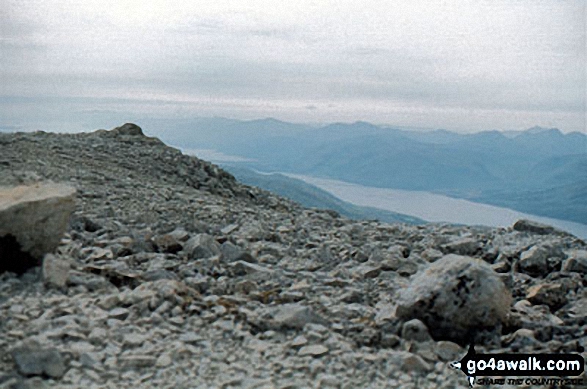 The summit of Ben Nevis in The Glen Roy & Monadhliath MountainsScotland
Photo: John Reed
Is there a Mountain, Peak, Top or Hill missing from the above google map or list?
Let us know an we will add it to our database.

