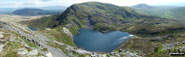
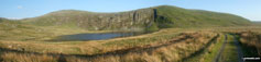
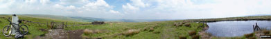
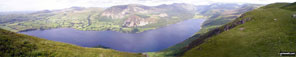
Walk Photographs and views from British Walks published during 2010
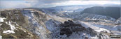
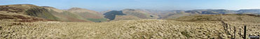
Bamford Moor and Winhill Pike (Win Hill) from The Tower, Alport Castles in the snow

Kinder Scout from The Tower, Alport Castles in the snow

Deep snow on the lane beside Derwent Reservoir in the Upper Derwent Valley

Path to Alport from Derwent Reservoir in the Upper Derwent Valley in the snow

Bridge over Fagney Clough where it enters Derwent Reservoir in the Upper Derwent Valley in the snow


Beinn Chorranach from Beinn Ime

Beinn Chorranach summit cairn with Beinn Ime beyond


Russell Farm Horse Gallop Track near Cobblershill Lane, Wendover Dean


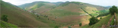
Dunsmore Old Farm from Dunsmore

The Rising Sun pub in Little Hampden

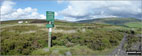
Sandstone Trail Information Board at Beacon Hill Car Park near Frodsham

Sandstone Trail sign crossing Frodsham Golf Course

Sandstone Trail descending into Dunsdale Wood near Frodsham

The Sandstone Trail in Dunsdale Wood near Frodsham

Sandstone 'Steps' in Dunsdale Wood near Frodsham

On The Sandstone Trail in Dunsdale Wood near Frodsham

The Sandstone Trail in Dunsdale Wood near Frodsham

The Sandstone Trail in Dunsdale Wood near Frodsham

Helsby Hill from The Sandstone Trail in Dunsdale Wood near Frodsham

Helsby Hill from The Sandstone Trail in Dunsdale Wood near Frodsham

The Sandstone Trail in Dunsdale Wood near Frodsham


Helsby and The Mersey Estuary from Helsby Hill

The Sandstone Trail on Helsby Hill

Helsby Hill summit trig point with Ellesmere Port and The Mersey Estuary beyond


Helsby, The Mersey Estuary and Runcorn from Helsby Hill

Helsby, Ellesmere Port and The Mersey Estuary from Helsby Hill

The Sandstone Trail in Snidley Moor Wood

Farmland on the edge of Snidley Moor Wood

Helsby Hill from Snidley Moor Wood

The Sandstone Trail on Woodhouse Hill

Helsby Hill from Woodhouse Hill

The Cheshire Plain from Woodhouse Hill

Sandstone 'steps' in Woodhouse Hill Wood

The Sandstone Trail in Woodhouse Hill Wood

The Mosspaul Hotel on the A7 between Carlisle and Hawick


Comb Hill (Langhope Height) from Wisp Hill (Teviothead)


Wisp Hill (Teviothead) summit trig point

Pikethaw Hill from Wisp Hill (Teviothead)
Ewenshope Fell and Wisp Hill (Teviothead) from Pikethaw Hill

Pikethaw Hill summit cairn with Wisp Hill (Teviothead) beyond

Pikethaw Hill from Frodaw Height


Blackhall Hill and White Hill (Teviothead) from Upper Hill (Fiddleton Cottage)


Crude Hill from Fiddleton Cottage on the A7 between Carlisle and Hawick

Ellson Fell from Glenrief Cottage

Climbing Bught Knowe on the way to Glenrief Rig


Bught Knowe on the way to Glenrief Rig

On Bught Knowe on the way to Glenrief Rig

Mosspaul Burn from The Mosspaul Hotel


Little Fell (Lunds Fell) (Mallerstang) and Mallerstang Common from Wild Boar Fell in the snow


Nine Standards Rigg and upper Mallerstang Common from Wild Boar Fell in the snow

Wild Boar Fell summit in the snow

The Howgill Fells from Wild Boar Fell in the snow

The Howgills from Wild Boar Fell in the snow

The Howgills (left) and Wild Boar Fell (right) from Swarth Fell in the snow

The Howgills from Swarth Fell in the snow

Wild Boar Fell from Swarth Fell in the snow

Wild Boar Fell, Mallerstang Common and Nine Standards Rigg from Swarth Fell in the snow

Swarth Fell from Aisgill Moor Cottages, Mallerstang Common

Geese near Aisgill Moor Cottages, Mallerstang Common

Geese near Aisgill Moor Cottages, Mallerstang Common


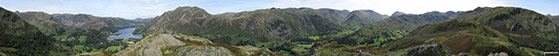
Side Pike from near Wall End Farm, Great Langdale

The Langdale Pikes from near Wall End Farm, Great Langdale

Pike of Blisco (Pike o' Blisco) from near Wall End Farm, Great Langdale

Snow on Wrynose Fell from near Blea Tarn (Langdale)

Snow on The Langdale Pikes from near Blea Tarn (Langdale)

Snow and sunshine on The Langdale Pikes from near Blea Tarn (Langdale)

The last rays on sunshine on The Langdale Pikes across a frozen Blea Tarn (Langdale)

The last rays on sunshine on The Langdale Pikes across a frozen Blea Tarn (Langdale)

Great Langdale under a deep snow

Cutthroat Bridge at the confluence of Highshaw Clough and Ladybower Brook

The Wheel Stones on Derwent Edge

Winhill Pike (Win Hill), Ladybower Reservoir and Crook Hill from Dovestones Tor, Derwent Edge


Meadow overlooking Sheldon near Ashford in the Water

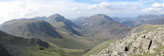
Great Gable and Green Gable from Base Brown

Little Scoat Fell and Pillar (distance) with Brandreth (foreground) from Base Brown

Dale Head (Newlands) and High Spy from Base Brown


Esk Pike (far left), Great End (centre) and Scafell Pike from Base Brown

On the summit of Slieve Bernagh


Looking up to Thorpe Cloud from Dove Dale

Stepping Stones across the River Dove in Dove Dale

Dove Dale Stepping Stones across the River Dove


Dove Dale from the summit of Thorpe Cloud

Tissington Spires, Reynards (Dove Dale) and Dove Dale from the summit of Thorpe Cloud


Thorpe and Cliff Top (Swinscoe) from Thorpe Cloud summit

The River Dove and Dove Dale from Thorpe Cloud

On Spidean Coire nan Clach (Beinn Eighe) summit

Ben Chonzie from Glen Lednock in all its autumn glory


Wetherlam from The Old Man of Coniston

Gowbarrow Fell (Airy Crag) from Hallin Fell summit

Great Mell Fell and Little Mell Fell from Hallin Fell

Ullock Pike, Carl Side, Skiddaw and Little Man (Skiddaw) from Cat Bells (Catbells)

Above the Rheidol Valley, near Pontarfynach / Devil's Bridge

Pen Pumlumon Fawr (Plynlimon) from Nant-y-moch Reservoir

Afon Mynach above Pontarfynach / Devil's Bridge

Approaching the gorge of Craig y Pistyll


One of the narrow streets in Lynton

Lynton Tourist Information Centre

Lynton from the path up to The Danes or Valley of Rocks

Woody Bay, Crock Point and Lee Bay from The Danes or Valley of Rocks near Lynton

Castle Rock and Rugged Jack from The Danes or Valley of Rocks near Lynton

Collapsed Shed in the grounds of Croscombe Barton Farm near Lynton

Woody Bay from The South West Coast Path on Crock Point

Duty Point and Lee Bay from The South West Coast Path on Crock Point

Castle Rock and Rugged Jack from the South West Coast Path near Lee Abbey

Castle Rock from the South West Coast Path in The Danes or Valley of Rocks

Castle Rock from the South West Coast Path beneath Rugged Jack

Wild goat on the South West Coast Path beneath Rugged Jack

Foreland Point from the South West Coast Path above Lynton


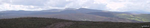
Axe Edge from the summit of Oliver Hill


Millennium Bench in Butterton Village


Hoo Brook ford, Butterton village


The Staffordshire countryside from Butterton


My friend Paula on Dunkery Beacon


Ullswater and Glenridding from Arnison Crag, Patterdale

Place Fell from Arnison Crag, Patterdale

Anlgetarn Pikes and Brock Crags from Arnison Crag, Patterdale


The Helvellyn Ridge beyond St Sunday Crag from Arnison Crag, Patterdale

Kirk Fell, Looking Stead & Pillar from the summit of Green Gable

Ennerdale and High Stile, High Crag & Hay Stacks from Green Gable summit


East towards Simonside from the top of Tosson Hill

North towards The Cheviot Hills from Tosson Hill summit

South across Harwood Forest from the summit of Tosson Hill

West to The Kielder Forest from Tosson Hill trig point


Kinder Reservoir from Middle Moor (Hayfield)
Junction with the Snake Path on Middle Moor (Hayfield)

Footbridge over the River Wharf near Hebden

Suspension footbridge over the River Wharf near Hebden

Weir on the River Wharf near Grassington

The River Wharf near Grassington

Ducks on the River Wharf near Grassington

Bridge over the River Wharf near Grassington

The road around East side of Great Orme

The view from the summit of Great Orme

Great Orme from Happy Valley Car Park

Waterfall off the Llanberis path up Mount Snowdon (Yr Wyddfa)


The summit of Mount Snowdon (Yr Wyddfa)

Glaslyn and Clogwyn y Garnedd from Bwlch Glas just below the summit of Mount Snowdon (Yr Wyddfa)
360 panorama taken from the top of Arnison Crag, Patterdale


Looking up to Green Crag (Ulpha Fell) from near the top of Birker Force, Eskdale


Crags on Lingmell just west of the summit

Lingmell summit cairn with Great Gable in the background


The River Derwent on The Red Kite Trail near Winlaton Mill, Gateshead


The Red Kite Trail in Chopwell Wood

Pennard Cliffs at Pwlldu Head on the Gower Peninsula

The Red Kite Trail in Chopwell Wood

Loch Linnhe from the summit of Ben Nevis

Pennard Cliffs at Pwlldu Head on the Gower Peninsula

Threecliff Bay with Penmaen beyond from Shire Combe, The Gower Peninsula

Threecliff Bay from Shire Combe, The Gower Peninsula

Threecliff Bay from Shire Combe, The Gower Peninsula

Pwlldu Bay, The Gower Peninsula

Threecliff Bay, The Gower Peninsula

Threecliff Bay, The Gower Peninsula

Threecliff Bay, The Gower Peninsula

Threecliff Bay, The Gower Peninsula

Threecliff Bay, The Gower Peninsula

Rock Detail, Threecliff Bay, The Gower Peninsula

Rock Detail, Threecliff Bay, The Gower Peninsula

Rock Detail, Threecliff Bay, The Gower Peninsula

Threecliff Bay from Shire Combe, The Gower Peninsula

Threecliff Bay from Shire Combe, The Gower Peninsula

Threecliff Bay from Shire Combe, The Gower Peninsula

High Pennard and Pwlldu Head from Shire Combe, The Gower Peninsula

Pwlldu Head from Shire Combe, The Gower Peninsula

Shire Combe from High Pennard, Pwlldu Head, The Gower Peninsula

Pwlldu Bay and Brandy Cove from High Pennard, Pwlldu Head, The Gower Peninsula

The Langdale Pikes form Loughrigg Fell


Tarn Crag (Easedale) above Easedale Crag, Easedale Tarn


The track from Cat Bells to Nichol End

Castle Crag from the Derwent Water launch


Cadair Bronwen from Pen Creigiau'r

Moel Ferna from the summit of Pen Creigiau'r


Nant y Pandy from the summit of Moel Fferna

Cadair Berwyn and Cadair Bronwen from the summit of Pan y Ladron

Pen Bwlch Llandrillo Top with Cadair Bronwen in the background

Wayfarer Memorial on the summit of the Pen Bwlch Llandrillo pass

Cadair Berwyn and Cadair Bronwen from Cadair Bronwen (North Top) summit

Pantre and Nant Cwm-llawerrog from Cadair Bronwen

Cadair Bronwen summit cairn with Cadair Berwyn and Moel Sych in the background

Cadair Berwyn and Moel Sych from Bwlch Maen Gwynedd

Cadair Bronwen from Bwlch Maen Gwynedd

Nant Cadair from The Minffordd Path, Minffordd

Looking down Clochnant to The River Dee Valley from Bwlch Maen Gwynedd


Looking South East towards Corris from Craig Cwm Amarch

Looking East towards Minfford from Craig Cwm Amarch


Cadair Idris from Craig Cwm Amarch summit cairn

Lyn Cau from a break in the crags along Craig Cau

Lyn Cau and Craig Cwm Amarch from Craig Cau


Cairn/shelter on Cadair Idris (Penygadair)

The crags on the north side of Cadair Idris (Penygadair)

Looking down Bwlch Cau from Cadair Idris (Penygadair)

Cadair Idris (Penygadair) summit trig point

Mynydd Moel summit cairn and stone shelter

Gau Graig from Mynydd Moel summit


Cadair Idris (Penygadair) from Gau Graig summit cairn

Looing back up to Gau Graig from Mynydd Gwerngraig

Looing back up to Gau Graig from Mynydd Gwerngraig

Snowdonia Nationa Park sign in Minffordd

Pen Bwlch Llandrillo Top from the summit of Cerrig Coediog

Pen Creigau'r from the summit of Cerrig Coediog

Moel Fferna (right) from the summit of Cerrig Coediog

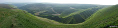
High Stones (Howden Moor) beyond Howden Reservoir


West End River running through Fagney Clough

Looking back down West End River to The Upper Derwent Valley from Ridgewalk Moor

Approaching Barrow Stones from Ridgewalk Moor

Heather in bloom at Barrow Stones

Heather and Grinah Stones in the distance from Barrow Stones

Anvil Stone at Bleaklow Stones (Bleaklow Hill)

Bleaklow Stones (Bleaklow Hill)

Westend Moor Pillar (Trig Point)

Looking down on Alport Dale from Westend Moor

The Johnson-Holme Family on the summit of Mount Snowdon

Dunkery Beacon from Webbers Post


Black Hill (Quantocks) summit pillar


Beacon Hill (Quantocks) summit Pillar


Sign on the Kennet and Avon Canal at Great Bedwyn

The Kennet and Avon Canal at Great Bedwyn


The Kennet and Avon Canal at Crofton Crossing

Telecommunications Mast in Chisbury Wood

The (fictional) home of Sherlock Holmes, East Dean

The plaque on the house in the previous photo in East Dean


East Dean Hill summit Trig Point


The chalk cliffs and Belle Tout Lighthouse from Beachy Head


Birling Gap and The Seven Sisters

Ancient Packhorse Bridge in Allerford


Exmoor through a break in the hedgerow, Selworthy


Selworthy Beacon Summit Trig Point

Porlock Bay and Culborne Hill from Hurlstone Point


Porlock Bay from Hurlstone Point

The former Coastguard Station at Hurlstone Point


Ashton Farm on The Windrush Way near The River Windrush

Ashton Cottage on The Windrush Way near The River Windrush

Ruth, Daisy and Zach at the start near Bletchingley

The path leading to tunnel under the M23 near Steners Hill

Leaving the tunnel under the M23 near Steners Hill


The path to South Nutfield from Steners Hill

Following The Greensand Way, South Nutfield

Stile on The Greensand Way, South Nutfield

Footbridge over the M23 near beyond Crabtree House

Approaching The Maltings near Henshaw Farm

The Surrey Countryside from The Greensand Way above Castlehill Farm


The Transporter Bridge in Newport

Moel y Golfa seen from the neighbouring summit of Rodney's Pillar (Breidden Hill)


Moel y Golfa from the south western slopes of Middletown Hill

Stile and cotton grass on the way from Burnbank Fell to Blake.


The famous Bowder Stone below King's How in Borrowdale, south of Keswick

Carling Knott, Holme Wood and Loweswater from the track to Low Fell

The magnificent Newlands Valley from Dale Head (Newlands)

Dale Head (Newlands) summit cairn

Cat Bells (Catbells), Derwent Water with Bleaberry Fell & High Seat (Ashness Fell) from Scar Crags

Sour Milk Gill Waterfall, near Easedale Tarn

Sour Milk Gill near Easedale Tarn


The Mushroom Shelter on the summit of Scout Scar (Barrowfield) above Kendal

Looking south from the summit of Scout Scar (Barrowfield)

Looking west from the summit of Scout Scar (Barrowfield)

Looking west from Scout Scar (Barrowfield)


The Tom Gill Waterfalls near Tarn Hows

Downstream from the Tom Gill Waterfalls near Tarn Hows

The view west to The Coniston Fells and Wetherlam from near Low Arnside Farm


Flora on the St Brides Bay section of the Pembrokshire Coast

Lovely sandy bay on the St Brides Bay section of the Pembrokshire Coast


Stepping Stones across the River Ure near Askrigg


The River Ure, Askrigg Bottoms


The path back to Askrigg across Askrigg Bottoms from Worton Bridge over the River Ure


Nora Batty's House (from BBC TV's Last of the Summer Wine), Holmfirth

Sid's Cafe (from BBC TV's Last of the Summer Wine), Holmfirth

Shelter on the summit of Whittle Hill
The huge mast on the summit of Winter Hill (Rivington Moor)


Piddington and The Oxfordshire Countryside from Muswell Hill

Muswell Hill summit trig point

Rapeseed in bloom on The Ridgeway near Bledlow

Rapeseed field from The Ridgeway on the top of Lodge Hill


The bench on the top of Whiteleaf Cross

The stunning view from the summit of Whiteleaf Cross

The Ridgeway on the summit of Whiteleaf Cross

'Nora Batty's' House from BBC TV's 'Last of the Summer Wine', Holmfirth

'Sid's Cafe' from BBC TV's 'Last of the Summer Wine', Holmfirth


Woodland near Hinchliffe Mill, Holmfirth

The Holme Valley from near Hogley Green


Woodland between Upperthong and Netherthong


Harden Reservoir from Harden Clough

Harden Clough from Snailsden Reservoir


Snailsden Reservoir from Snailsden


Snailsden Reservoir outlet with Winscar Reservoir beyond

Boundary stone near Harden Reservoir

Brown Knoll (Edale) from The Pennine Way near Upper Booth

The footbridge carrying The Pennine Way at the foot of Jacob's Ladder (Edale)

Pym Chair from the large cairn at the top of Jacob's Ladder (Edale)

Pym Chair from the large cairn at the top of Jacob's Ladder (Edale)

The Vale of Edale from the top of Jacob's Ladder (Edale)

Pym Chair and Crowden Tower from the Pennine Way near Kinder Low (Kinder Scout)

Kinder Low (Kinder Scout) trig point


At the top of Grindsbrook Clough with Grindslow Knoll (Kinder Scout) in the distance


Crossing the footbridge over Grinds Brook near Edale

The old bridge over Afon Claerwen at the South East end of Dolymynach Reservoir

Cwm Marchnant with Rhos y Gelynnen beyond

Gorllwyn (Pen y Gorllwyn) summit trig point and shelter

Large cairn on Gorllwyn (Pen y Gorllwyn) summit

Drygarn Fawr from a boundary stone on Gorllwyn (Pen y Gorllwyn)

Large cairn on the summit of Carnau

One of the two huge beacons on Drygarn Fawr

The other huge beacon on Drygarn Fawr

Drygarn Fawr summit and trig point

The trig point on Drygarn Fawr


Afon Claerwen with Gro Hill beyond

Afon Claerwen with Waun Lydan beyond

Garreg-ddu Reservoir, The Elan Valley

Caban-coch Reservoir, The Elan Valley

The lower slopes of Whimble above New Radnor, Radnor Forest

Whimble summit with Whinyard Rocks beyond and Bache Hill in the distance, Radnor Forest

Harley Dingle from the summit of Whimble, Radnor Forest

Whimble from near Whinyard Rocks, Radnor Forest

Bache Hill summit trig point with Black Mixen on the horizon, Radnor Forest

Whimble beyond Harley Dingle from the head of Ystol Bach Brook, Radnor Forest

Bache Hill from the head of Ystol Bach Brook, Radnor Forest

Great Rhos above Harley Dingle from the head of Ystol Bach Brook, Radnor Forest

Black Mixen summit, Radnor Forest

Black Mixen summit trig point, Radnor Forest

Harley Dingle from Shepherd's Well, Radnor Forest

Woodland near Cross Dyke, Radnor Forest

Bache Hill and Harley Dingle from near Cross Dyke, Radnor Forest

Great Rhos summit trig point, Radnor Forest

Crags on Three Riggles below Great Rhos, Radnor Forest


Black Mixen above the Harley Dingle/New Radnor Firing Range, Radnor Forest


Great Creigiau from Harley Dingle Brook, Lower Harley, Radnor Forest

The footbridge over Harley Dingle Brook, Lower Harley, Radnor Forest

Great Rhos from Harley Dingle Brook, Lower Harley, Radnor Forest

Mynd (Radnor Forest) from Harley Gorse, New Radnor, Radnor Forest

The Smatcher from Harley Gorse, New Radnor, Radnor Forest

New Radnor church, Radnor Forest

New Radnor village, Radnor Forest

New Radnor war memorial, Radnor Forest


Swanbourne Lake entrance to Arundel Park


Amberley and The South Downs from Arundel Park

Arundel Park entrance gate near South Stoke


The River Arun near South Stoke


The George and Dragon, Burpham

Boat wreck - some distance inland from The River Arun between Burpham and Arundel


Carving on the gate post at the entrance to King George's Field, Yapton

Carving on right-hand gate post at the entrance to King George's Field, Yapton

Weststone Bridge over Ryebank Rife


Walkers' Railway Crossing near Lidsey Lodge Farm

What is left of The (former) Portsmouth and Arundel Navigation Canal near Barnham Court, Barnham

The (former) Portsmouth and Arundel Navigation Canal name plaque near Barnham Court, Barnham

The (former) Portsmouth and Arundel Navigation Canal near Tilebarn Farm, Barnham

The (former) Portsmouth and Arundel Navigation Canal beyond Tilebarn Farm, Barnham

The Monarch's Way waymarker in Eartham Woods


Flint Wall detail near Little Halnaker


Stane Street (Roman Road) north east of Halnaker

The Windmill on the top of Halnaker Hill

Myself, Paul Baldry, Max the Dog, Jenny Baldry, Tom Evans and Martin Brown on top of Ingleborough.

Black timber clad church in Ganllwyd

The Y Garn (Rhinogs) ridge from Ffridd Bryn-melyn

Ruined mine building beneath Bryn Bedwog on the lower slopes of Y Garn (Rhinogs)

Fenced of mine shaft beneath Bryn Bedwog on the lower slopes of Y Garn (Rhinogs)

Climbing Y Garn (Rhinogs) above Bryn Bedwog

Rhaeadr Du (Black Waterfall), Cwm Camlan, Ganllwyd

Llyn Du in mist on Moel Ysgyfarnogod

Moel Ysgyfarnogod summit in mist

Gritstone 'pavement' on Moel Ysgyfarnogod

Foel Penolau summit cairn in mist

Llyn Dywarchen on Moel Ysgyfarnogod in mist


Tremadog Bay from the lower slopes of Moel Ysgyfarnogod as the mist starts to lift

The sun setting behind the hills of The Lleyn Peninsula across Tremadog Bay from Llandanwg

The Moelwyns across Tremadog Bay from Llandanwg

The Lleyn Peninsula at sunset from Llandanwg

Y Garn (Pumlumon) from Nant-y-moch Reservoir


Drosgol (Pumlumon) and Nant-y-moch Reservoir from Y Garn (Pumlumon)
Nant-y-moch Reservoir, Drosgol (Pumlumon) and Pen Pumlumon Fawr (Plynlimon) from Y Garn (Pumlumon)

Y Garn (Pumlumon) summit cairn


Y Garn (Pumlumon) from Pen Pumlumon Fawr (Plynlimon)

Nant-y-moch Reservoir from Pen Pumlumon Fawr (Plynlimon)

Pen Pumlumon Fawr (Plynlimon) summit trig point with Y Garn (Pumlumon) in the distance

Pen Pumlumon Fawr (Plynlimon) summit trig point with Nant-y-moch Reservoir below


Pen Pumlumon Fawr (Plynlimon) summit

Pen Pumlumon Fawr (Plynlimon) from Pumlumon Fach summit cairn

Pen Pumlumon Fawr (Plynlimon) summit from the cairn on the North end of the ridge

Pumlumon Fach from Pumlumon Fach (East Top) summit

The Pumlumon Fach crags beneath Pen Pumlumon Fawr (Plynlimon)

Llyn Llygad Rheidol from Pen Pumlumon Fawr (Plynlimon)


Pen Pumlumon Llygad-bychan summit cairn

Boundary stone on Pen Pumlumon Llygad-bychan

Boundary stone on the approach to Pen Pumlumon Arwystli

The two massive cairns on the summit of Pen Pumlumon Arwystli

Memorial stone on Pen Pumlumon Arwystli


Pen Pumlumon Arwystli and Pen Cor-maen (right) from Cwm Gwerin

Pen Cor-maen (right) from the junction of Cwm Gwerin with Afon Hengwm


Ruin with Carn Hyddgen beyond from Afon Hengwm

Banc Llechwedd-mawr from Afon Hengwm at the North East end of Nant-y-moch Reservoir


Moelfre (Rhinogs) from the lower slopes of Rhinog Fawr above Nantcol

Ruined barn on the lower slopes of Rhinog Fawr above Nantcol

Rhinog Fawr summit from the large cairn on the SW flank of Rhinog Fawr

Rhinog Fawr summit with Carreg-y-Saeth and Gloyw Lyn below

Looking East from the summit of Rhinog Fawr

Looking down to Bwlch Drws-Ardudwy from Rhinog Fawr

Rhinog Fach and Y Llethr with Bwlch Drws-Ardudwy below from Rhinog Fawr

Looking back up to Rhinog Fawr from the large cairn on Bwlch Drws-Ardudwy

The large cairn at the top of the Bwlch Drws-Ardudwy pass

Looking down to Bwlch Drws-Ardudwy after the very steep section on the North Face of Rhinog Fach

Rhinog Fawr towers above Bwlch Drws-Ardudwy from the cairn on the North end of the Rhinog Fach ridge
Rhinog Fawr and Northern Snowdonia from the cairn on the north end of the Rhinog Fach ridge

Rhinog Fawr from the Rhinog Fach summit cairn


Y Llethr from the summit of Rhinog Fach (with Cadair Idris in the distance behind the summit cairn)

Y Llethr and Llyn Hywel from the summit of Rhinog Fach

Llyn y Bi from the summit of Rhinog Fach

Rhinog Fach from the pass above Llyn Hywel

Rhinog Fawr (centre left) and Rhinog Fach (centre right) and Llyn Hywel from Y Llethr

Y Llethr from the pass above Llyn Hywel

Y Llethr summit cairn with Rhinog Fawr in the distance

Crib-y-rhiw (foreground) and Diffwys from Y Llethr

Y Llethr from the modest cairn on the summit of Crib-y-rhiw


Y Llethr and Crib-y-rhiw above Llyn Dulyn from Diffwys


360° panorama taken at the summit of Freeholds Top


The path along the Simonside ridge to Simonside Crag


Stone Beacons on the summit of Branstree

Nan Bield Pass and Small Water with Rough Crag and High Street beyond from Harter Fell (Mardale)

Mellbreak from the Kirkstile Inn car park at Loweswater


Ladybower Reservoir from the dam near Yorkshire Bridge

Damflask Reservoir from Low Bradfield

On The South Bucks Way near Little Missenden

On The South Bucks Way South East of Little Missenden

On The South Bucks Way South East of Little Missenden

Shardeloes Lake through the trees


The River Kinder at Kinder Gates on Kinder Scout, east of Kinder Downfall


The rather Narnia-like stone table above Mermaid's Pool near The Edge (Kinder Scout), Kinder Scout


Looking back towards Eyam from the lower slopes of Sir William Hill

Para gliders above Bretton, Eyam Edge

Stanage Edge from Bole Hill, Eyam Moor

Airplane wreckage below Broad Crag buttress, just off the corridor route to Scafell Pike

Great End from Broad Crag buttress, just off the corridor route to Scafell Pike

The propeller from a crashed Mosquito aircraft on Aran Fawddwy

Hydro Dam in Coppermines Valley, near Miners Bridge, above Coniston

Coniston Water from Hole Rake below Wetherlam

Fairfield from Hole Rake below Wetherlam

Looking down into Tilberthwaite from Hole Rake below Wetherlam


Looking North from Thrunton Crag


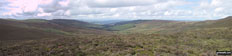
Views from Cwmcarn Forest Drive

Views from Cwmcarn Forest Drive

Views from Cwmcarn Forest Drive

Views from Cwmcarn Forest Drive

Views from Cwmcarn Forest Drive

Views from Cwmcarn Forest Drive

Views from Cwmcarn Forest Drive

Views from Cwmcarn Forest Drive

Views from Cwmcarn Forest Drive

Views from Cwmcarn Forest Drive

Views from Cwmcarn Forest Drive

Views from Cwmcarn Forest Drive


Newcastle quayside - Walking The Hadrian's Wall Path National Trail - Day 1

Part of re-developed Tyne in Newcastle - Walking The Hadrian's Wall Path National Trail - Day 1


Sage Music Centre, Gateshead - Walking The Hadrian's Wall Path National Trail - Day 1

Segedunum Fort - Walking The Hadrian's Wall Path National Trail - Day 1

The Kittiwake colony on the Tyne Bridge - Walking The Hadrian's Wall Path National Trail - Day 1

The View west from Millennium Eye Bridge - Walking The Hadrian's Wall Path National Trail - Day 1

Heddon-on-the Wall - Walking The Hadrian's Wall Path National Trail - Day 1

Whittle Dene Reservoir - Walking The Hadrian's Wall Path National Trail - Day 2

Whittle Dene Reservoir - Walking The Hadrian's Wall Path National Trail - Day 2


On Whittington Fell - Walking The Hadrian's Wall Path National Trail - Day 3

View from near Bruntwood Bank - Walking The Hadrian's Wall Path National Trail - Day 3

High Brunton Turret - Walking The Hadrian's Wall Path National Trail - Day 3

Locals near High Brunton Turret - Walking The Hadrian's Wall Path National Trail - Day 3

River North Tyne at Chollerford - Walking The Hadrian's Wall Path National Trail - Day 3

Hadrian's Wall at Planetrees - Walking The Hadrian's Wall Path National Trail - Day 3

Walwick Hall - Walking The Hadrian's Wall Path National Trail - Day 3

Hadrian's Wall near Carrawbrough - Walking The Hadrian's Wall Path National Trail - Day 4

The view from Shield on the Wall - Walking The Hadrian's Wall Path National Trail - Day 4

Temple of Mithras, Carrawbrough - Walking The Hadrian's Wall Path National Trail - Day 4

Vercovicium Fort, Housesteads - Walking The Hadrian's Wall Path National Trail - Day 4

Hadrian's Wall near Black Carts Turret - Walking The Hadrian's Wall Path National Trail - Day 4

Cawfields-Quarry - Walking The Hadrian's Wall Path National Trail - Day 5

Once Brewed - Walking The Hadrian's Wall Path National Trail - Day 5

Hadrian's Wall near Once Brewed - Walking The Hadrian's Wall Path National Trail - Day 5

The view west of Steel Rigg - Walking The Hadrian's Wall Path National Trail - Day 5

Birdoswald - Walking The Hadrian's Wall Path National Trail - Day 5

Thirlwall Castle - Walking The Hadrian's Wall Path National Trail - Day 5

The view from Banks Walking The Hadrian's Wall Path National Trail - Day 6

The view from Banks Walking The Hadrian's Wall Path National Trail - Day 6


King Water near Walton Walking The Hadrian's Wall Path National Trail - Day 6

Rickerby Hall Walking The Hadrian's Wall Path National Trail - Day 6

Crag Lough Walking The Hadrian's Wall Path National Trail - Day 4

Highshield Crags - Walking The Hadrian's Wall Path National Trail - Day 4

Heading towards Steel Rigg - Walking The Hadrian's Wall Path National Trail - Day 4

Steel Rigg - Walking The Hadrian's Wall Path National Trail - Day 4

Sycamore Gap - Walking The Hadrian's Wall Path National Trail - Day 4

The Causeway to Bowness-on-Solway - Walking The Hadrian's Wall Path National Trail - Day 7

The Causeway to Bowness-on-Solway - Walking The Hadrian's Wall Path National Trail - Day 7

The Causeway to Bowness-on-Solway - Walking The Hadrian's Wall Path National Trail - Day 7

Drumburgh Castle - with Roman Altar - Walking The Hadrian's Wall Path National Trail - Day 7

The River Eden West of Carlisle - Walking The Hadrian's Wall Path National Trail - Day 7

The Solway Estuary - Walking The Hadrian's Wall Path National Trail - Day 7

Statue of King Edward I, Burgh-by-Sands - Walking The Hadrian's Wall Path National Trail - Day 7

Port Carlisle - Walking The Hadrian's Wall Path National Trail - Day 7

Friends Joy & John at end of trail - Walking The Hadrian's Wall Path National Trail - Day 7

Me & John at end of trail made it! Walking The Hadrian's Wall Path National Trail - Day 7

King Water near Walton Walking The Hadrian's Wall Path National Trail - Day 6


Bluebells in woodland beside the River Noe in the Vale of Edale

Helvellyn above Thirlmere from Raven Crag (Thirlmere)

Bluebells covering the ground in woodland beside the River Noe in the Vale of Edale

Crookland Wood near Langsett Reservoir

Hordron Road (Track) crossing Langsett Moors

The Porter or Little Don River

The Porter or Little Don River in Laund Clough

The Porter or Little Don River in Hordron Clough


Deep peat groughs on Howden Edge

Horse Stone (Horse Stone Naze) on Howden Moors

Horse Stone (Horse Stone Naze) rock sculptures on Howden Moors

Rocking Stones at Crow Stones Edge on Howden Moors

Rocking Stones at Crow Stones Edge on Howden Moors

Rocking Stones Rock Sculptures at Crow Stones Edge on Howden Moors

Howden Reservoir, Derwent Reservoir and Ladybower Reservoir from Outer Edge


Margery Hill summit trig point

Cairn on the Cut Gate Path (Bridleway)

Damage to the Cut Gate Path (Bridleway) by mountain bikes


Macclesfield Forest from The Cat and Fiddle

Shutlingsloe from The Cat and Fiddle


The River Dane in Danebower Hollow

The River Dane in Danebower Hollow near Three Shires Head


Stone wall stile on Cheeks Hill - the highest point in Staffordshire

Goyt's Valley from Axe Edge Moor

Great Borne and Starling Dodd beyond Ennerdale from Ennerdale Weir

Bridge over The River Ehen at Ennerdale Weir


Great Borne and Starling Dodd above Ennerdale Water

Bowness Knott and Great Borne above Ennerdale Water

Bowness Knott and Great Borne above Ennerdale Water


The summit of Little Gowder Crag

Haycock summit cairn during a break in the mist

Ennerdale from the summit of Haycock during a break in the mist

Caw Fell summit cairn with Iron Crag beyond


Whoap summit boulder with Lank Rigg beyond


Great Borne across Ennerdale from the summit of Crag Fell


Grike summit cairn and shelter

Great Bourne and Bowness Knott from near Ennerdale Weir

Tyn-y-ffridd and Mynydd Mawr (Berwyns) from Mynydd Tarw


Cadair Bronwen from the gated track NW of Tomle

Cadair Berwyn from the summit of Tomle

Cadair Bronwen from near Tomle

Cwm Maen Gwynedd and Tyn-y-ffridd from Craig Berwyn


Cadair Berwyn and Moel Sych from Craig Berwyn


Craig Berwyn from Cadair Berwyn

Cadair Berwyn (North Top) summit trig point

Llyn Lluncaws from Cadair Berwyn

Cadair Berwyn from Moel yr Ewig

Decending the ridge from Cadair Berwyn towards Moel yr Ewig

Llyn Lluncaws from Moel yr Ewig

Moel Sych, Cadair Berwyn and Moel yr Ewig from Godor (North Top)


Looking East to the summit of Ben Nevis under a blanket of snow

Ben Nevis summit under a blanket of snow

Ben Nevis summit under a blanket of snow

Anocah Mor (left) and Anoach Beag (right) from the summit of Ben Nevis

The Langdale Pikes reflected in Blea Tarn (Langdale)


Lamaload Reservoir from near Yearns Low


The River Kinder being blown UP Kinder Downfall by the wind


The Tower on the summit of Callow Hill, Wenlock Edge

The Macclesfield Canal near Scholar Green


Woodcock's Well, Mount Pleasant

The Gritstone Trail at Mow Cop (Old Man of Mow)


The Cheshire Plain from the ruin on the summit of Mow Cop (Old Man of Mow)

On the summit of Mow Cop (Old Man of Mow)

Mow Cop (Old Man of Mow) summit ruin

Telecommunications Mast on Mow Cop (Old Man of Mow) summit

Wooden Barn near Little Moreton Hall


Shropshire from near View Edge (Weo Edge)

The wooded summit of View Edge (Weo Edge)

Callow Hill (Wenlock Edge) from Stokesay


Pontesbury Hill from Earl's Hill


On the Earl's Hill summit ridge


The Shropshire Hills from Earl's Hill

Tudor framed house in Pontesbury

The Seat (Birker Fell) and Devoke Water from Rough Crag (Birker Fell)

Rough Crag (Birker Fell) summit cairn

Approaching Water Crag (Birker Fell) from Rough Crag (Birker Fell)

The Seat (Birker Fell) and Devoke Water from Water Crag (Birker Fell) summit


The Knott (Stainton Fell) from Birkby Fell

The Knott (Stainton Fell) summit

The Knott (Stainton Fell) from White Pike (Birkby Fell)

White Pike (Birkby Fell) summit cairn


Woodend Height (Yoadcastle) summit cairn


Devoke Water from Seat How (Birker Fell) summit

Devoke Water from Seat How (Birker Fell)

The River Ashop in Lady Clough

Climbing Fair Brook towards Fairbrook Naze (Kinder Scout)

Fair Brook near the top of Fairbrook Naze (Kinder Scout)

Fair Brook frozen solid near the top of Fairbrook Naze (Kinder Scout)

Fairbrook Naze (Kinder Scout) from the top of Fair Brook

Rock sculptures on Fairbrook Naze (Kinder Scout)

Seal Edge beyond the rock sculptures on Fairbrook Naze (Kinder Scout)

The Ashop Valley from Fairbrook Naze (Kinder Scout)

The Edge (Kinder Scout) from Fairbrook Naze (Kinder Scout)

Looking West along The Edge (Kinder Scout)

Rock sculptures on The Edge (Kinder Scout)

Looking East across The Edge (Kinder Scout) towards Fairbrook Naze (Kinder Scout)

Rock sculptured by the wind on The Edge (Kinder Scout)

Kinder Scout from Mill Hill (Ashop Head)

Bridge over The River Wharf at Yockenthwaite


Pen-y-ghent from Horse Head Moor summit trig point

Buckden Pike from Firth Fell summit trig point


The River Swale from the bridge at Keld

Catrake Force Waterfall at Keld

Ivelet Moor and the Swale valley from the bridge at Keld

Kisdon Force waterfall at Keld

Kisdon Force waterfall at Keld

Kisdon Force waterfall at Keld

Kisdon from the Pennine Way on Black Moor north of Keld

Keld from the Pennine Way on Black Moor north of Keld

West Stones Dale from the Pennine Way on Stonesdale Moor

West Stones Dale from the Pennine Way on Stonesdale Moor


Sheepfold beside Stonesdale Beck

Thomas Gill Mea, West Stones Dale


Whitsundale Beck near Ravenseat

Stone bridge over Whitsundale Beck near Ravenseat


The River Lune Valley from Thorn Moor

The River Lune Valley from Castle Knott summit cairn


Sculpture outside Whinlatter Forest Park Visitors Centre

The Bassenthwaite Valley from Barf

Barf summit appears out of the mist

Lord's Seat (Whinlatter) summit in mist


Graystones above Widow Hause from Broom Fell


Scawgill Bridge, Whinlatter Pass

Heading down towards Scawgill Bridge, Whinlatter Pass from Graystones

Whinlatter (Brown How) summit cairn with Graystones in the distance

Whinlatter (Whinlatter Top) summit cairn


Cairn on Hail Storm Hill overlooking Cowpe Moss Reservoir


Pair of lone gate posts on Hail Storm Hill

Boundary Stone on Hail Storm Hill


Memorial to a crashed aircraft on Whittle Hill

Winter Hill (Rivington Moor) summit

Malvern (Worcestershire Beacon) summit trig point

The view from the top of Malvern (Worcestershire Beacon)

Sugarloaf Hill (Malverns) from the top of Malvern (Worcestershire Beacon)

Malvern (Worcestershire Beacon) and Sugarloaf Hill (Malverns) from North Hill (Malverns)

Looking North down to End Hill (Malverns) from North Hill (Malverns)

The countryside near West Malvern

Approaching the Swastika Stone on Ilkley Moor

The Swastika Stone on Ilkley Moor

Large boulder on on Ilkley Moor near the Swastika Stone

Climbing High Moor from the Swastika Stone


Another Boundary Stone on High Moor

Overgate Croft Farm trig point on High Moor

Cowper's Cross on Rombalds Moor (Ilkley Moor)

Rombalds Moor (Ilkley Moor) summit trig point

Boundary stone on Rombalds Moor (Ilkley Moor)

White Wells Farm and Ilkley from Rombalds Moor (Ilkley Moor)

Calf Top from Barth Bridge, Dentdale

Calf Top from Long Moor (Dentdale)

The Howgills from Long Moor (Dentdale)

Wernside and Dentdale from Aye Gill Pike

Great Coum and Gragareth across Dentdale from Aye Gill Pike

Aye Gill Pike summit trig point


Tunnel air shaft on Snaizwold Fell

Great Knoutberry Hill (Widdale Fell) summit trig point


Climbing up through Stanbroughs Wood

Brown Clee Hill (Abdon Burf) summit ruins

Brown Clee Hill (Abdon Burf) summit

Brown Clee Hill (Abdon Burf) summit trig point

View down towards Cockshutford from Brown Clee Hill (Clee Burf)

Brown Clee Hill (Abdon Burf) from Brown Clee Hill (Clee Burf)

Brown Clee Hill (Clee Burf) summit


Titterstone Clee Hill from near Nine Spring Farm


Ruins on the summit of Titterstone Clee Hill

Ruins on the summit of Titterstone Clee Hill

View down the Titterstone Incline from the summit of Titterstone Clee Hill

The summit of Titterstone Clee Hill

Titterstone Clee Hill summit trig point

Brown Clee Hill (Abdon Burf) from the summit of Titterstone Clee Hill

Sign in the lay by on the A6 at Demings Moss south of Shap

High House Bank from the featureless summit of Whatshaw Common

The fence junction marking the summit of Great Yarlside

Harrop Pike from Great Yarlside


Lord's Seat (Crookdale) from Harrop Pike

Grey Crag (Sleddale) summit winding tower

Great Yarlside from Lord's Seat (Crookdale)

Grey Crag (Sleddale) summit cairn

Lord's Seat (Crookdale) summit cairn

High House Bank from the summit of Robin Hood (Crookdale)


Broom in bloom along Tarnbrook Wyre near Abbeystead


White Moor from Backside of Tarnbrook Fell

Boundary Stone on Tarnbrook Fell


Wolfhole Crag summit trig point

Mallowdale Pike (Mallowdale Fell) Trig Point from Queen's Chair

Grey Mare and Foal (rock formations) from Mallowdale Pike (Mallowdale Fell) Trig Point

Pool on Mallowdale Pike (Mallowdale Fell) summit

Boundary Stone on Mallowdale Pike (Mallowdale Fell) summit

Cairn near Ward's Stone (Mallowdale Fell) western summit

Ward's Stone (Mallowdale Fell) summit Trig Point

Rock formations on Ward's Stone (Mallowdale Fell) summit


Clougha Pike summit trig point

Shooter's Pile (cairn) on Grit Fell

Jubilee Tower on Abbeystead Fell

Stone plaque celebrating the Jubilee of Queen Victoria, Jubilee Tower on Abbeystead Fell


Alston Railway Station Name Plaque


Alston Railway Station Signal Box


Bridehead Lake waterfall, Littlebredy

Thomas Hardy memorial stone near his birthplace in Higher Bockhampton

Thomas Hardy's birthplace (rear) in Higher Bockhampton

Thomas Hardy's birthplace in Higher Bockhampton


James Hammett's grave stone (one of the Tolpuddle Martyrs) in Tolpuddle Churchyard


On Ramsden Road (track) near Rough Hill (Shore Moor) with Watergrove Reservoir in the distance

On Ramsden Road (track) near Rough Hill (Shore Moor)

Climbing Rough Hill (Shore Moor) with Watergrove Reservoir beyond

Rough Hill (Shore Moor) summit cairn

Ramsden Road on the North side of Rough Hill (Shore Moor)

Ramsden Road between Rough Hill (Shore Moor) and Freeholds Top

Manshead End (Soyland Moor) from Freeholds Top

Freeholds Top summit trig point

Middle Hill (Whitworth) summit cairn

Brown Wardle Hill from Middle Hill (Whitworth)

Brown Wardle Hill summit cairn

Boundary Stone on Brown Wardle Hill

Boundary Stone on Brown Wardle Hill


Former school at Budworth Heath


The River Ure from Worton Bridge

Decorated cottage in Great Budworth village

The former Post Office in Great Budworth


On the Carpley Green Road (track)

Wensleydale from the Carpley Green Road (track)

Addlebrough from Worton Pasture

Semer Water from Worton Pasture

Long haired highland cows near the summit of Arnside Knott

Kent Viaduct and Milnthorpe Sands from the summit of Arnside Knott

Morecambe Bay from the summit of Arnside Knott

Arnside Knott summit trig point

Morecambe Bay through the trees from Arnside Knott

Unusual tree remains on Arnside Knott

Humphrey Head Point from Arnside Knott


Hampsfell above Grange-over-Sands across Morecambe Bay from Arnside

Not a breath of wind on Arnside Sands, Morecambe Bay

Fishermen on Arnside Sands, Morecambe Bay

The beach at Arnside, Morecambe Bay

Slaidburn bridge over The River Hodder

Slaidburn and The River Hodder from Slaidburn bridge


The Lancashire countryside near Easington Brook


Unusual track vehicle in Fell Side Farm


'Old Ned' (cairn) on Easington Fell

'Old Ned's Wife' (cairn) on Easington Fell


Slaidburn Village War Memorial


Salter's Brook Packhorse Bridge

Woodhead Railway Tunnel Air Shaft

Dead Edge End summit trig point


Twizle Head Moss beyond Ramsden Clough


Little Grains Clough where it enters Winscar Reservoir

Winscar Reservoir from above Little Grains Clough

Winscar Reservoir from the lower slopes of Upper Dead Edge


Above The Ingleton Waterfalls near Twistleton Hall

Ingleborough from The River Doe above The Ingleton Waterfalls

The River Doe above Beezley Falls, The Ingleton Waterfalls

Ingleborough through the trees from above Beezley Falls, The Ingleton Waterfalls

The River Twiss in Kingsdale above Thornton Force, The Ingleton Waterfalls

The River Twiss in Kingsdale just before it tumbles over Thornton Force, The Ingleton Waterfalls

Thornton Force, The Ingleton Waterfalls

Thornton Force, The Ingleton Waterfalls

The River Twiss in Swilla Glen, below Thornton Force, The Ingleton Waterfalls


Black Combe from the cairn on Seaness above Townend Knotts

Place Fell and Angletarn Pikes above Brothers Water from High Hartsop Dodd


The summit of Little Hart Crag in deep snow

Great Rigg (right) and High Pike (Scandale) (left) from Dove Crag


Windermere from Orrest Head summit

Windermere under a blanket of mist from Orrest Head

Dawn across The Bassenthwaite Valley and The Derwent Fells from near Millbeck

Crookstone Hill and Blackden Edge from The River Ashop

Looking towards Windermere from Loughrigg Fell summit


Mist over Windermere from Loughrigg Fell summit

The Coniston Fells from from Loughrigg Fell


Loughrigg Fell summit trig point

Descending Loughrigg Fell in winter light towards Rydal


Beda Head (Beda Fell) summit cairn

Brothers Water from the summit of Angletarn Pikes

A frozen Angle Tarn from Angletarn Pikes

A snow capped Blencathra or Saddleback (Hallsfell Top) viewed from the summit of Skiddaw

On Edale Head looking towards Kinder Low (Kinder Scout) from Noe Stool (Edale)


Lose Hill (Ward's Piece) and The Vale of Edale from the summit of Grindslow Knoll (Kinder Scout)

The stone footbridge at the bottom of Jacob's Ladder (Edale)

Footbridge under a deep layer of snow in Little Hayfield


Cove Mountain from half way up Slieve Donard (Sliabh Donairt)

Slieve Commedagh from half way up Slieve Donard (Sliabh Donairt)

In the snow on the southern slope of Slieve Donard (Sliabh Donairt)

Cove Mountain and Slieve Bearnagh from Slieve Donard (Sliabh Donairt)

The southern slope of Slieve Donard (Sliabh Donairt)

Cove Mountain with Slieve Binnian in the distance from Slieve Donard (Sliabh Donairt)

The Mourne Mountains Range from the southern slope of Slieve Donard (Sliabh Donairt)

The Mourne Mountains Range from the southern slope of Slieve Donard (Sliabh Donairt)

Slieve Commedagh from the shelter on top from Slieve Donard (Sliabh Donairt)


The shelter on the summit of Slieve Donard (Sliabh Donairt)

On Slieve Donard (Sliabh Donairt) summit

Slieve Bearnagh from Slieve Donard (Sliabh Donairt)

Frozen Quarry at the top of the Bloody Bridge River

On a frozen Donard Bog at the top of the Bloody Bridge path

On a frozen Donard Bog at the top of the path from Bloody Bridge

On a frozen Slieve Donard (Sliabh Donairt) Bog at the top of the path from Bloody Bridge

Deep snow on the Lose Hill (Ward's Piece) ridge

Mam Tor, Hollins Cross, Back Tor (Hollins Cross) in deep snow on the Lose Hill (Ward's Piece) ridge

Kinder Scout and The Vale of Edale in deep snow from the Lose Hill (Ward's Piece) ridge

Lose Hill (Ward's Piece) in deep snow from Back Tor (Hollins Cross)

Mam Tor and Hollins Cross in deep snow from the summit of Back Tor (Hollins Cross)

The steep descent to Hollins Cross in deep snow from the summit of Back Tor (Hollins Cross)

Back Tor (Hollins Cross) under a blanket of snow

Deep snow on the ridge between Back Tor (Hollins Cross) and Hollins Cross

Walking the ridge towards Mam Tor in deep snow between Back Tor (Hollins Cross) and Hollins Cross

Mam Tor in deep snow from Hollins Cross

Descending from Hollins Cross towards Castleton with Mam Tor beyond

Castleton from Hollins Cross under a blanket of snow

Mam Tor from the path below Hollins Cross under a blanket of deep snow

Looking back up to Hollins Cross from near Mam Farm under a blanket of deep snow


Snowy fields East of Spring House Farm between Castleton and Hope

Snowy fields near Spring House Farm between Castleton and Hope

Shatton Edge from snowy fields near Spring House Farm between Castleton and Hope

Winhill Pike (Win Hill) from snowy fields near Spring House Farm between Castleton and Hope

Snowy fields near Spring House Farm between Castleton and Hope

Farm buildings at the end of Castleon Road north west of Hope

Walking along Castleon Road in deep snow north west of Hope

Mynydd Moel from the summit of Cadair Idris (Penygadair) in deep snow

The summit of Cadair Idris (Penygadair) in deep snow

Climbing Plynlimon (Pen Pumlumon Fawr) from Nant-y-moch Reservoir

On Plynlimon (Pen Pumlumon Fawr)

Plynlimon (Pen Pumlumon Fawr) from Pen Cerrig Tewion

Plynlimon (Pen Pumlumon Fawr) and Llyn Llygad Rheidol

On Plynlimon (Pen Pumlumon Fawr) near Llyn Llygad Rheidol


My wife just below High Pike (Scandale) during a temperature inversion on the Fairfield Horseshoe


Lake Windermere from the summit of Ill Bell


Sunset over Derwent Water with Cat Bells (Catbells) in the background from near Walla Crag

Icicles on the C2C between Threlkeld and Keswick


View north at top of Primrose Wood


Suilven (Caisteal Liath) and Meall Meadhonach (Suilven) across Loch Druim Suardalain

Canisp from the track beside Loch Druim Suardalain


Highland Cow near Weeting in the snow

On the Roman Road near Capel-y-ffin, Vale of Ewyas

Near Capel-y-ffin, Vale of Ewyas

The countryside near Weeting in the snow

Highland Cow near Weeting in the snow

Highland Cow near Weeting in the snow

Highland Cow in a field near Weeting in the snow

The countryside near Weeting in the snow

Highland Cattle near Weeting in the snow

Highland Cattle near Weeting in the snow

The countryside near Weeting in the snow

Looking East from the level crossing to Brandon Railway Station in the snow

Looking West from the level crossing at Brandon Railway Station in the snow

The Norfolk Countryside near Weeting in the snow

The Norfolk County Border at the Level Crossing, Brandon Railway Station

The Norfolk Countryside near Weeting in the snow

The Norfolk Countryside near Weeting in the snow

The Norfolk Countryside near Weeting in the snow

The Norfolk Countryside near Weeting in the snow

Cattle in a blizzard near Weeting in the snow

Cattle in a blizzard near Weeting in the snow

Cattle in a blizzard near Weeting in the snow

Cattle in a blizzard near Weeting in the snow

Pigs in a field near Weeting in the snow

Pigs in a field near Weeting in the snow

Rabbits near Weeting in the snow

Rabbit near Weeting in the snow

Woodland near Weeting in the snow

Woodland near Weeting in the snow

Lone gate in woodland near Weeting in the snow

Woodland near Weeting in the snow

Winter Berries near Weeting in the snow

Winter Berries near Weeting in the snow

Winter Berries near Weeting in the snow

Winter Berries near Weeting in the snow

Railway Bridge near Hope Station in the snow

Climbing towards Lose Hill (Ward's Piece) from Hope in heavy snow

Winhill Pike (Win Hill) from The River Noe Valley north of Hope in heavy snow

Climbing Lose Hill (Ward's Piece) from Hope in heavy snow and arctic winds

Mam Tor (centre left) from the upper slopes of Lose Hill (Ward's Piece) in heavy snow


Climbing towards the summit of Lose Hill (Ward's Piece) in arctic snow conditions

On the summit of Lose Hill (Ward's Piece) in arctic snow conditions


The Hope Valley from Lose Hill (Ward's Piece) in arctic snow conditions
To contribute to go4awalk.com or to contact us about anything at all - see Talk To Us.
For help see Help.
go4awalk.com and go4awalk.co.uk are registered trademarks of TMDH Limited.
Copyright © 2000-2026 TMDH Limited. All rights reserved.
Copyright Terms & Conditions Privacy Statement
A - Z Walks Home Log On/Accounts Photo Gallery Walk Ideas and Collections Fell Facts Hill Skills Walking Questions and Answers Your Stories News Competitions Product Reviews/Gear Tests Walking Gear Guides Peaks and Mountains Peak Bagging Find New Walking Friends Camping GPS Waypoints for Walking Contents Walk Search Talk To Us go4awalk.com Help Free Example Walks Newsletter


