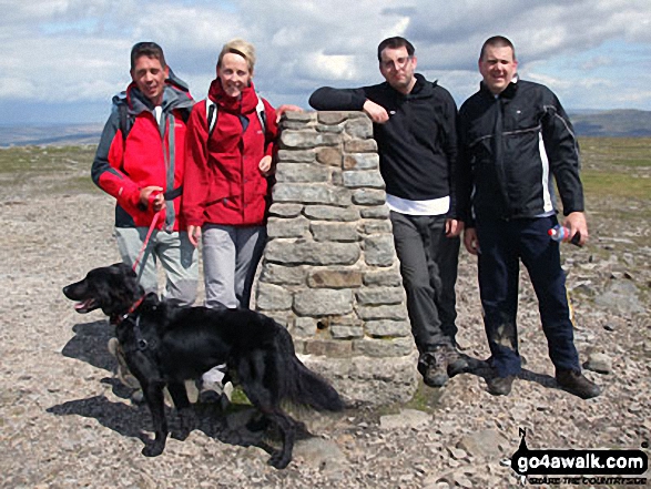
Myself, Paul Baldry, Max the Dog, Jenny Baldry, Tom Evans and Martin Brown on top of Ingleborough.
The Southern Dales Area,
The Yorkshire Dales National Park,
North Yorkshire, England
This was taken during our Yorkshire 3 Peaks Challenge for Cash 4 Kids Charity for which we have raised over £1500. We completed all three in 11 Hours, a very tiring but fulfilling day and a day we’ll remember for a long time. P.S Fantastic site, as we used your very detailed map and data for my GPS.
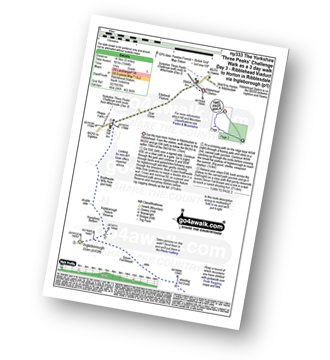
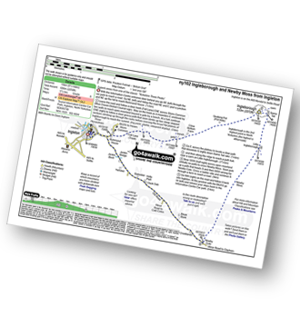
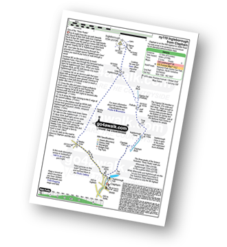
See views like this by using any of these 9 easy-to-follow circular walk route maps:
   |
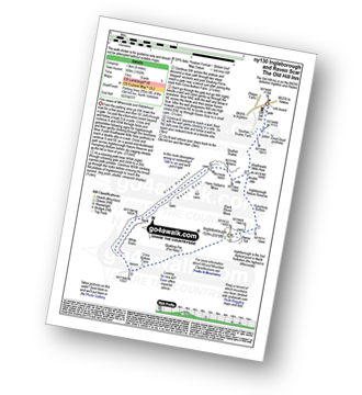
Vital Statistics:
| Length: | 9 miles (14.5 km) |
| Ascent: | 1,644ft (501m) |
| Time: | 5 hrs |
| Grade: |  |
Route Summary:
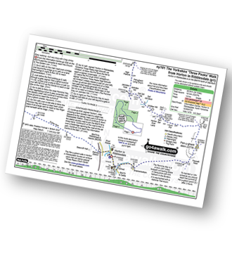
Ribblehead - (Railway Station - After Train Journey From Horton in Ribblesdale) - B6255 - Old Hill Inn - Chapel-le-Dale - Braithwaite Wife Hole - Ingleborough - Pen-y-ghent Cafe - Horton in Ribblesdale.
|
Vital Statistics:
| Length: | 9.5 miles (15 km) |
| Ascent: | 2,250ft (686m) |
| Time: | 5½ hrs |
| Grade: |  |
Route Summary:
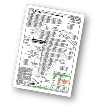
Ingleton - Ingleton Information Centre - Richmond House - Fell Lane - Crina Bottom Farm - Quaking Pot - Ingleborough - Little Ingleborough - Newby Moss - Newby Cote - Bleak Bank - Duck Dub - Holly Platt - Slatenber - Jenkin Bridge - Ingleton
|
Vital Statistics:
| Length: | 8.5 miles (13.5 km) |
| Ascent: | 2,178ft (664m) |
| Time: | 5 hrs |
| Grade: | |
Route Summary:
Clapham - Limekiln Plantation - Clapdale Farm - Ingleborough Cave - Trow Gill - Hernal Moss - Gaping Gill - Seat Haw - Little Ingleborough - Ingleborough - Little Ingleborough - Newby Moss - Cote Haw - Newby Cote - Clapham
|
Vital Statistics:
| Length: | 8.25 miles (13 km) |
| Ascent: | 1,932ft (589m) |
| Time: | 5 hrs |
| Grade: | |
Route Summary:
Ribblehead - (The Old Hill Inn) - Chapel-le-Dale - Braithwaite Wife Hole - Ingleborough Nature Reserve - Humphrey Bottom - Ingleborough - Quaking Pot - Crina Bottom Farm - White Scars - High Howeth - Raven Scar - Harry Hallam's Moss - Old Hill Inn - Ribblehead
|
Vital Statistics:
| Length: | 10 miles (16 km) |
| Ascent: | 2,244ft (684m) |
| Time: | 5.75hrs |
| Grade: | |
Route Summary:
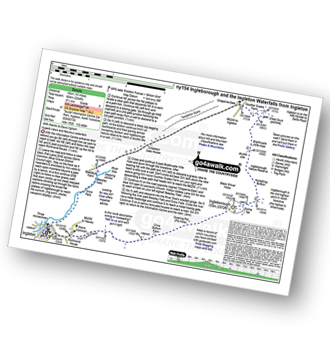
Ingleton - Fell Lane - Crina Bottom Farm - Quaking Pot - Ingleborough - Humphrey Bottom - Ingleborough Nature Reserve - Braithwaite Wife Hole - Souther Scales Farm - Chapel-le-Dale - Twistleton Scars - Oddies Lane - The Ingleton Waterfalls Trail - Beezley Falls - Snow Falls - Ingleton
|
Vital Statistics:
| Length: | 11.5 miles (18.5 km) |
| Ascent: | 2,227ft (679m) |
| Time: | 6½ hrs |
| Grade: | |
Route Summary:
Ribblehead - (The Old Hill Inn) - Ingleborough Nature Reserve - Humphrey Bottom - Ingleborough - Simon Fell - Park Fell (Ribblehead) - New Close Farm - Ribblehead - Gunnerfleet Farm - Ivescar Farm - Broadrake Farm - Ellerbeck Farm - Jingle Pot - Chaple-le-Dale - The Old Hill Inn - Ribblehead
|
Vital Statistics:
| Length: | 9.5 miles (15 km) |
| Ascent: | 2,362ft (720m) |
| Time: | 5.75hrs |
| Grade: | |
Route Summary:
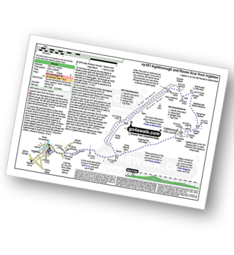
Ingleton - Ingleton Tourist Information Centre - Fell Lane - Crina Bottom Farm - Quaking Pot - Ingleborough - Humphrey Bottom - Ingleborough Nature Reserve - Raven Scar - High Howeth - Harry Hallam's Moss - White Scars - Ingleton
|
Vital Statistics:
| Length: | 14 miles (22.5 km) |
| Ascent: | 3,207ft (977m) |
| Time: | 8½ hrs |
| Grade: |  |
Route Summary:
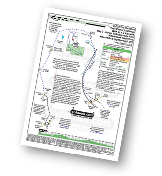
Horton in Ribblesdale - Railway Station - Train Journey - Ribblehead Railway Station - Ribblehead - Blea Moor - Whernside - Broadrake Farm - Ribblehead - Blea Moor - Whernside - Broadrake Farm - Chapel-le-Dale - Braithwaite Wife Hole - Ingleborough - Pen-y-ghent Cafe - Horton in Ribblesdale.
|
Vital Statistics:
| Length: | 24 miles (38.5 km) |
| Ascent: | 5,297ft (1,614m) |
| Time: | 14 hrs |
| Grade: |  |
Route Summary:
Horton in Ribblesdale - Pen-y-ghent Cafe - Brackenbottom - Gavel Rigg - The Pennine Way - Pen-y-ghent - Hunt Pot - Hull Pot - Whitber Hill - God's Bridge - Brow Gill Beck - Nether Lodge - River Ribble - Lodge Hall (or Ingman Lodge) - Ribblehead - Blea Moor - Whernside - Broadrake Farm - Chapel-le-Dale - Braithwaite Wife Hole - Ingleborough - Pen-y-ghent Cafe - Horton in Ribblesdale.
Send us your photographs and pictures of walks and hikes in the British countryside
If you would like to see your digital photographs as part of this collection, please send them as email attachments (configured for any computer) along with your name to:
and we shall do our best to publish them.
(Guide Resolution = 300dpi. At least = 587 pixels (wide) x 440 pixels (high).)

You can also submit photos via our Facebook Page.
NB. Please indicate where each photo was taken.
NB. To see photographs and pictures from a particular walk choose your walk from Walks or use our Walk Search facility.
To see photographs and pictures on, of or from a particular Mountain, Peak, Top or Hill select from Peaks & Mountains' or enter the Mountain, Peak, Top or Hill Name into our 'Photo Search facility.


