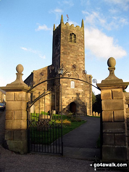
Longnor Church
The Peak District National Park,
Staffordshire, England
See views like this by using any of these 10 easy-to-follow circular walk route maps:
   |
Vital Statistics:
| Length: | 4.5 miles (7 km) |
| Ascent: | 538ft (164m) |
| Time: | 2.25hrs |
| Grade: |  |
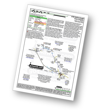
Route Summary:
Longnor - The Manifold Trail - Moss Carr Farm - Hollinsclough - Swallow Brook - Yewtree Grange - Under The Hill - Longnor
|
Vital Statistics:
| Length: | 5 miles (8 km) |
| Ascent: | 640ft (195m) |
| Time: | 2½ hrs |
| Grade: |  |
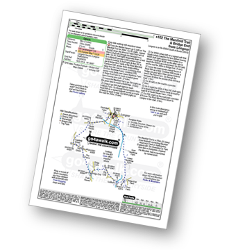
Route Summary:
Longnor - The Manifold Trail - River Manifold - Lower Boothfold Farm - Ludburn Farm - Bridge End - The Ferns Farm - Heath House - Longnor
|
Vital Statistics:
| Length: | 4.75 miles (7.5 km) |
| Ascent: | 659ft (201m) |
| Time: | 2½ hrs |
| Grade: | |
Route Summary:
Longnor - Beggar's Bridge - River Dove - Crowdecote (Crowdicote) - Bridge End Farm - Under Wwhitle Farm - Over Boothlow Farm - The Manifold Trail - River Manifold - Longnor.
|
Vital Statistics:
| Length: | 4.5 miles (7 km) |
| Ascent: | 834ft (254m) |
| Time: | 2½ hrs |
| Grade: | |
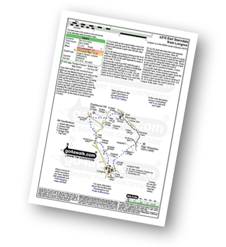
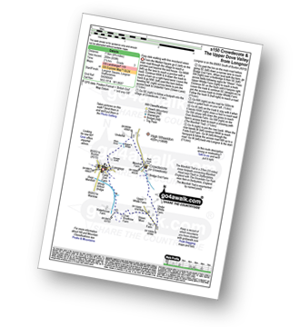
Route Summary:
Longnor - River Dove - Beggar's Bridge - High Wheeldon - Abbotside Farm - Earl Sterndale - Hitter Hill - Parkhouse Hill - High Acres - Yewtree Grange - Underhill Farm - Longnor
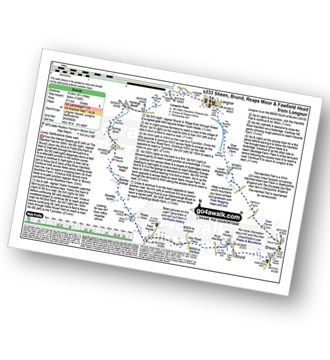
|
Vital Statistics:
| Length: | 7 miles (11 km) |
| Ascent: | 1,090ft (332m) |
| Time: | 3.75hrs |
| Grade: |  |
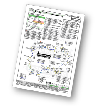
Route Summary:
Longnor - The Manifold Trail - Gauledge Farm - Fawside Farm - The River Manifold - Hardings Booth - Hollinsclough Moor - Hollinsclough - Swallow Brook - Earl Sterndale - Abbotside Farm - Green Lane - Beaggar's Bridge - Longnor
|
Vital Statistics:
| Length: | 7.5 miles (12 km) |
| Ascent: | 811ft (247m) |
| Time: | 3½ hrs |
| Grade: | |
Route Summary:
Longnor - The Manifold Trail - River Manifold - Lower Boothfold Farm - Ludburn Farm - Reaps Moor - Blake Brook - Boosley Grange - Bank House Farm - Shining Ford Farm - Hardings Booth Farm - Fawside Farm - Gualedge Farm - Longnor
|
Vital Statistics:
| Length: | 14.5 miles (23.5 km) |
| Ascent: | 3,049ft (929m) |
| Time: | 8½ hrs |
| Grade: |  |
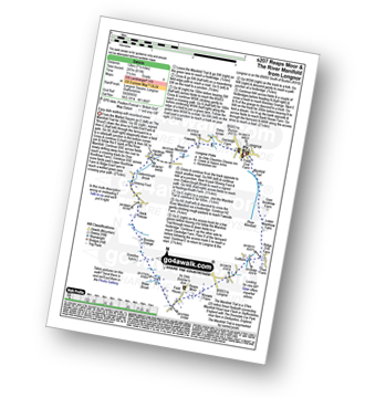
Route Summary:
Longnor - The Manifold Trail - Gauledge Farm - Fawside Farm - The River Manifold - Hardings Booth - Ball Bank Farm - The River Manifold - Heathylee House - Hollinsclough Moor - Wilshaw Bottom - Wilshaw Farm - Moorside Farm - Hollinsclough - Hollins Farm - Swallow Brook - Parkhouse Hill - Hitter Hill - Earl Sterndale - Abbots Grove - Wheeldon Trees - High Wheeldon - Crowdecote - Bridge End Farm - Pilsbury Castle Hills - Pilsbury - Sheen Lane Farm - Ridge End Farm - The Manifold Trail - Lower Boothlow Farm - Folds End Farm - Longnor
|
Vital Statistics:
| Length: | 11 miles (17.5 km) |
| Ascent: | 1,342ft (409m) |
| Time: | 5.25hrs |
| Grade: | |
Route Summary:
Longnor - River Manifold - The Manifold Trail - Over Boothlow Farm - Lower Boothlow Farm - Hill End Farm - Sheen Hill - Slate House Farm - Sheen - Brund - River Manifold - Brund Mill - New Road Farm - Field House Farm - Reaps Moor - Black Brook - Smedley Sytch - Boosley Grange - Fawfield Head - Bank House - Shining Ford - The Manifold Trail - Hardings Booth - Fawside Farm - Gauledge Farm,Longnor.
|
Vital Statistics:
| Length: | 13.5 miles (21.5 km) |
| Ascent: | 1,286ft (392m) |
| Time: | 6.25hrs |
| Grade: |  |
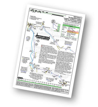
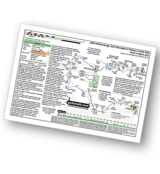
Route Summary:
Hartington - Sheen - Brund - Manifold Valley - Longnor - Crowdecote (Crowdicote) - Bridge End Farm - Upper Dove Dale - Pilsbury Castle Hills - Vincent House - Darley Farm - The High Peak Trail - Parlsey Hay - The Tissington Trail - Hartington Station - Heathcote - Heathcote Mere - Highfield Lane - Hartington
|
Vital Statistics:
| Length: | 11.5 miles (18.5 km) |
| Ascent: | 1,487ft (453m) |
| Time: | 2.75hrs |
| Grade: | |
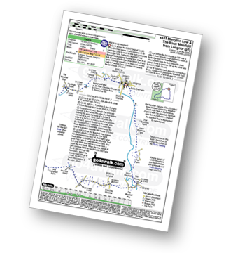
Route Summary:
Longnor - The Manifold Trail - Gauledge Farm - Fawside Farm - The River Manifold - Hardings Booth - Shining Ford - Holly Grove Farm - Newtown - Lady Edge - Round Knowl - Noon Sun Farm - Blake Mere (Merryton Low) - Blake Brook - Lower Fleetgreen Farm - Little Fernyford Farm - The Manifold Trail - Brund Mill - Pool Farm - Lower Boothlow Farm - Over Boothlow Farm - Folds End Farm - Longnor
Send us your photographs and pictures of walks and hikes in the British countryside
If you would like to see your digital photographs as part of this collection, please send them as email attachments (configured for any computer) along with your name to:
and we shall do our best to publish them.
(Guide Resolution = 300dpi. At least = 587 pixels (wide) x 440 pixels (high).)

You can also submit photos via our Facebook Page.
NB. Please indicate where each photo was taken.
NB. To see photographs and pictures from a particular walk choose your walk from Walks or use our Walk Search facility.
To see photographs and pictures on, of or from a particular Mountain, Peak, Top or Hill select from Peaks & Mountains' or enter the Mountain, Peak, Top or Hill Name into our 'Photo Search facility.


