UK Postcode OX1 - The 30 nearest easy-to-follow, circular walk route maps to you
The thirty nearest easy-to-follow, circular walk route maps to you in UK Postcode OX1 in Walk Grade Order
The UK cities, towns and villages in Oxfordshire, England that have OX1 in their UK Postcode include:
• Boars Hill • Kennington • Oxford • South Hinksey • Wootton •
Not familiar with the area around OX1?
See these 30 nearest walks to UK Postcode OX1 on a google map
   |
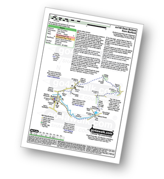
Vital Statistics:
| Length: | 4.75 miles (7.5 km) |
| Ascent: | 476ft (145m) |
| Time: | 2.25hrs |
| Grade: |  |
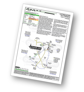
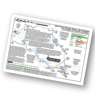
Route Summary:
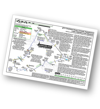
Piddington - Muswell Hill - Oakcroft Farm - Little Wood - Piddington Wood - Widnell Park - Piddington
|
Vital Statistics:
| Length: | 4.75 miles (7.5 km) |
| Ascent: | 368ft (112m) |
| Time: | 2.25hrs |
| Grade: | |
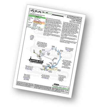
Route Summary:
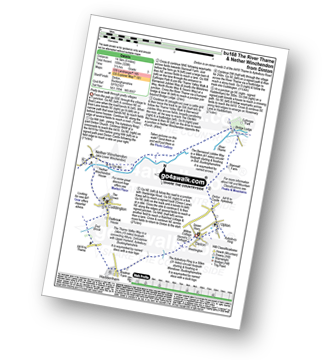
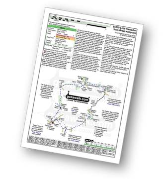
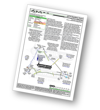
Lower Heyford - Heyford Wharfe - The Oxford Canal - Steeple Aston - The Eye Catcher (Folly) - River Cherwell - The Oxfordshire Canal Walk - The Oxford Canal - Allens Lock - Lower Heyford
|
Vital Statistics:
| Length: | 6.75 miles (11 km) |
| Ascent: | 427ft (130m) |
| Time: | 3 hrs |
| Grade: |  |
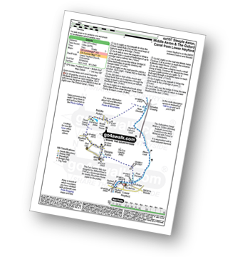
Route Summary:
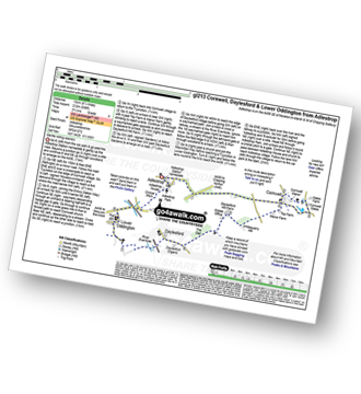
Lower Heyford - Heyford Wharfe - The Oxford Canal - The Eye Catcher - Steeple Aston - Three Corner Clump - Middle Aston - River Cherwell - Somerton Crossing - The Oxfordshire Canal Walk - The Oxford Canal - Heyford Common Lock - Allens Lock - Lower Heyford
|
Vital Statistics:
| Length: | 9.75 miles (15 km) |
| Ascent: | 555ft (169m) |
| Time: | 4 hrs |
| Grade: |  |
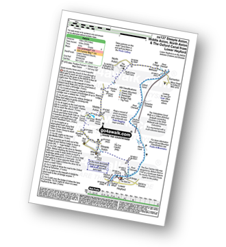
Route Summary:
Lower Heyford - Heyford Wharfe - The Oxford Canal - The Eye Catcher - Steeple Aston - Three Corner Clump - Middle Aston - Warren Lodge - Hendon Farm - North Aston - The Manor - River Cherwell - Somerton - The Oxfordshire Canal Walk - The Oxford Canal - Somerton Crossing - Heyford Common Lock - Allens Lock - Lower Heyford
|
Vital Statistics:
| Length: | 7 miles (11 km) |
| Ascent: | 420ft (128m) |
| Time: | 3 hrs |
| Grade: | |
|
Vital Statistics:
| Length: | 8.75 miles (14 km) |
| Ascent: | 574ft (175m) |
| Time: | 3.75hrs |
| Grade: | |
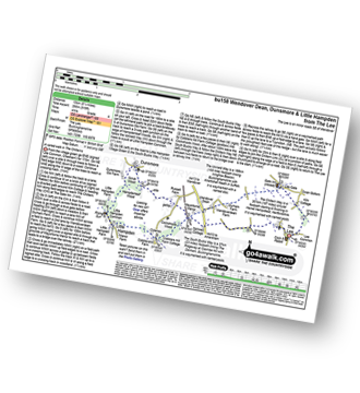
Route Summary:
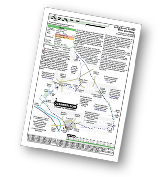
Charlbury - The Oxfordshire Way - Dean Grove - Coldron Mill - Spelsbury - Taston - Taston Village Cross - The Wychwood Way - Inotts Clump - Shilcott Wood - Ditchley Park - Charlbury
|
Vital Statistics:
| Length: | 5.25 miles (8.5 km) |
| Ascent: | 177ft (54m) |
| Time: | 2.25hrs |
| Grade: |  |
Route Summary:
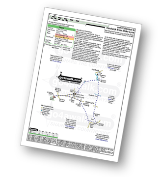
Stoke Wood - Stoke Lyne - Bainton - Hardwick Ford - Hardwick - Stoke Bushes - Stoke Lyne - Stoke Wood
|
Vital Statistics:
| Length: | 9 miles (14.5 km) |
| Ascent: | 328ft (100m) |
| Time: | 3½ hrs |
| Grade: | |
Route Summary:
Dinton - Upton - The Aylsebury Ring - Dinton Castle - Starveall Farm - Eythrope Park - The Midshires Way - The North Bucks Way - The Swans Way - Bridge Lodge - The River Thame - The Bernwood Jubilee Way - The Thame Valley Way - Nether Winchendon - Lower Winchendon - Cuddington - Haddenham - Dad Brook - Townsend - Haddenham - Westington - Dinton
|
Vital Statistics:
| Length: | 6.75 miles (10 km) |
| Ascent: | 256ft (78m) |
| Time: | 2.75hrs |
| Grade: | |
|
Vital Statistics:
| Length: | 7.75 miles (12.5 km) |
| Ascent: | 295ft (90m) |
| Time: | 3.25hrs |
| Grade: | |

|
Vital Statistics:
| Length: | 6 miles (9.5 km) |
| Ascent: | 528ft (161m) |
| Time: | 2.75hrs |
| Grade: | |
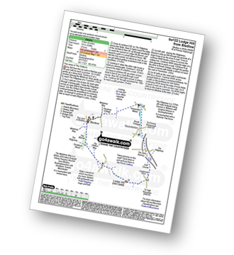
Route Summary:
Bledlow - The Midshires Way - The Warren - The Ridgeway - Thickthorn Wood - Lodge Hill - Longwood Farm - The Old Rectory - Saunderton - Horsenden - Bledlow
|
Vital Statistics:
| Length: | 6.5 miles (10.5 km) |
| Ascent: | 272ft (83m) |
| Time: | 2.75hrs |
| Grade: | |
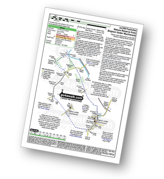
Route Summary:
Shipton Under Wychwood - Milton Under Wychwood - Grange Farm - Home Farm - Foxholes Nature Reserve - The Oxfordshire Way - Bruern Abbey - Shipton Under Wychwood
|
Vital Statistics:
| Length: | 6.5 miles (10.5 km) |
| Ascent: | 230ft (70m) |
| Time: | 2½ hrs |
| Grade: | |
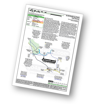
Route Summary:
Stone - Hartwell Church - Upper Hartwell - Whaddon Hill Farm - The North Bucks Way - River Thame - Thame Valley Walk - The Midshires Way - Weir Lodge - Bridge Lodge - Eythrope Park - Beachendon Cottages - Eythrope House - Aylesbury Ring - Stone
|
Vital Statistics:
| Length: | 6.25 miles (10 km) |
| Ascent: | 558ft (170m) |
| Time: | 2.75hrs |
| Grade: | |
Route Summary:
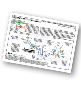
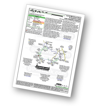
Burford - Fulbrook - Widley Copse - Dean Bottom - Widford Church - River Windrush - Burford
|
Vital Statistics:
| Length: | 6 miles (9.5 km) |
| Ascent: | 496ft (151m) |
| Time: | 2.75hrs |
| Grade: | |
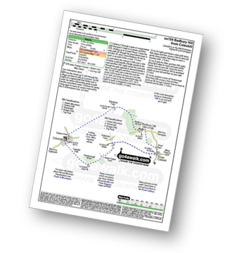
Route Summary:
Coleshill - Brimstone Farm - Badbury Hill Fort - Badbury Hill - Great Coxwell - Ashen Copse Farm - Flamborough Wood - Coleshill Park - Coleshill
Not familiar with the area around OX1?
See these 30 nearest walks to UK Postcode OX1 on a google map
|
Vital Statistics:
| Length: | 5.5 miles (9 km) |
| Ascent: | 400ft (122m) |
| Time: | 2½ hrs |
| Grade: | |
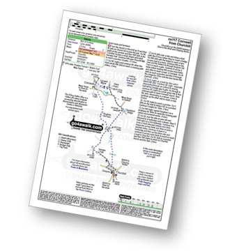
Route Summary:
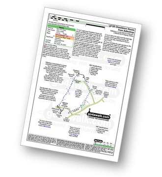
Churchill - Sarsden Halt. Kingham Hill Farm - Cornwell - Swailsford Bridge - Churchill
|
Vital Statistics:
| Length: | 4.5 miles (7 km) |
| Ascent: | 693ft (211m) |
| Time: | 2½ hrs |
| Grade: | |
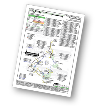
Route Summary:
Great Kimble - The North Bucks Way - Askett - Monks Risborough - Whiteleaf - The Icknield Way - The Ridgeway - Whiteleaf Cross - Cadsden - Grangelands And Pulpit Hill Nature Reserve - Chequer's Knap - The North Bucks Way - Great Kimble
|
Vital Statistics:
| Length: | 5.5 miles (9 km) |
| Ascent: | 722ft (220m) |
| Time: | 2.75hrs |
| Grade: | |
Route Summary:
Great Hampden - The Chiltern Way - Hampden House - Little Hampden - The South Bucks Way - Cobbleshill Farm - Hampden Bottom - Pepperboxes Wood - Honor End Farm - Great Hampden
|
Vital Statistics:
| Length: | 5.5 miles (9 km) |
| Ascent: | 853ft (260m) |
| Time: | 3 hrs |
| Grade: | |
Route Summary:
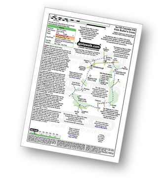
Butler's Cross - Monument Hill (Coombe Hill) - The Ridgeway - Linton's Wood - Goodmerhill Wood - Chisley Wood - The Icknield Way - Chequers - Pond Wood - Pulpit Wood - The North Bucks Way - The Midshires Way - Chequers Knap - Whorley Wood - Ellesborough Warren - Boxtree Wood - Beacon Hill (Ellesborough) - Ellesborough - The Aylesbury Ring - Springs Farm - Butler's Cross
|
Vital Statistics:
| Length: | 3.75 miles (6 km) |
| Ascent: | 538ft (164m) |
| Time: | 2 hrs |
| Grade: | |
Route Summary:
Little Hampden Common - Little Hampden - The South Bucks Way - Cobblershill Farm - The Chiltern Way - Cockshoots Wood - Mayortorne Manor - Russell Farm - Dunsmore - Scrub Wood - Hampdenleaf Wood - The Icknield Way - Little Hampden Common
|
Vital Statistics:
| Length: | 3.75 miles (6 km) |
| Ascent: | 394ft (120m) |
| Time: | 1.75hrs |
| Grade: | |
Route Summary:
Adlestrop - The Macmillan Way - Chastleton - Chastleton House - Chastleton Barrow Iron Age Fort - Long Drive - Adlestrop
|
Vital Statistics:
| Length: | 9 miles (14.5 km) |
| Ascent: | 801ft (244m) |
| Time: | 4.25hrs |
| Grade: | |
Route Summary:
Adlestrop - The Macmillan Way - Chastleton - Chastleton House - Chastleton Barrow Iron Age Fort - Cornwell - Daylesford - The Macmillan Way - Lower Oddington - Adlestrop Park - Adlestrop
|
Vital Statistics:
| Length: | 6.25 miles (10 km) |
| Ascent: | 670ft (204m) |
| Time: | 3 hrs |
| Grade: | |
Route Summary:
Adlestrop - The Macmillan Way - Chastleton - Chastleton House - Chastleton Barrow Iron Age Fort - Cornwell - Adlestrop
|
Vital Statistics:
| Length: | 8.25 miles (13 km) |
| Ascent: | 696ft (212m) |
| Time: | 3.75hrs |
| Grade: | |
|
Vital Statistics:
| Length: | 6.75 miles (11 km) |
| Ascent: | 312ft (95m) |
| Time: | 3 hrs |
| Grade: | |
Route Summary:
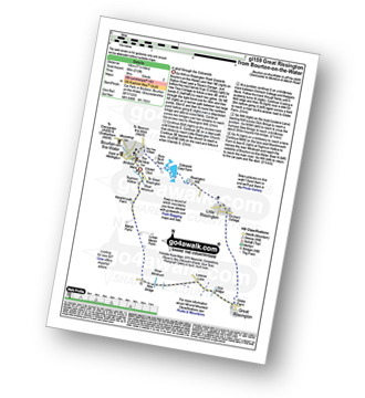
Bourton-on-the-Water - Little Rissington - Great Rissington - New Bridge - River Windrush - Bourton-on-the-Water
|
Vital Statistics:
| Length: | 10.75 miles (17 km) |
| Ascent: | 689ft (210m) |
| Time: | 4.75hrs |
| Grade: | |
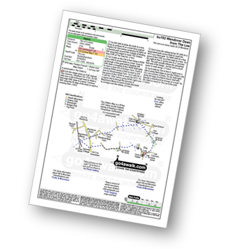
Route Summary:
Bourton-on-the-Water - The Warden's Way - River Eye - Lower Slaughter - Upper Slaughter - Brockhill Farm - Naunton - The Windrush Way - River Windrush - Aston Farm - Bourton-on-the-Water
|
Vital Statistics:
| Length: | 8.25 miles (13 km) |
| Ascent: | 919ft (280m) |
| Time: | 4 hrs |
| Grade: | |
Route Summary:
The Lee - Kiln Cottage - Lee Gate - The Chiltern Way - Durham Farm - Wendoverdean Farm - Wendover Dean - Mayortorne Manor - Russell Farm - Dunsmore - Scrub Wood - Hampdenleaf Wood - The Icknield Way - Little Hampden Common - Little Hampden - The South Bucks Way - Cobblershill Farm - The Chiltern Way - Cockshoots Wood - Mayortorne Manor - Spinney Cottage - The Lee
|
Vital Statistics:
| Length: | 4.5 miles (7 km) |
| Ascent: | 345ft (105m) |
| Time: | 2 hrs |
| Grade: | |
Route Summary:
The Lee - Kiln Cottage - Lee Gate - The Chiltern Way - Durham Farm - Wendoverdean Farm - Wendover Dean - Mayortorne Manor - Spinney Cottage - The Lee
|
Vital Statistics:
| Length: | 8.5 miles (13.5 km) |
| Ascent: | 873ft (266m) |
| Time: | 4 hrs |
| Grade: | |
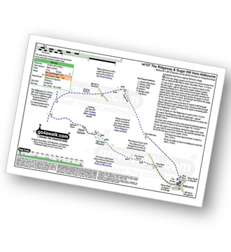
Route Summary:
Aldbourne - The Giant's Grave - Upper Upham - The Ridgeway - Sugar Hill - Four Barrows - Aldbourne
|
Vital Statistics:
| Length: | 6 miles (9.5 km) |
| Ascent: | 508ft (155m) |
| Time: | 2½ hrs |
| Grade: | |
Route Summary:
Stow-on-the-Wold - The Monarch's Way - Broadwell - Donnington - Battle of Stow Memorial - The Gloucestershire Way - Upper Swell - Stow-on-the-Wold
Not familiar with the area around OX1?
See these 30 nearest walks to UK Postcode OX1 on a google map


