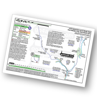
UK Postcode NE63 - The 30 nearest easy-to-follow, circular walk route maps to you
The thirty nearest easy-to-follow, circular walk route maps to you in UK Postcode NE63 in Walk Grade Order
The UK cities, towns and villages in Northumberland, England that have NE63 in their UK Postcode include:
• Ashington • Hirst • North Seaton •
Tap/mouse over a coloured circle (1-3 easy walks, 4-6 moderate walks, 7-9 hard walks) and click to select.
Scroll down the list of walks below & click on each walk title (in blue) to locate it on the map above.
   |
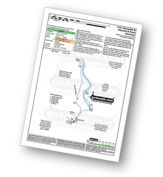
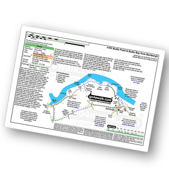
Vital Statistics:
| Length: | 5.5 miles (8.5 km) |
| Ascent: | 46ft (14m) |
| Time: | 2 hrs |
| Grade: |  |
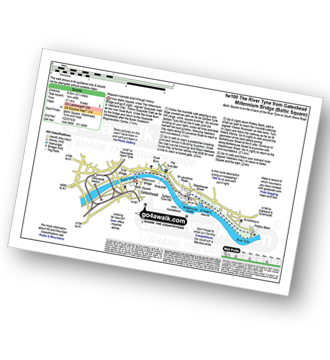
Route Summary:
Baltic Square - Gateshead - Millennium Bridge - Newcastle - Quayside Walk - The Hadrian's Way - The Hadrian's Wall Path - Byker Ouseburn Regeneration Centre - Ouse Burn - Spillars Tyne Mill - Hadrian's Cycle Way - St Anthony's - Pottery Bank - St Peters Marina - Quayside Walk - Newcastle - Millennium Bridge - Gateshead.
|
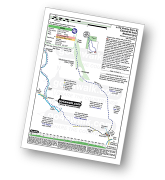
Vital Statistics:
| Length: | 4.5 miles (7 km) |
| Ascent: | 387ft (118m) |
| Time: | 2 hrs |
| Grade: |  |
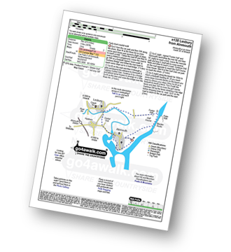
Route Summary:
Alnmouth - Beach - The St Oswald's Way - River Aln - Lesbury - Foxton Hall - Marden Rocks - Alnmouth Golf Club - Alnmouth
|
Vital Statistics:
| Length: | 8.5 miles (13.5 km) |
| Ascent: | 1,450ft (442m) |
| Time: | 4.75hrs |
| Grade: |  |
Route Summary:
Rothbury - The St Oswald's Way - Whitton - Whittondean Farm - Garleigh Moor - Lordenshaws Car Park - The Beacon - Dove Crag - Old stell Crag - Simonside - Bob Pyle's Studdie - Joe's Wood - Great Tosson - The Old Pumphouse - River Coquet - Anton's Letch - Rothbury
|
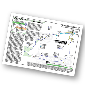
Vital Statistics:
| Length: | 5 miles (8 km) |
| Ascent: | 1,030ft (314m) |
| Time: | 3 hrs |
| Grade: |  |
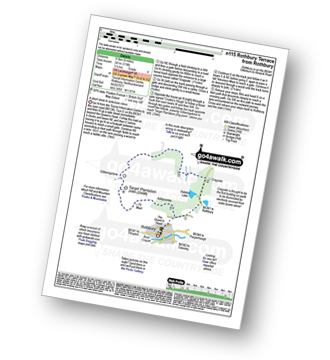
Route Summary:
Rothbury - Blaeberry Hill - Telecommncations Mast - Ship Crag - Brae Head - Target Plantation - Glitteringstone - Rothbury Terrace - Primrose Cottage - Debdon Burn - Debdon Plantation - Tumbleton House - Debden Lake - Tumbleton Lake - Addycombe Farm - Hillside Road - Rothbury
|
Vital Statistics:
| Length: | 7.75 miles (12.5 km) |
| Ascent: | 1,250ft (381m) |
| Time: | 4 hrs |
| Grade: | |
Route Summary:
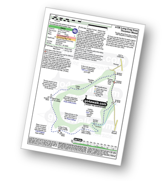
Thrunton Wood - Callaly Crag - Hard Nab - Long Crag - Coe Crags - Coe Burn - Thrunton Wood
|
Vital Statistics:
| Length: | 5.25 miles (8.5 km) |
| Ascent: | 430ft (131m) |
| Time: | 2½ hrs |
| Grade: | |
Route Summary:
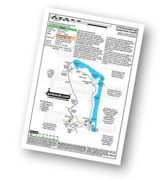
Craster - Cushat Stiel - Queen Margaret's Cove - Dunstanburgh Castle - The St Oswald's Way - Embleton Bay - Dunstan Steads - Dunstan Square Farm - Proctors Spread - Dunstan - Craster Tower - Craster
|
Vital Statistics:
| Length: | 4.5 miles (7 km) |
| Ascent: | 37ft (113m) |
| Time: | 2 hrs |
| Grade: | |
Route Summary:
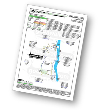
Craster - Black Hole - Cullernose Point - Rambling Kern - Howick Hall - Hips Heugh - Craster Tower - Craster
|
Vital Statistics:
| Length: | 8.75 miles (14 km) |
| Ascent: | 601ft (183m) |
| Time: | 4 hrs |
| Grade: | |
Route Summary:
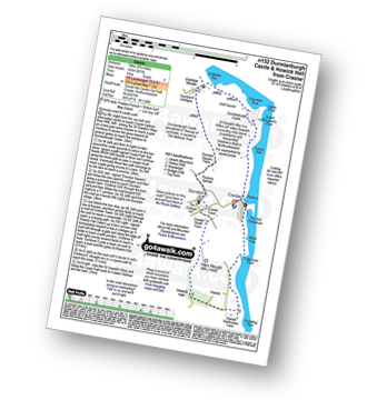
Craster - Dunstanburgh Castle - Dunstan Steads Farm - Dunstan - Craster Tower - Hips Heugh - Howick Hall - Northumberland Coast - Rambling Kern - Cullernose Point - Black Hole - Craster
|
Vital Statistics:
| Length: | 8.5 miles (13.5 km) |
| Ascent: | 988ft (301m) |
| Time: | 4.25hrs |
| Grade: | |
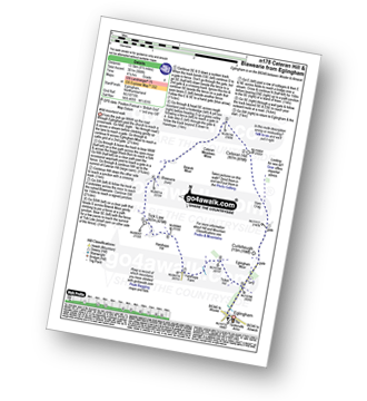
Route Summary:
Eglingham - Tarry - Eglingham Moor - Curleheugh - Hare Crag - Ceteran Hill - Ceteran Meadows Moss - Blawearie - Bewick Moor - Tick Law - Harehope Hill - Harehope Farm - Ticket Hill - Eglingham
|
Vital Statistics:
| Length: | 10.5 miles (16.5 km) |
| Ascent: | 2,244ft (684m) |
| Time: | 6 hrs |
| Grade: |  |
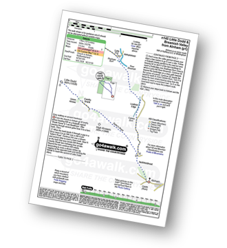
Route Summary:
Alnham - Salter's Road - Northfieldhead - White Gate - High Knowes - Ewartly Shank - Shank Burn - Little Dod - Shill Moor - Breamish Valley - Meggrim's Knowe - Alnhammoor Farm - Rowhope Burn - Leafield Edge - Deb Cleugh - Northfieldhead - Alnham
|
Vital Statistics:
| Length: | 4 miles (6.75 km) |
| Ascent: | 732ft (223m) |
| Time: | 2½ hrs |
| Grade: |  |
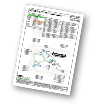
Route Summary:
Harbottle Castle - Drake Stone - West Wood - Harbottle Lake - Angryhaugh - Low Winton - River Coquet - Harbottle - Harbottle Castle
|
Vital Statistics:
| Length: | 17 miles (27 km) |
| Ascent: | 3,463ft (1,055m) |
| Time: | 9½ hrs |
| Grade: |  |
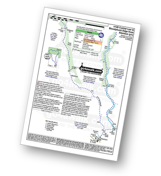
Route Summary:
Alwinton - River Alwin - Alwindale - Kidland Forest - Yoke Burn - Cushat Law - Bloodybush Edge - Uswayford Farm - Usway Burn - Nettlehope Hill - Flesh Shank - Wholehope - Clennell Street - Howedon Burn - Alwinton
|
Vital Statistics:
| Length: | 4.75 miles (7.5 km) |
| Ascent: | 735ft (225m) |
| Time: | 2½ hrs |
| Grade: | |
|
Vital Statistics:
| Length: | 13.5 miles (21.5 km) |
| Ascent: | 2,504ft (763m) |
| Time: | 7½ hrs |
| Grade: |  |
Route Summary:
Alwinton - Hosedon Burn - The Creel - Clennelstreet Farm - Clennell Street (Track) - Cross Dyke - Uplaw Knowe - Hare Sheds - Wholehope - Wholehope Knowe - Saughy Hill - Nettlehope Hill - Usway Burn - The Middle - Middle Hill - Fairhaugh - Hoseden Law - The Castles - Batailshiel Haugh - Shillmoor - The Knocks - Pass Peth - Alwinton
|
Vital Statistics:
| Length: | 3.75 miles (6 km) |
| Ascent: | 499ft (152m) |
| Time: | 2 hrs |
| Grade: | |
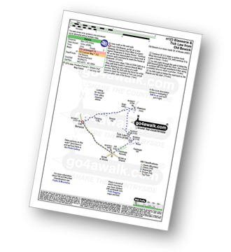
Route Summary:
Old Bewick - Hanging Crag - Blawearie - Tick Law - Harehop Kennels - Hill End - Old Bewick
|
Vital Statistics:
| Length: | 6.25 miles (10 km) |
| Ascent: | 1,037ft (316m) |
| Time: | 3½ hrs |
| Grade: | |
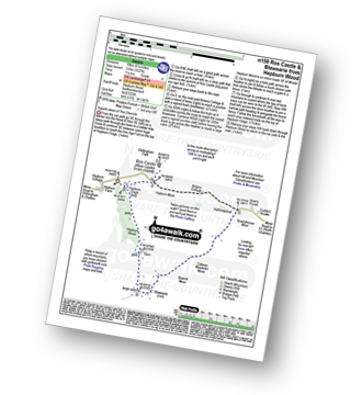
Route Summary:
Hepburn Wood - Hepburn Crags - Ros Castle (Ross Castle) - Hepburn Moor - Botany Cottage - Quarryhouse Moor - Blawearie - Hepburn Crags - Hepburn Wood
|
Vital Statistics:
| Length: | 11.25 miles (18 km) |
| Ascent: | 2,311ft (704m) |
| Time: | 6½ hrs |
| Grade: | |
Route Summary:
Wedder Leap - River Coquest - Rowhope Burn - Hindside Knowe - The Street - Swineside Law - Black Braes - Windy Rigg Top - Windy Gyle - Hazely Law - Usway Burn - Middle Hill - Fairhaugh - Barrow Burn - Barrowburn.
|
Vital Statistics:
| Length: | 9.5 miles (15 km) |
| Ascent: | 2,009ft (612m) |
| Time: | 5½ hrs |
| Grade: | |
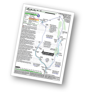
Route Summary:
Wedder Leap - River Coquet - Rowhope Burn - Trows Burn - Windy Gyle - The Pennine Way - Hazely Law - Hepden Burn - Clennel St - Middle Hill - Fairhaugh - Barrow Burn - Barrowburn.
|
Vital Statistics:
| Length: | 10.5 miles (17 km) |
| Ascent: | 2,614ft (797m) |
| Time: | 6½ hrs |
| Grade: | |

Route Summary:
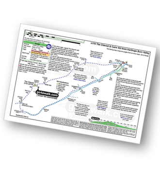
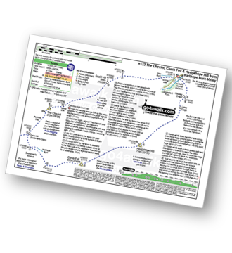
Harthope Burn Valley - Cold Law - Broadhope Hill - Scald Hill - The Cheviot - The Pennine Way - Harthope Burn - Langleeford Hope - Langleeford - Harthope Burn Valley
|
Vital Statistics:
| Length: | 8.5 miles (13.5 km) |
| Ascent: | 2,114ft (644m) |
| Time: | 5½ hrs |
| Grade: | |
Route Summary:
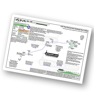
Harthope Burn Valley - Hawsen Burn Parking Area - New Burn - Scald Hill - The Cheviot - Cairn Hill (Scotsmans Cairn) - Harthope Burn - Hrthope Linn - Langleeford Hope - Cat Loup - Ray Burn - Langleeford Farm - Hawsen Burn Parking Area.
|
Vital Statistics:
| Length: | 7 miles (11 km) |
| Ascent: | 2,022ft (616m) |
| Time: | 4½ hrs |
| Grade: | |
Route Summary:
Harthope Burn Valley - Hawsen Burn Parking Area - New Burn - Scald Hill - The Cheviot - Scald Hill - New Burn - Hawsen Burn Parking Area.
|
Vital Statistics:
| Length: | 9.5 miles (15.5 km) |
| Ascent: | 2,800ft (853m) |
| Time: | 6½ hrs |
| Grade: | |
Route Summary:
Harthope Burn Valley - Hawsen Burn Parking Area - New Burn - Scald Hill - The Cheviot - Cairn Hill (Scotsmans Cairn) - Harthope Burn - Comb Fell - Hedgehope Hill - Long Crags - Housey Crags - Hawsen Burn Parking Area.
|
Vital Statistics:
| Length: | 7.5 miles (12 km) |
| Ascent: | 1,753ft (534m) |
| Time: | 4½ hrs |
| Grade: | |
Route Summary:
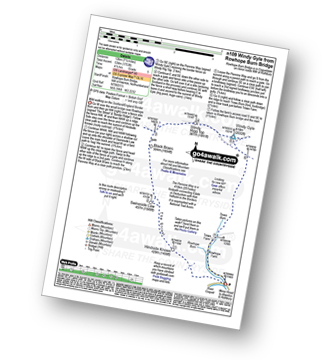
Rowhope Burn Bridge - River Coquet - Hindside Knowe - The Street - Swineside Law - Black Braes - Windy Rigg Top - Windy Gyle - Trows Burn - Rowhope Burn - Rowhope Burn Bridge
|
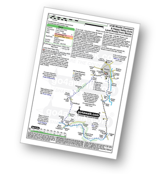
Vital Statistics:
| Length: | 4.5 miles (7 km) |
| Ascent: | 781ft (238m) |
| Time: | 2½ hrs |
| Grade: | |

Route Summary:
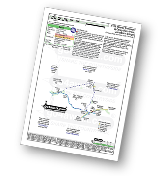
Careyburn Bridge - Carey Burn - Harthope Burn - Middleton Old Town - North Middleton - Colgate Mill - Colgate Water (Low Level Route) - Happy Valley - Broom Crook Plantation - Grimping Haugh - Skirl Naked - Careyburn Bridge
|
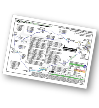
Vital Statistics:
| Length: | 3.75 miles (6 km) |
| Ascent: | 700ft (213m) |
| Time: | 2.25hrs |
| Grade: | |
Route Summary:
Careyburn Bridge - Carey Burn - Switcher Wood - Earlhillhead Farm - Wooler Common - Carey Burn - Careyburn Bridge
|
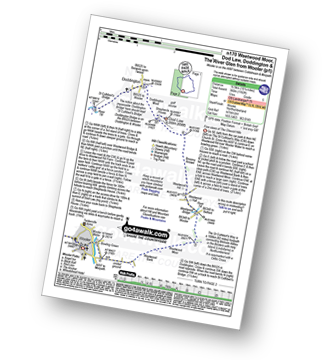
Vital Statistics:
| Length: | 5.25 miles (8.5 km) |
| Ascent: | 512ft (156m) |
| Time: | 2½ hrs |
| Grade: | |
Route Summary:
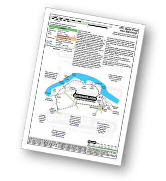
Bamburgh - Bamburgh Castle - The Wynding - Harkess Rocks - Bamburgh Lighthouse - Blackrocks Point - Hare Law - Kittling Hill - Budle Point - Heather Cottages - Kiln Point - Budle - East Hill - Warren Camping and Caravan Park - Drawkiln Hill - Shada Plantation - Gallinheugh Bank - Bamburgh
|
Vital Statistics:
| Length: | 6.5 miles (10.5 km) |
| Ascent: | 650ft (198m) |
| Time: | 3½ hrs |
| Grade: | |
Route Summary:
Bamburgh - Bamburgh Castle - The Wynding - Harkess Rocks - Bamburgh Lighthouse - Blackrocks Point - Hare Law - Kittling Hill - Budle Point - Heather Cottages - Kiln Point - Budle - Budle Bay - Widehoe Haugh - Spindlestone Heaughs - Ladley Worm's Trough - Drawkiln Hill - Warren Camping and Caravan Park - East Hill - Shada Plantation - Gallinheugh Bank - Bamburgh
|
Vital Statistics:
| Length: | 6.5 miles (10.5 km) |
| Ascent: | 1,043ft (318m) |
| Time: | 3½ hrs |
| Grade: | |
Route Summary:
Wooler - The St Cuthbert's Way - Waud House - Kenterdale Hill - Wooler Common - Switcher Wood - Earlhillhead Farm - Carey Burn - Careyburn Bridge - Harthope Burn - Colgate Water (Low Level Route) - Skirl Naked - Grimping Haugh - Broom Crook Plantation - Happy Valley - Careyburn Bridge - Colgate Mill - Earle Mill - Wooler Water - Wooler
|
Vital Statistics:
| Length: | 10.75 miles (17 km) |
| Ascent: | 1,746ft (532m) |
| Time: | 5.75hrs |
| Grade: | |
Route Summary:
Wooler - The St Cuthbert's Way - Waud House - Kenterdale Hill - Wooler Common - Carey Burn - Broadstruthers Burn - Commonburn House - Wackerage Cairn - Tom Tallon's Crag - The St Cuthbert's Way - Gleadscleugh - Akeld Burn - Humbleton - Gallowlaw - Wooler
|
Vital Statistics:
| Length: | 10.25 miles (16.5 km) |
| Ascent: | 1,182ft (360m) |
| Time: | 5 hrs |
| Grade: | |
Route Summary:
Wooler - The St Cuthbert's Way - Weetwood Bank - Weetwood Moor - River Till - Weetwood Bridge - Weetwood Hall - Weetwood Hill - Broomy Knowe - Shepherds House - Dod Law (Doddington Moor) - Doddington Moor - Doddington - River Till - St Cuthbert's Bridge - Milfield Plain - River Glen - Bridge End - Bowchester - Low Humbleton - Gallowlaw Hill - Gallowlaw - Wooler


