
![]()
The Nab (Martindale)
576m (1890ft)
The Far Eastern Fells, The Lake District, Cumbria, England
Not familiar with this top?
   |
|---|
Vital Statistics:
| Length: | 12.5ml (20km) |
|---|---|
| Ascent: | 3,769ft (1,149m) |
| Time: | 8½ hrs |
| Grade: |  (Hard) (Hard) |
Route Summary:
Christy Bridge - Martindale - Dale Head Farm - Heck Crag - Angle Tarn - Buck Crag - Brock Crags - Satura Crag - The Nab (Martindale) - Rest Dodd - The Knott - Rampsgill Head - Kidsty Pike - High Raise (Mardale) - Red Crag - Keasgill Head - Christy Bridge
See The Nab (Martindale) and the surrounding tops on our free-to-access 'Google Style' Peak Bagging Maps:
The Far Eastern Fells of The Lake District National Park
Less data - quicker to download
The Whole of The Lake District National Park
More data - might take a little longer to download
See The Nab (Martindale) and the surrounding tops on our downloadable Peak Bagging Maps in PDF format:

NB: Whether you print off a copy or download it to your phone, these PDF Peak Baggers' Maps might prove incredibly useful when your are up there on the tops and you cannot get a phone signal.
*This version is marked with the walk routes you need to follow to Walk all 214 Wainwrights in just 59 walks.
You can find The Nab (Martindale) & all the walks that climb it on these unique free-to-access Interactive Walk Planning Maps:
1:25,000 scale OS Explorer Map (orange/yellow covers):
1:50,000 scale OS Landranger Map (pink/magenta covers):
 Fellow go4awalkers who have already walked, climbed, summited & bagged The Nab (Martindale)
Pete George walked up The Nab (Martindale) on August 23rd, 2025 [from/via/route] Martindale [with] Roco [weather] Lovely warm & clear.
Geoff Hand climbed The Nab (Martindale) on July 16th, 2025 [from/via/route] C159 Walked from Martindale church down to Dalehead, upto Angletarn & Brock Crags, onto the Nab, Rest Dodd (no rest!) onto the Knott, then Kidsy Pike (realised I had already climbed this several years ago). From there it was straight up High Raise. From here, because I had parked in the wrong place I headed back over Pikeawassa & down to the church. Great day [with] none [weather] Started off a bit dull & overcast but cleared to a pleasent sunny afternoon. - Lots of wildlife: Hawks, deer, badger & strangely a wasps nest in the cairn on High raise.
Simon Myerscough bagged The Nab (Martindale) on February 1st, 2025 [from/via/route] C159 - From Martindale Church - meal at The Crown Inn afterwards & stayed over. Good start to the walk, but wind really picked up by the time we reached Angle Tarn. Missed Bock Crags in the confusion. Was a long walk for Feb & Joanne suffering with bit of knee pain we did last half hour in the dark. [with] Joanne [weather] Bright start, very windy on the tops, bit of snow & ice as well, Joanne tried Crampons for first time
James Hughes hiked The Nab (Martindale) on September 17th, 2024 [from/via/route] c159 The Nab & Rest Dodd from Christy Bridge [weather] Beautiful clear warm day. - Long day added Beda Fell & Angletarn Pikes to start of walk. Slight variations up to Brock Crags & the Nab. Nab very boggy in places. Stags & Bucks mating calls in valley. Parked at Church at the Coombs below Hallin Hill. Stayed at Waterside Campsite.
Tim Winn summited The Nab (Martindale) on April 28th, 2024 [with] Barry and Louise [weather] Sunny & clear.
Ian Ashton conquered The Nab (Martindale) on November 11th, 2023 [from/via/route] Solo [with] Solo
Simon Boddy scaled The Nab (Martindale) on July 13th, 2022 [from/via/route] Hartsop [with] My girlfriend [weather] Sunny & clear
John Ramsbottom walked up The Nab (Martindale) on June 2nd, 2022 [from/via/route] Howtown, walk c159 Camped under Angletarn Pikes [with] Lola [weather] Sunny weather - solo walk with Lola
Richard Fulcher climbed The Nab (Martindale) on April 25th, 2022 [from/via/route] Parked next to St Martins church in Martindale. Walked to Dale End farm & ascended under Heck Crag up to the path above Angle Tarn. Walked on the main path until veering left up to Rest Dodd. I went on to The Nab whilst Jen waited by the wall. We then walked right around Rest Dodd & up to The Knott. From the Knott we crossed over to Rampsgill Head & on up to High Raise. We followed the ridge towards Low Raise before realising our mistake & correcting. We reached Red Crag & started to descend via Gowk Hill eventually reaching our car after 10h 20m of walking!! [with] Jen [weather] Still & breezy at times on the top with a cold wind. Temp on the tops was about 1 celcius. Some sun but lots of cloud. - Good packed lunch with coffee, fruit cake & chocolate biscuits.
Christine Shepherd bagged The Nab (Martindale) on April 15th, 2009 [from/via/route] I walked from Christy Bridge using walk c159. Climbed again from Hartsop 22.6.21 On 20.4.22 I decided to add this to a walk as I got to Knott with time to spare. [with] On my own [weather] Hot but hazy - This summit is in a deer protection area & I was lucky enough to see some of the deer that were being protected. A very quiet walk.
Richard Marchant hiked The Nab (Martindale) on January 28th, 2022 [from/via/route] Parked at Hartsop, walked up Hayeswater Gill to Hayeswater then climbed Easterly up on to The Knott, then North on to Rest Dodd & further on to Then Nab. From The Nab back track to the Rest Dodd but just before reaching the summit traversed to Satura Crag & across to Brock Crag. Slight back track here & followed a path down Calfgate Gill & eventually down to Hayeswater Gill & back to the car. [with] On my own [weather] Dull grey windy day
Nick Dobson summited The Nab (Martindale) on October 13th, 2021 [from/via/route] Hartsop via Brock Crags [with] Margaret & Ralph [weather] Cool dry Autumn day with the Red Deer in abundance - Continued up the ridge to Rest Dodd to complete the Far Eastern Fells
Paul Ward conquered The Nab (Martindale) on August 13th, 2021 [from/via/route] Started from Howtown Hotel Bonscale Pike, [with] Jamie [weather] Dry, overcast with strong winds on tops.
John Bryers scaled The Nab (Martindale) on May 11th, 2018 [from/via/route] Walked from St. Peter's church up front of Bonscale Pike, Arthur's Pike, Loadpot Hill, Wether Hill, High Raise, Kidsty Pike, Rampsgill Head, Rest Dodd & The Nab dropping back into Bannerdale & road back to church. [with] With Mya my faithful 12 year old Patterdale Terrier. [weather] Weather sunny to start, slight wind on ridges with light rain at times ending with some warm sunshine.
Richard Marshall walked up The Nab (Martindale) on May 26th, 2021 [from/via/route] RM super route from Martindale 19 miles 6300ft ascent [with] Roxy & Bo [weather] Showers,fog, sun & very wet underfoot
Christina Lander climbed The Nab (Martindale) on October 16th, 2020 [from/via/route] Dale End (near Martindale) - Angle Tarn - Brock Crags - Rest Dodd - The Nab - Angletarn Pikes - Dale Head [with] Dick [weather] Started off dry, but then we were in the clouds at we approached Rest Dodd. Sunshine & a rainbow at the end - A second walk in 2 days from Martindale. We'd heard the red deer rutting on the previous day so went to get a closer look.
Chris Sheard bagged The Nab (Martindale) on August 10th, 2020 [from/via/route] Up from Hartsop carpark [with] Jamie [weather] Quite warm start with light winds cleared for a glorious afternoon - Steep initial ascent & worth it for socialising with folks on CtC - Much water needed
Wayne Baxter hiked The Nab (Martindale) on August 6th, 2020 [from/via/route] Hartsop car park to filter house on to Brock crags & then onto The Nab [with] Sue [weather] Sunny
Andrew Johnson summited The Nab (Martindale) on November 19th, 2019 [from/via/route] Harsop [weather] Beautiful day, clear skies.
Richard Annett conquered The Nab (Martindale) on June 28th, 2019 [from/via/route] From Hartsop village. [with] Euan [weather] Really hot. Got sunburnt so Cath bought me a hat. - Pub of instant death. Walker with fantastic legs spotted by Euan. Euan had three pints.
Elaine Evans scaled The Nab (Martindale) on October 16th, 2018 [from/via/route] From Hartsop, across lower slopes of Brock Crags up to Satura Crag, across to The Nab then back to Rest Dodd, descended to Hayeswater & returned to car via path along Hayeswater Gill. [with] Sue and Christine [weather] Wet & very windy, low cloud. - Missed out on the views again today. On the plus side, the wind had dried us out before we got back to the car!
Phillip Bulley walked up The Nab (Martindale) on June 10th, 2018 [from/via/route] Via Rest Dodd [with] Ruby. [weather] Sunny.
Craig Steeland climbed The Nab (Martindale) on June 6th, 2018 [from/via/route] From Hartsop village car park [with] Sue [weather] Grey & still with cloud above the summits.
Darren Wilson bagged The Nab (Martindale) on September 1st, 2017 [from/via/route] Gray Crag 698m, Thornthwaite Crag 784m, High Street 810m, Kidsty Pike 780m, Rampsgill Head 792m, The Knott 739m, Rest Dodd 696m, The Nab 576m from Hartsop [with] Lone Walk [weather] Blustery above 500m
Beth Webster hiked The Nab (Martindale) on June 17th, 2017 [with] Hannah phillips & Cocoa
John Walter summited The Nab (Martindale) on April 17th, 2017 [from/via/route] .
John Tippins conquered The Nab (Martindale) on April 13th, 2016 [from/via/route] Christy Bridge [with] Solo [weather] The day started overcast & dull, the sort of day you want to stay in front of a fire. However, by late morning it was sunny, very little cloud cover & the warmest it's been all week. It didn't last long. By early afternoon it was complete cloud cover, chilly & windy, & from mid/late afternoon there was also a light rain. But still a good day for walking. - Brock Crags was my 107th Wainwright, so I completed half of all the Wainwrights with the first peak of the day.
Mark Davidson scaled The Nab (Martindale) on February 3rd, 2005 [with] Mike [weather] Bit grey & cold - but not bad for February
Adrian Sherriff walked up The Nab (Martindale) on September 13th, 2016 [from/via/route] c159
Anthony Scott climbed The Nab (Martindale) on September 19th, 2016 [from/via/route] Cow Bridge car park, Hartsop [weather] Cool & cloudy morning, then 16 degrees & sunny spells - The red deer must have been amused by my 'island hopping' over the missing grasses in the boggy parts. Must be terrible in winter
John Almond bagged The Nab (Martindale) on August 29th, 2016 [from/via/route] go4awalk c159 - solo walk from the Old Martindale Church - Angle Tarn - Brock Crags - The Nab - Rest Dodd - The Knott - Rampsgill Head - Kidsty Pike - High Raise - Red Crag [weather] Good
Jon Mapp hiked The Nab (Martindale) on July 30th, 2016 [from/via/route] c304/159 combined as we had done some of the peaks before we used these walks [with] Suzzann� [weather] Dry & warm, cloudy later, with a little rain - Nice walk, good climb to Beda Head, a little boggy to Angletarn Pikes - with a good path to the turn off to Brock Crags then bog again. Rest Dodd is a good climb but the top appeared sooner than expected, the walk to The Nab was very boggy, it must be really bad in wetter weather. Cheated by coming down a small path off The Nab to Christy Bridge.
Colin Egan summited The Nab (Martindale) on April 22nd, 2016 [from/via/route] Continuation from Rest Dodd on the officially recommended route into the Red Deer Reserve. Descent back over the shoulder of Rest Dodd once outside the reserve [with] My wife Faith and daughter Morwenna [weather] Cold in Northerly wind & cloud increasing - Not the most exciting Wainwright but made worthwhile by actually seeing red deer below the top on both valley sides. We saw a total of 7 deer & got a long distance photo of one group to prove it!
Dave Eyes conquered The Nab (Martindale) on April 16th, 2016 [from/via/route] Walked in from Hartsop [with] Christine Eyes, John and Martine Power [weather] Sunny & clear but a cold wind & occasional snow flurries
Charlie Housley scaled The Nab (Martindale) on January 13th, 2016 [from/via/route] From the summit of Rest Dodd; straight down & along the plateau; as recommended by Dalemain Estates, so as not to disturb the red deer. [with] Darren, Candy and Roxy. [weather] Superb. Lots of sunshine, & lots of snow above 150m.
David Hickin walked up The Nab (Martindale) on September 5th, 2015 [with] Sally
Clive Ward climbed The Nab (Martindale) on October 23rd, 2015 [from/via/route] Hartsop, Bordelle Hause, Angetarn Pikes, Rest Dodd [with] Chris, Conrad, Dave Donaldson, Keith, Dave Bell [weather] OK to start.Then wet, windy, foggy. Couldn't see anything at the top.
Tony Rogerson bagged The Nab (Martindale) on August 18th, 2013 [from/via/route] Martindale Beda Fell & The Nab [weather] Sunny
Victoria Bates hiked The Nab (Martindale) on September 3rd, 2015 [from/via/route] c297 with Wether Hill & Loadpot Hill [with] Mark
Steve Frank summited The Nab (Martindale) on July 12th, 2015 [from/via/route] Brotherswater
Christine Knowles conquered The Nab (Martindale) on June 14th, 2015 [from/via/route] From Patterdale, via Angle Tarn & Satura Crag [with] Graham [weather] Dreadful - low cloud & rain - Peat bogs were all pretty dry, & OK to walk through. No wildlife to be seen.
David Noble scaled The Nab (Martindale) on March 29th, 2015 [from/via/route] Christy Bridge [with] Jack [weather] 40mph winds rain & sleet
Kevin Parnham walked up The Nab (Martindale) on September 21st, 2014 [from/via/route] Brock Crags & skirting round summit of Rest Dodd [with] Jo [weather] Warm & sunny - Long walk out to summit
Keith Eastman climbed The Nab (Martindale) on June 8th, 2014 [from/via/route] c159
Harry Meijer bagged The Nab (Martindale) on June 17th, 2014 [from/via/route] The Martindale Skyline [with] The Lake District Walker
Chris Bramley hiked The Nab (Martindale) on October 26th, 2013 [from/via/route] Martindale [with] Jaqui, Blake and jan [weather] Miserable & gale force
Martin Hobson summited The Nab (Martindale) on October 1st, 2013 [from/via/route] The Eastern Martindale Fells (GR 436192)
Les Wrightson conquered The Nab (Martindale) on October 12th, 2012 [from/via/route] c159 from Howtown [with] work mates [weather] sunny dry
Darren Mortimer scaled The Nab (Martindale) on August 19th, 2012 [from/via/route] Martindale [with] Dermot Palmer [weather] Sunny at first then wet - This is one hell of a summit to walk down into Martindale. Hurts like hell & very steep but also much fun. Not much sign of red deer though.
Stephen Littlewood walked up The Nab (Martindale) on June 13th, 2009 [from/via/route] from Hartsop
Stephen Byrne, Jenny Godfrey, Patrick Rogozinski, Andrew Martin, Jonathan Bevan, Dale Sexton, Jane Wilkinson, David Butterfield, Paul Macey, Louis Smith, David Watson, Mike Walker, Louise Sandwith, David Shaw, Raymond Barnett, Patricia Dilley, Jonathan Tobin, Simon Duerden, Sarah Lowe, Paul Booth, Linda Mckeogh, Paul Henderson, Trevor Williams, Libby Burns, John Cuthbert, Jacqui Smith, Stephen Millington, Jeanette Coward and Ray O'hara have all walked, climbed & bagged The Nab (Martindale).
To add (or remove) your name and experiences on this page - Log On and edit your Personal Mountain Bagging Record
. . . [see less walk reports]
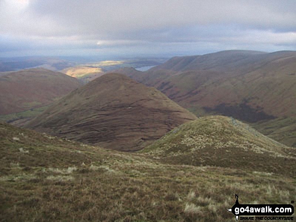
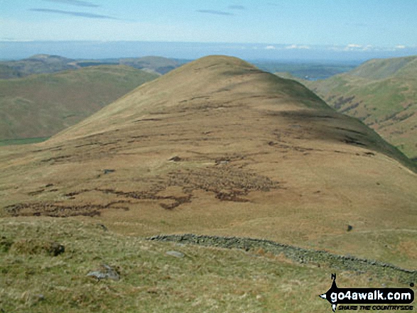
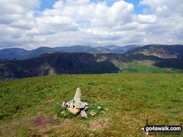
More Photographs & Pictures of views from, on or of The Nab (Martindale)
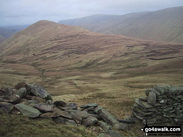
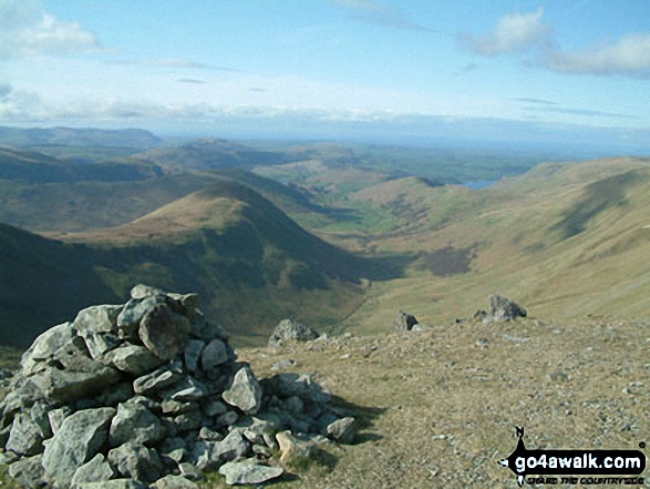
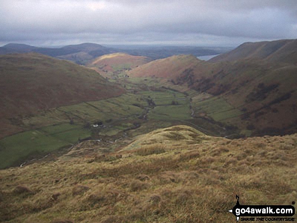
Rest Dodd (centre), The Knott and Rampsgill Head (left) from The Nab (Martindale)
Send us your photographs and pictures on, of, or from The Nab (Martindale)
If you would like to add your walk photographs and pictures featuring views from, on or of The Nab (Martindale) to this page, please send them as email attachments (configured for any computer) along with your name to:
and we shall do our best to publish them.
(Guide Resolution = 300dpi. At least = 660pixels (wide) x 440 pixels (high).)

You can also submit photos via our Facebook Page.
NB. Please indicate where each photo was taken and whether you wish us to credit your photos with a Username or your First Name/Last Name.
Not familiar with this top?


