
![]()
Outer Edge
541m (1775ft)
The Dark Peak Area, The Peak District, South Yorkshire, England
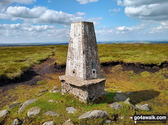
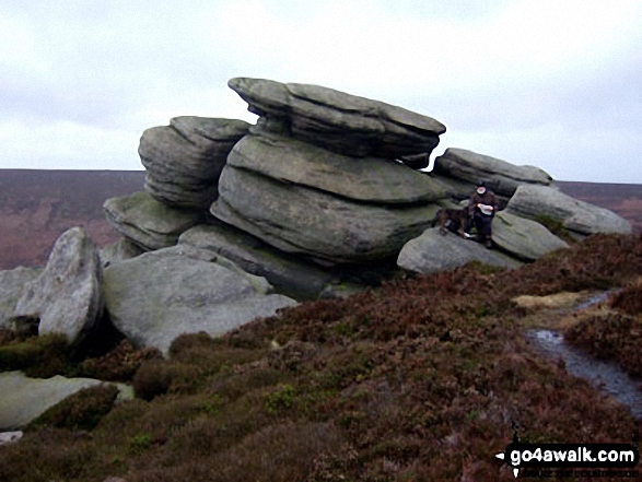
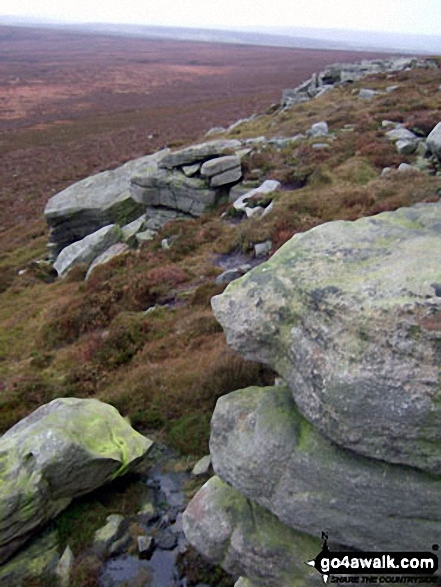
The summit of Outer Edge is marked by an Ordnance Survey Trig Point.
Not familiar with this top?
   |
|---|
Vital Statistics:
| Length: | 11.5ml (18.5km) |
|---|---|
| Ascent: | 1,674ft (510m) |
| Time: | 6 hrs |
| Grade: |  (Moderate) (Moderate) |
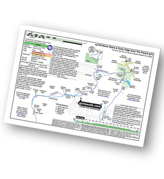
Route Summary:
The Flouch Car Park - Crookland Wood - Swinden Lane - Fox Clough - Langsett Moors - Barmings - Hordron Road - Long Moor Clough - Hordron Clough - The Porter or Little Don River - Laund Clough - Harden Moor - Howden Edge - Hoar Stones - Horse Stone (Horse Stone Naze) - Stainery Clough Head - Howden Moors - Crow Stones - Crow Stones Edge - Outer Edge - Cut Gate End - Cut Gate Path - Mickleden Edge - Delf Edge - Langsett Reservoir - The Porter or Little Don River - The Flouch.
|
|---|
Vital Statistics:
| Length: | 12.75ml (20.5km) |
|---|---|
| Ascent: | 2,094ft (638m) |
| Time: | 6.75hrs |
| Grade: |  (Hard) (Hard) |
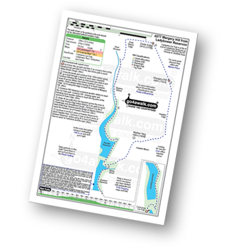
Route Summary:
Ladybower Reservoir - Fairholmes Car Park - Derwent Reservoir - Abbey Bank - Abbey Brook - Hey Bank (Nether Hey) - Howden Moors - Nether Hey (Howden Edge) - Row Top - Featherbed Moss (Howden Edge) - High Stones (Howden Moor) - Willfrey Edge - High Peak - Margery Stones - Margery Hill - Outer Edge - Crow Stones - Crow Stones Edge - Airspeed Consul TF-RPM Plane Wreckage - Broadhead Clough - Cranberry Bed - Swine Side - Cranberry Clough - Cold Side Oaks - Slippery Stones - Packhorse Bridge (River Derwent) - Howden Reservoir - Cold Side (Howden Reservoir) - Derwent Reservoir - Fairholmes Car Park - Ladybower Reservoir
|
|---|
Vital Statistics:
| Length: | 19.75ml (31.5km) |
|---|---|
| Ascent: | 2,757ft (840m) |
| Time: | 9.75hrs |
| Grade: |  (Hard) (Hard) |
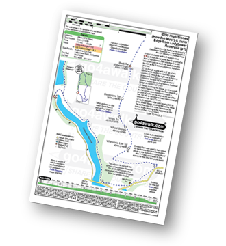
Route Summary:
Ladybower Reservoir - Fairholmes Car Park - Ashopton - Whinstone Lee Tor - Hurkling Stones - Wheel Stones - White Tor (Derwent Edge) - Salt Cellar (Boulder) - Derwent Edge - Dove Stone (Boulder) - Dovestones Tor - Cakes of Bread - Bradfield Gate Head - Back Tor (Derwent Edge) - Abbey Brook - High Peak - Howden Moors - Featherbed Moss (Howden Edge) - High Stones (Howden Moor) - Margery Hill - Outer Edge - Crow Stones - Crow Stones Edge - Airspeed Consul TF-RPM Plane Wreckage - Broadhead Clough - Cranberry Bed - Bull Clough - Cranberry Clough - Slippery Stones - Packhorse Bridge (River Derwent) - Howden Reservoir - Cold Side (Howden Reservoir) - Derwent Reservoir - Fairholmes Car Park - Ladybower Reservoir
See Outer Edge and the surrounding tops on our free-to-access 'Google Style' Peak Bagging Maps:
The Dark Peak Area of The Peak District National Park
Less data - quicker to download
See Outer Edge and the surrounding tops on our downloadable Peak Bagging Map in PDF format:

NB: Whether you print off a copy or download it to your phone, this PDF Peak Baggers' Map might prove incredibly useful when your are up there on the tops and you cannot get a phone signal.
You can find Outer Edge & all the walks that climb it on these unique free-to-access Interactive Walk Planning Maps:
1:25,000 scale OS Explorer Map (orange/yellow covers):
1:50,000 scale OS Landranger Map (pink/magenta covers):
 Fellow go4awalkers who have already walked, climbed, summited & bagged Outer Edge
Nicola Parkinson walked up Outer Edge on June 23rd, 2018 [from/via/route] sy119 Horse Stone & Outer Edge from Flouch [with] Stu [weather] Sunshine
Andrew Joss climbed Outer Edge on October 27th, 2013 [from/via/route] Ladybower Reservoir car park [with] Barbara, Mick, Pip & Benson [weather] Windy & rainy - Great views when it wasn't raining
Geoffrey Robertshaw and Mark Davidson have both walked, climbed & bagged Outer Edge.
To add (or remove) your name and experiences on this page - Log On and edit your Personal Mountain Bagging Record
More Photographs & Pictures of views from, on or of Outer Edge
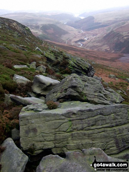
Howden Reservoir, Derwent Reservoir and Ladybower Reservoir from Outer Edge
Send us your photographs and pictures on, of, or from Outer Edge
If you would like to add your walk photographs and pictures featuring views from, on or of Outer Edge to this page, please send them as email attachments (configured for any computer) along with your name to:
and we shall do our best to publish them.
(Guide Resolution = 300dpi. At least = 660pixels (wide) x 440 pixels (high).)

You can also submit photos via our Facebook Page.
NB. Please indicate where each photo was taken and whether you wish us to credit your photos with a Username or your First Name/Last Name.
Not familiar with this top?


