
![]()
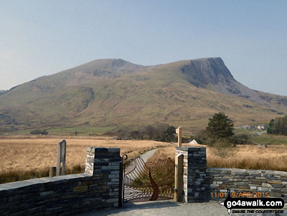
Moel Hebog
783m (2569ft)
The Moel Hebog Area, Snowdonia, Gwynedd, Wales
Moel Hebog means 'Bare Hill of the Hawk' in Welsh and is pronounced 'moy-el-heb-og'.
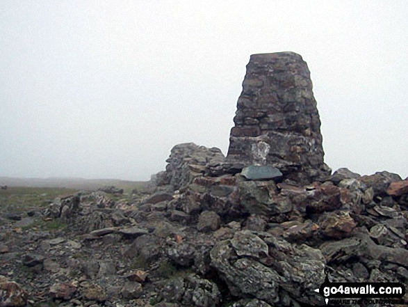
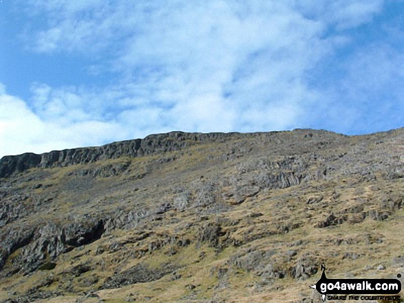
The summit of Moel Hebog is marked by an Ordnance Survey Trig Point.
Not familiar with this top?
   |
|---|
Vital Statistics:
| Length: | 7ml (11.5km) |
|---|---|
| Ascent: | 3,106ft (947m) |
| Time: | 5.75hrs |
| Grade: |  (Moderate) (Moderate) |
Route Summary:
Beddgelert - Welsh Mountain Railway - Moel Hebog - Bwlch Meillionen - Moel yr Ogof - Moel Lefn - Bwlch Sais - Craig Cwm-trwsgl - Bwlch Cwm-trwsgl - Coed Mawr - Beddgelert Forest Campsite - Beddgelert
See Moel Hebog and the surrounding tops on our free-to-access 'Google Style' Peak Bagging Maps:
The Moel Hebog area of Snowdonia National Park
Less data - quicker to download
The Whole of Snowdonia National Park
More data - might take a little longer to download
See Moel Hebog and the surrounding tops on our downloadable Peak Bagging Map in PDF format:

NB: Whether you print off a copy or download it to your phone, this PDF Peak Baggers' Map might prove incredibly useful when your are up there on the tops and you cannot get a phone signal.
You can find Moel Hebog & all the walks that climb it on these unique free-to-access Interactive Walk Planning Maps:
1:25,000 scale OS Explorer Map (orange/yellow covers):
1:50,000 scale OS Landranger Map (pink/magenta covers):
 Fellow go4awalkers who have already walked, climbed, summited & bagged Moel Hebog
Daniel Moran walked up Moel Hebog on December 29th, 2023 [from/via/route] From beddgelart campsite [with] Michelle Roberts Moran [weather] Cloudy - We walked from the campsite though the woods along the river path, up the shoulder & back through the forest road path Frankie was with us
Melfyn Parry climbed Moel Hebog on July 23rd, 2023 [from/via/route] Parked in the carpark just off the A4085 just before reaching the centre of Beddgelert on the Caernarfon Road. Crossed over the A4085 & took a path that crossed under & over the Welsh Highland Railway line 3 times before taking a well signposted path (Moel Hebog). The path is quite steep in parts & loose stone makes for hard going at times. We eventually reached the summit of Moel Hebog & then continued down the slope to Bwlch Meillion. The plan was to ascend Moel yr Ogof from here but the weather closed in & visibility was poor. So we descended along the side of the wall to reach the forest. The path through the trees followed the stream which was in full flow, parts of the path were quite boggy but we eventually reached the forest track that lead past Beudy Ysgubor & Parc Ty'n y Coed to rejoin the outward leg to return to the carpark. [with] With 10 members of PRC, which dropped to 2 because of the weather [weather] Started off okay but rain soon developed which was quite heavy at times. Sun came out for final half hour of the route. - Aiming to return to this area soon to do this peak again together with the other 2 Nuttalls.
Adrian Haywood bagged Moel Hebog on October 9th, 2022 [from/via/route] From Beddgelert [with] Mike, Celia and Rob [weather] mixed
Robert Shaw hiked Moel Hebog on April 7th, 2018 [from/via/route] On sports club walk in the mist [with] usual crew [weather] Wet & misty
Mark Davidson summited Moel Hebog on July 24th, 2003 [from/via/route] Walk gw192 Moel Hebog from Beddgelert [with] Alone [weather] Bit cloudy, misty on the top. Huge rain storm on the way back to the car. Got soaked.
Donovan Suddell conquered Moel Hebog on September 5th, 2021 [from/via/route] Beddgelert [with] Wife [weather] Hazy Sunshine - Beautiful walk as part of my birthday present.
Andy Buxton scaled Moel Hebog during August, 1963 [with] Dad
Anthony Scott walked up Moel Hebog on July 31st, 2018 [with] HF
Bleddyn Rhys climbed Moel Hebog on April 23rd, 2016 [from/via/route] Gwneud hanner cyntaf Pedol Pennant fel recee gyda Kev a Ceri a 2 aelod arall or clwb rhedag. [with] Kev a Ceri [weather] Eithaf braf gyda cymylau ond sych a dim llawer o wynt mond ar y top - Gwneud lot mewn amser byr - lot o redag. Coesau wedi blino.
Christina Lander bagged Moel Hebog on April 21st, 2018 [from/via/route] Beddgelert - Moel Hebog - Moel yr Ogof - Moel Lefn - Beddgelert Forest - Beddgelert [with] Dick [weather] Very warm sunny day
Louis Smith hiked Moel Hebog on October 14th, 2017 [from/via/route] unsure of date [weather] fog
Gerald Murphy summited Moel Hebog on June 9th, 2015 [from/via/route] Beddgelert car park. Used the go4awalk route gw192. Went via Cwm Cloch; clear path up Moel Hebog; clear path to Moel Ogof; clear path to Moel Lefn (though the path passed the true summit & I finished up retracing my steps); steep descent to the forest along a clear path; found the path into the forest but lost the path after leaving the forest, after the first blue waymark (very boggy ground). It wasn't clear where was meant by the "second stand of trees" & I couldn't see the stile leading back into the forest. I followed the wall outside the forest across very boggy ground, found a way over a broken section of the wall back into the forest (where a fence leads away from the wall). From then on, quickly refound the proper path. After that there was a proper forest track past Hafod Ruffydd to Cwm Cloch & back rto the car park. [with] alone [weather] sunny, dry, windy at higher level, high pressure haze - There are brilliant views all the way along this walk.
Robert Taylor-Marriott conquered Moel Hebog on May 13th, 2014 [from/via/route] Route 58: Moel Hebog. Moel yr Ogof. Moel Lefn (MH) Completed 13.05.14 [with] Vince Wetton & Robert Taylor-Marriott [weather] Fair
Vince Wetton scaled Moel Hebog on May 13th, 2014 [from/via/route] Bedgellert Classic Route gw192 [with] RTM [weather] Cloudy am bright sunny pm - Very hard work
Robert Logan walked up Moel Hebog on July 13th, 2013 [from/via/route] Beddgellert Forest campsite, Moel Hebog NE ridge, Moel Hebog, Bwlch Meillionen, Cwm Meillionen, Beddgellwert Forest campsite. [with] Judith Logan [weather] Hottest day in a very hot July. - Saw & photgraphed nesting Choughs near Bwlch Meillionen.
John Drysdale climbed Moel Hebog on September 24th, 2006 [from/via/route] Directly from Beddgelert [with] Self [weather] Bright sunny - Listened to Ryder Cup final day on the way up. Beautiful evening at the top.
Bay Wan bagged Moel Hebog on April 2nd, 2012 [with] Cocoa Dog [weather] Rain - Wanted a lower level walk after tackling Dafydd & Llewelyn the day before
Patrick Rogozinski, Mike Harris, Linda Mckeogh, Paul Booth, Trevor Williams, Mark Ellerington, Steve Lockett, Andrew Greenhill, Kath Edwards and Victoria Bates have all walked, climbed & bagged Moel Hebog.
To add (or remove) your name and experiences on this page - Log On and edit your Personal Mountain Bagging Record
. . . [see less walk reports]
More Photographs & Pictures of views from, on or of Moel Hebog
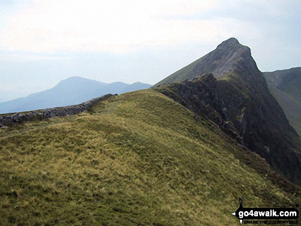
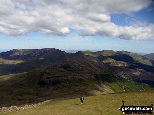
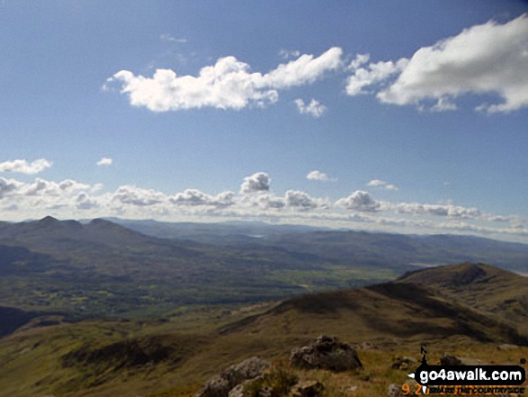
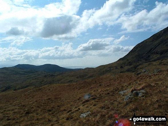
Mynydd Drws-y-coed and The Nantlle Ridge with Moel Hebog, Moel Lefn and Moel yr Ogof in the distance (left) from Y Garn (Moel Hebog)

Mynydd Mawr (Llyn Cwellyn), Craig y Bera and Moel Eilio (Llanberis) from Y Garn (Moel Hebog)
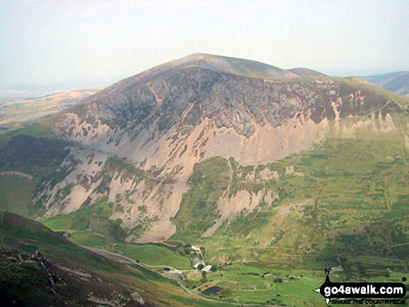
Mynydd Drws y Coed (far left), Y Garn (Moel Hebog Area) (left) and Mynydd Mawr (Llyn Cwellyn) (right)
Mynydd Mawr (Llyn Cwellyn) above Craig y Bera from Y Garn (Moel Hebog)
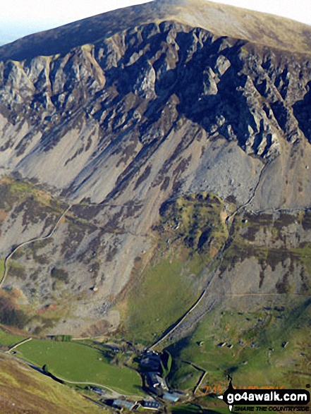
Craig y Bera and Mynydd Mawr (Llyn Cwellyn) tower above Drws-y-coed from Y Garn (Moel Hebog)
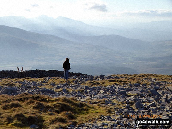
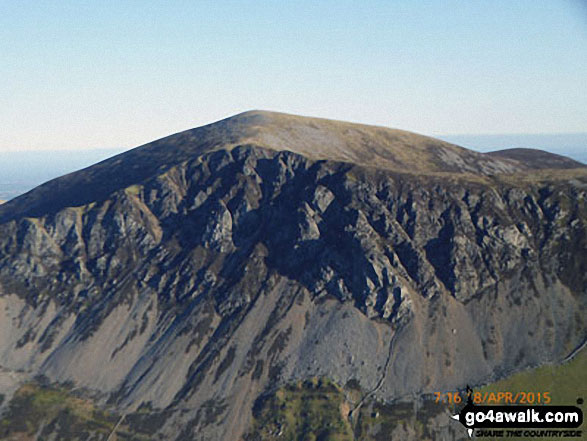
On the summit of Y Garn (Moel Hebog) with the Snowdon (Yr Wyddfa) group in the background


The Nantlle Ridge - Mynydd Drws-y-coed (left) and Trum y Ddysgl from a cairn on the slopes of Y Garn (Moel Hebog)
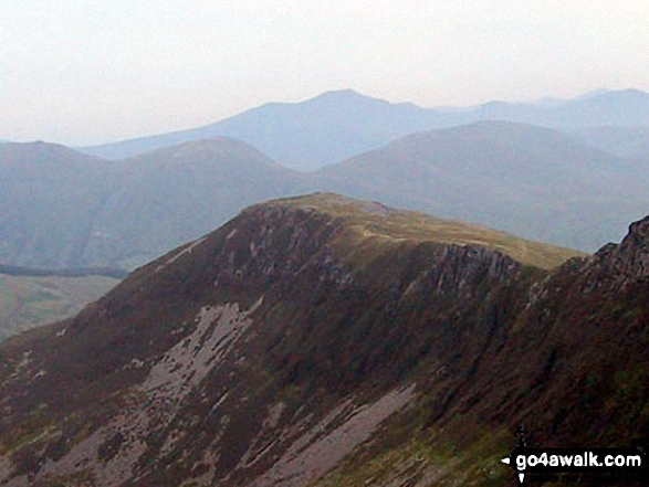
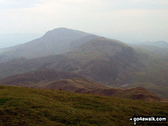
Y Garn (Moel Hebog) from Trum y Ddysgl - with Foel Goch (left), Moel Cynghorion (right) and Elidir Fawr between
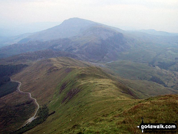
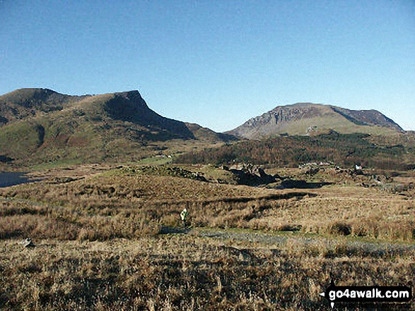
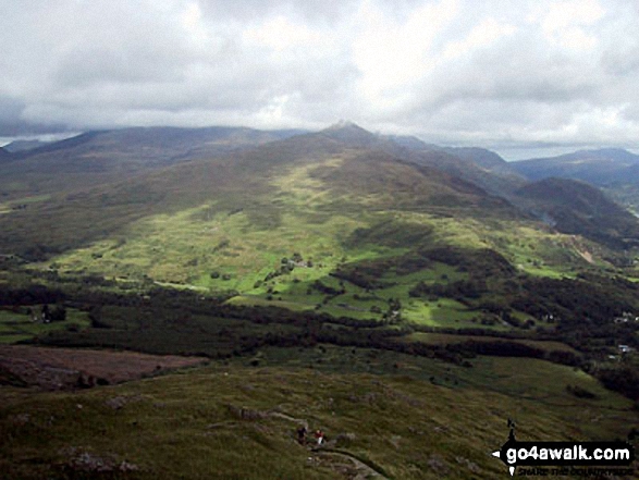
Moel Hebog, Moel Lefn and Moel yr Ogof from Trum y Ddysgl with Bwlch-y-Ddwy-elor bottom left
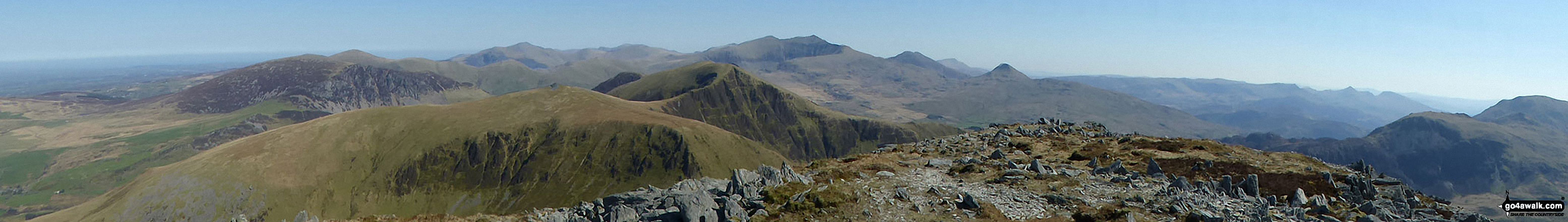
Mynydd Mawr (Llyn Celyn), Craig y Bera, Mynydd Tal-y-mignedd and Mynydd Drws-y-coed from the summit of Craig Cwm Silyn with Garnedd Ugain (Crib y Ddysgl), Snowdon (Yr Wyddfa), Y Lliwedd & Yr Aran on the horizon (centre) and Moel Lefn, Moel yr Ogof & Moel Hebog on the far left
. . . see all 51 walk photographs & pictures of views from, on or of Moel Hebog
Send us your photographs and pictures on, of, or from Moel Hebog
If you would like to add your walk photographs and pictures featuring views from, on or of Moel Hebog to this page, please send them as email attachments (configured for any computer) along with your name to:
and we shall do our best to publish them.
(Guide Resolution = 300dpi. At least = 660pixels (wide) x 440 pixels (high).)

You can also submit photos via our Facebook Page.
NB. Please indicate where each photo was taken and whether you wish us to credit your photos with a Username or your First Name/Last Name.
Not familiar with this top?


