
![]()
Moel yr Ogof
655m (2150ft)
The Moel Hebog Area, Snowdonia, Gwynedd, Wales
Moel yr Ogof means 'Bare Hill with a Cave' in Welsh and is pronounced 'moy-el-ur-og-ov'.
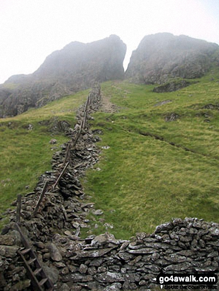
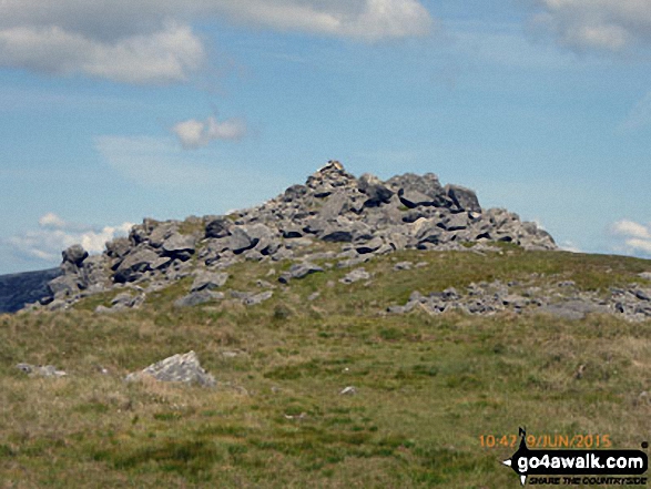
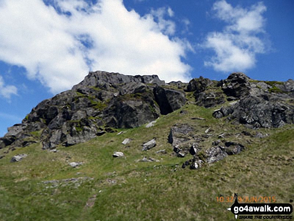
The summit of Moel yr Ogof is marked by a small cairn on rocky outcrop.
Not familiar with this top?
   |
|---|
Vital Statistics:
| Length: | 7ml (11.5km) |
|---|---|
| Ascent: | 3,106ft (947m) |
| Time: | 5.75hrs |
| Grade: |  (Moderate) (Moderate) |
Route Summary:
Beddgelert - Welsh Mountain Railway - Moel Hebog - Bwlch Meillionen - Moel yr Ogof - Moel Lefn - Bwlch Sais - Craig Cwm-trwsgl - Bwlch Cwm-trwsgl - Coed Mawr - Beddgelert Forest Campsite - Beddgelert
See Moel yr Ogof and the surrounding tops on our free-to-access 'Google Style' Peak Bagging Maps:
The Moel Hebog area of Snowdonia National Park
Less data - quicker to download
The Whole of Snowdonia National Park
More data - might take a little longer to download
See Moel yr Ogof and the surrounding tops on our downloadable Peak Bagging Map in PDF format:

NB: Whether you print off a copy or download it to your phone, this PDF Peak Baggers' Map might prove incredibly useful when your are up there on the tops and you cannot get a phone signal.
You can find Moel yr Ogof & all the walks that climb it on these unique free-to-access Interactive Walk Planning Maps:
1:25,000 scale OS Explorer Map (orange/yellow covers):
1:50,000 scale OS Landranger Map (pink/magenta covers):
 Fellow go4awalkers who have already walked, climbed, summited & bagged Moel yr Ogof
Daniel Moran walked up Moel yr Ogof on January 1st, 2024 [from/via/route] Caravan walk from beddgelart [with] Chels and frankie [weather] Mixed, not great visibility - Water sounds & slow wind
Melfyn Parry climbed Moel yr Ogof on August 6th, 2023 [from/via/route] Parked in the carpark just off the A4085 just before reaching the centre of Beddgelert on the Caernarfon Road. Crossed over the A4085 & took a path that crossed under & over the Welsh Highland Railway line 3 times before taking a well signposted path (Moel Hebog). The path is quite steep in parts & loose stone makes for hard going at times. We eventually reached the summit of Moel Hebog & then continued down the slope to Bwlch Meillion. The weather being better today than 2 weeks ago we continued the ascent of Moel yr Ogof & onwards to Moel Lefn before dropping down to Bwlch Sais & then on to Bwlch Cwm Trwsgl. From here we took the forest tracks around Llyn Llywelyn then passing Hafod Ruffydd Ganol & on to the railway line. Continuing along the forest track we rejoined our outbound route & returned to the car park. [with] With 4 members of PRC [weather] Started off okay but rain soon developed which was quite heavy at times. Visibility was good & after lunch the weather improved greatly, becoming sunny & warm.
Adrian Haywood bagged Moel yr Ogof on October 9th, 2022 [from/via/route] From Beddgelert [with] Mike, Celia and Rob [weather] mixed
Robert Shaw hiked Moel yr Ogof on April 7th, 2018 [from/via/route] On sports club walk clear [with] usual crew [weather] Sunny
Mark Davidson summited Moel yr Ogof on July 24th, 2003 [from/via/route] Walk gw192 Moel Hebog from Beddgelert [with] Alone [weather] Bit cloudy, misty on the top. Huge rain storm on the way back to the car. Got soaked.
Donovan Suddell conquered Moel yr Ogof on September 5th, 2021 [from/via/route] Beddgelert [with] Wife [weather] Hazy Sunshine - Beautiful walk as part of my birthday present.
Andy Buxton scaled Moel yr Ogof during August, 1963 [with] Dad
Bleddyn Rhys walked up Moel yr Ogof on April 23rd, 2016 [from/via/route] Gwneud hanner cyntaf Pedol Pennant fel recee gyda Kev a Ceri a 2 aelod arall or clwb rhedag. [with] Kev a Ceri [weather] Eithaf braf gyda cymylau ond sych a dim llawer o wynt mond ar y top - Gwneud lot mewn amser byr - lot o redag. Coesau wedi blino.
Christina Lander climbed Moel yr Ogof on April 21st, 2018 [from/via/route] Beddgelert - Moel Hebog - Moel yr Ogof - Moel Lefn - Beddgelert Forest - Beddgelert [with] Dick [weather] Very warm sunny day
Louis Smith bagged Moel yr Ogof on October 14th, 2017 [from/via/route] unsure of date [weather] fog
To add (or remove) your name and experiences on this page - Log On and edit your Personal Mountain Bagging Record
. . . [see more walk reports]
More Photographs & Pictures of views from, on or of Moel yr Ogof
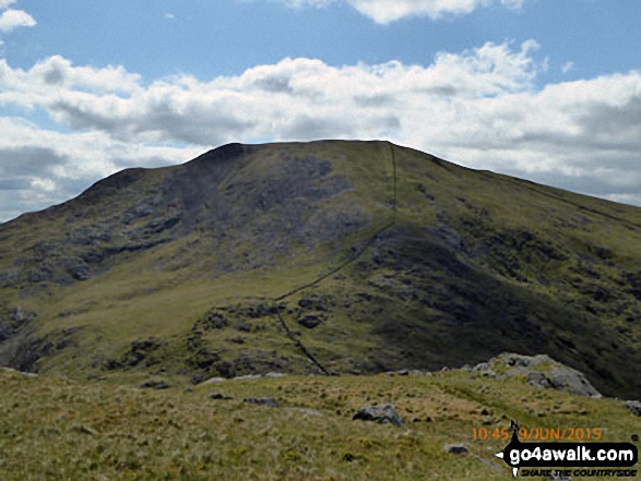
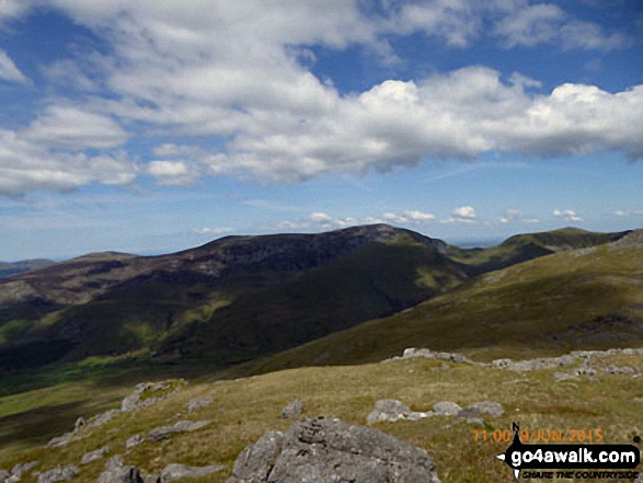
Moel Lefn (centre), Moel yr Ogof and Moel Hebog (right) from the summit of Craig Cwm Silyn
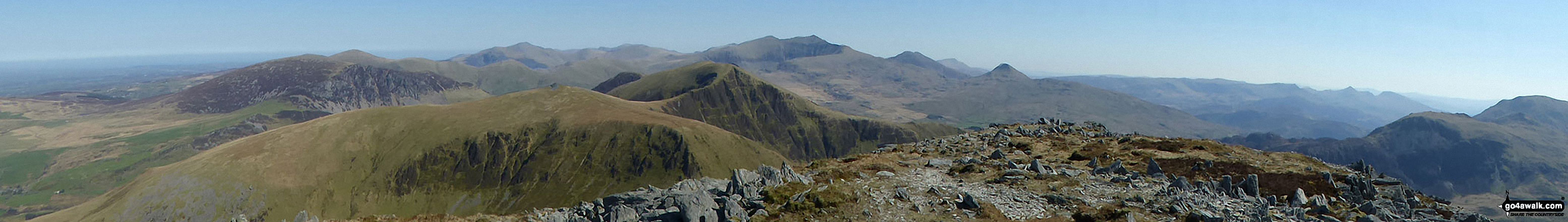
Mynydd Mawr (Llyn Celyn), Craig y Bera, Mynydd Tal-y-mignedd and Mynydd Drws-y-coed from the summit of Craig Cwm Silyn with Garnedd Ugain (Crib y Ddysgl), Snowdon (Yr Wyddfa), Y Lliwedd & Yr Aran on the horizon (centre) and Moel Lefn, Moel yr Ogof & Moel Hebog on the far left
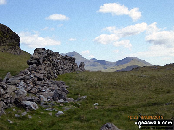
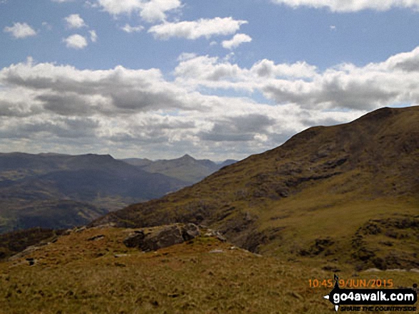
The Snowdon (Yr Wyddfa) (left) and Yr Aran (right) from Bwlch Meillionen
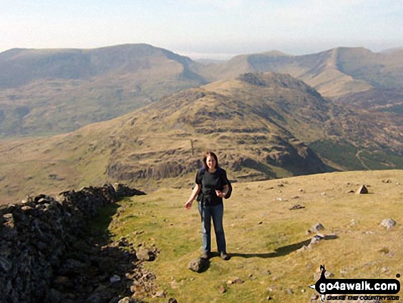
Look! Its me ;-) on Moel Hebog last April with Craig Cwm Silyn (left), Mynydd Tal-y-mignedd (centre right), Trum y Ddysgl (right) on the horizon and Moel Lefn and Moel yr Ogof in the mid-distance
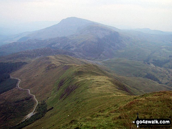
Mynydd Drws-y-coed and The Nantlle Ridge with Moel Hebog, Moel Lefn and Moel yr Ogof in the distance (left) from Y Garn (Moel Hebog)
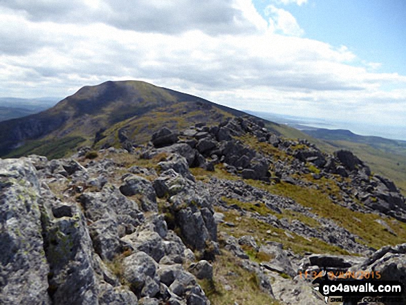
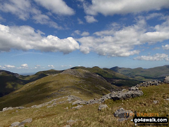
The Nantlle Ridge - Garnedd-goch, Craig Cwm Silyn, Mynydd Tal-y-mignedd, Bwlch Dros-bern and Mynydd Drws-y-coed - from Moel Yr Ogof
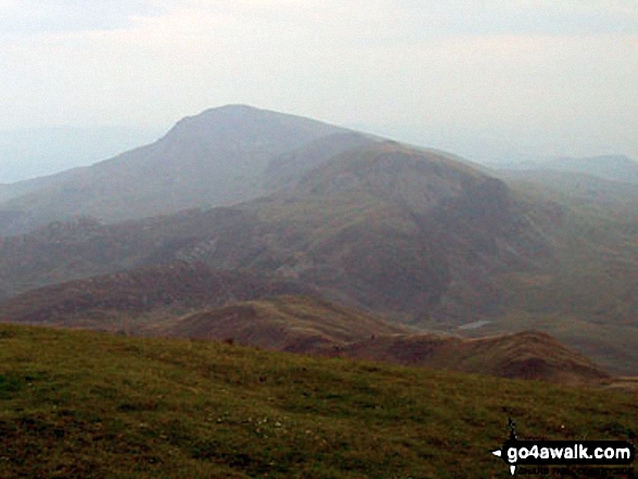
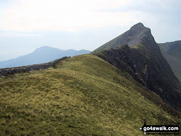
Moel Hebog, Moel Lefn and Moel yr Ogof from Trum y Ddysgl with Bwlch-y-Ddwy-elor bottom left
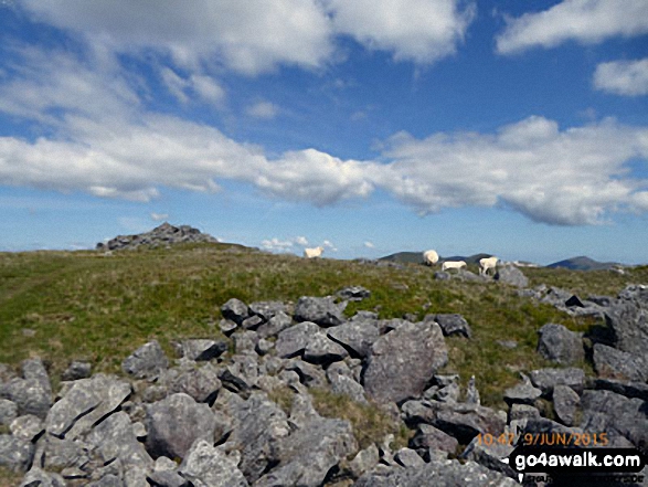
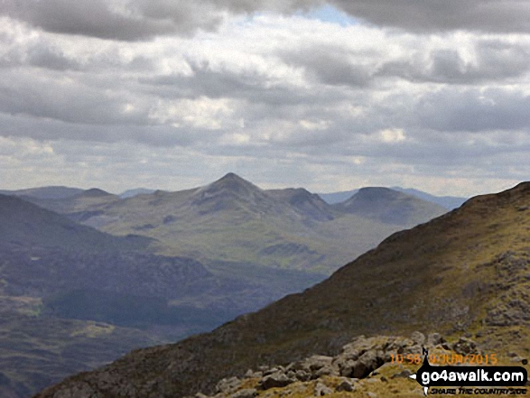
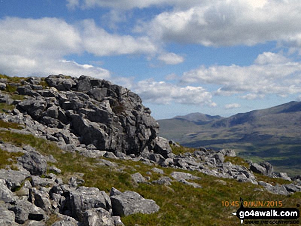
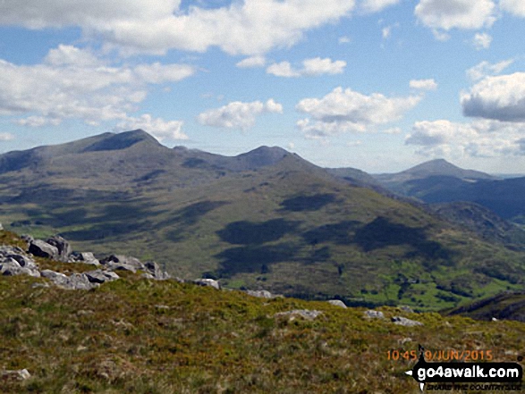
Mynydd Tal-y-mignedd and Mynydd Drws-y-coed (left) with Moel Eilio (in shadow), Foel Gron, Moel Cynghorion and Snowdon (Yr Wyddfa) from the cairn on the summit of Moel Yr Ogof
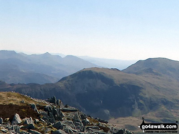
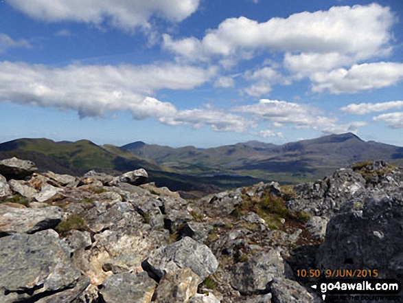
Snowdon (Yr Wyddfa) (left), Yr Aran and Carnedd Moel Siabod (right) from the summit of Moel Yr Ogof
. . . see all 25 walk photographs & pictures of views from, on or of Moel yr Ogof
Send us your photographs and pictures on, of, or from Moel yr Ogof
If you would like to add your walk photographs and pictures featuring views from, on or of Moel yr Ogof to this page, please send them as email attachments (configured for any computer) along with your name to:
and we shall do our best to publish them.
(Guide Resolution = 300dpi. At least = 660pixels (wide) x 440 pixels (high).)

You can also submit photos via our Facebook Page.
NB. Please indicate where each photo was taken and whether you wish us to credit your photos with a Username or your First Name/Last Name.
Not familiar with this top?


