![]()
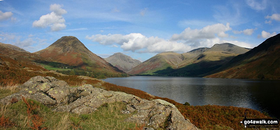
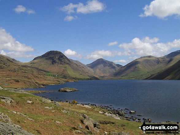
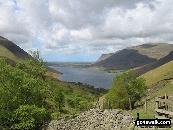
Lingmell
807m (2648ft)
The Southern Fells, The Lake District, Cumbria, England
Not familiar with this top?
   |
|---|
Vital Statistics:
| Length: | 7.5ml (12km) |
|---|---|
| Ascent: | 4,195ft (1,279m) |
| Time: | 7 hrs |
| Grade: |  (Hard) (Hard) |
Route Summary:
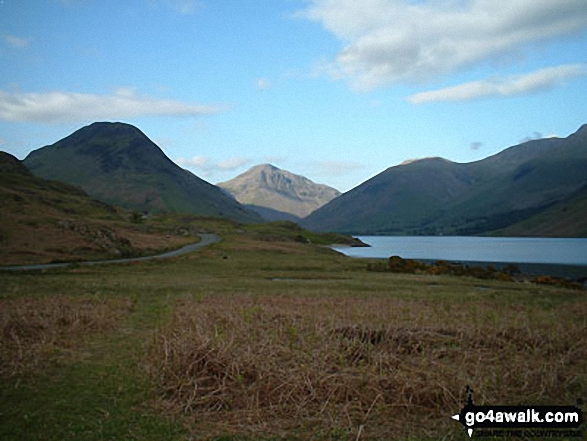
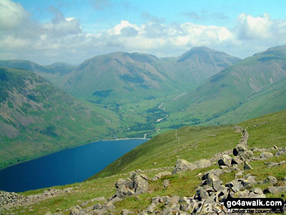
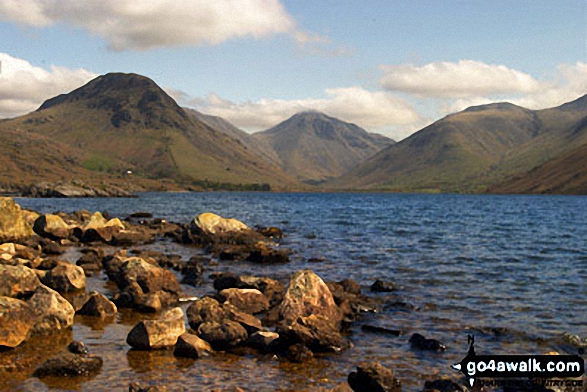
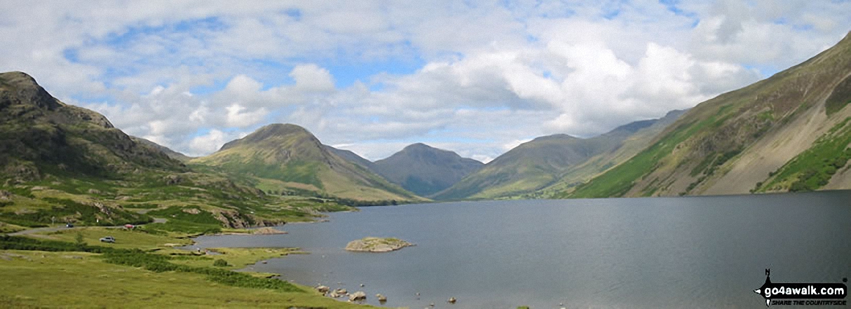
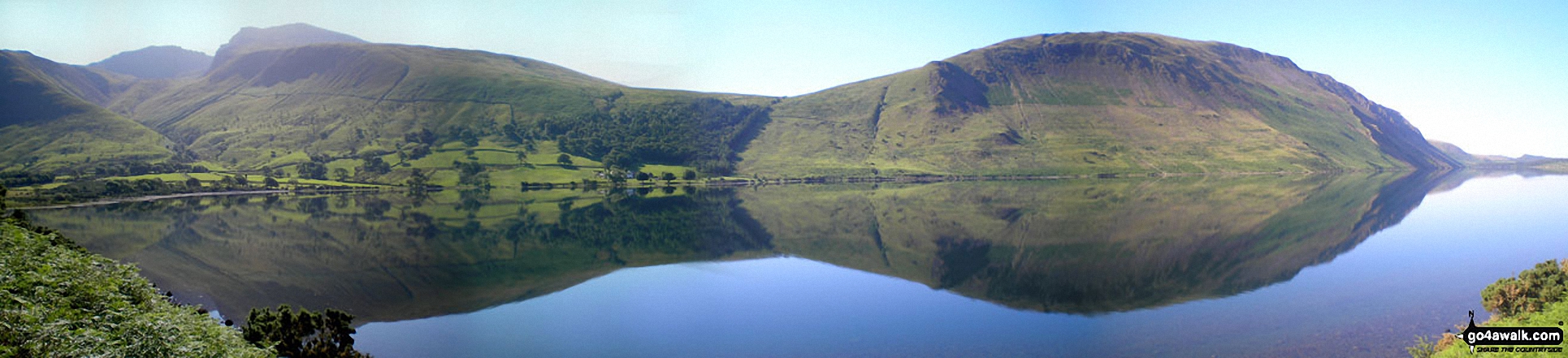
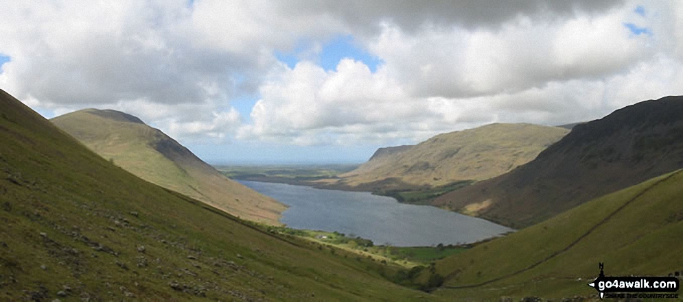
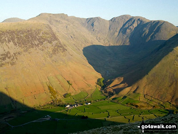
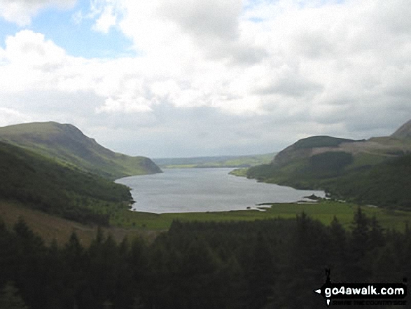
Wasdale Head - (National Trust Campsite) - Wast Water - Lingmell - Corridor Route - Scafell Pike - Mickledore - Foxes Tarn - Symonds Knott - Sca Fell - Lingmell Gill - Wasdale Head - Wast Water.
|
|---|
Vital Statistics:
| Length: | 9ml (14.5km) |
|---|---|
| Ascent: | 3,696ft (1,126m) |
| Time: | 7 hrs |
| Grade: | (Hard) |
Route Summary:
Wasdale Head - Wast Water - Lingmell - Lingmell Col - Scafell Pike - Broad Crag - Ill Crag - Great End - Esk Hause - Sty Head - Lingmell Beck - Gable Beck Bridge - Wasdale Head - Wast Water.
|
|---|
Vital Statistics:
| Length: | 9.75ml (15.5km) |
|---|---|
| Ascent: | 5,140ft (1,567m) |
| Time: | 8.75hrs |
| Grade: |  (Hard) (Hard) |
Route Summary:
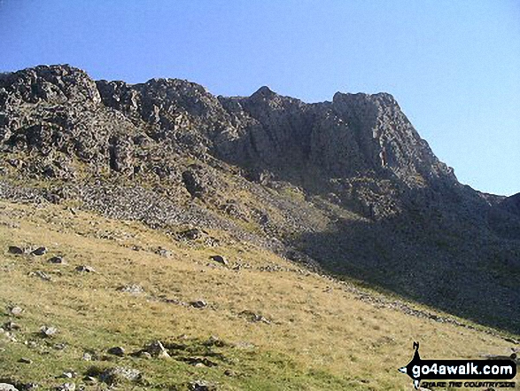
Wasdale Head - (National Trust Campsite) - Wast Water - Lingmell - Middleboot Knotts - Round How (Scafell) - Great End - Ill Crag - Broad Crag - Scafell Pike - Mickledore - Foxes Tarn - Symonds Knott - Sca Fell - Wast Water.
|
|---|
Vital Statistics:
| Length: | 11ml (17.5km) |
|---|---|
| Ascent: | 5,409ft (1,648m) |
| Time: | 9½ hrs |
| Grade: | (Hard) |
Route Summary:
Wasdale Head - (National Trust Campsite) - Wast Water - Lingmell - Corridor Route - Great End - Ill Crag - Broad Crag - Scafell Pike - Mickledore - Foxes Tarn - Symonds Knott - Sca Fell - Slight Side - Broad Tongue - Hardrigg Gill - Wasdale Head - Wast Water.
See Lingmell and the surrounding tops on our free-to-access 'Google Style' Peak Bagging Maps:
The Southern Fells of The Lake District National Park
Less data - quicker to download
The Whole of The Lake District National Park
More data - might take a little longer to download
See Lingmell and the surrounding tops on our downloadable Peak Bagging Maps in PDF format:

NB: Whether you print off a copy or download it to your phone, these PDF Peak Baggers' Maps might prove incredibly useful when your are up there on the tops and you cannot get a phone signal.
*This version is marked with the walk routes you need to follow to Walk all 214 Wainwrights in just 59 walks.
You can find Lingmell & all the walks that climb it on these unique free-to-access Interactive Walk Planning Maps:
1:25,000 scale OS Explorer Map (orange/yellow covers):
1:50,000 scale OS Landranger Maps (pink/magenta covers):
 Fellow go4awalkers who have already walked, climbed, summited & bagged Lingmell
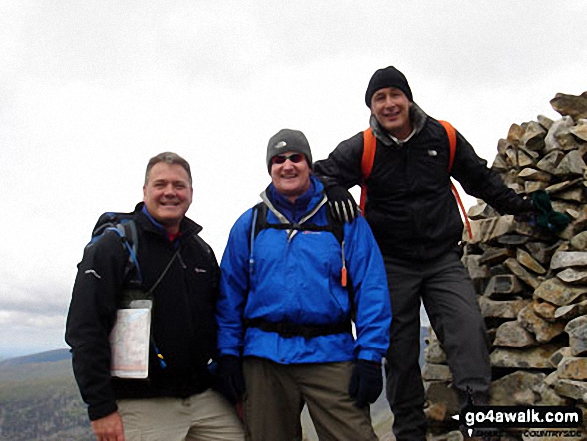
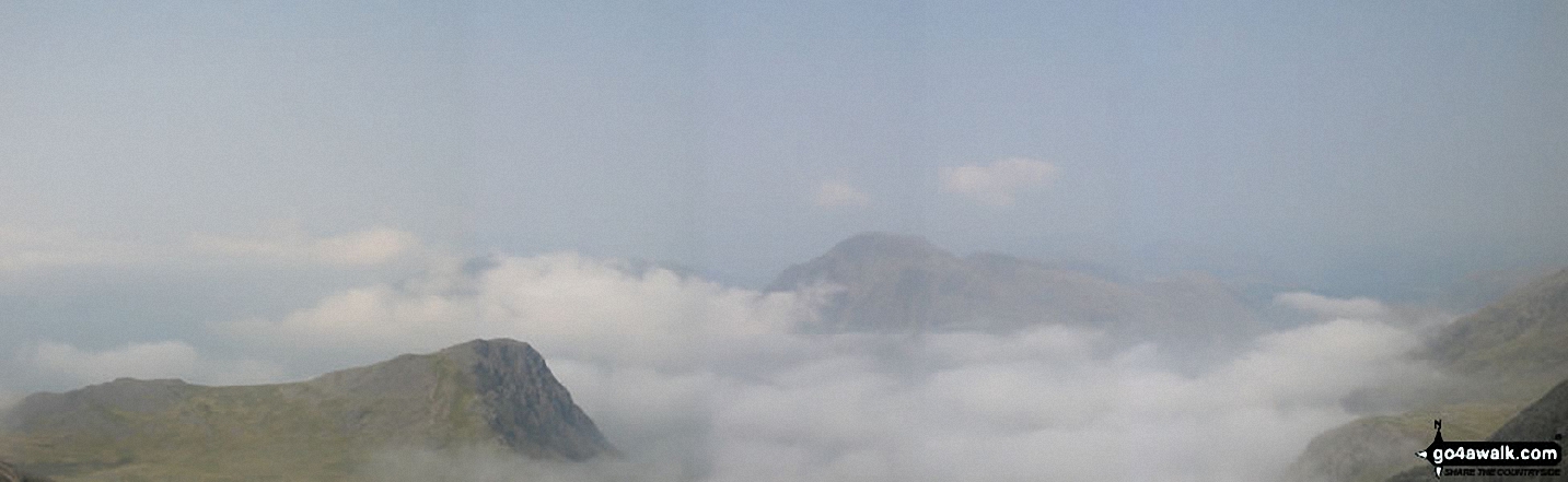
Pete George walked up it on October 13th, 2025 [from/via/route] Wasdale Head [with] Roco [weather] Beautiful cloud inversion on Lingmell, cloud rising on Scafell Pike, rest of day in fog
Geoff Hand climbed it on July 2nd, 2025 [from/via/route] Originally planned to do the Mosedale round, however the weather was against us so we opted for Lingmell from Wasdale head straight up & down. [with] richard Macilwaine (friend) [weather] Poor at first then improved as afternoon went on. - Great views around once on top. Nice to see the hoards on scar felland yet it be fairly quiet on Lingmell.
Ian Ashton bagged it on July 28th, 2024 [with] Solo - Ì
David Higginbottom hiked it on November 15th, 2018 [from/via/route] Scafell loop [with] Carolyn [weather] Good bit of cloud up Scafell
Jason Mcmillan summited on April 28th, 2023 [from/via/route] Lingmell, Scafell Pike & Scafell
Christine Shepherd conquered it on April 26th, 2008 [from/via/route] Wasdale. Straight up & down Climbed up & down again on a hot summer's day on 1.9.10 My third ascent was before going on to climb Scafell Pike with Jenny & Ian. We were led by Basia from Hills & Skills on 21.10.23 Climbed again on 21.4.24 just up & down. [with] On my own [weather] Dreadful; driving wind & heaving rain. - I reached the summit cairn & came down. Climbed again 1.9.10 when I went on to look at the view of Gable from the tall cairn. Climbed again on 21.10.23 with Basia from Hills & Skills, & my friends Jenny & Ian & David, another guest. Went on from here to climb Scafell Pike. My fourth up & down was on 21.4.24 as I had never been convinced that I reached the summit on my first visit in the terrible weather.I didn't want to finish my third Wainwright round with any doubts.
Claire Kirk scaled it on June 24th, 2023 [from/via/route] Seathwaite Farm [with] Sarah, Leigh, Matt and Anne - Sarah's last Wainwright - Round 2. My first Wainwright of Round 2
John Ramsbottom walked up it on January 7th, 2024 [from/via/route] Started at Wasdale Head car park [with] Lola [weather] sunshine cold & frosty, nice day - No pub this time . Being good
James Hughes climbed it on June 15th, 2023 [from/via/route] Lingmell, Scafell Pike, Broad Crag, Ill Crag, Great End [with] Solo [weather] Beautiful day, clear, warm. blue skies & no wind. - Pearler of a day...
John Tippins bagged it on May 2nd, 2023 [from/via/route] From Wast Water [with] Alone [weather] Mild, blowy - a bit more windy than forecast. Complete cloud cover with occasional signs of sunshine. Dry all day. Higher summits shrouded in cloud.
To add (or remove) your name and experiences on this page - Log On and edit your Personal Mountain Bagging Record
. . . [see more walk reports]
More Photographs & Pictures of views from, on or of Lingmell


. . . see just 20 walk photographs & pictures of views from, on or of Lingmell
Send us your photographs and pictures on, of, or from Lingmell
If you would like to add your walk photographs and pictures to this page, please send them as email attachments (configured for any computer) along with your name to:
and we shall do our best to publish them.
(Guide Resolution = 300dpi. At least = 660pixels (wide) x 440 pixels (high).)

You can also submit photos via our Facebook Page.
NB. Please indicate where each photo was taken and whether you wish us to credit your photos with a Username or your First Name/Last Name.
Not familiar with this top?