
![]()
Elidir Fawr
924m (3033ft)
The Glyders (or Glyderau), Snowdonia, Gwynedd, Wales
Tap/mouse over a coloured circle (1-3 easy walks, 4-6 moderate walks, 7-9 hard walks) and click to select.
Elidir Fawr means 'Big Elidir' in Welsh and is pronounced 'el-ee-d-eer vawr'.
Not familiar with this top?
   |
|---|
Vital Statistics:
| Length: | 10.75ml (17km) |
|---|---|
| Ascent: | 4,699ft (1,432m) |
| Time: | 8½ hrs |
| Grade: |  (Hard) (Hard) |
Route Summary:
Nant Peris - Gwastadnant - Afon Las - Llyn y Cwm - Y Garn (Glyderau) - Bwlch y Cywion - Foel-goch - Bwlch y Brecan - Mynydd Perfedd - Carnedd y Filiast (Glyderau) - Carnedd y Filiast (Glyderau) (North Top) - Carnedd y Filiast (Glyderau) - Mynydd Perfedd - Bwlch y Marchlyn - Elidir Fawr - Afon Dudodyn - Nant Peris
|
|---|
Vital Statistics:
| Length: | 12.5ml (18.5km) |
|---|---|
| Ascent: | 5,327ft (1,624m) |
| Time: | 9½ hrs |
| Grade: | (Hard) |
Route Summary:
Pen-y-Gwryd Hotel - Llyn Caseg-fraith - Bwlch Tryfan - Tryfan - (Adam and Eve) - Bwlch Tryfan - Glyder Fach - The Cantilever Stone - Castell y Gwynt (Glyder Fach) - Bwlch y Ddwy-Glyder - Glyder Fawr - Y Garn (Glyderau) - Bwlch y Cywion - Foel-goch - Bwlch y Brecan - Bwlch y Marchlyn - Elidir Fawr - Afon Dudodyn - Nant Peris
See Elidir Fawr and the surrounding tops on our free-to-access 'Google Style' Peak Bagging Maps:
The Glyders (or Glyderau) of Snowdonia National Park
Less data - quicker to download
The Whole of Snowdonia National Park
More data - might take a little longer to download
See Elidir Fawr and the surrounding tops on our downloadable Peak Bagging Map in PDF format:

NB: Whether you print off a copy or download it to your phone, this PDF Peak Baggers' Map might prove incredibly useful when your are up there on the tops and you cannot get a phone signal.
You can find Elidir Fawr & all the walks that climb it on these unique free-to-access Interactive Walk Planning Maps:
1:25,000 scale OS Explorer Map (orange/yellow covers):
1:50,000 scale OS Landranger Map (pink/magenta covers):
 Fellow go4awalkers who have already walked, climbed, summited & bagged Elidir Fawr
Hazel Gilbert walked up Elidir Fawr on May 13th, 2016 [with] Lawrence [weather] Sunny
Daniel Moran climbed Elidir Fawr on March 5th, 2021 [from/via/route] Lake below [with] Wardy [weather] Decent weather - Small horse shoe
Donovan Suddell bagged Elidir Fawr on September 4th, 2023 [from/via/route] Nant Peris [with] Solo [weather] Beautiful sunny blue-sky day giving fantastic views
Stephanie Doyle hiked Elidir Fawr on March 19th, 2022 [with] Friend [weather] Windy
Melfyn Parry summited Elidir Fawr on November 1st, 2018 [from/via/route] Marchlyn Mawr loop. Start point 596631, tarmac path up to Marchlyn Mawr dam, scrambling up east side of Elidir Fawr ridge, ascending to summit. Return to notch then descent to Bwlch y Marchlyn then climb to summit of Mynydd Perfedd & then over to Carnedd y Filiast stopping on route to see "Atlantic Slabs". Descent from summit to west side of Marchlyn dam before returning to start point. [with] DS & ChW [weather] Mainly sunny day
Neall Garrad conquered Elidir Fawr on June 22nd, 2007 [from/via/route] 15 peaks route from Nant Peris to Llanfairfechan [with] Andy, Chris, John and Warren [weather] Mixed
Sion Britton scaled Elidir Fawr on August 25th, 2021 [from/via/route] O Deiniolen. [with] Gyda Sion Rich a Meical. [weather] Noswaith braf.
Adrian Haywood walked up Elidir Fawr on April 18th, 2021 [from/via/route] From Nant Peris [with] Friends [weather] Nice day!
Andy Buxton climbed Elidir Fawr on June 22nd, 1968 [from/via/route] 14 Peaks (but done before & since) [with] BVGS
Angela Moroney bagged Elidir Fawr during 2011 - 2017 3PEAKS
Alan Pritchard hiked Elidir Fawr on October 5th, 2014 [with] A group [weather] Good - Walked the 15 peaks in 24 hours challenge - enjoyed... 😎🚶♂️
Christina Lander summited Elidir Fawr on September 27th, 2018 [from/via/route] Deiniolen - Carnedd y Filiast - Mynydd Perfedd - Elidyr Fawr - Elidyr Fach - Deiniolen [with] Dick & Meg [weather] A perfect sunny day - Beautiful views across Anglesey, & towards Tryfan & Snowdon
Bleddyn Rhys conquered Elidir Fawr on April 5th, 2017 [from/via/route] Bee-line syth fynnu ac i lawr o Nant Peris [with] Ar ben fy hyn... [weather] Cymylog, niwlog a gwlyb. Gweld dim byd ar y top ac wedyn daeth y glaw - yr holl ffordd lawr! - Rhaid mynd yn ol eto - welais i ddim o'r olygfa o gwbwl!
Kevin Williams scaled Elidir Fawr on March 20th, 2018 [from/via/route] Marchlyn Mawr reservoir road [with] Solo [weather] Sunny, some snow
John Drysdale walked up Elidir Fawr on April 2nd, 2017 [from/via/route] From Vaynol Arms to summit then heading out along the ridge to Carnedd y Filiast 821 m [with] Solo [weather] Sunny
Rachael Tyler climbed Elidir Fawr on August 30th, 2016 [from/via/route] Y Garn from Nant Peris [with] Husband [weather] Cold, wet & cloudy at top
Iain Jones bagged Elidir Fawr on May 24th, 2015 [from/via/route] Gwern Gof Isaf campsite (run) [with] Graeme High
Marilyn Wadkin hiked Elidir Fawr on May 15th, 2016 [from/via/route] Circular walk from Deiniolen past Marchlyn Mawr reservoir. [with] Rob. [weather] Very cold wind with warm sunny intervals. - Had first summited carnedd y filiast & mynydd perfedd then onto elidir fach.
Robert Taylor-Marriott summited Elidir Fawr on August 25th, 2010 [from/via/route] Llanberris Pass [with] Vince Wetton & Robert Taylor-Marriott [weather] Clould, cold Ice.
Gerald Murphy conquered Elidir Fawr on August 4th, 2014 [from/via/route] See notes for Y Garn walk, same day. [with] alone [weather] See notes for Y Garn walk, same day. - no other comments
Simon Neilson-Clark scaled Elidir Fawr on June 17th, 2014 [with] Mrs H [weather] Sunshine
Wyn Griffiths walked up Elidir Fawr on June 21st, 2014 [from/via/route] Vaynol Arms [with] Chris & Andy [weather] Perfect
Stephen Lewis climbed Elidir Fawr on August 24th, 2013 [from/via/route] gw194, Nant Peris [with] Alone [weather] Low cloud, drizzle - Nice pint in Vaynol Arms post walk
Richard Evered bagged Elidir Fawr on March 27th, 2014 [from/via/route] Nant Peris [with] Keith, Rooney [weather] Warm & sunny start, then hail, heavy snow & sleet - high winds & very wet underfoot. - Great few days. Campervan in Nant Peris car park, few pints in Vaynol Arms. Training/route finding days for Keith's Welsh 3000's attempt.
Graham Williams hiked Elidir Fawr on January 24th, 2014 [from/via/route] Ogwen Cottage up through Devils Kitchen to Y Garn then Elidr Fawr [with] The Travelling Raspberries (Chris Barnes, Nick Jones) [weather] Cold, Wet & Windy
Vince Wetton summited Elidir Fawr on August 25th, 2010 [with] RTM
Patrick Rogozinski, Mike Harris, Sarah Groves, Wendy Sockett, Darran Tunnah, Math Llwyd, Mark Davidson, Hugh Strickland, Linda Mckeogh, Andrew Else, Craig Lewis, Paul Booth, Trevor Williams, Paul Donoghue, Steve Lockett, Stephen Hobdell and Stephen Millington have all walked, climbed & bagged Elidir Fawr.
To add (or remove) your name and experiences on this page - Log On and edit your Personal Mountain Bagging Record
. . . [see less walk reports]
More Photographs & Pictures of views from, on or of Elidir Fawr
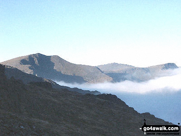
Y Garn (Moel Hebog) from Trum y Ddysgl - with Foel Goch (left), Moel Cynghorion (right) and Elidir Fawr between
Foel-goch, Elidir Fawr, Mynydd Perfedd and Carnedd y Filiast from Drosgl
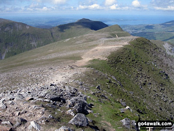
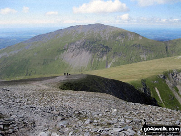
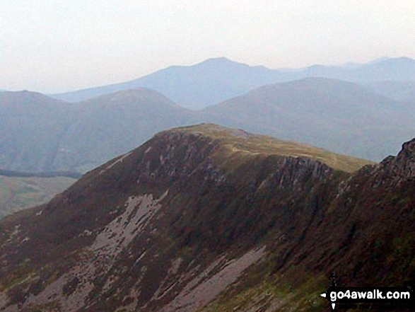
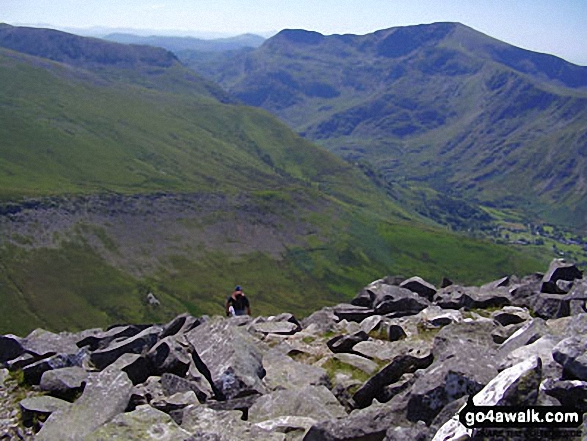
The shoulder of Elidir Fawr, Carnedd y Filiast (Glyderau), Mernedd Perfedd and Foel-goch from Y Garn (Glyderau)
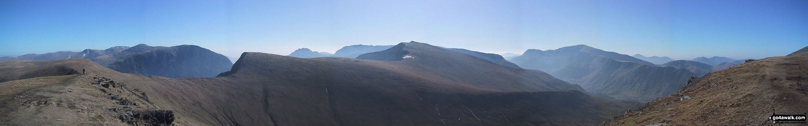
*Y Garn (Glyderau) (far left), Elidir Fawr, Foel-goch, Mynydd Perfedd and Carnedd y Filiast (Glyderau) from Tryfan
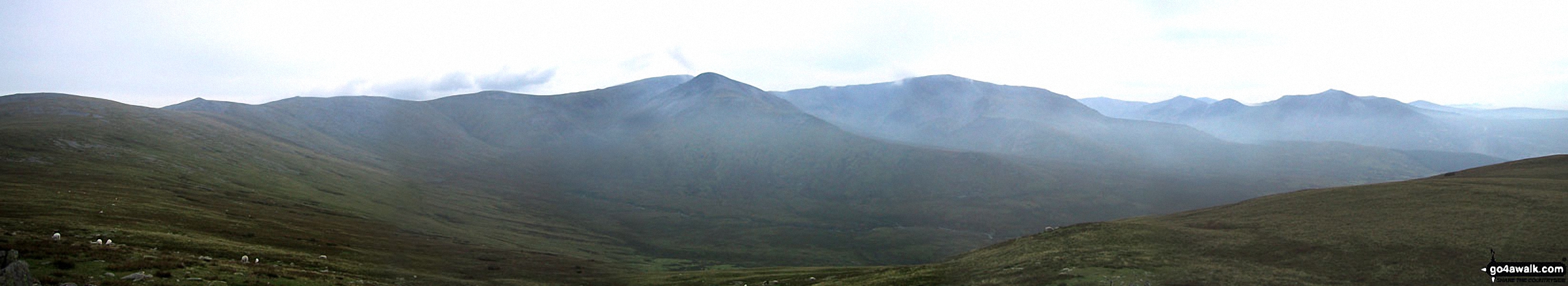
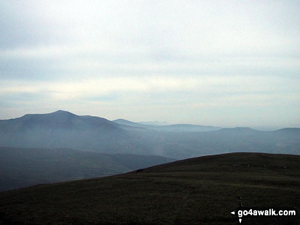
*Carnedd Gwenllian (Carnedd Uchaf), Foel Grach, Carnedd Llewelyn, Carnedd Dafydd, Yr Elen, Foel-goch, Elidir Fawr, Mynydd Perfedd and Carnedd y Filiast from Drosgl
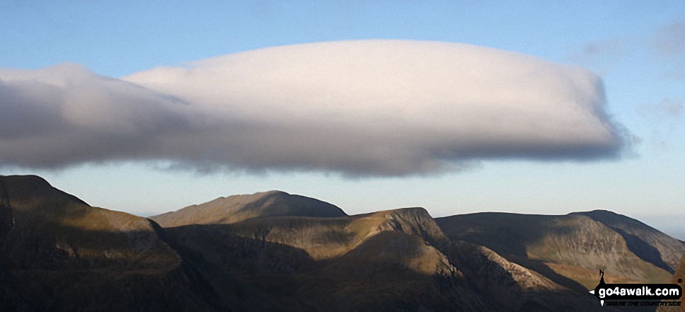
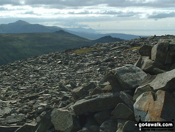
*360 degree panorama featuring Carnedd Dafydd, Foel-Goch (foreground), Tryfan and Glyder Fach, Y Garn (foreground), Crib Goch and Snowdon (Yr Wyddfa) from the summit of Elidir Fawr
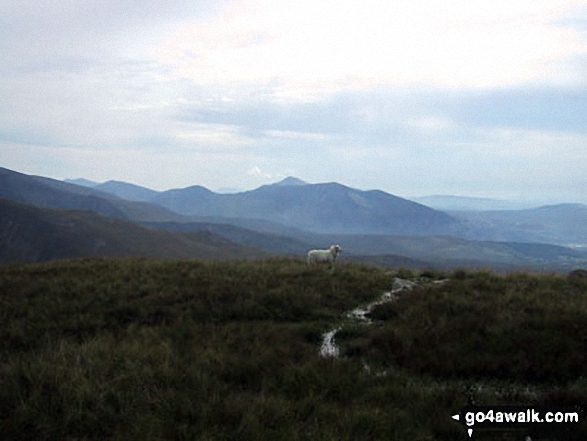
Foel-goch, Elidir Fawr, Mynydd Perfedd and Carnedd y Filiast from Carnedd Gwenllian (Carnedd Uchaf)
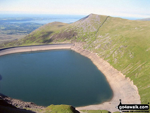
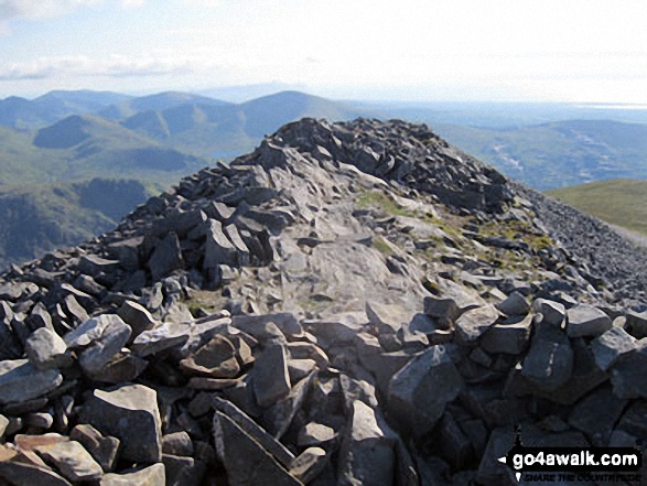
Carnedd y Filiast (Glyderau) (North Top), Carnedd y Filiast (Glyderau) and Marchlyn Mawr Reservoir from Bwlch Y Marchlyn, Elidir Fawr
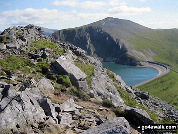
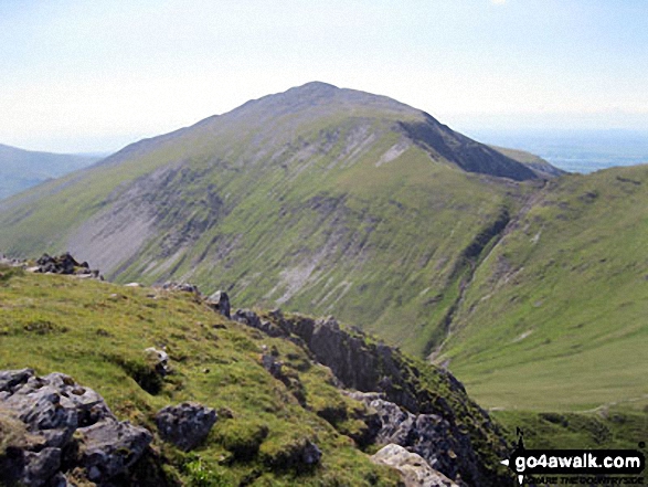
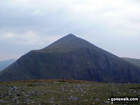
Elidir Fawr across Marchlyn Mawr Reservoir from Carnedd y Filiast (Glyderau) summit
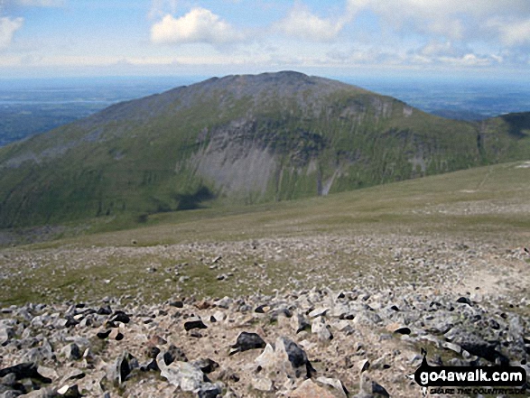
Y Garn (Glyderau), Elidir Fawr (centre) and Foel-goch from near Y Foel Goch
Elidir Fawr, Bera Bach and Bera Mawr, with Yr Eifl in the distance from Llwytmor
Send us your photographs and pictures on, of, or from Elidir Fawr
If you would like to add your walk photographs and pictures featuring views from, on or of Elidir Fawr to this page, please send them as email attachments (configured for any computer) along with your name to:
and we shall do our best to publish them.
(Guide Resolution = 300dpi. At least = 660pixels (wide) x 440 pixels (high).)

You can also submit photos via our Facebook Page.
NB. Please indicate where each photo was taken and whether you wish us to credit your photos with a Username or your First Name/Last Name.
Not familiar with this top?


