
![]()
Crinkle Crags (South Top)
834m (2737ft)
The Southern Fells, The Lake District, Cumbria, England
Not familiar with this top?
   |
|---|
Vital Statistics:
| Length: | 7.75ml (12.5km) |
|---|---|
| Ascent: | 2,770ft (844m) |
| Time: | 5.75hrs |
| Grade: |  (Moderate) (Moderate) |
Route Summary:
Great Langdale - Old Dungeon Ghyll - Stool End - Oxendale Beck - Browney Gill - Red Tarn (Langdale) - Great Knott - Crinkle Crags (South Top) - Crinkle Crags (Long Top) - Crinkle Crags (Gunson Knott) - Shelter Crags - Shelter Crags (North Top) - Three Tarns - Earing Crag - White Stones - The Band - Oxendale - Stool End Farm - The Old Dungeon Ghyll - Great Langdale
|
|---|
Vital Statistics:
| Length: | 10ml (16km) |
|---|---|
| Ascent: | 4,007ft (1,221m) |
| Time: | 7½ hrs |
| Grade: |  (Hard) (Hard) |
Route Summary:
Great Langdale - The Old Dungeon Ghyll - Wall End Farm - Redacre Gill - Wrynose Fell - Pike of Blisco (Pike O' Blisco) - Red Tarn (Langdale) - Cold Pike - Cold Pike (West Top) - Cold Pike (Far West Top) - Great Knott - Little Stand - Great Knott - Crinkle Crags (South Top) - Crinkle Crags (Long Top) - Crinkle Crags (Gunson Knott) - Shelter Crags - Shelter Crags - (North Top) - Three Tarns - Earing Crag - White Stones - The Band - Oxendale - Stool End Farm - The Old Dungeon Ghyll - Great Langdale
|
|---|
Vital Statistics:
| Length: | 11.25ml (18km) |
|---|---|
| Ascent: | 3,604ft (1,098m) |
| Time: | 7.75hrs |
| Grade: | (Hard) |
Route Summary:
Great Langdale - The Old Dungeon Ghyll - Stool End Farm - Oxendale - Oxendale Beck - Browney Gill - Red Tarn (Langdale) - Great Knott - Crinkle Crags (South Top) - Crinkle Crags (Long Top) - Crinkle Crags (Gunson Knott) - Shelter Crags - Shelter Crags (North Top) - Three Tarns - Climbers' Traverse (optional) - Flat Crag - Cambridge Crag - Bowfell Buttress - Bow Fell (Bowfell) - Bow Fell (Bowfell) (North Top) - Ore Gap - Angle Tarn (Langdale) - Rossett Pike - Rossett Beck - Mickleden - Mickleden Beck - The Cumbria Way - The Old Dungeon Ghyll - Great Langdale
|
|---|
Vital Statistics:
| Length: | 11.75ml (19km) |
|---|---|
| Ascent: | 4,680ft (1,426m) |
| Time: | 9 hrs |
| Grade: |  (Hard) (Hard) |
Route Summary:
Great Langdale - The Old Dungeon Ghyll - Wall End Farm - Redacre Gill - Wrynose Fell - Pike of Blisco (Pike O' Blisco) - Red Tarn (Langdale) - Great Knott - Crinkle Crags (South Top) - Crinkle Crags (Long Top) - Crinkle Crags (Gunson Knott) - Shelter Crags - Shelter Crags (North Top) - Three Tarns - Climbers' Traverse (optional) - Flat Crag - Cambridge Crag - Bowfell Buttress - Bow Fell (Bowfell) - Bow Fell (Bowfell) (North Top) - Ore Gap - Angle Tarn (Langdale) - Rossett Pike - Rossett Beck - Mickleden - Mickleden Beck - The Cumbria Way - The Old Dungeon Ghyll - Great Langdale
See Crinkle Crags (South Top) and the surrounding tops on our free-to-access 'Google Style' Peak Bagging Maps:
The Southern Fells of The Lake District National Park
Less data - quicker to download
The Whole of The Lake District National Park
More data - might take a little longer to download
See Crinkle Crags (South Top) and the surrounding tops on our downloadable Peak Bagging Maps in PDF format:

NB: Whether you print off a copy or download it to your phone, these PDF Peak Baggers' Maps might prove incredibly useful when your are up there on the tops and you cannot get a phone signal.
*This version is marked with the walk routes you need to follow to Walk all 214 Wainwrights in just 59 walks.
You can find Crinkle Crags (South Top) & all the walks that climb it on these unique free-to-access Interactive Walk Planning Maps:
1:25,000 scale OS Explorer Map (orange/yellow covers):
1:50,000 scale OS Landranger Maps (pink/magenta covers):
 Fellow go4awalkers who have already walked, climbed, summited & bagged Crinkle Crags (South Top)
Nick Tippins walked up Crinkle Crags (South Top) on September 28th, 2025 [from/via/route] c279: The Oxendale Horseshoe from The Old Dungeon Ghyll, Great Langdale [with] Fran
Chris Faulkner climbed Crinkle Crags (South Top) on April 9th, 2023 [from/via/route] Troutbeck [with] Michelle Chandler [weather] Bright & blustery.
Paul Macey bagged Crinkle Crags (South Top) on June 19th, 2019 [with] Luke
Christine Shepherd hiked Crinkle Crags (South Top) on April 16th, 2009 [from/via/route] Used walk c279 'The Oxendale Horseshoe' Bagged again 30-07-2015 when bagging Little Stand. Climbed again in heavy rain & a strong wind on 2.7.22 [with] Jenny [weather] Fine but windy - Enjoyed every 'crinkle'!
Shirley Philips has summited Crinkle Crags (South Top) [from/via/route] Great Langdale
Geoff Hand conquered Crinkle Crags (South Top) on June 15th, 2022 [from/via/route] Walk c279 The Oxendale Round from the Old Dungeon Ghyl up Pike of Blisco, Cold Pike, Great Knott, Little Stand, Crinkle crags & back by The Band. [with] Alone with Tess [weather] Beautiful sunny day, got burnt to a crisp! - Went a little bit wrong at first & went too clos to Blea Tarn. Tess was attacked by a dog who fortunately had a muzzle on otherwise it could have been a mess. Lovely memory of Swallows swooping over a flower meadow on the way back.
Carl Tillotson scaled Crinkle Crags (South Top) on October 10th, 2021 [from/via/route] from Oxendale descent via The Band [with] June [weather] Sunny with cloud, windy on top.
Kevin Foster walked up Crinkle Crags (South Top) on August 27th, 2021 [from/via/route] The Old Dungeon Ghyll National Trust car park. [with] By myself. [weather] Sunny. Clear visibility. - A classic ridge walk. Ascent via Browney Gill. Descent via Oxendale Beck. In between was walking heaven! The Bad Step wasn't even as 'bad' as I remembered. Excellent views in all directions but the Scafells & Bowfell were particularly impressive. Oh & a stunning waterfall near the end.
Stephen Eddy climbed Crinkle Crags (South Top) on June 22nd, 2019 [from/via/route] Old dungeon ghyll [with] Mike Woodhouse, Tony Harris, Martin Bayliss [weather] Sunny
Darren Wilson bagged Crinkle Crags (South Top) on June 15th, 2015 [from/via/route] Cockley Beck, Ulpha Fell, Little Stand, Cold Pike, Crinkle Crags, Hard Knott [with] lone walk [weather] Beautiful summers day
Simon Myerscough hiked Crinkle Crags (South Top) on December 28th, 2006 [from/via/route] C279 [weather] Snowing & cloudy - low visibility - Starting to feel lost on Crinkle Crags
Anthony Scott summited Crinkle Crags (South Top) on July 14th, 2017 [from/via/route] Old Dungeon Ghyl Hotel [with] me [weather] Grey cloud, some rain, windy, sunny spells. Changeable! - walk 179. Beware of the bad step
Caroline Winter conquered Crinkle Crags (South Top) on February 12th, 2017 [from/via/route] Wrynose-three shires pass, pike o blisco, south & long top crinkles [with] Karen [weather] Good visibility, but deteriorated late afternoon, high gale force winds, snow & ice underfoot, snow & white out 3-4pm - Parked on three shires pass & wind ferocious. Slow progress to pike o blisco due to ice & snow. Difficult to locate track. Great visibility to Crinkles-covered in snow. Weather closed in on ascent of second & unable to find route back. After one & a half hours managed to get off & abandoned Cold Pike to return to car.
Mark Davidson scaled Crinkle Crags (South Top) on August 2nd, 2004 [with] Alone [weather] Sunny & warm - fantastic
Joanne Mcgawley walked up Crinkle Crags (South Top) on July 6th, 2016 [with] Rich [weather] No Visibility & Damp! - 8.8 miles
Christina Lander climbed Crinkle Crags (South Top) on August 3rd, 2015 [from/via/route] Old Dungeon Ghyll - Stool End Farm - Great Knott - Crinkle Crags - Shelter Crags - Bow Fell - Esk Pike - Esk Hause - Scafell Pike - Esk Hause - Angle Tarn - Cumbria Way/Mickleden Beck - Old Dungeon Ghyll (20 miles) [with] Dick and Mick & Kath Hobday [weather] Lovely day
Harry Meijer bagged Crinkle Crags (South Top) on April 22nd, 2013 [from/via/route] Crinkles Crags & Bowfell [with] The Lake District Walker
Darren Mortimer hiked Crinkle Crags (South Top) on February 25th, 2012 [from/via/route] Old Dungeon Ghyll [with] Dermot Palmer
Iain Taylor summited Crinkle Crags (South Top) on August 29th, 2010 [from/via/route] Langdale (NY 29589 06415)
Chris Bramley conquered Crinkle Crags (South Top) on August 18th, 2012 [from/via/route] To Bow fell [with] Janet
Patrick Rogozinski, Wendy Sockett, Angela Moroney, Leon Potts, Craig Lewis, Matthew Thomas, Paul Booth, Tracey Cordes, Jeanette Coward, Louise Sandwith, Louis Smith, Paul Henderson, Helen Marrs, Trevor Williams, John Cuthbert, Stephen Millington, Ray O'hara and Steve Davenport have all walked, climbed & bagged Crinkle Crags (South Top).
To add (or remove) your name and experiences on this page - Log On and edit your Personal Mountain Bagging Record
. . . [see less walk reports]
More Photographs & Pictures of views from, on or of Crinkle Crags (South Top)
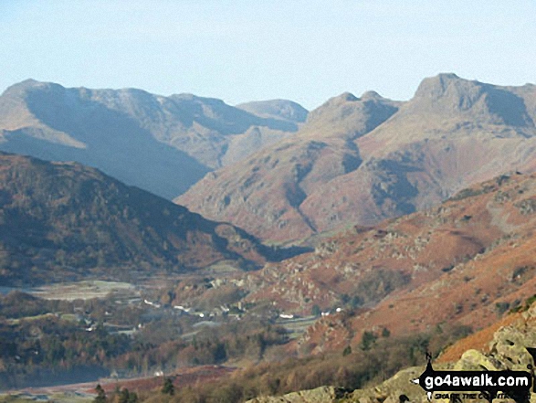
Crinkle Crags (Crinkle Crags (South Top), Crinkle Crags (Long Top), & Gunson Knott), Bow Fell (Bowfell), Esk Pike & The Langdale Pikes from Loughrigg
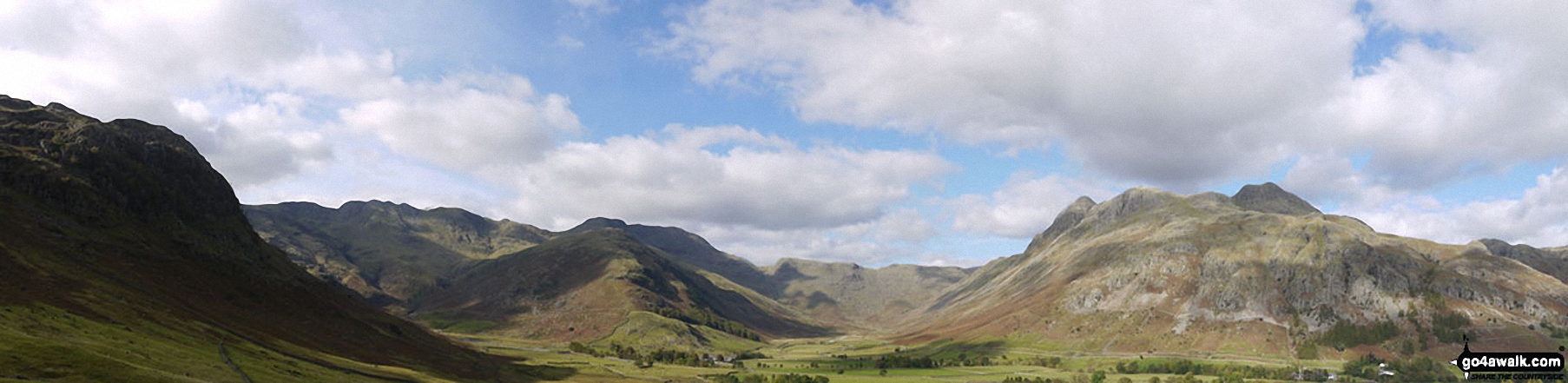
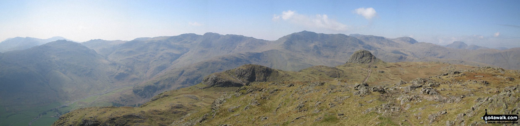
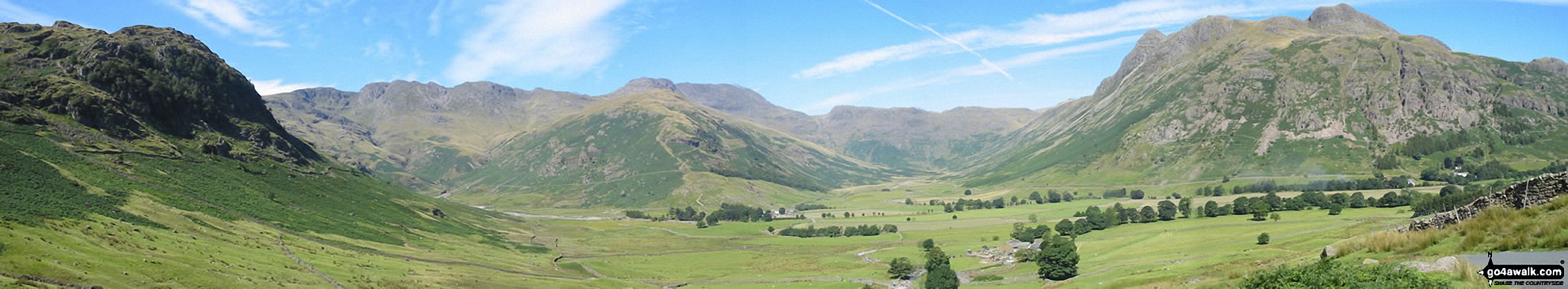
Crinkle Crags (South Top), Crinkle Crags (Long Top), Crinkle Crags (Gunson Knott), Shelter Crags, Shelter Crags, (North Top), The Band , Bow Fell (Bowfell) and Bow Fell (Bowfell) (North Top), Esk Pike, Rossett Pike and The Langdale Pikes including Pike of Stickle (Pike o' Stickle) (left) Loft Crag and Harrison Stickle from Stool End, Great Langdale
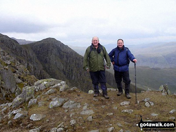
Me and a mate on the first crinkle of The Crinkle Crags above Great Langdale
Gunson Knott, Crinkle Crags (Long Top) and Crinkle Crags (South Top) from Slight Side
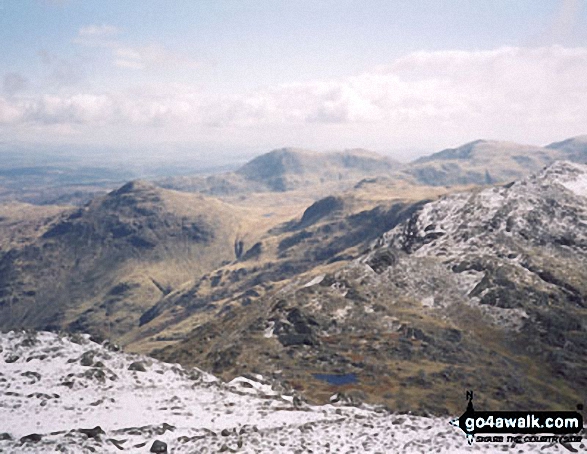
*Northernly Panorama from the summit of Hard Knott featuring Sca Fell, Scafell Pike, Esk Pike, Bow Fell (Bowfell), Gunson Knott, Crinkle Crags (Long Top) and Crinkle Crags (South Top)
Esk Pike, Bow Fell (Bowfell), Gunson Knott , Crinkle Crags (Long Top) and Crinkle Crags (South Top) from Scafell Pike
*Bow Fell (Bowfell), Crinkle Crags (Long Top), Gunson Knott and Crinkle Crags (South Top) from Mickledore (between Scafell Pike and Sca Fell)
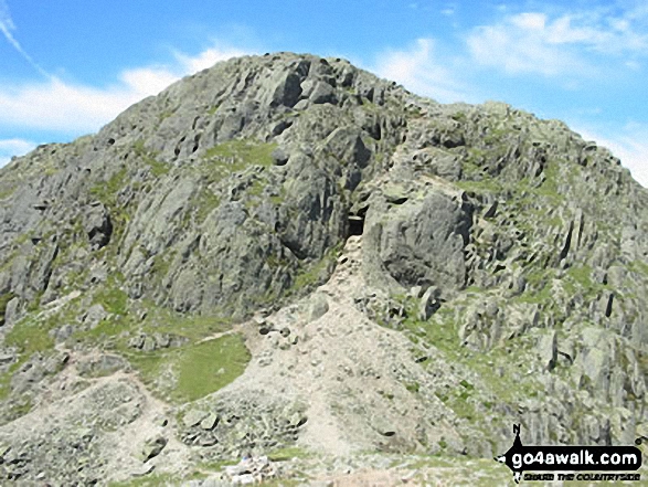
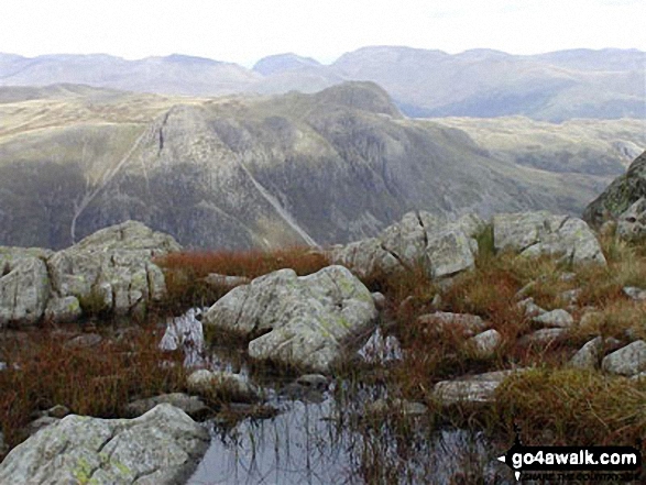
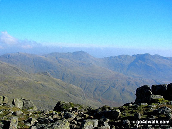
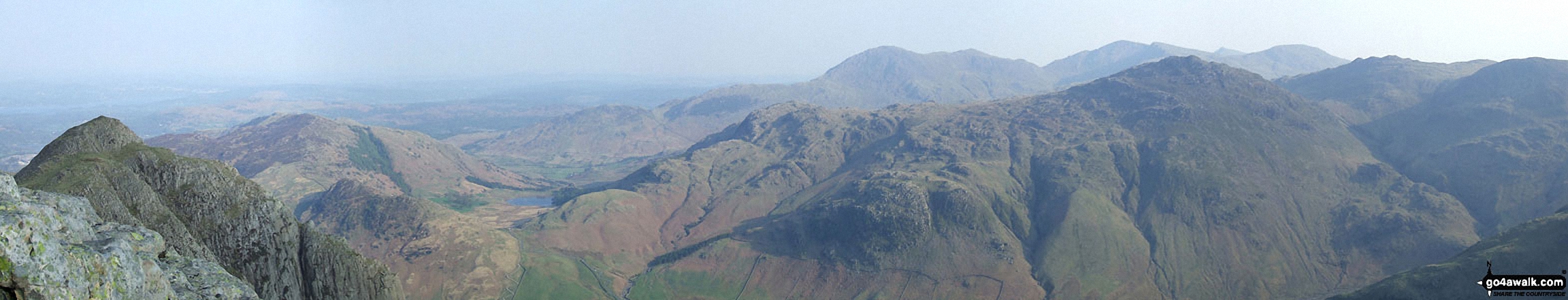
*Crinkle Crags (Long Top), Gunson Knott & Crinkle Crags (South Top) (right) including the infamous bad step with the Scafell Massiff beyond from Great Knott
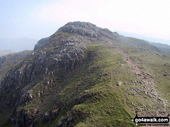
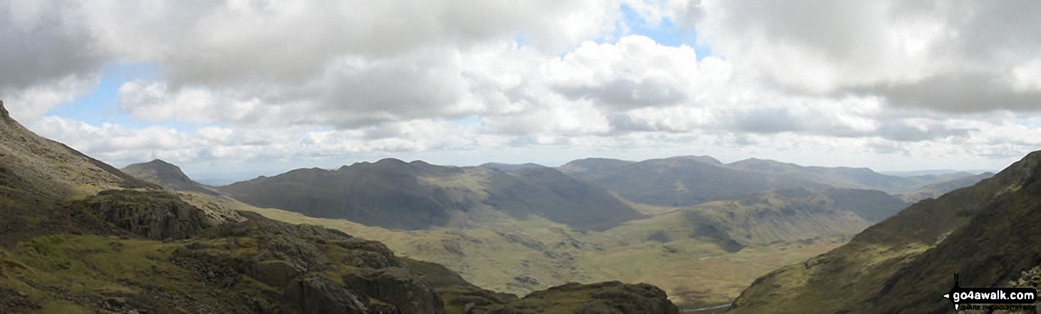
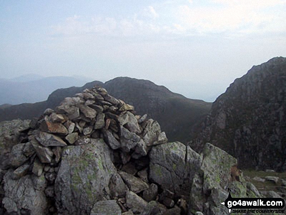
Crinkle Crags - The second Crinkle - Crinkle Crags (Long Top) and the third Crinkle - Gunson Knott from the first Crinkle - Crinkle Crags (South Top)
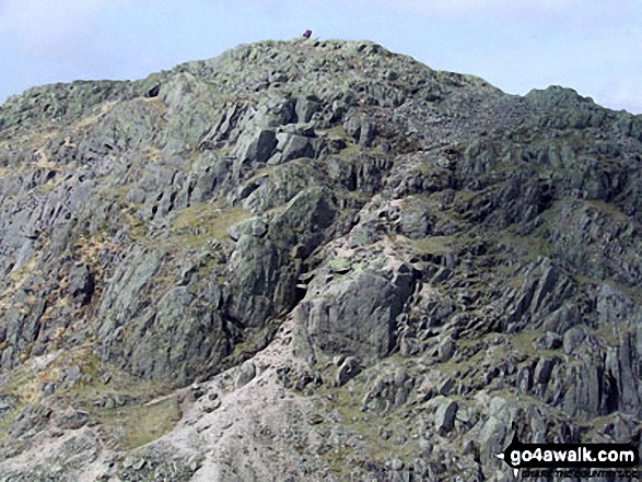
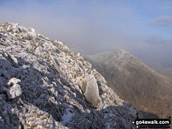
Crinkle Crags (Long Top) with the infamous 'Bad Step' (just below centre) from Crinkle Crags (South Top)
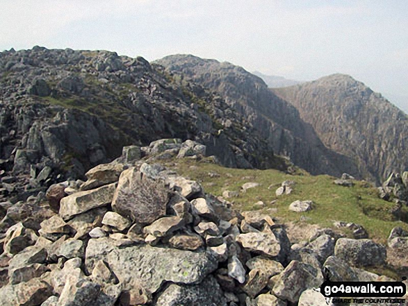
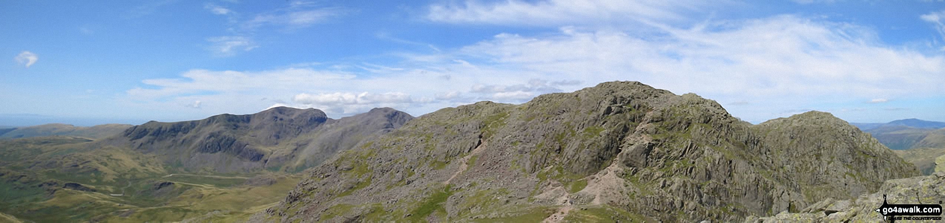
Crinkle Crags (Long Top), Crinkle Crags (Gunson Knott) and Shelter Crags from Crinkle Crags (South Top)
*Pike of Blisco (Pike o' Blisco), Crinkle Crags (South Top), Crinkle Crags (Long Top), Gunson Knott, Bow Fell (Bowfell), The Scafell Massif, Great Gable and Pike of Stickle (in the foreground) from Harrison Stickle
Pike of Blisco (Pike o' Blisco) and Crinkle Crags (South Top) from the cairn on the summit of Crinkle Crags (Gunson Knott)
*Loft Crag (foreground far left), Lingmoor, Blea Tarn, Pike of Blisco (Pike o' Blisco), Cold Pike and Crinkle Crags (featuring Crinkle Crags (South Top), Crinkle Crags (Long Top) and Gunson Knott) (mid-distance left to right) and Wetherlam, Great Carrs and Grey Friar (far-distance centre to right) from the summit of Pike of Stickle (Langdale Pikes)
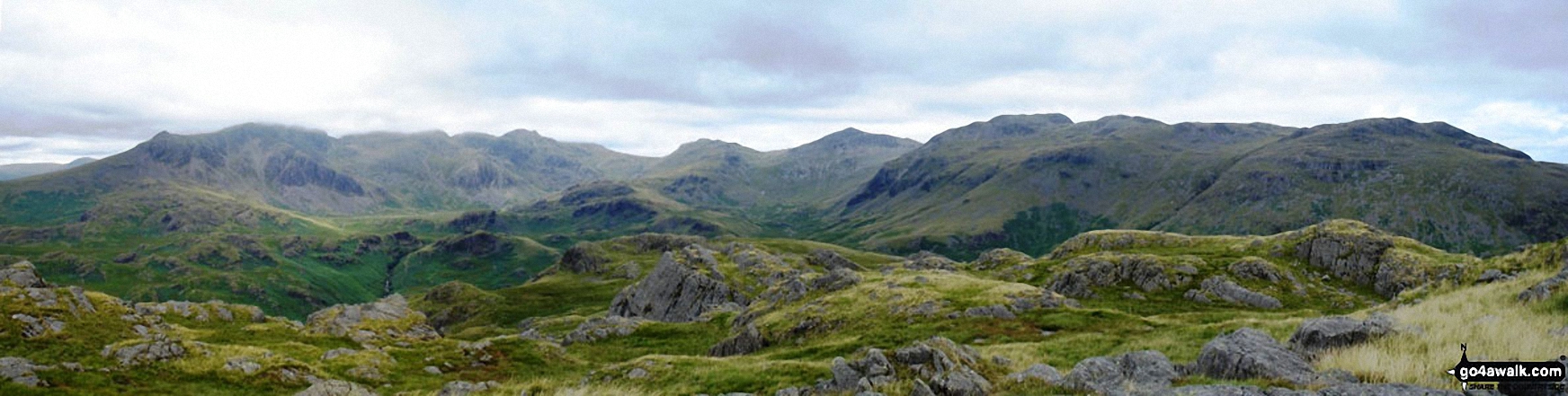
*Crinkle Crags featuring Crinkle Crags (Long Top), Gunson Knott & Crinkle Crags (South Top) (left), Bow Fell (Bowfell) (centre) and The Langdale Pikes (right) from Great Langdale
*Kettle Crag (left), Oxendale, The Band (centre - with Crinkle Crags (Crinkle Crags (South Top), Crinkle Crags (Long Top), & Gunson Knott) (top left) and Bow Fell (Bowfell) (top right), Mickleden and The Langdale Pikes from Side Pike
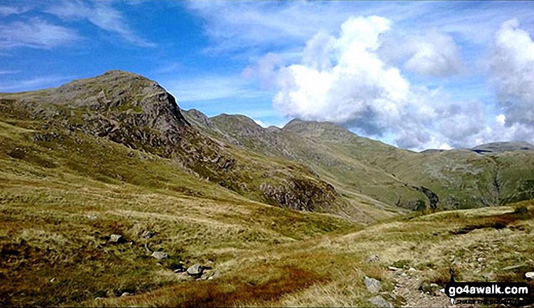
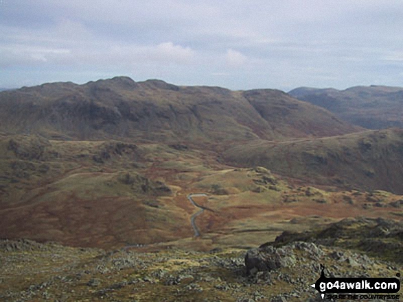
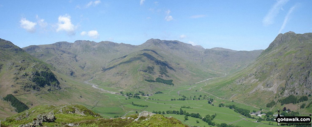
Great Knott, Crinkle Crags (South Top), Crinkle Crags (Long Top), Shelter Crags and Bow Fell from Browney Gill
. . . see all 33 walk photographs & pictures of views from, on or of Crinkle Crags (South Top)
Send us your photographs and pictures on, of, or from Crinkle Crags (South Top)
If you would like to add your walk photographs and pictures featuring views from, on or of Crinkle Crags (South Top) to this page, please send them as email attachments (configured for any computer) along with your name to:
and we shall do our best to publish them.
(Guide Resolution = 300dpi. At least = 660pixels (wide) x 440 pixels (high).)

You can also submit photos via our Facebook Page.
NB. Please indicate where each photo was taken and whether you wish us to credit your photos with a Username or your First Name/Last Name.
Not familiar with this top?


